Bruger:Nico/sandkasse 2

Der er 15 Nationalparker i Spanien, 10 på det spanske fastland og fem på Canariske og Baleariske Øer. Tolv af sytten af Spaniens autonome regioner har nationalparker. De Canariske Øer har flest (fire), efterfulgt af Andalusien, Castilla-La Mancha og Castilla og León (to hver). Der er fire autonome regioner der ikke har nationalparker: Baskerlandet, La Rioja, Murcia, Navarre, Valencia.
Omkring 10 millioner mennesker besøgte Spanske nationalparker i 2009, med Teide havde omkring 30% af alle besøgende. Den næst mest besøgte park var Picos de Europa (18%), fulgt af Timanfaya (13%). De mindst besøgte parker var Cabrera Archipelago (0.60%) og Cabañeros (0.90%).[1] Med mere end 2,5 millioner besøgende i 2013, var Teide den mest besøgte nationalpark i Europa det år, den sjete mest besøgte i verden.[2]
Nationalparker
| Name | Photo | Province | Autonomous community | Designated | Area | Description | Ref |
|---|---|---|---|---|---|---|---|
| Aigüestortes i Estany de Sant Maurici |  | Lleida | Catalonien | 1955 | 14.119 ha (34.889 acres) | Consists of two valleys (Sant Nicolau and L'Escrita) located between the rivers Noguera Pallaresa and Noguera Ribagorzana. Comaloforno is the highest mountain, with a peak at 3,033 meter (9,95 ft).[3] | [4] |
| Cabañeros | 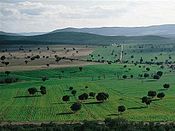 | Ciudad Real og Toledo | Castilla-La Mancha | 1995 | 40.856 ha (100.957 acres) | Part of the Montes de Toledo system of mountain ranges. Rocigalgo, at about 1.500 meter (4.900 ft), is the highest mountain in the park.[5] | [6] |
| Cabrera Archipelago | 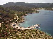 | Baleariske Øer | Baleariske Øer | 1991 | 10.021 ha (24.762 acres) | Consists of the Balearic island Cabrera, that was isolated from Majorca during the last glacial period 12,000 years ago, and the surrounding archipelago.[7] | [8] |
| Caldera de Taburiente | 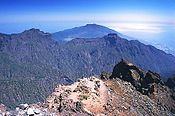 | Santa Cruz de Tenerife (La Palma island) | Canariske Øer | 1954 | 4.690 ha (11.589 acres) | [9] | |
| Doñana | 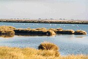 | Huelva og Sevilla | Andalusien | 1969 | 54.252 ha (134.060 acres) | [10] | |
| Garajonay | 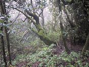 | Santa Cruz de Tenerife (Øen La Gomera ) | Canariske Øer | 1981 | 3.984 ha (9.845 acres) | [11] | |
| Guadarrama |  | Madrid, Segovia og Ávila | Madrid og Castilla y León | 2013 | 33.960 ha (83.917 acres) | [12] | |
| Illas Atlánticas de Galicia | 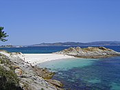 | A Coruña og Pontevedra | Galicien | 2002 | 8.480 ha (20.955 acres) | [13] | |
| Monfragüe | 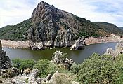 | Caceres | Extremadura | 2007 | 18.396 ha (45.458 acres) | [14] | |
| Ordesa y Monte Perdido | 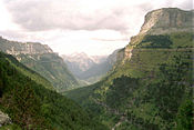 | Huesca | Aragon | 1918 | 15.608 ha (38.568 acres) | [15] | |
| Picos de Europa | 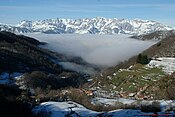 | Asturias, León og Cantabrien | Asturias, Castilla y León og Cantabrien | 1918 | 67.127 ha (165.874 acres) | Covers the mountain range Picos de Europa (part of the Cantabrian Mountains) and consists of three massifs: Central, Western and Eastern. Torre de Cerredo, at 2.646 meter (8.681 ft), is the highest mountain.[16] | [17] |
| Sierra Nevada | 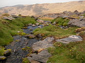 | Granada og Almería | Andalusien | 1999 | 85.883 ha (212.222 acres) | The parks has fifteen peaks over 3.000 meter (9.800 ft) altitude, including Mulhacén, the highest mountain in the Iberian Peninsula, with a peak of 3,482 meter (11,42 ft).[18] | [19] |
| Tablas de Daimiel | 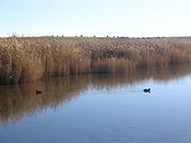 | Ciudad Real | Castilla-La Mancha | 1973 | 3.030 ha (7.487 acres) | [20] | |
| Teide | 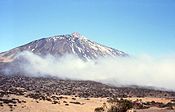 | Santa Cruz de Tenerife (Øen Tenerife) | Canariske Øer | 1954 | 18.990 ha (46.925 acres) | [21] | |
| Timanfaya |  | Las Palmas (øen Lanzarote) | Canariske Øer | 1974 | 5.107 ha (12.620 acres) | [22] |
References
Eksterne kilder og henvisninger
- Skabelon:Commons category-inline
- The parks at Ministry of Agriculture, Food and Environment's website (spansk)
Skabelon:National parks of SpainSkabelon:Europe in topic