Liste over counties i Minnesota
Dette er en liste over amter i Minnesota . Der er 87 amter i den amerikanske delstat Minnesota . Der er også flere historiske amter .
Den 27. oktober 1849 blev ni amter etableret: Benton, Dahkotah, Itasca, Ramsey, Mahkahta, Pembina, Wabasha, Washington og Wahnata. Seks af disse navne eksisterer stadig. Med grundlæggelsen af Kittson County den 9. marts 1878 eksisterede Pembina County ikke længere.[1] Da Minnesota blev organiseret som en delstat, blev 57 af de nuværende 87 amter etableret. Det sidste amt, der blev oprettet var Lake of the Woods County i 1923. [2]
Navne på mange af amterne skyldes den lange historie med udforskning. Mere end ti amter er opkaldt efter indianske grupper, der boede i dele af det der nu er Minnesota. Yderligere 15 amter er opkaldt efter fysiske geografiske træk og resten efter politikere.
FIPS-county code er den femcifrede Federal Information Processing Standard (FIPS) kode, som unikt identificerer amter og amtækvivalenter i USA. Det trecifrede nummer er unikt for hvert enkelt amt i en delstat, men for at være unikt i hele USA, skal det være præfikset af statskoden. Dette betyder at for eksempel nummer 001 deles af Aitkin County, Minnesota, Adams County, Wisconsin og Adair County, Iowa. For unikt at identificere Aitkin County, Minnesota, skal man bruge statskoden 27 plus amtskoden til 001; Derfor er den unikke landsdækkende identifikator for Aitkin County, Minnesota 27001. Links i kolonnen FIPS County Code er til Census Bureau Info siden for det pågældende amt.[3]
Amter
| Amt | FIPS-kode[3] | County seat[4] | Etableret[1][4] | Oprindselsessted[5][6][7] | Etymologi | Befolkning[4][8] | Område[4][8] | Kort |
|---|---|---|---|---|---|---|---|---|
| Aitkin County | 001 | Aitkin | 1857 | Pine County, Ramsey County | William Alexander Aitken (1785-1851), tidlig pels-handler med Ojibwe-indianerne | 16.202 | 181.930 sq mi (4.712 km2) |  |
| Anoka County | 003 | Anoka | 1857 | Ramsey County | Dakota-ord der betyder "begge sider" | 330.844 | 42.361 sq mi (1.097 km2) |  |
| Becker County | 005 | Detroit Lakes | 1858 | Cass County, Pembina County | George Loomis Becker, tidligere statssenator og tredje borgmester i Saint Paul (1856–1857) | 32.504 | 131.042 sq mi (3.394 km2) | 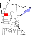 |
| Beltrami County | 007 | Bemidji | 1866 | Uorganiseret territorium, Itasca County, Pembina County, Polk County | Giacomo Beltrami, italiensk opdagelsesrejsende der udforskede de nordlige grænser af Mississippi-floden i 1823. | 44.442 | 250.527 sq mi (6.489 km2) |  |
| Benton County | 009 | Foley | 1849 | En af ni originale amter, fra St. Croix County, Wisconsin Territory. | Thomas Hart Benton (1782–1858), tidligere amerikansk senator fra Missouri (1821-1851) | 38.451 | 40.828 sq mi (1.057 km2) |  |
| Big Stone County | 011 | Ortonville | 1862 | Pierce County | Big Stone Lake, en sø i amtet | 5.269 | 49.695 sq mi (1.287 km2) |  |
| Blue Earth County | 013 | Mankato | 1853 | Unorganized Territory, Dakota County | Blue Earth River, en flod der flyder gennem Minnesota | 64.013 | 75.236 sq mi (1.949 km2) |  |
| Brown County | 015 | New Ulm | 1855 | Blue Earth County | Joseph Renshaw Brown (1805-1870), medlem af Minnesotas territorimæssige lovgivere(1854-55) og prominent pioner | 25.893 | 61.086 sq mi (1.582 km2) |  |
| Carlton County | 017 | Carlton | 1857 | Pine County, Saint Louis County | Rueben B. Carlton (1812-1863), tidlig beboer og statssenator (1857-1858) | 35.386 | 86.033 sq mi (2.228 km2) |  |
| Carver County | 019 | Chaska | 1855 | Hennepin County, Sibley County | Jonathan Carver (1710–1790), tidligere udforsker og kartograf af Mississippi-floden. | 91.042 | 35.704 sq mi (925 km2) | 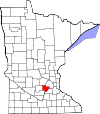 |
| Cass County | 021 | Walker | 1851 | Dakota County, Pembina County, Mankahto County, Wahnata County | Lewis Cass (1782–1866), senator fra Michigan (1845–1857) og United States Secretary of State (1831–1836) | 28.567 | 201.760 sq mi (5.226 km2) |  |
| Chippewa County | 023 | Montevideo | 1870 | Pierce County, Davis County | Chippewa River, en flod der flyder gennem Minnesota | 12.441 | 58.280 sq mi (1.509 km2) |  |
| Chisago County | 025 | Center City | 1851 | Washington County, Ramsey County | Chisago Lake, en sø i amtet | 53.887 | 41.763 sq mi (1.082 km2) |  |
| Clay County | 027 | Moorhead | 1862 | Pembina County | Henry Clay (1777-1852), Kentucky-statsmand og niende amerikanske indenrigsminister (1825–1829) | 58.999 | 104.524 sq mi (2.707 km2) |  |
| Clearwater County | 029 | Bagley | 1902 | Beltrami County | Clearwater-flod og sø, der begges findes i staten | 8.695 | 99.471 sq mi (2.576 km2) | 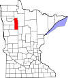 |
| Cook County | 031 | Grand Marais | 1874 | Lake County | Opkaldt efter borgerkrigsveteranen Major Michael Cook fra Faribault, der også være en territoriel og statssenator 1857-62 | 5.176 | 145.060 sq mi (3.757 km2) |  |
| Cottonwood County | 033 | Windom | 1857 | Brown County | Cottonwood River | 11.687 | 63.999 sq mi (1.658 km2) |  |
| Crow Wing County | 035 | Brainerd | 1857 | Ramsey County | Crow Wing River | 62.500 | 99.657 sq mi (2.581 km2) |  |
| Dakota County | 037 | Hastings | 1849 | One of nine original counties. | Fra Dakota-sproget, efter en lokal stamme Dakota, der betyder "Allierede" | 398.552 | 56.958 sq mi (1.475 km2) |  |
| Dodge County | 039 | Mantorville | 1855 | Rice County, Unorganized Territory | Henry Dodge (1782–1867), to gange guvernør i Wisconsin.[9] | 20.087 | 43.950 sq mi (1.138 km2) |  |
| Douglas County | 041 | Alexandria | 1858 | Cass County, Pembina County | Stephen Arnold Douglas (1813-1861), tidligere amerikansk senator fra Illinois (1847-1861) | 36.009 | 63.432 sq mi (1.643 km2) | 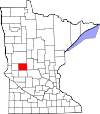 |
| Faribault County | 043 | Blue Earth | 1855 | Blue Earth County | Jean-Baptiste Faribault (1775-1860), tidlig beboer og pelshandler | 14.553 | 71.363 sq mi (1.848 km2) | 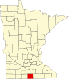 |
| Fillmore County | 045 | Preston | 1853 | Wabasha County | Millard Fillmore (1800-1874), trettende præsident i USA (1850-1853) | 20.866 | 86.125 sq mi (2.231 km2) |  |
| Freeborn County | 047 | Albert Lea | 1855 | Blue Earth County, Rice County | William S. Freeborn (1816-1900) | 31.255 | 70.764 sq mi (1.833 km2) |  |
| Goodhue County | 049 | Red Wing | 1853 | Wabasha County, Dakota County | James Madison Goodhue, første avisredaktør i Minnesota.[10] | 46.183 | 75.827 sq mi (1.964 km2) |  |
| Grant County | 051 | Elbow Lake | 1868 | Stevens County, Wilkin County, Traverse County | Ulysses S. Grant (1822-1885), 18. amerikanske præsident (1869-1877) | 6.018 | 54.641 sq mi (1.415 km2) | 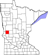 |
| Hennepin County | 053 | Minneapolis | 1852 | Dakota County | Father Louis Hennepin (1626-1705), tidlig opdager af Twin Cities-området i det 17. århundrede | 1.152.425 | 55.662 sq mi (1.442 km2) |  |
| Houston County | 055 | Caledonia | 1854 | Fillmore County | Sam Houston (1793–1863), anden og fjerde præsident i Republikken Texas og syvende guvernør i Texas | 19.027 | 55.841 sq mi (1.446 km2) | 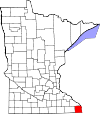 |
| Hubbard County | 057 | Park Rapids | 1883 | Cass County | Lucius Frederick Hubbard (1836-1913), niende guvernør i Minnesota (1882-1887) | 20.428 | 92.246 sq mi (2.389 km2) | 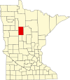 |
| Isanti County | 059 | Cambridge | 1857 | Ramsey County | Del af Dakotas kaldet Izatys, der betyder [dem der] dvæler ved Knife Lake, efter hvor de boede. | 37.816 | 43.907 sq mi (1.137 km2) |  |
| Itasca County | 061 | Grand Rapids | 1849 | En af ni oprindelige amter; dannet af det resterende La Pointe County, Wisconsin Territory. | Lake Itasca, Mississippi-flodens udspring (i det nordvestlige Minnesota). | 45.058 | 266.506 sq mi (6.902 km2) |  |
| Jackson County | 063 | Jackson | 1857 | Brown County | Henry Jackson, medlem af den første territorielle lovforsamling og den første handelsmand i St. Paul | 10.266 | 70.169 sq mi (1.817 km2) | 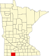 |
| Kanabec County | 065 | Mora | 1858 | Pine County | Fra Ojibwe-sproget Kan-a-bec-o-si-pi (Ginebigo-ziibi), hvilket betyder Snake River, der flyder gennem amtet | 16.239 | 52.493 sq mi (1.360 km2) |  |
| Kandiyohi County | 067 | Willmar | 1858 | Meeker County, Renville County, Pierce County, Davis County, Stearns County | Fra Sioux-sproget for "buffalo fish" | 42.239 | 79.606 sq mi (2.062 km2) |  |
| Kittson County | 069 | Hallock | 1879 | Pembina County | Norman Kittson (1814-1888), forretningsmand og borgmester i Saint Paul (1858-1859) | 4.552 | 109.708 sq mi (2.841 km2) | 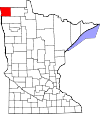 |
| Koochiching County | 071 | International Falls | 1906 | Itasca County | Fra Ojibwe-sproget Gojijiing | 13.311 | 310.236 sq mi (8.035 km2) |  |
| Lac qui Parle County | 073 | Madison | 1871 | Redwood County | 7.259 | 76.487 sq mi (1.981 km2) |  | |
| Lake County | 075 | Two Harbors | 1856 | Itasca County | Lake Superior | 10.866 | 209.916 sq mi (5.437 km2) |  |
| Lake of the Woods County | 077 | Baudette | 1923 | Beltrami County | Lake of the Woods | 4.045 | 129.670 sq mi (3.358 km2) |  |
| Le Sueur County | 079 | Le Center | 1853 | Dakota County | Pierre-Charles Le Sueur (1657-1704) | 27.703 | 44.850 sq mi (1.162 km2) |  |
| Lincoln County | 081 | Ivanhoe | 1873 | Lyon County | Abraham Lincoln (1809-1865) | 5.896 | 53.703 sq mi (1.391 km2) |  |
| Lyon County | 083 | Marshall | 1871 | Redwood County | Nathaniel Lyon (1818–1861) | 25.857 | 71.417 sq mi (1.850 km2) |  |
| McLeod County | 085 | Glencoe | 1856 | Carver County, Sibley County | Martin McLeod | 36.651 | 49.191 sq mi (1.274 km2) |  |
| Mahnomen County | 087 | Mahnomen | 1906 | Norman County | Ojibwa der betyder "wild rice". | 5.413 | 55.614 sq mi (1.440 km2) |  |
| Marshall County | 089 | Warren | 1879 | Kittson County | William Rainey Marshall (1825-1896), femte guvernør i Minnesota (1866-1870) | 9.439 | 177.224 sq mi (4.590 km2) | 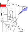 |
| Martin County | 091 | Fairmont | 1857 | Faribault County, Brown County | Morgan Lewis Martin (1805-1887) | 20.840 | 70.934 sq mi (1.837 km2) |  |
| Meeker County | 093 | Litchfield | 1856 | Davis County | Bradley B. Meeker (1813–1873) | 23.300 | 60.854 sq mi (1.576 km2) |  |
| Mille Lacs County | 095 | Milaca | 1857 | Ramsey County | Mille Lacs Lake | 26.097 | 57.447 sq mi (1.488 km2) |  |
| Morrison County | 097 | Little Falls | 1856 | Benton County | William & Allan Morrison, pelshandlende brødre[11] | 33.198 | 112.450 sq mi (2.912 km2) |  |
| Mower County | 099 | Austin | 1855 | Rice County | John Edward Mower (1815–1879) | 39.163 | 71.150 sq mi (1.843 km2) |  |
| Murray County | 101 | Slayton | 1857 | Brown County | William Pitt Murray (1825–1910) | 8.725 | 70.443 sq mi (1.824 km2) |  |
| Nicollet County | 103 | St. Peter | 1853 | Dakota County | Joseph Nicolas Nicollet (1786–1843) | 32.727 | 45.229 sq mi (1.171 km2) |  |
| Nobles County | 105 | Worthington | 1857 | Brown County | William H. Nobles | 21.378 | 71.539 sq mi (1.853 km2) | 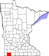 |
| Norman County | 107 | Ada | 1881 | Polk County | Tidlig norske beboere | 6.852 | 87.627 sq mi (2.270 km2) |  |
| Olmsted County | 109 | Rochester | 1855 | Fillmore County, Wabasha County, Rice County | David Olmsted | 144.248 | 65.301 sq mi (1.691 km2) | 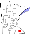 |
| Otter Tail County | 111 | Fergus Falls | 1858 | Pembina County, Cass County | Otter Tail Lake | 57.303 | 197.971 sq mi (5.127 km2) |  |
| Pennington County | 113 | Thief River Falls | 1910 | Red Lake County | Edmund Pennington (b. 1848) | 13.930 | 61.654 sq mi (1.597 km2) |  |
| Pine County | 115 | Pine City | 1856 | Chisago County, Ramsey County | Store skove i amtet | 29.750 | 141.104 sq mi (3.655 km2) |  |
| Pipestone County | 117 | Pipestone | 1857 | Brown County | Navn på hellig Dakota rød pipestone der findes i amtet | 9.596 | 46.589 sq mi (1.207 km2) |  |
| Polk County | 119 | Crookston | 1858 | Pembina County | James K. Polk (1795-1849) | 31.600 | 197.037 sq mi (5.103 km2) |  |
| Pope County | 121 | Glenwood | 1862 | Pierce County, Cass County, Unorganized Territory | John Pope (1822–1892) | 10.995 | 67.014 sq mi (1.736 km2) |  |
| Ramsey County | 123 | Saint Paul | 1849 | One of nine original counties; formed from residual St. Croix County, Wisconsin Territory. | Alexander Ramsey (1815-1903) | 508.640 | 15.578 sq mi (403 km2) |  |
| Red Lake County | 125 | Red Lake Falls | 1896 | Polk County | Red Lake River | 4.089 | 43.243 sq mi (1.120 km2) |  |
| Redwood County | 127 | Redwood Falls | 1862 | Brown County | Redwood River | 16.059 | 87.973 sq mi (2.278 km2) |  |
| Renville County | 129 | Olivia | 1855 | Nicollet County, Pierce County, Sibley County | Joseph Renville (1779-1846) | 15.730 | 98.292 sq mi (2.546 km2) |  |
| Rice County | 131 | Faribault | 1853 | Dakota County, Wabasha County | Henry Mower Rice (1816-1894) | 64.142 | 49.757 sq mi (1.289 km2) |  |
| Rock County | 133 | Luverne | 1857 | Brown County | Stort klippe-plateau kendt som "the mound" | 9.687 | 48.261 sq mi (1.250 km2) |  |
| Roseau County | 135 | Roseau | 1894 | Kittson County, Beltrami County | Roseau River | 15.629 | 166.251 sq mi (4.306 km2) | 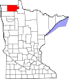 |
| Saint Louis County | 137 | Duluth | 1855 | Itasca County, Newton | Saint Louis River | 200.226 | 622.516 sq mi (16.123 km2) | 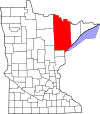 |
| Scott County | 139 | Shakopee | 1853 | Dakota County | Winfield Scott (1786–1866) | 129.928 | 35.668 sq mi (924 km2) |  |
| Sherburne County | 141 | Elk River | 1856 | Benton County | Moses Sherburne (1813–1873), | 88.499 | 43.630 sq mi (1.130 km2) |  |
| Sibley County | 143 | Gaylord | 1853 | Dakota County | Henry Hastings Sibley (1811-1891) | 15.226 | 58.865 sq mi (1.525 km2) |  |
| Stearns County | 145 | St. Cloud | 1855 | Cass County, Nicollet County, Pierce County, Sibley County | Charles Thomas Stearns (1814-1888) | 150.642 | 134.452 sq mi (3.482 km2) |  |
| Steele County | 147 | Owatonna | 1855 | Rice County, Blue Earth County, Le Sueur County | Franklin Steele (1813-1880) | 36.576 | 42.955 sq mi (1.113 km2) |  |
| Stevens County | 149 | Morris | 1862 | Pierce County, Unorganized Territory | Isaac Ingalls Stevens (1818-1862) | 9.726 | 56.206 sq mi (1.456 km2) | 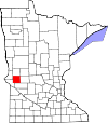 |
| Swift County | 151 | Benson | 1870 | Chippewa County | Henry Adoniram Swift (1823-1869) | 9.783 | 74.353 sq mi (1.926 km2) |  |
| Todd County | 153 | Long Prairie | 1855 | Cass County | John Blair Smith Todd | 24.895 | 94.202 sq mi (2.440 km2) |  |
| Traverse County | 155 | Wheaton | 1862 | Pierce County, Unorganized Territory | Lake Traverse | 3.558 | 57.409 sq mi (1.487 km2) |  |
| Wabasha County | 157 | Wabasha | 1849 | One of nine original counties. | Opkaldt efter M'dewakanton Dakota indianerhøvding Wabasha III | 21.676 | 52.501 sq mi (1.360 km2) |  |
| Wadena County | 159 | Wadena | 1858 | Cass County, Todd County | Wadena Trading Post | 13.843 | 53.502 sq mi (1.386 km2) |  |
| Waseca County | 161 | Waseca | 1857 | Steele County | Dakota-ord der betyder "rich and fertile" | 19.136 | 42.325 sq mi (1.096 km2) |  |
| Washington County | 163 | Stillwater | 1849 | One of nine original counties; formed from residual St. Croix County, Wisconsin Territory. | George Washington (1732-1799) | 238.136 | 39.170 sq mi (1.014 km2) |  |
| Watonwan County | 165 | St. James | 1860 | Brown County | Watonwan River | 11.211 | 43.451 sq mi (1.125 km2) |  |
| Wilkin County | 167 | Breckenridge | 1858 | Cass County, Pembina County | Alexander Wilkin (1820-1864) | 6.576 | 75.143 sq mi (1.946 km2) |  |
| Winona County | 169 | Winona | 1854 | Fillmore County, Wabasha County | Opkaldt efter Wee-No-Nah, søster eller kusine til høvding Wabasha III | 51.461 | 62.630 sq mi (1.622 km2) |  |
| Wright County | 171 | Buffalo | 1855 | Cass County, Sibley County | Silas Wright (1795-1847) | 124.700 | 66.075 sq mi (1.711 km2) |  |
| Yellow Medicine County | 173 | Granite Falls | 1871 | Redwood County | Yellow Medicine River | 10.438 | 75.796 sq mi (1.963 km2) | 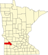 |