

Original file (1,600 × 1,231 pixels, file size: 395 KB, MIME type: image/png)
 | File:Boko Haram insurgency map.svg is a vector version of this file. It should be used in place of this PNG file. File:Boko Haram insurgency map.png → File:Boko Haram insurgency map.svg For more information, see Help:SVG.
|  |
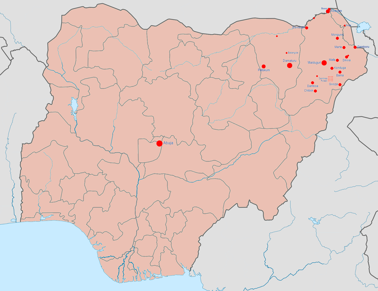
| DescriptionBoko Haram insurgency map.png | English: Map of the Boko Haram insurgency. The map image is based on Template:Nigerian insurgency detailed map. |
| Date | |
| Source | Own work |
| Author | BlueHypercane761 |
Click on a date/time to view the file as it appeared at that time.
| Date/Time | Thumbnail | Dimensions | User | Comment | |
|---|---|---|---|---|---|
| current | 07:08, 23 January 2017 | | 1,600 × 1,231 (395 KB) | BlueHypercane761 | 1-22-2017 Update. The Nigerian Army and its allies finally annihilated Boko Haram in its last camp in Sambisa Forest (its last known stronghold), on December 24, 2016, reducing Boko Haram to a weakened, insurgent group. |
| 23:41, 6 July 2016 |  | 1,600 × 1,231 (395 KB) | BlueHypercane761 | 7-6-2016 Update. The Nigerian Army and the Chadian Army completely sealed off the Sambisa Forest region on June 9, 2016, and have captured 50% of the forest. | |
| 22:09, 25 December 2015 |  | 1,600 × 1,231 (395 KB) | BlueHypercane761 | 12-25-2015 Update. The Nigerian Army has pushed into the heart of Sambisa Forest. | |
| 06:43, 12 November 2015 |  | 1,600 × 1,231 (395 KB) | BlueHypercane761 | Update for 11-12-2015. Boko Haram's territorial control was reduced to Sambisa Forest on Septemebr 8, 2015. The situation is current as of November 12, 2015. | |
| 06:28, 12 November 2015 |  | 1,600 × 1,231 (395 KB) | BlueHypercane761 | User created page with UploadWizard |
The following other wikis use this file: