

Original file (6,000 × 4,000 pixels, file size: 20.05 MB, MIME type: image/jpeg)
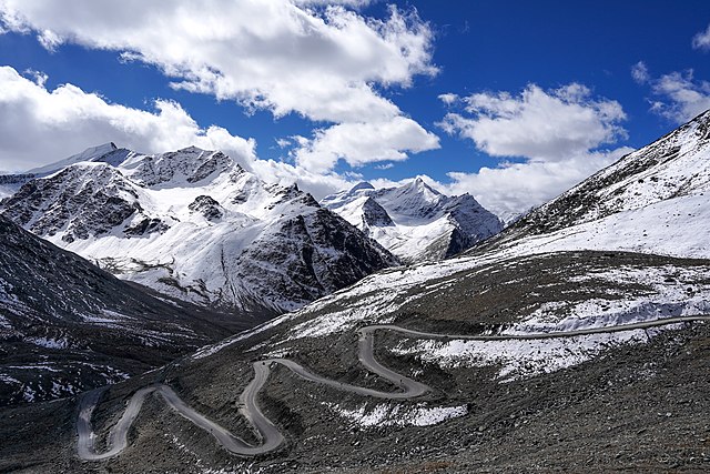
| DescriptionDarcha Padum Road Below Shinku La Lahaul Oct22 A7C 03533.jpg | English: Darcha-Padum road winding up to Shinku La, Lahaul, Himachal, India. Elev. 4,975m (16,322'). Peaks about 5,600m (18,375'). Español: El sinuoso camino a Shingo La, un paso montañoso del Himalaya de 5090 m de altura en el norte de India, que conecta la región de Lahaul en Himachal Pradesh con la región de Zanskar en Ladakh. Українська: Звивиста дорога до Шінго Ла, гімалайського гірського перевалу висотою 5091 м на півночі Індії, що з’єднує регіон Лахаул у Гімачал-Прадеші з регіоном Занскар у Ладакху. | |||
| Date | ||||
| Source | Own work | |||
| Author |
|
| Camera location | 32° 53′ 36.54″ N, 77° 11′ 21.88″ E | View this and other nearby images on: OpenStreetMap |
|---|
|
Click on a date/time to view the file as it appeared at that time.
| Date/Time | Thumbnail | Dimensions | User | Comment | |
|---|---|---|---|---|---|
| current | 05:07, 18 October 2022 | | 6,000 × 4,000 (20.05 MB) | Tagooty | Uploaded own work with UploadWizard |
The following other wikis use this file:
This file contains additional information, probably added from the digital camera or scanner used to create or digitize it.
If the file has been modified from its original state, some details may not fully reflect the modified file.
| Image title |
|
|---|---|
| Camera manufacturer | SONY |
| Camera model | ILCE-7C |
| Author | TA Gonsalves |
| Copyright holder |
|
| Exposure time | 1/640 sec (0.0015625) |
| F-number | f/11 |
| ISO speed rating | 100 |
| Date and time of data generation | 10:05, 4 October 2022 |
| Lens focal length | 28 mm |
| Latitude | 32° 53′ 36.53″ N |
| Longitude | 77° 11′ 21.88″ E |
| Altitude | 4,975 meters above sea level |
| Short title |
|
| Horizontal resolution | 300 dpi |
| Vertical resolution | 300 dpi |
| Software used | Adobe Photoshop Lightroom 6.14 (Macintosh) |
| File change date and time | 10:28, 18 October 2022 |
| Exposure Program | Aperture priority |
| Exif version | 2.32 |
| Date and time of digitizing | 10:05, 4 October 2022 |
| Shutter speed | 9.321928 |
| APEX aperture | 6.918863 |
| APEX brightness | 11.321875 |
| Exposure bias | 0 |
| Maximum land aperture | 4 APEX (f/4) |
| Metering mode | Pattern |
| Light source | Unknown |
| Flash | Flash did not fire, compulsory flash suppression |
| DateTimeOriginal subseconds | 517 |
| DateTimeDigitized subseconds | 517 |
| Color space | sRGB |
| File source | Digital still camera |
| Scene type | A directly photographed image |
| Custom image processing | Normal process |
| Exposure mode | Auto exposure |
| White balance | Auto white balance |
| Digital zoom ratio | 1 |
| Focal length in 35 mm film | 28 mm |
| Scene capture type | Standard |
| Contrast | Normal |
| Saturation | Normal |
| Sharpness | Normal |
| GPS time (atomic clock) | 04:35 |
| Receiver status | Measurement in progress |
| Measurement mode | 2-dimensional measurement |
| Direction of image | 165 |
| Geodetic survey data used | WGS-84 |
| GPS date | 4 October 2022 |
| GPS differential correction | 0 |
| GPS tag version | 0.0.3.2 |
| Lens used | FE 28-60mm F4-5.6 |
| Date metadata was last modified | 15:58, 18 October 2022 |
| Rating (out of 5) | 3 |
| Unique ID of original document | 41CBFB9FCD3DD1FFB6AA3F453DCB90A3 |
| Keywords |
|
| IIM version | 4 |
