
Size of this preview: 409 × 600 pixels. Other resolutions: 163 × 240 pixels | 327 × 480 pixels | 524 × 768 pixels | 1,181 × 1,732 pixels.
Original file (1,181 × 1,732 pixels, file size: 1.71 MB, MIME type: image/jpeg)
Summary
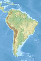
| Description | English: Relief location map of SouthAmerica.
|
| Date | |
| Source | Own work |
| Author | Uwe Dedering |
Licensing
I, the copyright holder of this work, hereby publish it under the following licenses:
This file is licensed under the Creative Commons Attribution-Share Alike 3.0 Unported license.
- You are free:
- to share – to copy, distribute and transmit the work
- to remix – to adapt the work
- Under the following conditions:
- attribution – You must give appropriate credit, provide a link to the license, and indicate if changes were made. You may do so in any reasonable manner, but not in any way that suggests the licensor endorses you or your use.
- share alike – If you remix, transform, or build upon the material, you must distribute your contributions under the same or compatible license as the original.
 | Permission is granted to copy, distribute and/or modify this document under the terms of the GNU Free Documentation License, Version 1.2 or any later version published by the Free Software Foundation; with no Invariant Sections, no Front-Cover Texts, and no Back-Cover Texts. A copy of the license is included in the section entitled GNU Free Documentation License. |
You may select the license of your choice.
File history
Click on a date/time to view the file as it appeared at that time.
| Date/Time | Thumbnail | Dimensions | User | Comment | |
|---|---|---|---|---|---|
| current | 12:50, 27 November 2010 | | 1,181 × 1,732 (1.71 MB) | Uwe Dedering | {{Information |Description={{en|1= Relief location map of SouthAmerica. * Projection: Lambert azimuthal equal-area projection. * Area of interest: :* N: 25.0° N :* S: -60.0° N :* W: -90.0° E :* E: -30.0° E * Projection center: :* NS: -17.5° N :* WE: |
File usage
More than 100 pages use this file.The following list shows the first 100 pages that use this file only.A full list is available.
- 1575 Valdivia earthquake
- 1922 Vallenar earthquake
- 1939 Chillán earthquake
- 1985 Algarrobo earthquake
- 2001 southern Peru earthquake
- 2007 Tocopilla earthquake
- Ana Lake
- Araré Lake
- Asiru Qucha
- Asunción
- Battle of Callao
- Battle of Junín
- Beagle Channel
- Bellavista Lake
- Belo Horizonte
- Blockade of Callao
- Bogotá
- Bolivia Lake
- Brasília
- Buenos Aires
- Cachimbo Lake
- Caral
- Carodnia
- Chalalán Lake
- Chaplín Lake
- Chilata Lake
- Cobija
- Cochabamba
- Coipasa Lake
- Cololo Lake
- Concepción Lake
- Corani Lake
- Coruto Lake
- Curitiba
- Cusco
- Cáceres Lake
- El Alto
- FIS Alpine World Ski Championships 1966
- Fortaleza
- Georgetown, Guyana
- Guayaquil
- Huachi Lake
- Huaytunas Lake
- Jara Lake
- Kalina Lake
- La Angostura Lake
- La Paz
- La Venta (Colombia)
- Laguna Blanca (Bolivia)
- Laguna Celeste
- Laguna Colorada
- Laguna Glaciar
- Laguna Verde (Bolivia)
- Lake Musters and Lake Colhué Huapí
- Lake Poopó
- Lake Titicaca
- List of impact structures in South America
- Los Baños del Inca District
- Monte San Lorenzo
- Montevideo
- Mount Robinson
- Mount Roraima
- Mount Skittle
- Mourasuchus
- Natal, Rio Grande do Norte
- Nuevo Mundo Lake
- Oruro
- Pacaraima Mountains
- Panama City
- Pantanal
- Paramaribo
- Parqu Qucha (Bolivia)
- Pilawit'u
- Porto Alegre
- Potosí
- Quito
- Qullpa Qucha
- Recife
- Rhynchippus
- Rio de Janeiro
- Rogagua Lake
- Rogaguado Lake
- Río Cuarto, Córdoba
- Salvador, Bahia
- San Francisco Lake
- San Jorge Lake
- San José Lake
- San Pedro Lake
- Santa Cruz de la Sierra
- Santiago
- Stanley Peak, South Georgia
- Sucre
- São Paulo
- Tajzara Lake
- Tarija
- Thalassocnus
- Tinguiririca fauna
- Trigonostylops
- Uru Uru Lake
- Wiñaymarka Lake
View more links to this file.
Global file usage
The following other wikis use this file:
- Usage on als.wikipedia.org
- Usage on ar.wikipedia.org
- Usage on ast.wikipedia.org
- Usage on av.wikipedia.org
- Usage on azb.wikipedia.org
- Usage on az.wikipedia.org
- And dağları
- Amazon çayı
- Robinzon Kruzo adası
- Aleksandr Selkirk adası
- Santa Klara adası
- Kopaue
- Şablon:Yer xəritəsi Cənubi Amerika
- İquiqe zəlzələsi (2014)
- İquasu Milli Parkı (Argentina)
- İquasu (şəlalə)
- Serra-du-Mar
- Magellan boğazı
- Dreyk boğazı
- Biql boğazı
- Valdivia zəlzələsi (1960)
- Grau dənizi
- Argentina dənizi
- Pataqoniya arxipelaqı
- Qalinas burnu
- Frоuаrd burnu
- Parinyas burnu
- Seyşas burnu
- Tietе
- Quayra şəlaləsi
- Lyulyaylyako milli parkı
- Kabu-Branku burnu
- Moça adası
- Benxamin adası
- Quamblin adası
- Ceyms adası (Çili)
- Viktoriya adası (Çili)
- Kuptana adası
- Melçor adası
- Rivero adası
- Trayqen adası
- San Ambrosio
- Doson adası
View more global usage of this file.
Metadata
🔥 Top keywords: Main PageSpecial:SearchIndian Premier LeagueWikipedia:Featured picturesPornhubUEFA Champions League2024 Indian Premier LeagueFallout (American TV series)Jontay PorterXXXTentacionAmar Singh ChamkilaFallout (series)Cloud seedingReal Madrid CFCleopatraRama NavamiRichard GaddDeaths in 2024Civil War (film)Shōgun (2024 miniseries)2024 Indian general electionJennifer PanO. J. SimpsonElla PurnellBaby ReindeerCaitlin ClarkLaverne CoxXXX (film series)Facebook2023–24 UEFA Champions LeagueYouTubeCandidates Tournament 2024InstagramList of European Cup and UEFA Champions League finalsJude BellinghamMichael Porter Jr.Andriy LuninCarlo AncelottiBade Miyan Chote Miyan (2024 film)