Poskam County[6][7][8][9][10][11][12][13] (Posgam,[14] Uyghur: پوسكام ناھىيىسى), also Zepu County (Chinese: 泽普县) is a county in Kashgar Prefecture, Xinjiang Uyghur Autonomous Region, China. The county is located on the southern bank of the Yarkand River, also known as the Zarafshān River (泽勒普善河).[1] Poskam County is bordered to the north and west across the Yarkand River by Yarkant County (Shache) and to the south and east by Kargilik County (Yecheng).[15]
Poskam County Posgam, Tse-p'u, Zepu | |
|---|---|
 | |
.png) Location of Poskam County (pink) within Kashgar Prefecture (yellow) and Xinjiang | |
 Poskam Location of the seat in Xinjiang  Poskam Poskam (Xinjiang)  Poskam Poskam (China) | |
| Coordinates: 38°11′44″N 77°16′20″E / 38.19556°N 77.27222°E | |
| Country | China |
| Autonomous region | Xinjiang |
| Prefecture | Kashgar |
| County seat | Poskam (Zepu) |
| Area | |
| • Total | 987.97 km2 (381.46 sq mi) |
| Population (2020)[3] | |
| • Total | 214,543 |
| • Density | 220/km2 (560/sq mi) |
| Ethnic groups | |
| • Major ethnic groups | Uyghur, Han Chinese, Mountain Tajik (China)[1][4][5] |
| Time zone | UTC+8 (China Standard[a]) |
| Postal code | 844800 |
| Website | www |
| Poskam County, Xinjiang | |||||||||||
|---|---|---|---|---|---|---|---|---|---|---|---|
| Uyghur name | |||||||||||
| Uyghur | پوسكام ناھىيىسى | ||||||||||
| |||||||||||
| Chinese name | |||||||||||
| Simplified Chinese | 泽普县 | ||||||||||
| Traditional Chinese | 澤普縣 | ||||||||||
| |||||||||||
History
In 1921, Poskam County was established.[2]
After the Communist takeover, Poskam (Zepu) County was part of Yarkant Prefecture (莎車專區), which was dissolved and became part of Kashgar Prefecture in June 1956.[1]
In 1990, 'unauthorized' mosque construction in Poskam (Zepu) County was reported in the Xinjiang Daily.[16]
Chinese state media reported that in the early morning of October 24, 1999, two died, two were injured and major property damage was sustained at the Seyli (Saili) Township police office in a terrorist attack.[17][18]
On the morning of March 4, 2004, a fire broke out in the Kalatuzi coal mine killing at least six people.[14]
On March 12, 2005, several Uyghur students and their teachers were arrested after a fight with Han Chinese outside Poskam Petroleum No.1 Middle School.[19]
As reported by Radio Free Asia, on August 23, 2013, at least six Uyghurs (possibly twelve) were killed and twenty wounded in a raid carried out by about seventy to eighty armed security personnel on a place in Jigdejay village (Jigedaijiayi; جىگدەجاي كەنتى / 吉格代加依村 38°05′33″N 77°05′00″E / 38.092382°N 77.083273°E), Kuybagh (Kuiyibage) township near the edge of the desert thought to be a 'terrorist' or separatist training camp and munitions center.[20]
On August 27, 2018, Tong'an Township was established.[21] (See also: Kosrap)
In 2018, Poskam County was among ten counties in Xinjiang named by the Ministry of Commerce as a model rural e-commerce county.[22] The county was also listed as the only county in Kashgar Prefecture reaching the standard for a national-level public sanitation county.[23]
In 2019, China National Petroleum Corp announced plans to close Taxinan refinery (塔西南勘探开发公司[1]).[24]
Geography
The county is between 1215 and 1490 meters above sea level. The land is flat and soil is fertile. Rainfall amounts are low.[15]
Climate
| Climate data for Poskam, elevation 1,275 m (4,183 ft), (1991–2020 normals, extremes 1981–2010) | |||||||||||||
|---|---|---|---|---|---|---|---|---|---|---|---|---|---|
| Month | Jan | Feb | Mar | Apr | May | Jun | Jul | Aug | Sep | Oct | Nov | Dec | Year |
| Record high °C (°F) | 19.5 (67.1) | 18.7 (65.7) | 30.1 (86.2) | 34.4 (93.9) | 36.1 (97.0) | 41.0 (105.8) | 38.5 (101.3) | 38.6 (101.5) | 34.0 (93.2) | 29.4 (84.9) | 25.4 (77.7) | 19.5 (67.1) | 41.0 (105.8) |
| Mean daily maximum °C (°F) | 0.7 (33.3) | 6.7 (44.1) | 16.0 (60.8) | 23.7 (74.7) | 27.7 (81.9) | 31.2 (88.2) | 32.4 (90.3) | 30.7 (87.3) | 26.9 (80.4) | 20.8 (69.4) | 12.0 (53.6) | 2.7 (36.9) | 19.3 (66.7) |
| Daily mean °C (°F) | −5.2 (22.6) | 0.5 (32.9) | 9.2 (48.6) | 16.4 (61.5) | 20.2 (68.4) | 23.7 (74.7) | 25.0 (77.0) | 23.6 (74.5) | 19.2 (66.6) | 12.1 (53.8) | 4.1 (39.4) | −3.2 (26.2) | 12.1 (53.9) |
| Mean daily minimum °C (°F) | −10.2 (13.6) | −4.7 (23.5) | 3.1 (37.6) | 9.7 (49.5) | 13.5 (56.3) | 16.9 (62.4) | 18.5 (65.3) | 17.5 (63.5) | 12.8 (55.0) | 5.2 (41.4) | −1.7 (28.9) | −7.6 (18.3) | 6.1 (42.9) |
| Record low °C (°F) | −23.3 (−9.9) | −23.0 (−9.4) | −7.2 (19.0) | 0.0 (32.0) | 4.5 (40.1) | 8.7 (47.7) | 10.9 (51.6) | 9.7 (49.5) | 4.3 (39.7) | −2.6 (27.3) | −11.5 (11.3) | −20.2 (−4.4) | −23.3 (−9.9) |
| Average precipitation mm (inches) | 2.9 (0.11) | 3.1 (0.12) | 3.7 (0.15) | 4.7 (0.19) | 11.9 (0.47) | 11.6 (0.46) | 11.8 (0.46) | 11.0 (0.43) | 5.8 (0.23) | 1.0 (0.04) | 1.9 (0.07) | 1.6 (0.06) | 71 (2.79) |
| Average precipitation days (≥ 0.1 mm) | 2.3 | 1.9 | 1.4 | 1.4 | 3.3 | 4.7 | 4.2 | 3.5 | 2.4 | 0.8 | 0.5 | 1.9 | 28.3 |
| Average snowy days | 5.4 | 3.1 | 0.4 | 0 | 0 | 0 | 0 | 0 | 0 | 0 | 0.6 | 4.5 | 14 |
| Average relative humidity (%) | 64 | 55 | 43 | 39 | 45 | 47 | 53 | 58 | 60 | 58 | 57 | 67 | 54 |
| Mean monthly sunshine hours | 174.6 | 179.2 | 209.3 | 222.6 | 262.2 | 297.6 | 293.5 | 264.7 | 244.2 | 248.9 | 210.2 | 173.9 | 2,780.9 |
| Percent possible sunshine | 57 | 58 | 56 | 56 | 59 | 67 | 66 | 64 | 67 | 73 | 71 | 59 | 63 |
| Source: China Meteorological Administration[25][26] | |||||||||||||
Administrative divisions
The county includes 2 towns, 10 townships, 1 ethnic township, and 2 township-level divisions:[2][27][4][28]
| Name | Simplified Chinese | Hanyu Pinyin | Uyghur (UEY) | Uyghur Latin (ULY) | Administrative division code | |
|---|---|---|---|---|---|---|
| Towns | ||||||
| Poskam Town[29] (Zepu Town[30]) | 泽普镇 | Zépǔ Zhèn | پوسكام بازىرى | poskam baziri | 653124100 | |
| Küybagh Town (Kuiyibage Town) | 奎依巴格镇 | Kuíyībāgé Zhèn | كۈيباغ بازىرى | küybagh baziri | 653124101 | |
| Townships | ||||||
| Poskam Township[31] (Bosikamu Township) | 波斯喀木乡 | Bōsīkāmù Xiāng | پوسكام يېزسى | poskam yëzsi | 653124200 | |
| Zhima Township (Yima Township) | 依玛乡 | Yīmǎ Xiāng | ژىما يېزىسى | zhima yëzsi | 653124201 | |
| Gülbagh Township (Gulebage Township) | 古勒巴格乡 | Gǔlèbāgé Xiāng | گۈلباغ يىزىسى | gülbagh yëzsi | 653124202 | |
| Seyli Township (Saili Township) | 赛力乡 | Sàilì Xiāng | سەيلى يىزىسى | seyli yëzsi | 653124203 | |
| Ikkisu Township (Yikensu Township) | 依肯苏乡 | Yīkěnsū Xiāng | ئىككىسۇ يېزىسى | Ikkisu yëzsi | 653124204 | |
| Tughchi Township (Tuhuqi Township) | 图呼其乡 | Túhūqí Xiāng | تۇغچى يېزىسى | tughchi yëzsi | 653124205 | |
| Küybagh Township (Kuiyibage Township) | 奎依巴格乡 | Kuíyībāgé Xiāng | كۈيباغ يېزىسى | küybagh yëzsi | 653124206 | |
| Aqtam Township (Aketamu Township) | 阿克塔木乡 | Kuíyībāgé Xiāng | ئاقتام يېزىسى | Aqtam yëzsi | 653124207 | |
| Aykol Township (Ayikule Township) | 阿依库勒乡 | Āyīkùlè Xiāng | ئاقتام يېزىسى | Ayköl yëzsi | 653124208 | |
| Tong'an Township | 桐安乡 | Tóng'ān Xiāng | توڭئەن يېزىسى | tong'en yëzsi | 653124210 | |
| Ethnic townships | ||||||
| Buyluq Tajik Ethnic Township | 布依鲁克塔吉克族乡 | Bùyīlǔkè Tǎjíkèzú Xiāng | بۇيلۇق تاجىك مىللىي يىزىسى | buyluq tajik milliy yëzsi | 653124209 | |
| township-level divisions | ||||||
| Poskam Certified Seed Farm | 泽普县良种场 | Zépǔ Xiàn Liángzhǒngchǎng | پوسكام ناھىيە ئۇرۇمچىلىق مەيدانى | poskam nahiye Urumchiliq meydani | 653124401 | |
| State-owned Tree Farm | 国营林场 | Guóyíng Línchǎng | 653124403 | |||
Economy
Irrigation is well-developed in the county, and the county is an important producer of wheat, rice, corn and cotton in southern Xinjiang. Grapes are a local speciality. Industries include mining, machinery, construction and cotton-spinning.[32] As of 2017, Poskam County had 42,405.25 hectares of arable land.[1] On January 14–15, 2020, Kashgar Prefecture officials carried out fourteen lectures in Poskam County on scientific methods of agriculture attended by more than 12,000 persons.[33]
Tourism
A tourist attraction located in the county is Jinhuyang National Forest Park, rated as a AAAAA Tourist Attractions of China according to the official classification for tourist sights.[34]
Demographics
| Year | Pop. | ±% p.a. |
|---|---|---|
| 2000 | 181,721 | — |
| 2010 | 206,936 | +1.31% |
| [2][35] | ||
As of the end of 2016, 175,686 (84.1%) of the 208,950 residents of the county were Uyghur, 27,131 (13%) were Han Chinese, 4,463 (2.1%) were Mountain Tajik (China), and 1,670 (0.8%) were from other ethnic groups.[1]
As of 2015, 181,256 of the 223,694 residents of the county were Uyghur, 35,950 were Han Chinese, 4,452 were Mountain Tajik (China) and 2,036 were from other ethnic groups.[36]
According to the 2002 census, it has a population of 180,000.[citation needed]
As of the 2000 Census, ethnic minorities made up 79.38% of the population of Poskam County.[35]
As of 1999, 75.29% of the population of Poskam (Zepu) County was Uyghur and 20.76% of the population was Han Chinese.[37]
Transportation
Poskam is served by China National Highway 315 and the Kashgar-Hotan Railway.
Historical maps
 Map including Poskam (labeled as Posgambasar) (1917)
![Map including Zepu (labeled as TSE-P'U (POSGAM)) and surrounding region from the International Map of the World (AMS, 1966)[b]](//upload.wikimedia.org/wikipedia/commons/thumb/a/ae/Txu-oclc-6654394-nj-43-5th-ed.jpg/215px-Txu-oclc-6654394-nj-43-5th-ed.jpg) Map including Zepu (labeled as TSE-P'U (POSGAM)) and surrounding region from the International Map of the World (AMS, 1966)[b]
Map including Zepu (labeled as TSE-P'U (POSGAM)) and surrounding region from the International Map of the World (AMS, 1966)[b] Map including Poskam (labeled as ZEPU TSE-P'U) (DMA, 1980)
![From the Operational Navigation Chart; map including Poskam (labeled as Zepu (Tse-p'u)) (DMA, 1980)[c]](//upload.wikimedia.org/wikipedia/commons/thumb/f/fb/Operational_Navigation_Chart_G-7%2C_6th_edition.jpg/331px-Operational_Navigation_Chart_G-7%2C_6th_edition.jpg)
![Map including Poskam (labeled as Zepu (Tse-p'u)) (DMA, 1984)[d]](//upload.wikimedia.org/wikipedia/commons/thumb/a/a1/Txu-pclmaps-oclc-22834566_g-7a.jpg/335px-Txu-pclmaps-oclc-22834566_g-7a.jpg)
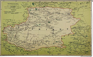
_p61_PLATE19._SINKIANG_(14597194848).jpg)
![Map including Zepu (labeled as TSE-P'U (POSGAM)) and surrounding region from the International Map of the World (AMS, 1966)[b]](https://www.search.com.vn/wiki/en/File:Txu-oclc-6654394-nj-43-5th-ed.jpg)

![From the Operational Navigation Chart; map including Poskam (labeled as Zepu (Tse-p'u)) (DMA, 1980)[c]](https://www.search.com.vn/wiki/en/File:Operational_Navigation_Chart_G-7,_6th_edition.jpg)
![Map including Poskam (labeled as Zepu (Tse-p'u)) (DMA, 1984)[d]](https://www.search.com.vn/wiki/en/File:Txu-pclmaps-oclc-22834566_g-7a.jpg)