Malline:Sijaintikartta
(Ohjattu sivulta Malline:Location map)
Ohje
Mallineen avulla saadaan karttapohjaan yksi markkeri, johin voi lisätä klikattavan linkin.
Käyttö
{{Location map |''location'' |label = ''label text'' |label_size = map font size, per cent |alt = [[WP:ALT|Alt text]] for image (defaults to generic description) |position = left ''or'' right ''or'' top ''or'' bottom ''or'' none – position of the label relative to the mark, defaults to ''right'' |background = ''color'', background color for the label, defaults to none |lon_dir=W longitude: W=west, E=east (default) |lat_dir=S latitude: S=south, N=north (default) |lat_deg = ''latitude'' degrees |lat_min = ''latitude'' minutes |lat_sec = ''latitude'' seconds |lon_deg = ''longitude'' degrees |lon_min = ''longitude'' minutes |lon_sec = ''longitude'' seconds |lat = ''latitude'' (decimal format; enter negative numbers for southern latitude) |long = ''longitude'' (decimal format; enter negative numbers for western longitude) |mark = ''marker image file name'', a red dot by default |marksize = ''marker size'', default=8 |border = ''border color'' or ''none'' |caption = ''map caption''; for no caption enter "caption="; if the parameter is omitted then the caption will be "Marker text (location map name)" |float = left ''or'' right ''or'' center ''or'' none |width = ''map width'' (omit "px" or will stretch across page) |AlternativeMap = Alternative map, must use same border coordinates as the default map}}Valmiita karttoja
Valmiita sijaintikarttoja
- Sijaintikartta
- Sijaintikartta/Info
- Sijaintikartta/monta
- Sijaintikartta/monta/ohje
- Sijaintikartta/ohje
- Sijaintikartta 100x100
- Sijaintikartta Afganistan
- Sijaintikartta Ahvenanmaan maakunta
- Sijaintikartta Alankomaat
- Sijaintikartta Alaska
- Sijaintikartta Albania
- Sijaintikartta Algeria
- Sijaintikartta Alpit
- Sijaintikartta Andorra
- Sijaintikartta Angola
- Sijaintikartta Anguilla
- Sijaintikartta Argentiina
- Sijaintikartta Armenia
- Sijaintikartta Australia
- Sijaintikartta Azerbaidžan
- Sijaintikartta Bahrain
- Sijaintikartta Bangladesh
- Sijaintikartta Barbados
- Sijaintikartta Belgia
- Sijaintikartta Benin
- Sijaintikartta Bhutan
- Sijaintikartta Bolivia
- Sijaintikartta Bosnia ja Hertsegovina
- Sijaintikartta Botswana
- Sijaintikartta Brasilia
- Sijaintikartta Brunei
- Sijaintikartta Bulgaria
- Sijaintikartta Burkina Faso
- Sijaintikartta Burundi
- Sijaintikartta Chile
- Sijaintikartta Costa Rica
- Sijaintikartta Delaware
- Sijaintikartta Djibouti
- Sijaintikartta Dominikaaninen tasavalta
- Sijaintikartta EBEL
- Sijaintikartta Ecuador
- Sijaintikartta Egypti
- Sijaintikartta El Salvador
- Sijaintikartta Englanti
- Sijaintikartta Eritrea
- Sijaintikartta Espanja
- Sijaintikartta Etelä-Afrikka
- Sijaintikartta Etelä-Karjalan maakunta
- Sijaintikartta Etelä-Korea
- Sijaintikartta Etelä-Norja
- Sijaintikartta Etelä-Pohjanmaan maakunta
- Sijaintikartta Etelä-Savon maakunta
- Sijaintikartta Etelä-Sudan
- Sijaintikartta Etiopia
- Sijaintikartta Eurooppa
- Sijaintikartta Fidži
- Sijaintikartta Filippiinit
- Sijaintikartta Gabon
- Sijaintikartta Gambia
- Sijaintikartta Georgia
- Sijaintikartta Ghana
- Sijaintikartta Grönlanti
- Sijaintikartta Guatemala
- Sijaintikartta Guinea
- Sijaintikartta Guinea-Bissau
- Sijaintikartta Haiti
- Sijaintikartta Havaiji
- Sijaintikartta Honduras
- Sijaintikartta Hongkong
- Sijaintikartta Indonesia
- Sijaintikartta Intia
- Sijaintikartta Intia Jammu ja Kashmir
- Sijaintikartta Irak
- Sijaintikartta Iran
- Sijaintikartta Irlanti
- Sijaintikartta Islanti
- Sijaintikartta Israel
- Sijaintikartta Italia
- Sijaintikartta Itä-Timor
- Sijaintikartta Itämeri
- Sijaintikartta Itävalta
- Sijaintikartta Jamaika
- Sijaintikartta Japani
- Sijaintikartta Jemen
- Sijaintikartta Jordania
- Sijaintikartta Kainuun maakunta
- Sijaintikartta Kambodža
- Sijaintikartta Kamerun
- Sijaintikartta Kanada
- Sijaintikartta Kanada Alberta
- Sijaintikartta Kanada Brittiläinen Kolumbia
- Sijaintikartta Kanada Luoteisterritoriot
- Sijaintikartta Kanada Manitoba
- Sijaintikartta Kanada New Brunswick
- Sijaintikartta Kanada Newfoundland ja Labrador
- Sijaintikartta Kanada Nova Scotia
- Sijaintikartta Kanada Nunavut
- Sijaintikartta Kanada Ontario
- Sijaintikartta Kanada Prinssi Edwardin saari
- Sijaintikartta Kanada Quebec
- Sijaintikartta Kanada Saskatchewan
- Sijaintikartta Kanariansaaret
- Sijaintikartta Kanta-Hämeen maakunta
- Sijaintikartta Kap Verde
- Sijaintikartta Karibianmeri
- Sijaintikartta Karjalan kannas
- Sijaintikartta Kaukasia
- Sijaintikartta Kazakstan
- Sijaintikartta Kenia
- Sijaintikartta Keski-Afrikan tasavalta
- Sijaintikartta Keski-Pohjanmaan maakunta
- Sijaintikartta Keski-Suomen maakunta
- Sijaintikartta Kiina
- Sijaintikartta Kiina2
- Sijaintikartta Kiina Guangdong
- Sijaintikartta Kiina Liaoning
- Sijaintikartta Kiina Shandong
- Sijaintikartta Kiina Sichuan
- Sijaintikartta Kiina Yunnan
- Sijaintikartta Kirgisia
- Sijaintikartta Kolumbia
- Sijaintikartta Komorit
- Sijaintikartta Kongon demokraattinen tasavalta
- Sijaintikartta Kongon tasavalta
- Sijaintikartta Korsika
- Sijaintikartta Kosovo
- Sijaintikartta Kreikka
- Sijaintikartta Kreikka Attika
- Sijaintikartta Kroatia
- Sijaintikartta Kroatia Osijek-Baranja
- Sijaintikartta Kuuba
- Sijaintikartta Kuwait
- Sijaintikartta Kymenlaakson maakunta
- Sijaintikartta Kypros
- Sijaintikartta Kööpenhamina
- Sijaintikartta Laos
- Sijaintikartta Lapin maakunta
- Sijaintikartta Latvia
- Sijaintikartta Lesotho
- Sijaintikartta Libanon
- Sijaintikartta Liberia
- Sijaintikartta Libya
- Sijaintikartta Liettua
- Sijaintikartta Lissabon
- Sijaintikartta Lähi-itä
- Sijaintikartta Länsi-Sahara
- Sijaintikartta Länsi-Saksa
- Sijaintikartta Maailma
- Sijaintikartta Madagaskar
- Sijaintikartta Madeira
- Sijaintikartta Maine
- Sijaintikartta Malawi
- Sijaintikartta Malesia
- Sijaintikartta Mali
- Sijaintikartta Manhattan
- Sijaintikartta Mansaari
- Sijaintikartta Marokko
- Sijaintikartta Martinique
- Sijaintikartta Mauritania
- Sijaintikartta Mauritius
- Sijaintikartta Mayotte
- Sijaintikartta Meksiko
- Sijaintikartta Mesoamerikka
- Sijaintikartta Mexico City
- Sijaintikartta Michigan
- Sijaintikartta Minnesota
- Sijaintikartta Moldova
- Sijaintikartta Monaco
- Sijaintikartta Mongolia
- Sijaintikartta Montenegro
- Sijaintikartta Montserrat
- Sijaintikartta Mosambik
- Sijaintikartta Mustameri
- Sijaintikartta Myanmar
- Sijaintikartta Namibia
- Sijaintikartta Nauru
- Sijaintikartta Nepal
- Sijaintikartta New Mexico
- Sijaintikartta New York
- Sijaintikartta Newfoundland
- Sijaintikartta Nicaragua
- Sijaintikartta Niger
- Sijaintikartta Nigeria
- Sijaintikartta Norja
- Sijaintikartta Norja Akershusin lääni
- Sijaintikartta Norja Buskerudin lääni
- Sijaintikartta Norja Etelä-Trøndelagin lääni
- Sijaintikartta Norja Finnmarkin lääni
- Sijaintikartta Norja Hedmarkin lääni
- Sijaintikartta Norja Hordalandin lääni
- Sijaintikartta Norja Huippuvuoret
- Sijaintikartta Norja Itä-Agderin lääni
- Sijaintikartta Norja Länsi-Agderin lääni
- Sijaintikartta Norja Møren ja Romsdalin lääni
- Sijaintikartta Norja Nordlandin lääni
- Sijaintikartta Norja Opplandin lääni
- Sijaintikartta Norja Oslo
- Sijaintikartta Norja Oslon keskusta
- Sijaintikartta Norja Oslonvuono
- Sijaintikartta Norja Pohjois-Trøndelagin lääni
- Sijaintikartta Norja Rogalandin lääni
- Sijaintikartta Norja Sognin ja Fjordanen lääni
- Sijaintikartta Norja Telemarkin lääni
- Sijaintikartta Norja Tromssan lääni
- Sijaintikartta Norja Vestfoldin lääni
- Sijaintikartta Norja Østfoldin lääni
- Sijaintikartta Norsunluurannikko
- Sijaintikartta Oman
- Sijaintikartta Pakistan
- Sijaintikartta Palestiina
- Sijaintikartta Panama
- Sijaintikartta Papua-Uusi-Guinea
- Sijaintikartta Paraguay
- Sijaintikartta Pennsylvania
- Sijaintikartta Peru
- Sijaintikartta Pirkanmaan maakunta
- Sijaintikartta Pohjanmaan maakunta
- Sijaintikartta Pohjanmeri
- Sijaintikartta Pohjois-Amerikka
- Sijaintikartta Pohjois-Irlanti
- Sijaintikartta Pohjois-Italia
- Sijaintikartta Pohjois-Karjalan maakunta
- Sijaintikartta Pohjois-Korea
- Sijaintikartta Pohjois-Makedonia
- Sijaintikartta Pohjois-Pohjanmaan maakunta
- Sijaintikartta Pohjois-Savon maakunta
- Sijaintikartta Portugali
- Sijaintikartta Puerto Rico
- Sijaintikartta Puola
- Sijaintikartta Puola Aleksandrówin piirikunta
- Sijaintikartta Puola Olesnon piirikunta
- Sijaintikartta Puola Opolen voivodikunta
- Sijaintikartta Puola Ostrowiecin piirikunta
- Sijaintikartta Puola Strzelcen piirikunta
- Sijaintikartta Pyreneet
- Sijaintikartta Päijät-Hämeen maakunta
- Sijaintikartta Päiväntasaajan Guinea
- Sijaintikartta Qatar
- Sijaintikartta Qatar Doha
- Sijaintikartta Ranska
- Sijaintikartta Ranskan Guayana
- Sijaintikartta Ranskan Polynesia
- Sijaintikartta Reunion
- Sijaintikartta Romania
- Sijaintikartta Ruanda
- Sijaintikartta Ruotsi
- Sijaintikartta Ruotsi Blekingen lääni
- Sijaintikartta Ruotsi Etelä-Ruotsi
- Sijaintikartta Ruotsi Gotlannin lääni
- Sijaintikartta Ruotsi Gotlannin lääni (muokattu)
- Sijaintikartta Ruotsi Gävleborgin lääni
- Sijaintikartta Ruotsi Hallandin lääni
- Sijaintikartta Ruotsi Itä-Götanmaan lääni
- Sijaintikartta Ruotsi Jämtlandin lääni
- Sijaintikartta Ruotsi Jönköpingin lääni
- Sijaintikartta Ruotsi Kalmarin lääni
- Sijaintikartta Ruotsi Kronobergin lääni
- Sijaintikartta Ruotsi Länsi-Götanmaan lääni
- Sijaintikartta Ruotsi Norrbottenin lääni
- Sijaintikartta Ruotsi Skånen lääni
- Sijaintikartta Ruotsi Södermanlandin lääni
- Sijaintikartta Ruotsi Taalainmaan lääni
- Sijaintikartta Ruotsi Tukholma
- Sijaintikartta Ruotsi Tukholman lääni
- Sijaintikartta Ruotsi Tukholman saaristo
- Sijaintikartta Ruotsi Uppsalan lääni
- Sijaintikartta Ruotsi Värmlannin lääni
- Sijaintikartta Ruotsi Västerbottenin lääni
- Sijaintikartta Ruotsi Västernorrlandin lääni
- Sijaintikartta Ruotsi Västmanlandin lääni
- Sijaintikartta Ruotsi Örebron lääni
- Sijaintikartta Saaristomeri
- Sijaintikartta Saaristomeri (laaja)
- Sijaintikartta Saaristomeri ja Ahvenanmaa
- Sijaintikartta Saksa
- Sijaintikartta Sambia
- Sijaintikartta Samoa
- Sijaintikartta San Marino
- Sijaintikartta Sardinia
- Sijaintikartta Satakunnan maakunta
- Sijaintikartta Saudi-Arabia
- Sijaintikartta Senegal
- Sijaintikartta Serbia
- Sijaintikartta Sierra Leone
- Sijaintikartta Singapore
- Sijaintikartta Skandinavia
- Sijaintikartta Skotlanti
- Sijaintikartta Slovakia
- Sijaintikartta Slovenia
- Sijaintikartta Somalia
- Sijaintikartta Somalimaa
- Sijaintikartta Sri Lanka
- Sijaintikartta Sudan
- Sijaintikartta Suomi
- Sijaintikartta Suomi (1920–1940)
- Sijaintikartta Suriname
- Sijaintikartta Suur-Lontoo
- Sijaintikartta Sveitsi
- Sijaintikartta Swazimaa
- Sijaintikartta Syyria
- Sijaintikartta São Tomé ja Príncipe
- Sijaintikartta Tadžikistan
- Sijaintikartta Taiwan
- Sijaintikartta Taka-Baikalian aluepiiri
- Sijaintikartta Tamil Nadu
- Sijaintikartta Tansania
- Sijaintikartta Tanska
- Sijaintikartta Teneriffa
- Sijaintikartta Texas
- Sijaintikartta Thaimaa
- Sijaintikartta Togo
- Sijaintikartta Tonga
- Sijaintikartta Tunisia
- Sijaintikartta Turkki
- Sijaintikartta Turkmenistan
- Sijaintikartta Tuvalu
- Sijaintikartta Tyynimeri
Esimerkkejä
Kartta vakiotekstillä (asteet/minuutit)
Pag (Croatia){{Location map |Kroatia | label=Pag |alt=Pag is on an island off the Croatian coast. |mark=Locator Dot2.gif <!--Sykkivä täplä--> |marksize=20 <!--Täplän koko--> |lat_deg=44|lat_min=26 |lon_deg=15|lon_min=3 |position=right |width=300 |float=right}} | 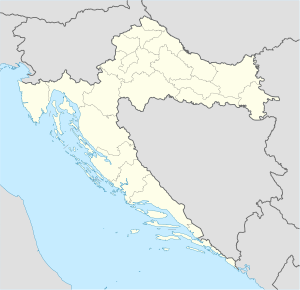 Pag |
Kartta vakiotekstillä ja vakiopointterilla (koordinaatit desimaaleina)
Pag (Croatia){{Location map | Kroatia |label=Pag |lat= <!--decimal form--> 44.44 |long=15.05 |position=right |width= <!--smaller--> 200 |float=right}} |  Pag |
Kartta omalla tekstillä ja tekstin taustalla
Imotski{{Location map |Kroatia |label=Imotski |lat=43.44 |long=17.21 |position=right |width=300 |float=right |background=#FFFFDD |caption=Imotski on the map of Croatia }} | Imotsky Imotski on the map of Croatia |
Markkeri/teksti kartan ulkopuolella
Pag (Croatia){{Location map | Kroatia |label=Pag |lat=44.44 |long=<!--outside map-->11.05 |position=right |width=200 |float=right}} | Pag |
Teksti ja markkeri isolla
Pag (Croatia){{Location map |Kroatia |label=Pag |label_size=200 |lat=44.44 |long=15.05 |marksize=14 |position=right |width=300 |float=right |background=#FFFFDD |caption=Pag Island on the map of Croatia }} | Pag Pag Island on the map of Croatia |
Ei kuvatekstiä
Katla-tulivuori (Islanti){{{Location map |Islanti |label=Katla |label_size=150 |alt=Katla on Mýrdalsjökull-jäätikön alla sijaitseva tulivuori Islannissa |mark=Mountain sign.svg <!--Vuorimarkkeri--> |marksize=20 |lat_deg=63|lat_min=38 |lon_deg=19|lon_min=3|lon_dir=W <!-- W = länteen Greenwichistä--> |caption= <!--Ei kuvatekstiä --> |position=right |width=300 |float=right}} |  Katla |
Läntinen pallonpuolisko
Lockerbie (Scotland){{Location map | Yhdistynyt kuningaskunta |label=Lockerbie | marksize=9 |mark=Blue_pog.svg |lat_dir=N | lat_deg=55 | lat_min=07 | lat_sec=16 |lon_dir=W | lon_deg=03 | lon_min=21 | lon_sec=19 |position=right |width=170 |float=right |caption=Lockerbie in Scotland}} |  Lockerbie Lockerbie in Scotland |
Maa ylittää 180° meridiaanin
Uelen (Russia){{Location map |Venäjä |label=Uelen | marksize=7 |mark=Locator_Dot.png |lat_deg=66|lat_min=09 |lon_deg=169|lon_min=48|lon_dir=W |position=left |width=500 |float=left |background=yellow}} |
 Uelen |
Vaihtoehtoinen karttapohja ("Alternative Map")
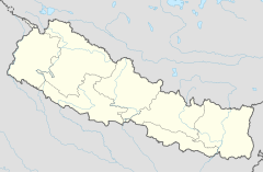
Biratnagar
Biratnagarin lentokenttä Nepalissa
{{Location map | Nepal| lat_deg = 26 | lat_min = 28 | lat_sec = 53 | lat_dir = N| lon_deg = 87 | lon_min = 15 | lon_sec = 50 | lon_dir = E| label = Biratnagar| position = top| mark = Airplane silhouette.svg| marksize = 10| caption = Biratnagarin lentokenttä Nepalissa| alt = Biratnagarin lentokenttä on Nepalin koilliskulmassa}}
Biratnagar
Biratnagarin lentokenttä Nepalissa
{{Location map | Nepal| lat_deg = 26 | lat_min = 28 | lat_sec = 53 | lat_dir = N| lon_deg = 87 | lon_min = 15 | lon_sec = 50 | lon_dir = E| label = Biratnagar| position = top| mark = Airplane silhouette.svg| marksize = 10| caption = Biratnagarin lentokenttä Nepalissa| alt = Biratnagarin lentokenttä on Nepalin koilliskulmassa| AlternativeMap = Nepal relief location map.jpg}}Pointtereita
Katso myös
- Location map Monta: yhdestä yhdeksään pointteria teksteineen
- Location map+: niin monta pointteria teksteineen kuin halutaan
- Malline:Location map Lua: Moduuli-karttapohjia varten
- Malline:Sijaintikartta/monta: Lua-moduulia käyttävä karttamalline
🔥 Top keywords: Wikipedia:EtusivuToiminnot:HakuAnders AdlercreutzJalkapallon Euroopan-mestaruuskilpailutPahan väriIda PaulJalkapallon Euroopan-mestaruuskilpailut 2024Kylian MbappéMichel PlatiniLuettelo Suomen kaupungeistaRomelu LukakuMichael PenttiläJuhannusJalkapallon maailmanmestaruuskilpailutToiminnot:Tuoreet muutoksetJalkapallon Euroopan-mestaruuskilpailut 2020AdlercreutzJarno SaarinenRuud GullitKipparikvartetti (elokuva)SuomiRanskan jalkapallomaajoukkueLuettelo hätäkeskuksen tehtäväluokistaIsänpäiväAntoine GriezmannKipparikvartettiSalatut elämät – 26. esityskausi (2023–2024)IlonBelgian jalkapallomaajoukkueBelgiaAntti KaikkonenErkka V. LehtolaRitva OksanenRomaniaCasino Royale (vuoden 1967 elokuva)Marianne MiettinenJalkapallon maailmanmestaruuskilpailut 2022IslantiLiisa Tuomi