
Blazed_alder_snotel.jpg (400 × 532 pixels, file size: 38 KB, MIME type: image/jpeg)
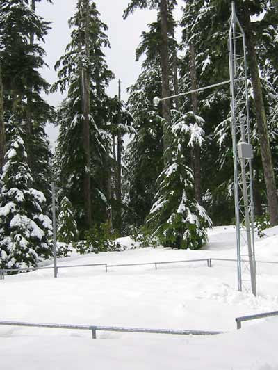
| DescriptionBlazed alder snotel.jpg | English: Snow telemetry (SNOTEL) station near Blazed Alder Creek in northwest Oregon, United States. At 3,650 feet (1,110 m), the station is the highest above sea level of the three SNOTELs in the Bull Run River watershed. |
| Date | Unknown date Unknown date but post-1982 |
| Source | Blazed Alder SNOTEL, Natural Resources Conservation Service of the U.S. Department of Agriculture |
| Author | Unknown authorUnknown author |
| Public domainPublic domainfalsefalse |
| This image is a work of the Natural Resources Conservation Service, part of the United States Department of Agriculture, taken or made as part of an employee's official duties. As a work of the U.S. federal government, the image is in the public domain in the United States. |
Click on a date/time to view the file as it appeared at that time.
| Date/Time | Thumbnail | Dimensions | User | Comment | |
|---|---|---|---|---|---|
| current | 04:03, 18 July 2010 | | 400 × 532 (38 KB) | Finetooth | {{Information |Description={{en|1=Snow telemetry (SNOTEL) station near Blazed Alder Creek in northwest Oregon, United States. At {{convert|3650|ft|m}}, the station is the highest above sea level of the three SNOTELs in the [[:en |
This file contains additional information, probably added from the digital camera or scanner used to create or digitize it.
If the file has been modified from its original state, some details may not fully reflect the modified file.
| _error | 0 |
|---|