
ClearwaterEscarpment-Lewiston-USDA-1917.png (595 × 464 pixels, file size: 301 KB, MIME type: image/png)
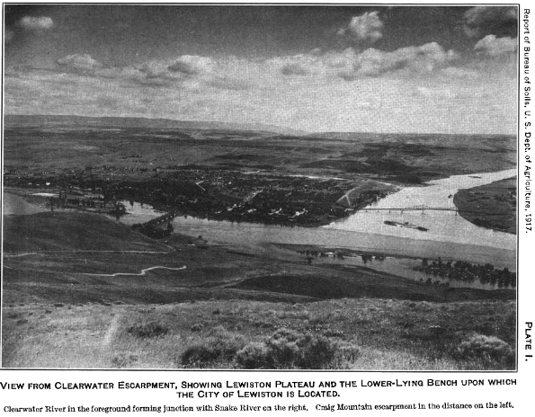
| DescriptionClearwaterEscarpment-Lewiston-USDA-1917.png | English: Clearwater River in the foreground forming junction with Snake River on the right. Craig Mountain escarpment in the distance on the left. Photo credit: United States Department of Agriculture, 1917. |
| Date | |
| Source | https://www.nrcs.usda.gov/Internet/FSE_MANUSCRIPTS/idaho/nezperce&lewisID1920/nezperce&lewisID1920.pdf |
| Author | USDA |
| Camera location | 46° 27′ 36.89″ N, 117° 00′ 58.55″ W | View this and other nearby images on: OpenStreetMap |
|---|
,
| Public domainPublic domainfalsefalse |
This image or file is a work of a United States Department of Agriculture employee, taken or made as part of that person's official duties. As a work of the U.S. federal government, the image is in the public domain. English ∙ español ∙ Nederlands ∙ slovenščina ∙ Tiếng Việt ∙ македонски ∙ русский ∙ українська ∙ 日本語 ∙ +/− |  |
Click on a date/time to view the file as it appeared at that time.
| Date/Time | Thumbnail | Dimensions | User | Comment | |
|---|---|---|---|---|---|
| current | 23:33, 14 January 2021 | | 595 × 464 (301 KB) | RobLa | Uploaded a work by USDA from https://www.nrcs.usda.gov/Internet/FSE_MANUSCRIPTS/idaho/nezperce&lewisID1920/nezperce&lewisID1920.pdf with UploadWizard |
This file contains additional information, probably added from the digital camera or scanner used to create or digitize it.
If the file has been modified from its original state, some details may not fully reflect the modified file.
| Software used |
|---|