

Original file (1,206 × 1,238 pixels, file size: 529 KB, MIME type: image/jpeg)
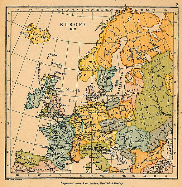
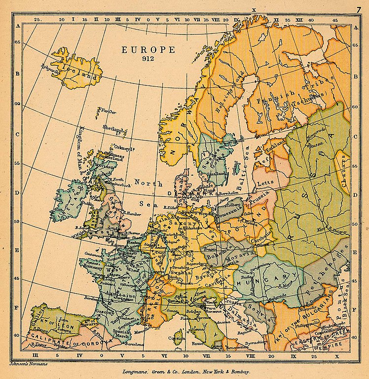
| DescriptionEurope 912 en.jpg | English: A political map of most of Europe in 912 CE |
| Date | |
| Source | The map is taken from "The Public Schools Historical Atlas" by Charles Colbeck. Longmans, Green; New York; London; Bombay. 1905. It was accessed through the University of Texas at Austin's Perry-Castañeda Library Map Collection. |
| Author | Charles Colbeck |
| Public domainPublic domainfalsefalse |
This work is in the public domain in the United States because it was published (or registered with the U.S. Copyright Office) before January 1, 1929. Public domain works must be out of copyright in both the United States and in the source country of the work in order to be hosted on the Commons. If the work is not a U.S. work, the file must have an additional copyright tag indicating the copyright status in the source country. Note: This tag should not be used for sound recordings.PD-1923Public domain in the United States//commons.wikimedia.org/wiki/File:Europe_912_en.jpg |
Click on a date/time to view the file as it appeared at that time.
| Date/Time | Thumbnail | Dimensions | User | Comment | |
|---|---|---|---|---|---|
| current | 18:28, 11 January 2019 | | 1,206 × 1,238 (529 KB) | Bryanrutherford0 | User created page with UploadWizard |
The following other wikis use this file:
This file contains additional information, probably added from the digital camera or scanner used to create or digitize it.
If the file has been modified from its original state, some details may not fully reflect the modified file.
| Orientation | Normal |
|---|---|
| Horizontal resolution | 300 dpi |
| Vertical resolution | 300 dpi |
| Software used | Adobe Photoshop 7.0 |
| File change date and time | 16:21, 9 October 2003 |
| Color space | Uncalibrated |
_en.png)
.png)
.jpg)