

Original file (SVG file, nominally 940 × 415 pixels, file size: 1.49 MB)
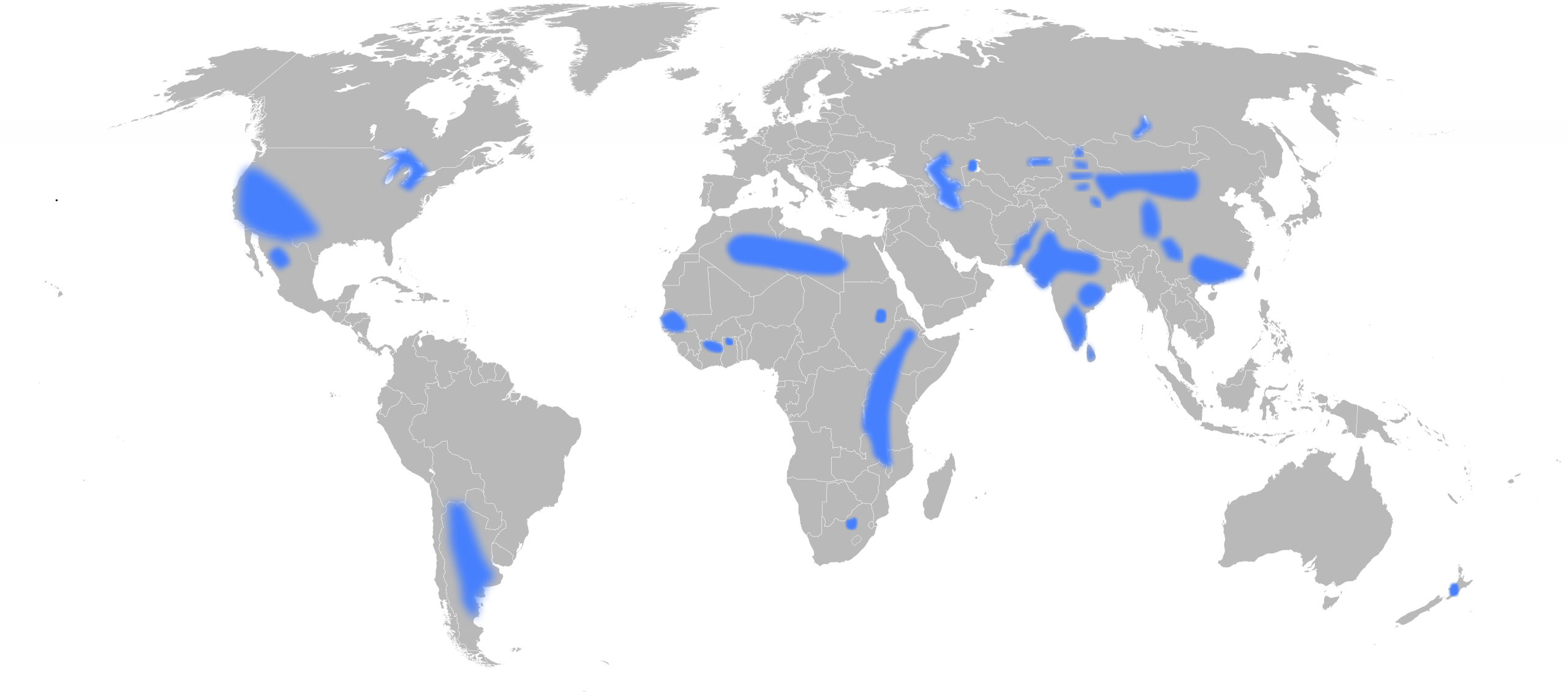
| DescriptionGroundwater-fluoride-world.svg | English: Geographical areas associated with groundwater fluoride concentrations above 1.5 mg/L. |
| Date | |
| Source | Own work using:
|
| Author | User:Eubulides |
| SVG development InfoField |
 | Permission is granted to copy, distribute and/or modify this document under the terms of the GNU Free Documentation License, Version 1.2 or any later version published by the Free Software Foundation; with no Invariant Sections, no Front-Cover Texts, and no Back-Cover Texts. A copy of the license is included in the section entitled GNU Free Documentation License.http://www.gnu.org/copyleft/fdl.htmlGFDLGNU Free Documentation Licensetruetrue |
Click on a date/time to view the file as it appeared at that time.
| Date/Time | Thumbnail | Dimensions | User | Comment | |
|---|---|---|---|---|---|
| current | 08:43, 22 May 2009 | | 940 × 415 (1.49 MB) | Eubulides | {{Information |Description= {{en|Geographical areas associated with groundwater fluoride concentrations above 1.5 mg/L. Derived from data in Figure 2 in: {{cite web |url=http://www.nhmrc.gov.au/PUBLICATIONS/synopses/_files/eh41.pdf |format=PDF |accessdate |
The following other wikis use this file: