Bild:Location San Marino Europe.svg

Größe der PNG-Vorschau dieser SVG-Datei: 713 × 600 Pixels. Anner Oplösungen: 285 × 240 Pixels | 571 × 480 Pixels | 913 × 768 Pixels | 1.218 × 1.024 Pixels | 2.435 × 2.048 Pixels | 2.045 × 1.720 Pixels.
Originaldatei (SVG-Datei, Utgangsgrött: 2.045 × 1.720 Pixel, Dateigrött: 4,51 MB)
| Disse Datei warrt direkt vun Wikimedia Commons inbunnen. Angaven to'n Autor un de Lizenz staht op de Sied to de Datei bi Commons. |
Beschrieven
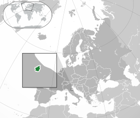
| Beschrievung | English: Location of San Marino in Europe. Italiano: Posizione di San Marino in Europa. |
| Datum/Tiet | (UTC) |
| Born | Diese Datei wurde von diesen Werken abgeleitet: |
| Autor |
Lizenz
Disse Datei is verfögbar ünner de Creative Commons Attribution-Share Alike 3.0 Unported Afspraak.
- Du dröffst:
- wiedergeven – Kopien maken, an Annere wiedergeven un överdregen
- nee tohoopsetten – dat Wark verännern
- Ünner disse Bedingen:
- Naam nömen – Du musst den Naam von’n Autor oder von’n Afspraakgever in de von em fastleggte Wies nömen (aver nich so, dat dat utsüht, as wenn he di oder dien Gebruuk von dat Wark ünnerstütten deit).
- egaal wiedergeven – Wenn du dit Wark ännerst, afwannelst oder in en eegen Wark inboost, dörffst du dat nie’e Wark, dat dor bi rutkummt, man ünner desülve Afspraak oder een, de so temlich dat sülve is, rutgeven.
Ursprüngliches Datei-Logbuch
This image is a derivative work of the following images:
- File:Location San Marino Europe.png licensed with Cc-by-sa-3.0, GFDL
- 2013-07-02T00:40:32Z Klodde 2056x1800 (455515 Bytes) Bigger
- 2009-06-30T03:08:02Z Bosonic dressing 2056x1800 (378475 Bytes) {{Information |Description={{en|1=San Marino (dark green) / Europe (dark grey); inspired by and consistent with general country locator maps by User:Vardion, et al}} |Source=Own work by uploader |Author=[[User:Bosonic dressin
- File:Europe-Faroe Islands.svg licensed with Cc-by-sa-3.0
- 2020-02-06T08:22:11Z Rob984 2045x1720 (7791783 Bytes) General improvements. Base: [[:File:Location European nation states.svg]]. Zoom insert derived from [[:File:Map of the Faroe Islands de.svg]].
- 2011-02-22T11:24:44Z Chipmunkdavis 2045x1720 (2329810 Bytes) {{Information |Description={{en|1={{Europe-SVG-en|Northern Cyprus}}}} {{en|1=The Full Map of Jersey}} |Source=*[[:File:Europe-Jersey.svg|]] |Date=2011-02-22 11:23 (UTC) |Author=*[[:File:Europe-Jersey.svg|]]: *[[:File:Europe-N
- File:Location European nation states.svg licensed with Cc-by-sa-3.0-migrated, GFDL
- 2020-05-22T17:41:59Z Thayts 2045x1720 (2972998 Bytes) The island of Borkum belongs to Germany, not the Netherlands
- 2020-02-06T03:54:48Z Rob984 2045x1720 (2936560 Bytes) Huge code cleanup + fixed XML errors
- 2020-02-02T06:21:11Z Rob984 2045x1720 (5974727 Bytes) Per COM:OVERWRITE, since this file conforms with UN: Added Morocco-Western Sahara border. Removed border showing Israeli-occupied Golan Heights.
- 2020-02-01T02:16:25Z Rob984 2045x1720 (5937232 Bytes) Fixed Flevoland in the Netherlands, and other minor inaccuracies.
- 2019-12-29T02:09:08Z Rob984 2045x1720 (5955906 Bytes) Minor corrections to shading of islands.
- 2019-12-29T00:50:58Z Rob984 2045x1720 (5955939 Bytes) Per original file: a few disputed areas I changed by accident.
- 2019-12-29T00:10:39Z Rob984 2045x1720 (5858427 Bytes) Subtly revised the pan/scale in order to show the Flores Island in the Azores, and Franz Josef Land (the Russia archipelago north east of Svalbard). Note: the image dimensions remain the same.
- 2017-11-19T14:03:18Z Giorgi Balakhadze 2045x1720 (7667567 Bytes) Rv of Rob984 edits per COM:OVERWRITE, the original file by Ssolbergj had no conflict regions
- 2017-08-29T17:14:14Z Бровар 2045x1720 (7708628 Bytes) Reverted to version as of 01:26, 10 March 2017 (UTC)
- 2017-08-29T17:09:09Z Бровар 512x431 (772453 Bytes) Crimea is not an island, it is a Ukrainian peninsula.
- 2017-03-10T01:26:45Z Geom10 2045x1720 (7708628 Bytes) fixed disputed borders
- 2016-08-09T23:51:53Z Rob984 2045x1720 (7694883 Bytes) More contrast between Europe and other areas+ocean. Also changed to neutral grey rather than blue tinted.
- 2015-05-18T12:40:29Z Denniss 2045x1720 (7737776 Bytes) Reverted to version as of 16:09, 19 August 2014
- 2015-05-18T10:47:19Z Ercwlff 2045x1720 (748293 Bytes) Reverted to version as of 15:55, 9 October 2010
- 2014-08-19T16:09:45Z Rob984 2045x1720 (7737776 Bytes) Minor
- 2014-08-06T15:09:11Z Rob984 2045x1720 (7737748 Bytes) Improved version: More accurate coastline, borders, etc. Added Gradient and Longitude and latitude lines.
- 2010-10-09T15:55:16Z LX 2045x1720 (748293 Bytes) Reverted sockpuppet edits to version as of 15:03, 11 November 2009
- 2010-10-02T06:27:34Z Lartyo 2045x1720 (730891 Bytes) Reverted to version as of 20:37, 18 October 2009
- 2009-11-11T15:03:57Z NuclearVacuum 2045x1720 (748293 Bytes) minor
- 2009-11-11T14:59:54Z NuclearVacuum 2045x1720 (733426 Bytes) territorial fixes
- 2009-10-18T20:37:51Z NuclearVacuum 2045x1720 (730891 Bytes) several countries did not include all its territories
- 2008-12-04T00:44:42Z Ssolbergj 2045x1720 (726069 Bytes) Kosovo
- 2008-06-20T13:09:36Z Ssolbergj 2045x1720 (724181 Bytes) Reverted to version as of 00:57, 12 June 2008
- 2008-06-19T17:59:14Z Ssolbergj 2045x1720 (719110 Bytes) {{Information |Description= |Source= |Date= |Author= |Permission= |other_versions= }}
- 2008-06-12T00:57:39Z Ssolbergj 2045x1720 (724181 Bytes) {{Information |Description={{en|1=SVG map of Europe. Borders of nation states.}} {{no|1=SVG-kart over Europa. Nasjonstatlige grenser.}} |Source=[[:Image:Location Spain EU Europe 1.svg]] |Author=[[:en:User:Ssolbergj|Ssolbergj]
Hochgeladen mit derivativeFX
Datei-Historie
Klick op de Tiet, dat du de Datei ankieken kannst, so as se do utseeg.
| Datum/Tiet | Duumnagelbild | Grött | Bruker | Kommentoor | |
|---|---|---|---|---|---|
| aktuell | 22:44, 24. Feb. 2023 | | 2.045 × 1.720 (4,51 MB) | Arrow303 | contorni |
| 22:43, 24. Feb. 2023 |  | 2.045 × 1.720 (4,51 MB) | Arrow303 | Corretto errore | |
| 22:40, 24. Feb. 2023 |  | 2.045 × 1.720 (4,51 MB) | Arrow303 | == {{int:filedesc}} == {{Information |Description={{en|1=Location of San Marino in Europe.}} {{it|1=Posizione di San Marino in Europa.}} |Source={{Derived from|Location San Marino Europe.png|Europe-Faroe Islands.svg|Location European nation states.svg|display=50}} |Date=2023-02-24 20:32 (UTC) |Author=* File:Location San Marino Europe.png: Bosonic dressing * File:Europe-Faroe Islands.svg: [[Us... |
Dateibruuk
Disse Sied bruukt dit Bild:
Allmeen Datei-Bruuk
Disse annern Wikis bruukt disse Datei:
- Bruuk op af.wikipedia.org
- Bruuk op ar.wikipedia.org
- Bruuk op arz.wikipedia.org
- Bruuk op ast.wikipedia.org
- Bruuk op az.wikipedia.org
- Bruuk op ca.wikipedia.org
- Bruuk op ce.wikipedia.org
- Bruuk op diq.wikipedia.org
- Bruuk op fa.wikipedia.org
- Bruuk op fr.wikipedia.org
- Bruuk op fr.wikinews.org
- Bruuk op ga.wikipedia.org
- Bruuk op gl.wikipedia.org
- Bruuk op ha.wikipedia.org
- Bruuk op hy.wikipedia.org
- Bruuk op ia.wikipedia.org
- Bruuk op incubator.wikimedia.org
- Bruuk op it.wikipedia.org
- Bruuk op kab.wikipedia.org
- Bruuk op ku.wikipedia.org
- Bruuk op la.wikipedia.org
- Bruuk op mdf.wikipedia.org
- Bruuk op oc.wikipedia.org
- Bruuk op olo.wikipedia.org
- Bruuk op sl.wikipedia.org
- Bruuk op ur.wikipedia.org
- Bruuk op www.wikidata.org
- Bruuk op zh.wikivoyage.org
Metadaten
🔥 Top keywords: Wikipedia:HööftsietWikipedia:ImpressumWikipedia:PortalWikipedia:KuntaktWikipedia:Infos för NiegeTweete WeltkriegWikipedia:HülpSpezial:SöökWikipediaWikipedia:Wikiprojekt Öörd/BrannenborgSpezial:Toletzt ännertPlattdüütschWikipedia:Ik bruuk HülpAmmoniakDeziWikipedia:Wikiprojekt Öörd/SüüdholsteenPyritWikipedia:Wikiprojekt ÖördRusanda PanfiliWikipedia:Wikiprojekt Öörd/Landkreis OssenbrüggeBernd EichingerWikipedia:Mi fehlt dat WoortJosef HerbergerGood Will HuntingEngelsche SpraakDüütschlandHoofdsietVereenigte StatenWikipedia:Ne’en Artikel schrievenVereenigt Königriek vun Grootbritannien un NoordirlandStäder in MaliMela Marie SpaemannGipsKategorie:Gifft dat nich mehrComité flamand de FranceHülp:HülpÉcole polytechniqueWikipedia:AdministratersVörlaag:Navigatschoonsliest Gemenen un Städer in den Kreis Seebarg