Fil:Macedonia-Thracia-Illyria-Moesia-Dacia1849refurbished.jpg

Originalfil (2 038 × 1 677 pixlar, filstorlek: 837 kbyte, MIME-typ: image/jpeg)
| Denna fil tillhandahålls av Wikimedia Commons. Informationen nedan är kopierad från dess filbeskrivningssida. |
Sammanfattning
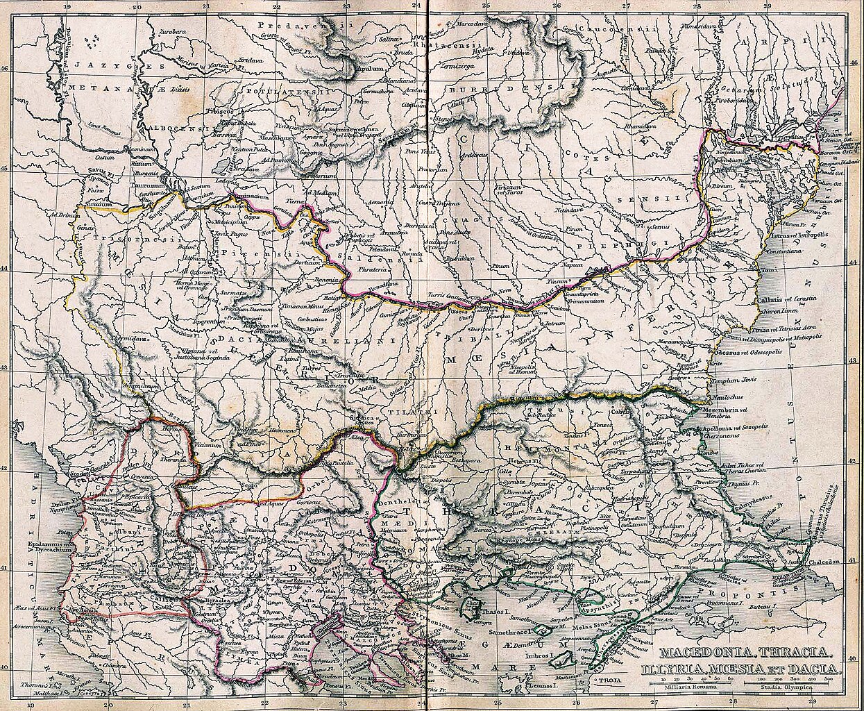
| Beskrivning | Macedonia, Thracia, Illyria, Moesia, Dacia,(Map X)"Comment on Map from author; Map X., & c. - Although most portions of this map are well represented, still we have a deficiency in the classical portion, as it has not been yet sufficiently examined by those who are capable of deciding and systematizing the comparative geography."
| ||||
| Datum | |||||
| Källa | A classical atlas, to illustrate ancient geography: comprised in twenty-five maps, showing the various divisions of the world as known to the ancients : composed from the most authentic sources with an index of the ancient and modern names,Alexander G. Findlay,Publisher;Harper,1849 | ||||
| Skapare | Alexander G. Findlay | ||||
| Tillstånd (Återanvändning av denna fil) |
| ||||
| Andra versioner | |||||


Filhistorik
Klicka på ett datum/klockslag för att se filen som den såg ut då.
| Datum/Tid | Miniatyrbild | Dimensioner | Användare | Kommentar | |
|---|---|---|---|---|---|
| nuvarande | 14 augusti 2005 kl. 10.52 | | 2 038 × 1 677 (837 kbyte) | Jkransen | Classical Balkans: from ''Map from "rothers Publishers, New York, 1849A Classical Atlas to Illustrate Ancient Geography,'' Alexander G. Findlay, Harper and Bros. NY 1849 Digitally refurbished by Jeroen Kransen for readability. [[:en:Ima |
Filanvändning
Följande 2 sidor använder den här filen:
Global filanvändning
Följande andra wikier använder denna fil:
- Användande på da.wikipedia.org