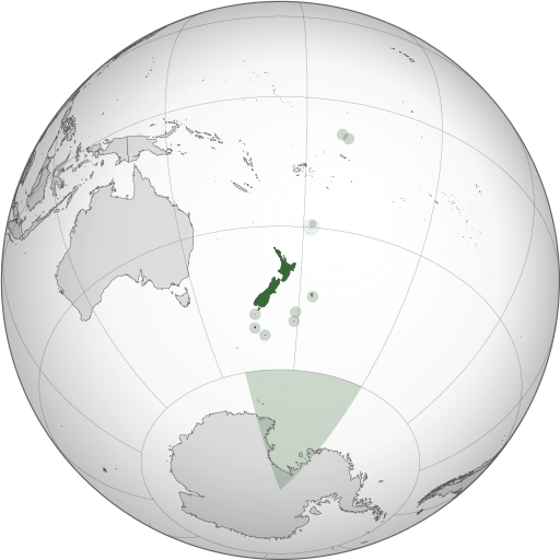
Tập tin:NZL orthographic NaturalEarth.svg

Kích thước bản xem trước PNG này của tập tin SVG: 512×512 điểm ảnh. Độ phân giải khác: 240×240 điểm ảnh | 480×480 điểm ảnh | 768×768 điểm ảnh | 1.024×1.024 điểm ảnh | 2.048×2.048 điểm ảnh.
Tập tin gốc (tập tin SVG, 512×512 điểm ảnh trên danh nghĩa, kích thước: 574 kB)
Lịch sử tập tin
Nhấn vào ngày/giờ để xem nội dung tập tin tại thời điểm đó.
| Ngày/giờ | Hình xem trước | Kích cỡ | Thành viên | Miêu tả | |
|---|---|---|---|---|---|
| hiện tại | 22:06, ngày 31 tháng 10 năm 2013 |  | 512×512 (574 kB) | TooncesB | == Summary == {{Information |Description={{en|1=A map of the hemisphere centred on Wellington, New Zealand, using an orthographic projection, created using gringer's Perl script with [http://www.naturalear... |
| 23:52, ngày 5 tháng 10 năm 2013 |  | 553×553 (505 kB) | TooncesB | {{Information |Description={{en|1=A map of the hemisphere centred on Wellington, New Zealand, using an orthographic projection, created using gringer's Perl script with [http://www.naturalearthdata.com/ Na... | |
| 13:22, ngày 2 tháng 10 năm 2013 |  | 553×553 (504 kB) | TooncesB | {{Information |Description={{en|1=A map of the hemisphere centred on Wellington, New Zealand, using an orthographic projection, created using gringer's Perl script with [http://www.naturalearthdata.com/ Na... | |
| 20:07, ngày 1 tháng 10 năm 2013 |  | 553×553 (556 kB) | TooncesB | {{Information |Description={{en|1=A map of the hemisphere centred on Wellington, New Zealand, using an orthographic projection, created using gringer's Perl script with [http://www.naturalearthdata.com/ Na... | |
| 14:41, ngày 1 tháng 5 năm 2013 |  | 553×553 (558 kB) | Gringer | Updated generation script (still needs some Inkscape hand-holding). Slightly larger image. Used high-resolution (10m) shapes for all countries, added highlight circles and Antarctica claim. | |
| 04:35, ngày 1 tháng 9 năm 2010 |  | 550×550 (398 kB) | Gringer | Using high resolution (10m) shapes for New Zealand, removed odd Antarctica spike. | |
| 23:13, ngày 30 tháng 8 năm 2010 |  | 550×550 (250 kB) | Gringer | changed size to fit with recommendations, white sea | |
| 22:54, ngày 30 tháng 8 năm 2010 |  | 1.050×1.050 (249 kB) | Gringer | {{Information |Description={{en|1=A map of the hemisphere centred on Wellington, New Zealand, using an orthographic projection, created using gringer's [[[w:User:Gringer/perlshaper|Perl script] with [http://www.naturalearthdata.com/ Natur |
Trang sử dụng tập tin
Có 2 trang tại Wikipedia tiếng Việt có liên kết đến tập tin (không hiển thị trang ở các dự án khác):
Sử dụng tập tin toàn cục
Những wiki sau đang sử dụng tập tin này:
- Trang sử dụng tại ace.wikipedia.org
- Trang sử dụng tại ami.wikipedia.org
- Trang sử dụng tại ar.wikipedia.org
- Trang sử dụng tại as.wikipedia.org
- Trang sử dụng tại azb.wikipedia.org
- Trang sử dụng tại bg.wikipedia.org
- Trang sử dụng tại bh.wikipedia.org
- Trang sử dụng tại bn.wikipedia.org
- Trang sử dụng tại bs.wikipedia.org
- Trang sử dụng tại cdo.wikipedia.org
- Trang sử dụng tại ceb.wikipedia.org
- Trang sử dụng tại ckb.wikipedia.org
- Trang sử dụng tại cs.wikipedia.org
- Trang sử dụng tại da.wikipedia.org
- Trang sử dụng tại diq.wikipedia.org
- Trang sử dụng tại ee.wikipedia.org
- Trang sử dụng tại el.wikipedia.org
- Trang sử dụng tại en.wikipedia.org
- Trang sử dụng tại en.wikibooks.org
- Trang sử dụng tại en.wiktionary.org
- Trang sử dụng tại es.wikipedia.org
- Trang sử dụng tại eu.wikipedia.org
- Trang sử dụng tại fa.wikipedia.org
- Trang sử dụng tại fi.wikipedia.org
- Trang sử dụng tại fj.wikipedia.org
- Trang sử dụng tại fr.wikipedia.org
- Trang sử dụng tại gl.wikipedia.org
- Trang sử dụng tại gn.wikipedia.org
- Trang sử dụng tại gu.wikipedia.org
- Trang sử dụng tại hak.wikipedia.org
- Trang sử dụng tại hif.wikipedia.org
- Trang sử dụng tại hi.wikipedia.org
- Trang sử dụng tại hr.wikipedia.org
- Trang sử dụng tại id.wikipedia.org
Xem thêm các trang toàn cục sử dụng tập tin này.
Đặc tính hình
🔥 Top keywords: Đài Truyền hình Kỹ thuật số VTCTrang ChínhGiỗ Tổ Hùng VươngTrương Mỹ LanĐặc biệt:Tìm kiếmHùng VươngVương Đình HuệUEFA Champions LeagueKuwaitChiến dịch Điện Biên PhủFacebookĐài Truyền hình Việt NamTrần Cẩm TúĐội tuyển bóng đá quốc gia KuwaitGoogle DịchViệt NamCúp bóng đá U-23 châu ÁCúp bóng đá U-23 châu Á 2024Real Madrid CFBảng xếp hạng bóng đá nam FIFACleopatra VIITô LâmTim CookNguyễn Phú TrọngHồ Chí MinhHai Bà TrưngManchester City F.C.VnExpressChủ tịch nước Cộng hòa xã hội chủ nghĩa Việt NamNguyễn Ngọc ThắngĐền HùngCúp bóng đá trong nhà châu Á 2024Võ Văn ThưởngOne PieceLịch sử Việt NamCuộc đua xe đạp toàn quốc tranh Cúp truyền hình Thành phố Hồ Chí Minh 2024Phạm Minh ChínhTikTokĐinh Tiên Hoàng


