Tập tin:Satellite image of New Zealand in December 2002.jpg
Kích thước hình xem trước: 455×600 điểm ảnh. Độ phân giải khác: 182×240 điểm ảnh | 364×480 điểm ảnh | 582×768 điểm ảnh | 777×1.024 điểm ảnh | 1.554×2.048 điểm ảnh | 4.400×5.800 điểm ảnh.
Tập tin gốc (4.400×5.800 điểm ảnh, kích thước tập tin: 3,39 MB, kiểu MIME: image/jpeg)
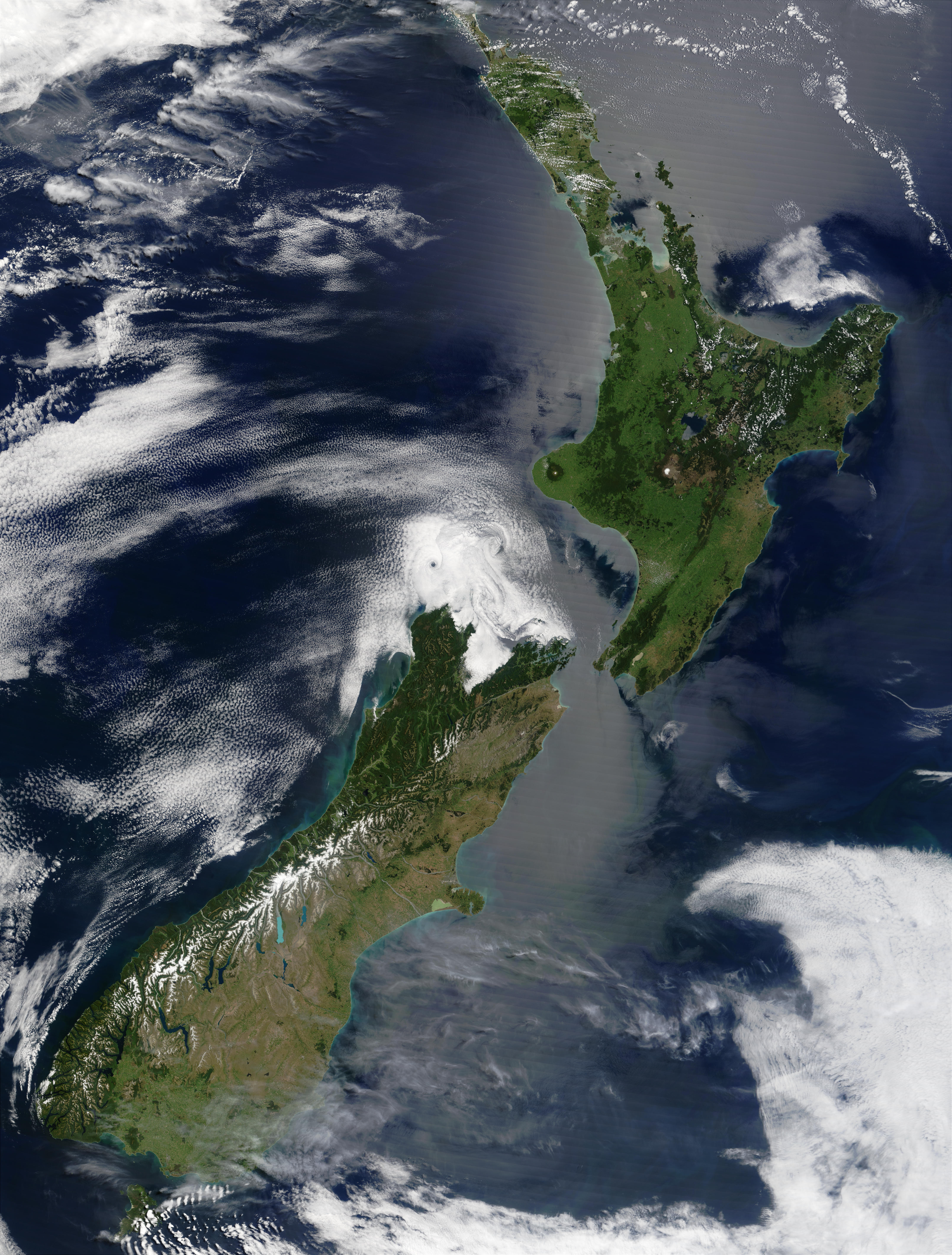
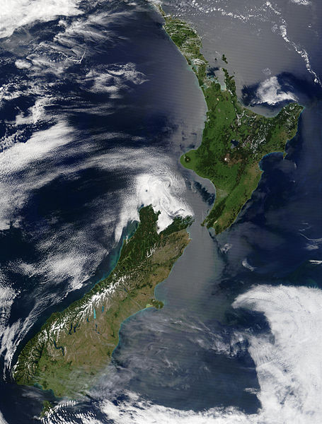
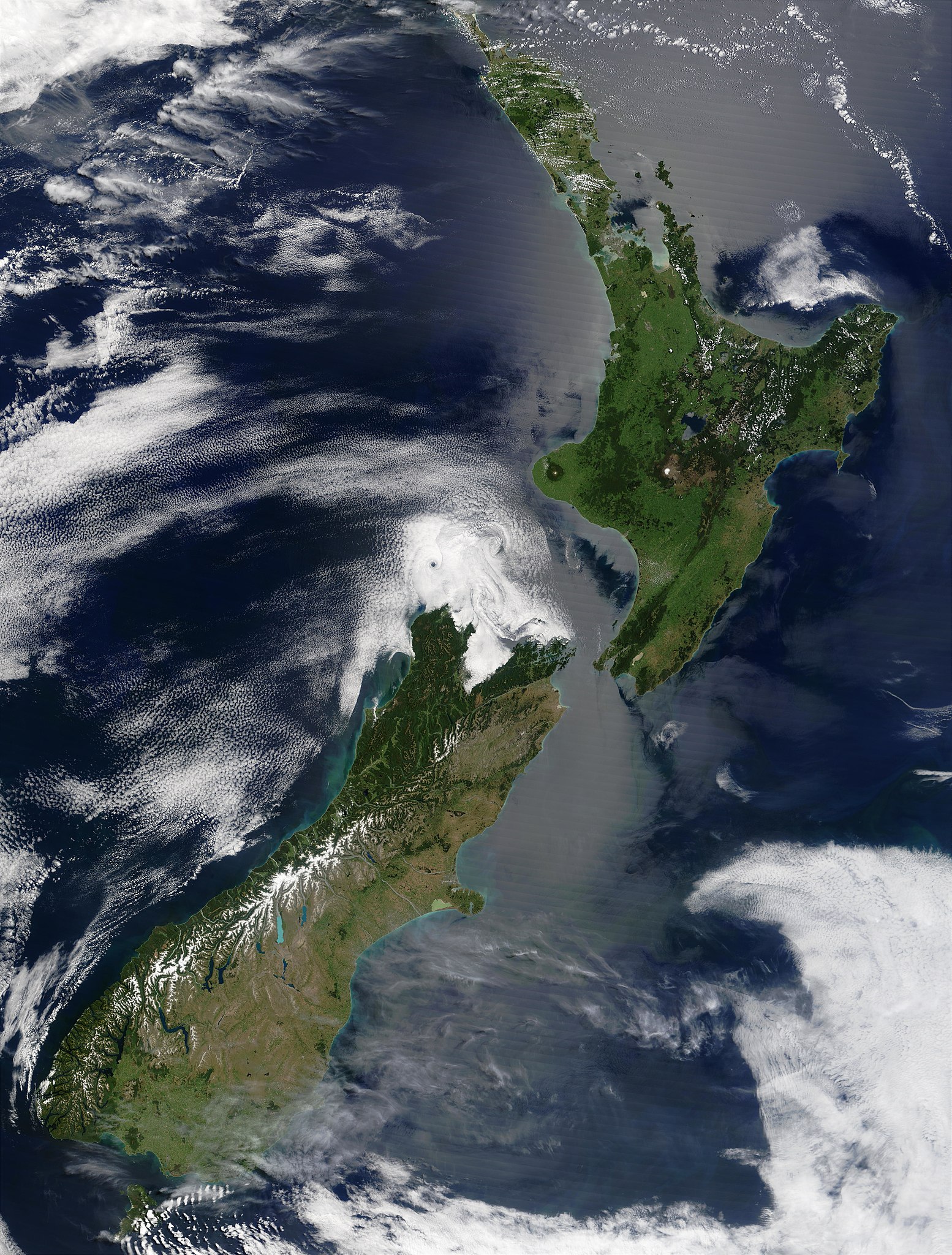
| Miêu tả | English: Satellite image of New Zealand in December 2002. NASA's description:
|
| Ngày | |
| Nguồn gốc | Taken from NASA's Visible Earth: [1] |
| Tác giả | Jacques Descloitres, MODIS Land Rapid Response Team at NASA GSFC |
| This file is in the public domain in the United States because it was solely created by NASA. NASA copyright policy states that "NASA material is not protected by copyright unless noted". (See Template:PD-USGov, NASA copyright policy page or JPL Image Use Policy.) | ||
 | Warnings:
|
Lịch sử tập tin
Nhấn vào ngày/giờ để xem nội dung tập tin tại thời điểm đó.
| Ngày/giờ | Hình xem trước | Kích cỡ | Thành viên | Miêu tả | |
|---|---|---|---|---|---|
| hiện tại | 15:51, ngày 3 tháng 5 năm 2005 | | 4.400×5.800 (3,39 MB) | Hautala | {{PD-USGov-NASA}} Satellite image of New Zealand in December 2002. NASA's description: :These stunning true-color images provide a rare, cloud-free look at the island nation of New Zealand, including most of its North and South Islands. This scene was ac |
Trang sử dụng tập tin
Có 1 trang tại Wikipedia tiếng Việt có liên kết đến tập tin (không hiển thị trang ở các dự án khác):
Sử dụng tập tin toàn cục
Những wiki sau đang sử dụng tập tin này:
- Trang sử dụng tại ckb.wikipedia.org
- Trang sử dụng tại en.wikipedia.org
- Trang sử dụng tại eo.wikipedia.org
- Trang sử dụng tại es.wikipedia.org
- Trang sử dụng tại frp.wikipedia.org
- Trang sử dụng tại fr.wikipedia.org
- Trang sử dụng tại got.wikipedia.org
- Trang sử dụng tại hu.wikipedia.org
- Trang sử dụng tại hy.wikipedia.org
- Trang sử dụng tại ia.wikipedia.org
- Trang sử dụng tại is.wikipedia.org
- Trang sử dụng tại ja.wikipedia.org
- Trang sử dụng tại ja.wikinews.org
- Trang sử dụng tại ka.wikipedia.org
- Trang sử dụng tại ko.wikipedia.org
- Trang sử dụng tại nl.wikipedia.org
- Trang sử dụng tại pl.wikipedia.org
- Trang sử dụng tại pt.wikipedia.org
- Trang sử dụng tại ru.wikipedia.org
- Trang sử dụng tại ru.wikinews.org
- Trang sử dụng tại sl.wikipedia.org
- Trang sử dụng tại sw.wikipedia.org
- Trang sử dụng tại ta.wikinews.org
- Trang sử dụng tại tr.wikipedia.org
- Trang sử dụng tại zh.wikipedia.org
Đặc tính hình
🔥 Top keywords: Đài Truyền hình Kỹ thuật số VTCTrang ChínhGiỗ Tổ Hùng VươngTrương Mỹ LanĐặc biệt:Tìm kiếmHùng VươngVương Đình HuệUEFA Champions LeagueKuwaitChiến dịch Điện Biên PhủFacebookĐài Truyền hình Việt NamTrần Cẩm TúĐội tuyển bóng đá quốc gia KuwaitGoogle DịchViệt NamCúp bóng đá U-23 châu ÁCúp bóng đá U-23 châu Á 2024Real Madrid CFBảng xếp hạng bóng đá nam FIFACleopatra VIITô LâmTim CookNguyễn Phú TrọngHồ Chí MinhHai Bà TrưngManchester City F.C.VnExpressChủ tịch nước Cộng hòa xã hội chủ nghĩa Việt NamNguyễn Ngọc ThắngĐền HùngCúp bóng đá trong nhà châu Á 2024Võ Văn ThưởngOne PieceLịch sử Việt NamCuộc đua xe đạp toàn quốc tranh Cúp truyền hình Thành phố Hồ Chí Minh 2024Phạm Minh ChínhTikTokĐinh Tiên Hoàng