Crossing Knob

Crossing Knob is a mountain in the North Carolina High Country, west from the community of Sugar Grove. The mountain is within the Pisgah National Forest and its elevation reaches 3,340 feet (1,018 m). The mountain is flanked by the Watauga River on three sides and US 321 along its south.

Crossing Knob
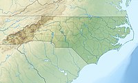
Crossing Knob is located in North Carolina
Crossing Knob
Crossing Knob
Location in North Carolina
Highest point
Elevation3,340 ft (1,020 m)[1]
Coordinates36°15′43″N 81°51′56″W / 36.26194°N 81.86556°W / 36.26194; -81.86556[1]
Geography
LocationWatauga County, North Carolina, U.S.
Parent rangeBlue Ridge Mountains
Topo mapUSGS Sherwood

References


🔥 Top keywords: Main PageSpecial:SearchWikipedia:Featured picturesYasukeHarrison ButkerRobert FicoBridgertonCleopatraDeaths in 2024Joyce VincentXXXTentacionHank AdamsIt Ends with UsYouTubeNew Caledonia2024 Indian general electionHeeramandiDarren DutchyshenSlovakiaKingdom of the Planet of the ApesAttempted assassination of Robert FicoLawrence WongBaby ReindeerXXX: Return of Xander CageThelma HoustonFuriosa: A Mad Max SagaMegalopolis (film)Richard GaddKepler's SupernovaWicked (musical)Sunil ChhetriXXX (2002 film)Ashley MadisonAnya Taylor-JoyPlanet of the ApesNava MauYoung SheldonPortal:Current eventsX-Men '97