Dormans (French pronunciation: [dɔʁmɑ̃]) is a commune located in the Marne department and in the Grand Est region of France.[3]
Dormans | |
|---|---|
 Memorial chapel to the Battles of the Marne, in Dormans | |
.svg) Coat of arms | |
Location of Dormans  | |
 Dormans  Dormans | |
| Coordinates: 49°04′38″N 3°38′25″E / 49.0772°N 3.6403°E | |
| Country | France |
| Region | Grand Est |
| Department | Marne |
| Arrondissement | Épernay |
| Canton | Dormans-Paysages de Champagne |
| Intercommunality | Paysages de la Champagne |
| Government | |
| • Mayor (2020–2026) | Michel Courteaux[1] |
| Area 1 | 22.58 km2 (8.72 sq mi) |
| Population (2021)[2] | 2,911 |
| • Density | 130/km2 (330/sq mi) |
| Time zone | UTC+01:00 (CET) |
| • Summer (DST) | UTC+02:00 (CEST) |
| INSEE/Postal code | 51217 /51700 |
| Elevation | 62–250 m (203–820 ft) |
| 1 French Land Register data, which excludes lakes, ponds, glaciers > 1 km2 (0.386 sq mi or 247 acres) and river estuaries. | |
Geography
Dormans is located in the valley of the Marne, at the border between the departments of the Marne and the Aisne, some 40 km from Reims and 25 km from Chateau-Thierry. The RN 3 goes through Dormans and leads to the autoroute A4. Dormans has a train station on the Paris–Strasbourg railway that sees multiple SNCF trains daily.
Dormans is at the heart of the Champagne vineyards.
Villages under jurisdiction of Dormans
The commune of Dormans regroups several small villages: Champaillet, Chavenay, Soilly, Try, Sainte-Croix, Vassieux and Vassy.
Soilly used to be its own commune but was integrated to Dormans in 1969.[4]
Politics and administration
The commune is located in the arrondissement of Épernay, in the department of the Marne.[3]
Population
| Year | Pop. | ±% p.a. |
|---|---|---|
| 1968 | 2,638 | — |
| 1975 | 2,950 | +1.61% |
| 1982 | 2,920 | −0.15% |
| 1990 | 3,125 | +0.85% |
| 1999 | 3,126 | +0.00% |
| 2007 | 2,979 | −0.60% |
| 2012 | 2,855 | −0.85% |
| 2017 | 2,921 | +0.46% |
| Source: INSEE[6] | ||
Gallery
 castle
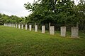 World War I cemetery
 churches


.JPG)
See also
References
Further reading
- Dom Albert Noël, Dormans (Notice historique sur le canton), Le Livre d'Histoire – Lorisse, 1877, ISBN 2-7428-0162-6