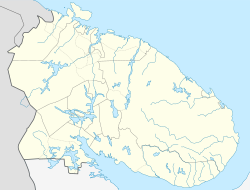
Kandalaksha (Russian: Кандала́кша; Finnish: Kantalahti, also Kandalax or Candalax in the old maps; Karelian: Kannanlakši; Northern Sami: Gáddeluokta; Skolt Sami: Käddluhtt) is a town in Kandalakshsky District of Murmansk Oblast, Russia, located at the head of Kandalaksha Gulf on the White Sea, north of the Arctic Circle. Population: 35,654 (2010 Russian census);[2] 40,564 (2002 Census);[5] 54,080 (1989 Soviet census).[6]
Kandalaksha Кандалакша | |
|---|---|
 A view of Kandalaksha | |
| Coordinates: 67°09′25″N 32°24′42″E / 67.15694°N 32.41167°E | |
| Country | Russia |
| Federal subject | Murmansk Oblast |
| Administrative district | Kandalakshsky District |
| Founded | 11th century |
| Town status since | April 20, 1938[1] |
| Elevation | 20 m (70 ft) |
| Population | |
| • Total | 35,654 |
| • Municipal district | Kandalakshsky Municipal District |
| • Urban settlement | Kandalaksha Urban Settlement |
| Time zone | UTC+3 (MSK |
| Postal code(s)[4] | 184041 |
| Dialing code(s) | +7 81533 |
| OKTMO ID | 47608101001 |
History
The settlement was founded the 11th century but may have existed as a temporary stop for fishermen from the 9th century.[citation needed] In the 13th century, it became a part of the Novgorod Republic along with the southern part of the Kola Peninsula, and in 1478 was annexed by the Grand Duchy of Moscow. In 1915, the construction of a seaport started, and in 1918 a railroad connecting Moscow to Murmansk running through Kandalaksha was opened. On August 29, 1927, Kandalaksha was made the administrative center of the newly established Kandalakshsky District,[7] and on June 1, 1932, it was granted work settlement status.[1] Status of a town of district significance was granted to it on April 20, 1938.[1] On February 9, 1940, Kandalaksha was administratively separated from the district and granted the status of a town of oblast significance.[1]
In July 1941, during World War II, the town was the primary target of an unsuccessful German-Finnish offensive which attempted to cut the strategic Kirov Railway.
By the Decree of the Presidium of the Supreme Soviet of the RSFSR of March 19, 1959, the Councils of Deputies of Kandalaksha and of Kandalakshsky District were merged into one Kandalaksha Town Council of Deputies.[8] While the district was nominally retained as a separate administrative division, all its subdivisions were administratively subordinated to the town's Council of Deputies.[8]
Since 1995, Vitino oil port operates near Beloye More a few kilometers south of Kandalaksha.
Kandalaksha Mayor Nina Varlamova was murdered in an attack in December 2008.[9]
International relations

Twin towns and sister cities
Kandalaksha is twinned with:
Geography
The town is located at the head of Kandalaksha Gulf on the White Sea, north of the Arctic Circle.
Climate
Kandalaksha has a subarctic climate (Dfc) with mild, rainy summers, and cold, snowy winters.
| Climate data for Kandalaksha (Climate ID:22217) | |||||||||||||
|---|---|---|---|---|---|---|---|---|---|---|---|---|---|
| Month | Jan | Feb | Mar | Apr | May | Jun | Jul | Aug | Sep | Oct | Nov | Dec | Year |
| Record high °C (°F) | 7.5 (45.5) | 8.0 (46.4) | 12.2 (54.0) | 18.9 (66.0) | 27.2 (81.0) | 31.4 (88.5) | 31.6 (88.9) | 32.0 (89.6) | 22.1 (71.8) | 14.7 (58.5) | 11.4 (52.5) | 8.0 (46.4) | 32.0 (89.6) |
| Mean daily maximum °C (°F) | −7.7 (18.1) | −6.9 (19.6) | −1.6 (29.1) | 3.8 (38.8) | 9.8 (49.6) | 16.2 (61.2) | 19.5 (67.1) | 16.9 (62.4) | 11.4 (52.5) | 4.0 (39.2) | −1.9 (28.6) | −5 (23) | 4.9 (40.8) |
| Daily mean °C (°F) | −11.4 (11.5) | −10.9 (12.4) | −6.2 (20.8) | −0.5 (31.1) | 5.3 (41.5) | 11.5 (52.7) | 14.9 (58.8) | 12.6 (54.7) | 7.6 (45.7) | 1.4 (34.5) | −4.4 (24.1) | −8.2 (17.2) | 1.0 (33.8) |
| Mean daily minimum °C (°F) | −15.8 (3.6) | −15.4 (4.3) | −11.1 (12.0) | −5.1 (22.8) | 1.1 (34.0) | 7.0 (44.6) | 10.5 (50.9) | 8.4 (47.1) | 3.8 (38.8) | −1.4 (29.5) | −7.5 (18.5) | −12 (10) | −3.1 (26.3) |
| Record low °C (°F) | −43.5 (−46.3) | −41.6 (−42.9) | −34.6 (−30.3) | −27.9 (−18.2) | −15 (5) | −4.5 (23.9) | 1.8 (35.2) | −3.6 (25.5) | −9.7 (14.5) | −21.8 (−7.2) | −30.4 (−22.7) | −39.5 (−39.1) | −43.5 (−46.3) |
| Average precipitation mm (inches) | 41 (1.6) | 34 (1.3) | 30 (1.2) | 28 (1.1) | 45 (1.8) | 56 (2.2) | 75 (3.0) | 63 (2.5) | 56 (2.2) | 53 (2.1) | 46 (1.8) | 44 (1.7) | 571 (22.5) |
| Average rainy days | 1 | 2 | 3 | 9 | 18 | 18 | 18 | 18 | 19 | 15 | 6 | 3 | 130 |
| Average snowy days | 24 | 23 | 22 | 15 | 9 | 1 | 0 | 0 | 1 | 11 | 21 | 24 | 151 |
| Average relative humidity (%) | 86 | 84 | 81 | 75 | 72 | 69 | 74 | 79 | 84 | 86 | 89 | 87 | 81 |
| Mean monthly sunshine hours | 3.2 | 45.0 | 129.2 | 184.6 | 231.1 | 271.5 | 267.6 | 186.6 | 110.6 | 55.8 | 9.6 | 0.0 | 1,494.8 |
| Source 1: Roshydromet[10] | |||||||||||||
| Source 2: NOAA (sun)[11] | |||||||||||||
See also
References
Notes
Sources
- Архивный отдел Администрации Мурманской области. Государственный Архив Мурманской области. (1995). Административно-территориальное деление Мурманской области (1920-1993 гг.). Справочник. Мурманск: Мурманское издательско-полиграфическое предприятие "Север".
External links
 Media related to Kandalaksha at Wikimedia Commons
- Official website of Kandalaksha Archived July 25, 2021, at the Wayback Machine (in Russian)
- Kandalaksha Business Directory (in Russian)
- Kandalaksha Nature Reserve
- Information about Kandalaksha for tourists


