Jump to content

Marshall County, Minnesota

96°23′W / 48.35°N 96.38°W / 48.35; -96.38
From Wikipedia, the free encyclopedia

Marshall County
K. J. Taralseth Company
Map of Minnesota highlighting Marshall County
Location within the U.S. state of Minnesota
Map of the United States highlighting Minnesota
Minnesota's location within the U.S.
Coordinates: 48°21′N 96°23′W / 48.35°N 96.38°W / 48.35; -96.38
Country United States
State Minnesota
FoundedFebruary 25, 1879[1]
Named forWilliam Rainey Marshall
SeatWarren
Largest cityWarren
Area
 • Total1,813 sq mi (4,700 km2)
 • Land1,775 sq mi (4,600 km2)
 • Water38 sq mi (100 km2)  2.1%
Population
 (2020)
 • Total9,040
 • Estimate 
(2023)
8,810 Decrease
 • Density5.1/sq mi (2.0/km2)
Time zoneUTC−6 (Central)
 • Summer (DST)UTC−5 (CDT)
Congressional district7th
Websitewww.co.marshall.mn.us

Marshall County is a county in the northwestern part of the U.S. state of Minnesota. As of the 2020 census, the population was 9,040.[2] Its county seat is Warren.[3]

History

The Minnesota legislature created the county on February 25, 1879, with territory partitioned from the southern half of Kittson County, with Warren (which was first platted that same year) as the county seat. It was named for William Rainey Marshall, who served as Minnesota governor from 1866 to 1870.[4]

Marshall County was the location of a claimed UFO incident in 1979, the Val Johnson incident.
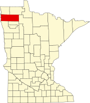
Geography

Marshall County lies on Minnesota's border with North Dakota (across the Red River, which flows north along the county's western border). The Snake River rises in Polk County and flows north through the western part of the county to its confluence with the Red. The Tamarac River rises in Marshall County and flows west through the county's northern area to its confluence with the Red. The Middle River also rises in Marshall County and flows west through the southern part of the county, discharging into the Snake just upstream of the Snake/Red confluence. The county terrain consists of low rolling hills, carved with drainages, completely devoted to agriculture where possible.[5] The terrain slopes to the west and north, with its highest point near the midpoint of its eastern border, at 1,194 ft (364 m) ASL.[6] The county has an area of 1,813 square miles (4,700 km2), of which 1,775 square miles (4,600 km2) is land and 38 square miles (98 km2) (2.1%) is water.[7] Marshall is one of 17 Minnesota savanna region counties where savanna soils predominate. The true highpoint is in the northeast of the county and caltopo displays 1237 ft at 48.5339°N, -96.0167°W

Soils of Marshall County[8]
Soils of Old Mill State Park

Major highways

Airports

Adjacent counties

Protected areas[5]

Lakes[5]

  • Thief Lake
  • Webster Creek Pool

Demographics

Historical population
CensusPop.Note
1880992
18909,130820.4%
190015,69871.9%
191016,3384.1%
192019,44319.0%
193017,003−12.5%
194018,3648.0%
195016,125−12.2%
196014,262−11.6%
197013,060−8.4%
198013,027−0.3%
199010,993−15.6%
200010,155−7.6%
20109,439−7.1%
20209,040−4.2%
2023 (est.)8,810[9]−2.5%
U.S. Decennial Census[10]
1790-1960[11] 1900-1990[12]
1990-2000[13] 2010-2020[2]

2020 Census

Marshall County Racial Composition[14]
RaceNum.Perc.
White (NH)8,33292.2%
Black or African American (NH)120.13%
Native American (NH)290.32%
Asian (NH)190.21%
Pacific Islander (NH)00%
Other/Mixed (NH)2582.9%
Hispanic or Latino3904.31%

2000 census

2022 US Census population pyramid for Marshall County, from ACS 5-year estimates

As of the census of 2000, there were 10,155 people, 4,101 households and 2,837 families in the county. The population density was 5.72 per square mile (2.21/km2). There were 4,791 housing units at an average density of 2.70 per square mile (1.04/km2). The racial makeup of the county was 97.22% White, 0.10% Black or African American, 0.29% Native American, 0.17% Asian, 1.62% from other races, and 0.60% from two or more races. 2.93% of the population were Hispanic or Latino of any race. 43.2% were of Norwegian, 12.1% Polish, 11.7% German and 9.6% Swedish ancestry.

There were 4,101 households, of which 30.20% had children under the age of 18 living with them, 60.20% were married couples living together, 5.40% had a female householder with no husband present, and 30.80% were non-families. 28.70% of all households were made up of individuals, and 15.10% had someone living alone who was 65 years of age or older. The average household size was 2.45 and the average family size was 3.01.

The county population contained 25.40% under the age of 18, 6.70% from 18 to 24, 24.70% from 25 to 44, 24.70% from 45 to 64, and 18.50% who were 65 years of age or older. The median age was 40 years. For every 100 females there were 103.20 males. For every 100 females age 18 and over, there were 102.10 males.

The median household income was $34,804, and the median family income was $41,908. Males had a median income of $30,051 versus $20,600 for females. The per capita income for the county was $16,317. About 6.90% of families and 9.80% of the population were below the poverty line, including 11.30% of those under age 18 and 12.80% of those age 65 or over.

Communities

Cities

Unincorporated communities

Townships

Unorganized territory

Government and politics

Marshall County has voted Republican in presidential elections since 2000, except in 2008, when Barack Obama won the county by less than one percentage point.

United States presidential election results for Marshall County, Minnesota[15]
YearRepublicanDemocraticThird party
No. %No. %No. %
20203,72172.78%1,29525.33%971.90%
20163,20866.60%1,22525.43%3847.97%
20122,56954.68%1,99842.53%1312.79%
20082,28548.22%2,31148.77%1433.02%
20043,18757.30%2,30841.50%671.20%
20002,91256.01%1,91036.74%3777.25%
19962,06840.12%2,33345.27%75314.61%
19922,13636.81%2,30939.79%1,35823.40%
19882,75247.36%3,00151.64%581.00%
19843,43355.31%2,70543.58%691.11%
19803,63853.70%2,63638.91%5017.39%
19762,60540.14%3,74457.70%1402.16%
19723,26452.73%2,79045.07%1362.20%
19682,36739.74%3,16153.07%4287.19%
19641,89329.17%4,59470.79%30.05%
19603,00644.36%3,75955.47%120.18%
19562,51941.93%3,47857.90%100.17%
19523,51652.22%3,13246.52%851.26%
19482,09032.12%4,12663.41%2914.47%
19442,02934.60%3,80864.94%270.46%
19402,44134.70%4,54964.67%440.63%
19361,90427.79%4,80270.08%1462.13%
19321,86634.16%3,25959.66%3386.19%
19283,73861.58%2,20036.24%1322.17%
19242,10040.03%2905.53%2,85654.44%
19204,73875.41%88514.09%66010.50%
19161,46144.73%1,51346.33%2928.94%
191233111.30%56719.35%2,03269.35%
19081,64859.99%73126.61%36813.40%
19041,72076.38%27512.21%25711.41%
19001,45759.66%90537.06%803.28%
18961,20048.94%1,22249.84%301.22%
189252627.90%35418.78%1,00553.32%
County Board of Commissioners[16]
PositionNameDistrictNext Election
Commissioner and ChairpersonJim DuckstadDistrict 12026
CommissionerRolland MillerDistrict 22024
CommissionerLarry NybladhDistrict 32024
CommissionerSharon BringDistrict 42024
CommissionerGary KiesowDistrict 52026
State Legislature (2023-2025)
PositionNameAffiliationDistrict
SenateMark Johnson[17]RepublicanDistrict 1
House of RepresentativesJohn BurkelRepublicanDistrict 1A
U.S Congress (2023-2025)
PositionNameAffiliationDistrict
House of RepresentativesMichelle FischbachDemocrat7th
SenateAmy Klobuchar[18]DemocratN/A
SenateTina Smith[19]DemocratN/A

See also

References

48°21′N 96°23′W / 48.35°N 96.38°W / 48.35; -96.38

🔥 Top keywords: Main PageSpecial:SearchWikipedia:Featured picturesYasukeHarrison ButkerRobert FicoBridgertonCleopatraDeaths in 2024Joyce VincentXXXTentacionHank AdamsIt Ends with UsYouTubeNew Caledonia2024 Indian general electionHeeramandiDarren DutchyshenSlovakiaKingdom of the Planet of the ApesAttempted assassination of Robert FicoLawrence WongBaby ReindeerXXX: Return of Xander CageThelma HoustonFuriosa: A Mad Max SagaMegalopolis (film)Richard GaddKepler's SupernovaWicked (musical)Sunil ChhetriXXX (2002 film)Ashley MadisonAnya Taylor-JoyPlanet of the ApesNava MauYoung SheldonPortal:Current eventsX-Men '97