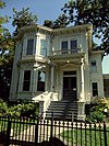
This is a list of the National Register of Historic Places listings in Butte County, California.

This is intended to be a complete list of the properties and districts on the National Register of Historic Places in Butte County, California, United States. Latitude and longitude coordinates are provided for many National Register properties and districts; these locations may be seen together in a Google map.[1]
There are 28 properties and districts listed on the National Register in the county.
This National Park Service list is complete through NPS recent listings posted May 10, 2024.[2]
Current listings
| [3] | Name on the Register[4] | Image | Date listed[5] | Location | City or town | Description |
|---|---|---|---|---|---|---|
| 1 | Allen-Sommer-Gage House |  | April 13, 1977 (#77000288) | 410 Normal St. 39°43′36″N 121°50′30″W / 39.726674°N 121.841673°W | Chico | |
| 2 | Bidwell Mansion |  | March 24, 1972 (#72000216) | Sowillenno Ave. 39°43′59″N 121°50′32″W / 39.733056°N 121.842222°W | Chico | |
| 3 | Centerville Schoolhouse |  | March 24, 1972 (#72000219) | 2 miles northeast of Paradise on Humbug Rd. 39°47′17″N 121°39′17″W / 39.788056°N 121.654722°W | Paradise | |
| 4 | A. H. Chapman House |  | January 28, 1982 (#82002170) | 256 E. 12th St. 39°43′30″N 121°50′27″W / 39.725°N 121.840833°W | Chico | |
| 5 | W. W. Durham House |  | April 2, 1992 (#92000316) | 2280 Durham-Dayton Rd. 39°38′48″N 121°47′36″W / 39.646667°N 121.793333°W | Durham | |
| 6 | Forks of Butte | January 2, 2004 (#03001357) | Travel northeast on State Highway 32 from Chico, 20 miles to Forest Ranch, then southeast on Doe Mill Road (graded dirt road), three and one-half miles to Butte Creek trailhead. Coordinates missing | Paradise | ||
| 7 | Gianella Bridge |  | July 8, 1982 (#82004614) | CA 32 39°45′04″N 121°59′46″W / 39.751111°N 121.996111°W | Hamilton City | Demolished in 1987.[6] |
| 8 | Hazel Hotel |  | July 13, 2001 (#01000705) | 850, 860, 880, and 890 Hazel St., and 602, 608, and 620 Kentuckey 39°21′54″N 121°41′43″W / 39.365°N 121.695278°W | Gridley | |
| 9 | Honey Run Covered Bridge |  | June 23, 1988 (#88000920) | Honey Run Humbug Rd. 39°43′44″N 121°42′09″W / 39.728889°N 121.7025°W | Chico | Destroyed by Camp Fire on November 8, 2018 |
| 10 | Inskip Hotel |  | May 2, 1975 (#75000425) | 6 miles north of Stirling on Skyway (Old Humbug Rd.) 39°59′25″N 121°32′29″W / 39.990361°N 121.541389°W | Stirling City | |
| 11 | Fong Lee Company | March 11, 1982 (#82002173) | 1500 Broderick St. Coordinates missing | Oroville | ||
| 12 | Magalia Community Church |  | January 11, 1982 (#82002172) | Stirling Highway 39°48′36″N 121°34′40″W / 39.81°N 121.577778°W | Magalia | |
| 13 | Mountain House Historic District | July 12, 2019 (#100004195) | 13465 Oroville-Quincy Highway Coordinates missing | Mountain House | ||
| 14 | Mud Creek Canyon | August 14, 1973 (#73000396) | Address Restricted | Chico | ||
| 15 | Oroville Carnegie Library |  | May 8, 2007 (#07000405) | 1675 Montgomery St. 39°30′46″N 121°33′32″W / 39.512724°N 121.558904°W | Oroville | Now the Butte County Public Law Library[7] |
| 16 | Oroville Chinese Temple |  | July 30, 1976 (#76000478) | 1500 Broderick St. 39°30′49″N 121°33′39″W / 39.513611°N 121.560833°W | Oroville | |
| 17 | Oroville Commercial District (old) |  | July 28, 1983 (#83001174) | Montgomery, Myers, and Huntoon Sts. and Miner Alley 39°30′50″N 121°33′19″W / 39.513889°N 121.555278°W | Oroville | |
| 18 | Oroville Inn |  | September 13, 1990 (#90001431) | 2066 Bird St. 39°30′49″N 121°33′16″W / 39.513641°N 121.55454°W | Oroville | |
| 19 | Patrick Ranch House |  | February 23, 1972 (#72000217) | 3 miles southeast of Chico off U.S. Route 99E 39°40′55″N 121°48′00″W / 39.681944°N 121.8°W | Chico | |
| 20 | Patrick Rancheria | February 23, 1972 (#72000218) | Address Restricted | Chico | ||
| 21 | Silberstein Park Building |  | February 17, 1983 (#83001175) | 426, 430, and 434 Broadway 39°43′41″N 121°50′17″W / 39.728056°N 121.838056°W | Chico | Downtown building designed by A.J. Byron, and used as a movie theater, The Lyric, and La Grande Hotel. |
| 22 | South Campus Neighborhood |  | June 24, 1991 (#91000636) | Bounded by W. 2nd, Normal, W. 6th, and Cherry Sts. 39°43′34″N 121°50′30″W / 39.726111°N 121.841667°W | Chico | |
| 23 | Southern Pacific Depot |  | January 29, 1987 (#87000001) | 430 Orange St. 39°43′24″N 121°50′42″W / 39.723333°N 121.845°W | Chico | |
| 24 | St. John's Episcopal Church |  | January 21, 1982 (#82002171) | 230 Salem St. 39°43′44″N 121°50′25″W / 39.728889°N 121.840278°W | Chico | |
| 25 | Stansbury House |  | June 5, 1975 (#75000424) | 307 W. 5th St. 39°43′37″N 121°50′19″W / 39.726944°N 121.838611°W | Chico | |
| 26 | State Theatre |  | September 13, 1991 (#91001383) | 1489 Myers St. 39°30′45″N 121°33′16″W / 39.512592°N 121.554489°W | Oroville | |
| 27 | US Post Office-Chico Midtown Station |  | January 11, 1985 (#85000122) | 141 W. 5th St. 39°43′39″N 121°50′16″W / 39.7275°N 121.837778°W | Chico | |
| 28 | US Post Office-Oroville Main |  | January 11, 1985 (#85000123) | 1735 Robinson St. 39°30′40″N 121°33′27″W / 39.511174°N 121.55738°W | Oroville |
See also

Wikimedia Commons has media related to National Register of Historic Places in Butte County, California.
References
🔥 Top keywords: Main PageSpecial:SearchWikipedia:Featured picturesYasukeHarrison ButkerRobert FicoBridgertonCleopatraDeaths in 2024Joyce VincentXXXTentacionHank AdamsIt Ends with UsYouTubeNew Caledonia2024 Indian general electionHeeramandiDarren DutchyshenSlovakiaKingdom of the Planet of the ApesAttempted assassination of Robert FicoLawrence WongBaby ReindeerXXX: Return of Xander CageThelma HoustonFuriosa: A Mad Max SagaMegalopolis (film)Richard GaddKepler's SupernovaWicked (musical)Sunil ChhetriXXX (2002 film)Ashley MadisonAnya Taylor-JoyPlanet of the ApesNava MauYoung SheldonPortal:Current eventsX-Men '97
