[3] Name on the Register[4] Image Date listed[5] Location City or town Description 1 Chatanika Gold Camp Chatanika Gold Camp October 16, 1979 (#79003753 ) Mile 27¾ on the Steese Highway 65°06′42″N 147°28′49″W / 65.11161°N 147.48029°W / 65.11161; -147.48029 (Chatanika Gold Camp ) Chatanika 2 Chena Pump House Chena Pump House March 17, 1982 (#82004900 ) 796 Chena Pump Road 64°49′53″N 147°53′05″W / 64.831389°N 147.884722°W / 64.831389; -147.884722 (Chena Pump House ) Fairbanks 3 Chugwater Site Upload image November 23, 1979 (#79003754 ) On Moose Creek Bluff, 35 kilometres (22 mi) southeast of Fairbanks[6] 64°41′30″N 147°13′05″W / 64.6917°N 147.2181°W / 64.6917; -147.2181 (Chugwater Site ) North Pole 4 Old City Hall Old City Hall May 30, 2002 (#02000561 ) 410 Cushman Street 64°50′30″N 147°43′15″W / 64.84179°N 147.72094°W / 64.84179; -147.72094 (Old City Hall ) Fairbanks 5 Clay Street Cemetery Clay Street Cemetery October 25, 1982 (#82001619 ) 7th Avenue and Clay Street 64°50′30″N 147°42′27″W / 64.84155°N 147.70746°W / 64.84155; -147.70746 (Clay Street Cemetery ) Fairbanks 6 Constitution Hall Constitution Hall November 3, 2005 (#05001196 ) University of Alaska Fairbanks campus64°51′27″N 147°49′19″W / 64.85738°N 147.82184°W / 64.85738; -147.82184 (Constitution Hall ) Fairbanks 7 Mary Lee Davis House Mary Lee Davis House September 30, 1982 (#82004901 ) 410 Cowles Street 64°50′36″N 147°43′52″W / 64.84325°N 147.73101°W / 64.84325; -147.73101 (Mary Lee Davis House ) Fairbanks 8 Discovery Claim on Pedro Creek Discovery Claim on Pedro Creek May 13, 1992 (#92000498 ) Mile 16.5 on the Steese Highway 65°00′32″N 147°29′51″W / 65.00891°N 147.49737°W / 65.00891; -147.49737 (Discovery Claim on Pedro Creek ) Fairbanks 9 Ester Camp Historic District Ester Camp Historic District May 6, 1987 (#87000703 ) Off Alaska Route 3 64°50′48″N 148°01′10″W / 64.84662°N 148.01943°W / 64.84662; -148.01943 (Ester Camp Historic District ) Ester 10 F.E. Company Housing F.E. Company Housing May 9, 1997 (#97000400 ) 505, 507, 521, and 523 Illinois Street 64°51′02″N 147°43′06″W / 64.85068°N 147.71835°W / 64.85068; -147.71835 (F.E. Company Housing ) Fairbanks 11 F.E. Company Machine Shop F.E. Company Machine Shop October 12, 1995 (#95001164 ) behind 612 Illinois Street 64°51′07″N 147°43′20″W / 64.85195°N 147.72218°W / 64.85195; -147.72218 (F.E. Company Machine Shop ) Fairbanks 12 F.E. Company Manager's House F.E. Company Manager's House February 16, 1996 (#96000095 ) 757 Illinois Street 64°51′11″N 147°42′58″W / 64.85292°N 147.71608°W / 64.85292; -147.71608 (F.E. Company Manager's House ) Fairbanks 13 F.E. Company Dredge No. 2 Upload image June 30, 1999 (#99000763 ) Fish Creek 65°02′35″N 147°05′37″W / 65.04295°N 147.09353°W / 65.04295; -147.09353 (F.E. Company Dredge No. 2 ) Fairbanks 14 F.E. Company Gold Dredge No. 5 Upload image March 18, 2004 (#04000186 ) Upper Dome Creek 65°01′47″N 147°34′35″W / 65.0296°N 147.57637°W / 65.0296; -147.57637 (F.E. Company Gold Dredge No. 5 ) Fairbanks Scrapped c. 2012. 15 Federal Building Federal Building August 2, 1978 (#78003422 ) 250 Cushman Street 64°50′35″N 147°43′17″W / 64.84293°N 147.72145°W / 64.84293; -147.72145 (Federal Building ) Fairbanks 16 Goldstream Dredge No. 8 Goldstream Dredge No. 8 February 28, 1984 (#84000637 ) 1755 Old Steese Highway North 64°56′14″N 147°39′28″W / 64.93718°N 147.65766°W / 64.93718; -147.65766 (Goldstream Dredge No. 8 ) Fairbanks 17 Gould Cabin Upload image August 12, 2021 (#100006828 ) 105 Dunkel St. 64°50′45″N 147°42′48″W / 64.8458°N 147.7134°W / 64.8458; -147.7134 (Gould Cabin ) Fairbanks 18 Harding Railroad Car Harding Railroad Car April 6, 1978 (#78003423 ) Pioneer Park , 2300 Airport Way64°50′17″N 147°46′20″W / 64.83807°N 147.77223°W / 64.83807; -147.77223 (Harding Railroad Car ) Fairbanks Pullman passenger-observation car Denali (Alaska Railroad No. X-336) 19 Hinckley-Creamer Dairy Hinckley-Creamer Dairy April 13, 1977 (#77001572 ) At end of Creamer Lane, in Creamer's Field Migratory Waterfowl Refuge 64°51′51″N 147°44′16″W / 64.86418°N 147.73766°W / 64.86418; -147.73766 (Hinckley-Creamer Dairy ) Fairbanks 20 Illinois Street Historic District Illinois Street Historic District September 14, 2001 (#01000966 ) 300-700 Illinois Street 64°50′59″N 147°43′12″W / 64.8496°N 147.71987°W / 64.8496; -147.71987 (Illinois Street Historic District ) Fairbanks 21 Immaculate Conception Church Immaculate Conception Church April 3, 1976 (#76002278 ) 115 North Cushman Street 64°50′43″N 147°43′18″W / 64.84526°N 147.72173°W / 64.84526; -147.72173 (Immaculate Conception Church ) Fairbanks 22 Falcon Joslin House Falcon Joslin House April 29, 1980 (#80004567 ) 413 Cowles Street 64°50′35″N 147°43′49″W / 64.84296°N 147.73034°W / 64.84296; -147.73034 (Falcon Joslin House ) Fairbanks 23 Lacey Street Theatre Lacey Street Theatre June 14, 1990 (#90000878 ) 504 Second Avenue 64°50′38″N 147°43′04″W / 64.84383°N 147.71789°W / 64.84383; -147.71789 (Lacey Street Theatre ) Fairbanks 24 Ladd Field Ladd Field February 4, 1985 (#85002730 ) Fort Wainwright 64°49′54″N 147°36′58″W / 64.83179°N 147.61601°W / 64.83179; -147.61601 (Ladd Field ) Fairbanks 25 Main School Main School September 27, 1990 (#90001472 ) 800 Cushman Street 64°50′23″N 147°43′16″W / 64.83966°N 147.72113°W / 64.83966; -147.72113 (Main School ) Fairbanks Now Fairbanks City Hall. 26 Nenana (steamer)Nenana (steamer)June 27, 1972 (#72001581 ) Pioneer Park , 2300 Airport Way64°50′19″N 147°46′20″W / 64.8386°N 147.77236°W / 64.8386; -147.77236 (Nenana (steamer) Fairbanks 27 Oddfellows Hall Oddfellows Hall June 3, 1980 (#80004569 ) 825 First Avenue 64°50′40″N 147°43′39″W / 64.8444°N 147.72748°W / 64.8444; -147.72748 (Oddfellows Hall ) Fairbanks 28 Rainey's Cabin Rainey's Cabin November 20, 1975 (#75002158 ) University of Alaska campus64°51′32″N 147°49′54″W / 64.85894°N 147.8318°W / 64.85894; -147.8318 (Rainey's Cabin ) College 29 Rose Building Rose Building May 11, 1992 (#92000444 ) Illinois and Church Streets 64°50′47″N 147°43′20″W / 64.84627°N 147.72224°W / 64.84627; -147.72224 (Rose Building ) Fairbanks Building demolished in 1998, before the start of urban improvements to Illinois Street; mitigation for the removal of the building was used to restore other historical properties in Fairbanks.[7] [8] AHRS# FAI-280[9]
30 St. Matthew's Episcopal Church St. Matthew's Episcopal Church February 12, 2016 (#16000001 ) 1029 First Avenue 64°50′45″N 147°43′51″W / 64.84576°N 147.73082°W / 64.84576; -147.73082 (St. Matthew's Episcopal Church ) Fairbanks AHRS# FAI-00110[10] 31 George C. Thomas Memorial Library George C. Thomas Memorial Library February 23, 1972 (#72001542 ) 901 First Avenue 64°50′41″N 147°43′41″W / 64.84463°N 147.72809°W / 64.84463; -147.72809 (George C. Thomas Memorial Library ) Fairbanks 32 Wickersham House Wickersham House April 27, 1979 (#79003757 ) Pioneer Park , 2300 Airport Way64°50′19″N 147°46′17″W / 64.83851°N 147.7714°W / 64.83851; -147.7714 (Wickersham House ) Fairbanks 


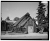
.JPG)


.jpg)


.jpg)

.JPG)


_Fairbanks,_Alaska.jpg)


.jpg)