| [2] | Name on the Register | Image | Date listed[3] | Location | Description |
|---|
| 1 | Academie Brochu |  Academie Brochu Academie Brochu | June 22, 1989
(#89000568) | 29 Pine St.
42°04′46″N 72°02′17″W / 42.079444°N 72.038056°W / 42.079444; -72.038056 (Academie Brochu) | |
|---|
| 2 | William E. Alden House |  William E. Alden House William E. Alden House | June 22, 1989
(#89000562) | 428 Hamilton St.
42°04′55″N 72°02′28″W / 42.081944°N 72.041111°W / 42.081944; -72.041111 (William E. Alden House) | |
|---|
| 3 | Alden-Delahanty Block |  Alden-Delahanty Block Alden-Delahanty Block | June 22, 1989
(#89000572) | 858 Main St.
42°04′54″N 72°02′46″W / 42.081667°N 72.046111°W / 42.081667; -72.046111 (Alden-Delahanty Block) | |
|---|
| 4 | American Optical Company Historic District | 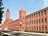 American Optical Company Historic District American Optical Company Historic District | May 3, 2023
(#100008957) | Optical Dr., Mechanic, Case, Cabot, Charlton, Main, and Wells Sts.
42°04′29″N 72°01′24″W / 42.0746°N 72.0233°W / 42.0746; -72.0233 (American Optical Company Historic District) | |
|---|
| 5 | Ammidown-Harding Farmhouse |  Ammidown-Harding Farmhouse Ammidown-Harding Farmhouse | June 22, 1989
(#89000552) | 83 Lebanon Hill Rd.
42°03′35″N 72°02′05″W / 42.059722°N 72.034722°W / 42.059722; -72.034722 (Ammidown-Harding Farmhouse) | |
|---|
| 6 | Ashland Mill Tenement |  Ashland Mill Tenement Ashland Mill Tenement | June 22, 1989
(#89000545) | 141–145 Ashland Ave.
42°03′55″N 72°00′37″W / 42.065278°N 72.010278°W / 42.065278; -72.010278 (Ashland Mill Tenement) | |
|---|
| 7 | Bacon-Morse Historic District |  Bacon-Morse Historic District Bacon-Morse Historic District | June 22, 1989
(#89000602) | N. Woodstock Rd. at Tipton Rock Rd.
42°02′09″N 72°00′48″W / 42.035833°N 72.013333°W / 42.035833; -72.013333 (Bacon-Morse Historic District) | |
|---|
| 8 | Beechwood |  Beechwood Beechwood | June 22, 1989
(#89000527) | 495 Main St.
42°04′38″N 72°02′18″W / 42.077222°N 72.038333°W / 42.077222; -72.038333 (Beechwood) | |
|---|
| 9 | Alexis Boyer House |  Alexis Boyer House Alexis Boyer House | June 22, 1989
(#89000560) | 306 Hamilton
42°04′53″N 72°02′16″W / 42.081389°N 72.037778°W / 42.081389; -72.037778 (Alexis Boyer House) | |
|---|
| 10 | Building at 25–27 River Street |  Building at 25–27 River Street Building at 25–27 River Street | June 22, 1989
(#89000574) | 25–27 River St.
42°04′56″N 72°02′21″W / 42.082222°N 72.0391°W / 42.082222; -72.0391 (Building at 25–27 River Street) | |
|---|
| 11 | Building at 29–31 River Street |  Building at 29–31 River Street Building at 29–31 River Street | June 22, 1989
(#89000575) | 29–31 River St.
42°04′56″N 72°02′21″W / 42.082222°N 72.0392°W / 42.082222; -72.0392 (Building at 29–31 River Street) | |
|---|
| 12 | Building at 38–42 Worcester Street |  Building at 38–42 Worcester Street Building at 38–42 Worcester Street | June 22, 1989
(#89000589) | 38–42 Worcester St.
42°04′46″N 72°01′47″W / 42.0794°N 72.0297°W / 42.0794; -72.0297 (Building at 38–42 Worcester Street) | |
|---|
| 13 | Building at 52 Main Street | 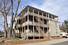 Building at 52 Main Street Building at 52 Main Street | June 22, 1989
(#89000583) | 52 Main St.
42°04′24″N 72°01′39″W / 42.0733°N 72.0275°W / 42.0733; -72.0275 (Building at 52 Main Street) | |
|---|
| 14 | Central Mills Historic District |  Central Mills Historic District Central Mills Historic District | June 22, 1989
(#89000595) | Roughly bounded by the Quinebaug River, North St., and Central St.
42°04′37″N 72°01′53″W / 42.0769°N 72.0314°W / 42.0769; -72.0314 (Central Mills Historic District) | |
|---|
| 15 | Centre Village Historic District |  Centre Village Historic District Centre Village Historic District | September 7, 1979
(#79000379) | Along Main St.
42°04′32″N 72°02′04″W / 42.0755°N 72.0345°W / 42.0755; -72.0345 (Centre Village Historic District) | |
|---|
| 16 | Chamberlain-Bordeau House |  Chamberlain-Bordeau House Chamberlain-Bordeau House | June 22, 1989
(#89000569) | 718 Main St.
42°04′49″N 72°02′35″W / 42.0803°N 72.0431°W / 42.0803; -72.0431 (Chamberlain-Bordeau House) | |
|---|
| 17 | Chapin Block | 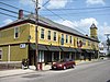 Chapin Block Chapin Block | June 22, 1989
(#89000558) | 208–222 Hamilton
42°04′48″N 72°02′08″W / 42.08°N 72.0356°W / 42.08; -72.0356 (Chapin Block) | |
|---|
| 18 | Alpha M. Cheney House |  Alpha M. Cheney House Alpha M. Cheney House | June 22, 1989
(#89000526) | 61 Chestnut St.
42°04′16″N 72°01′39″W / 42.0711°N 72.0275°W / 42.0711; -72.0275 (Alpha M. Cheney House) | |
|---|
| 19 | J.M. Cheney Rental House |  J.M. Cheney Rental House J.M. Cheney Rental House | June 22, 1989
(#89000564) | 32 Edwards St.
42°04′44″N 72°02′10″W / 42.0789°N 72.0361°W / 42.0789; -72.0361 (J.M. Cheney Rental House) | |
|---|
| 20 | Clarke-Glover Farmhouse |  Clarke-Glover Farmhouse Clarke-Glover Farmhouse | June 22, 1989
(#89000536) | 201 South St.
42°04′34″N 72°02′45″W / 42.0761°N 72.0458°W / 42.0761; -72.0458 (Clarke-Glover Farmhouse) | |
|---|
| 21 | Cliff Cottage |  Cliff Cottage Cliff Cottage | June 22, 1989
(#89000570) | 787 Mill St.
42°05′01″N 72°02′29″W / 42.083611°N 72.041389°W / 42.083611; -72.041389 (Cliff Cottage) | |
|---|
| 22 | E. Merritt Cole House |  E. Merritt Cole House E. Merritt Cole House | June 22, 1989
(#89000576) | 386 Main St.
42°04′36″N 72°02′08″W / 42.076667°N 72.035556°W / 42.076667; -72.035556 (E. Merritt Cole House) | |
|---|
| 23 | Comins-Wall House | 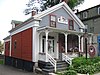 Comins-Wall House Comins-Wall House | June 22, 1989
(#89000555) | 42 Hamilton St.
42°04′35″N 72°02′04″W / 42.076389°N 72.034444°W / 42.076389; -72.034444 (Comins-Wall House) | |
|---|
| 24 | Congregational Church |  Congregational Church Congregational Church | June 22, 1989
(#89000591) | 61 Elm St.
42°04′23″N 72°02′06″W / 42.0731°N 72.035°W / 42.0731; -72.035 (Congregational Church) | |
|---|
| 25 | E. B. Cummings House |  E. B. Cummings House E. B. Cummings House | June 22, 1989
(#89000566) | 52 Marcy St.
42°04′43″N 72°02′15″W / 42.0786°N 72.0375°W / 42.0786; -72.0375 (E. B. Cummings House) | |
|---|
| 26 | Dani and Soldani Cabinet Makers and Wood Workers Factory |  Dani and Soldani Cabinet Makers and Wood Workers Factory Dani and Soldani Cabinet Makers and Wood Workers Factory | June 22, 1989
(#89000529) | 484 Worcester St.
42°05′26″N 72°01′22″W / 42.0906°N 72.0228°W / 42.0906; -72.0228 (Dani and Soldani Cabinet Makers and Wood Workers Factory) | |
|---|
| 27 | Dennison School House |  Dennison School House Dennison School House | June 22, 1989
(#89000551) | Dennison Ln.
42°03′38″N 72°03′42″W / 42.0606°N 72.0617°W / 42.0606; -72.0617 (Dennison School House) | |
|---|
| 28 | Sylvester Dresser House |  Sylvester Dresser House Sylvester Dresser House | June 22, 1989
(#89000523) | 29 Summer St.
42°04′18″N 72°02′05″W / 42.0717°N 72.0347°W / 42.0717; -72.0347 (Sylvester Dresser House) | |
|---|
| 29 | Dunbar-Vinton House |  Dunbar-Vinton House Dunbar-Vinton House | June 22, 1989
(#89000573) | Hook and Hamilton Sts.
42°04′38″N 72°02′03″W / 42.0772°N 72.0342°W / 42.0772; -72.0342 (Dunbar-Vinton House) | |
|---|
| 30 | Henry E. Durfee Farmhouse | 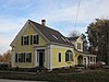 Henry E. Durfee Farmhouse Henry E. Durfee Farmhouse | June 22, 1989
(#89000547) | 281 Eastford Rd.
42°03′49″N 72°02′33″W / 42.0636°N 72.0425°W / 42.0636; -72.0425 (Henry E. Durfee Farmhouse) | |
|---|
| 31 | Elm Street Fire House |  Elm Street Fire House Elm Street Fire House | June 22, 1989
(#89000530) | 24 Elm St.
42°04′27″N 72°02′06″W / 42.074167°N 72.035°W / 42.074167; -72.035 (Elm Street Fire House) | |
|---|
| 32 | Evangelical Free Church |  Evangelical Free Church Evangelical Free Church | June 22, 1989
(#89000561) | Hamilton St.
42°04′55″N 72°02′29″W / 42.081944°N 72.041389°W / 42.081944; -72.041389 (Evangelical Free Church) | |
|---|
| 33 | James Gleason Cottage | 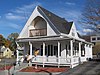 James Gleason Cottage James Gleason Cottage | June 22, 1989
(#89000533) | 31 Sayles St.
42°04′45″N 72°02′37″W / 42.079167°N 72.043611°W / 42.079167; -72.043611 (James Gleason Cottage) | |
|---|
| 34 | Globe Village Fire House |  Globe Village Fire House Globe Village Fire House | June 22, 1989
(#89000540) | West St. at Main St.
42°04′47″N 72°02′45″W / 42.0797°N 72.0458°W / 42.0797; -72.0458 (Globe Village Fire House) | |
|---|
| 35 | Glover Street Historic District |  Glover Street Historic District Glover Street Historic District | June 22, 1989
(#89000601) | Glover St. between High and Poplar Sts.
42°04′28″N 72°02′49″W / 42.074444°N 72.046944°W / 42.074444; -72.046944 (Glover Street Historic District) | |
|---|
| 36 | Hamilton Mill Brick House | 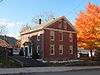 Hamilton Mill Brick House Hamilton Mill Brick House | June 22, 1989
(#89000542) | 16 High St.
42°04′48″N 72°02′43″W / 42.08°N 72.0453°W / 42.08; -72.0453 (Hamilton Mill Brick House) | |
|---|
| 37 | Hamilton Mill-West Street Factory Housing |  Hamilton Mill-West Street Factory Housing Hamilton Mill-West Street Factory Housing | June 22, 1989
(#89000541) | 45 West St.
42°04′46″N 72°02′47″W / 42.0794°N 72.0464°W / 42.0794; -72.0464 (Hamilton Mill-West Street Factory Housing) | |
|---|
| 38 | Hamilton Millwright-Agent's House | 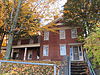 Hamilton Millwright-Agent's House Hamilton Millwright-Agent's House | June 22, 1989
(#89000543) | 757–761 Main St.
42°04′48″N 72°02′40″W / 42.08°N 72.0444°W / 42.08; -72.0444 (Hamilton Millwright-Agent's House) | |
|---|
| 39 | Hamilton Woolen Company Historic District |  Hamilton Woolen Company Historic District Hamilton Woolen Company Historic District | June 22, 1989
(#89000594) | Roughly bounded by McKinstry Brook, the Quinebaug River, and Mill St.
42°04′56″N 72°02′37″W / 42.0822°N 72.0436°W / 42.0822; -72.0436 (Hamilton Woolen Company Historic District) | |
|---|
| 40 | Theodore Harrington House |  Theodore Harrington House Theodore Harrington House | June 22, 1989
(#89000557) | 77 Hamilton St.
42°04′37″N 72°02′07″W / 42.0769°N 72.0353°W / 42.0769; -72.0353 (Theodore Harrington House) | |
|---|
| 41 | George H. Hartwell House |  George H. Hartwell House George H. Hartwell House | June 22, 1989
(#89000556) | 105 Hamilton St.
42°04′39″N 72°02′08″W / 42.0775°N 72.0356°W / 42.0775; -72.0356 (George H. Hartwell House) | |
|---|
| 42 | Samuel C. Hartwell House |  Samuel C. Hartwell House Samuel C. Hartwell House | June 22, 1989
(#89000592) | 79 Elm St.
42°04′22″N 72°02′07″W / 42.0728°N 72.0353°W / 42.0728; -72.0353 (Samuel C. Hartwell House) | |
|---|
| 43 | High-School Streets Historic District |  High-School Streets Historic District High-School Streets Historic District | June 22, 1989
(#89000600) | High St. at School St.
42°04′40″N 72°02′45″W / 42.0778°N 72.0458°W / 42.0778; -72.0458 (High-School Streets Historic District) | |
|---|
| 44 | William Hodgson Two-Family House |  William Hodgson Two-Family House William Hodgson Two-Family House | June 22, 1989
(#89000578) | 103–105 Sayles St.
42°04′38″N 72°02′38″W / 42.0772°N 72.0439°W / 42.0772; -72.0439 (William Hodgson Two-Family House) | Probably demolished. |
|---|
| 45 | House at 3 Dean Street |  House at 3 Dean Street House at 3 Dean Street | June 22, 1989
(#89000587) | 3 Dean St.
42°04′32″N 72°01′42″W / 42.0756°N 72.0283°W / 42.0756; -72.0283 (House at 3 Dean Street) | |
|---|
| 46 | House at 18 Walnut Street |  House at 18 Walnut Street House at 18 Walnut Street | June 22, 1989
(#89000580) | 18 Walnut St.
42°04′25″N 72°01′46″W / 42.0736°N 72.0294°W / 42.0736; -72.0294 (House at 18 Walnut Street) | |
|---|
| 47 | House at 34 Benefit Street |  House at 34 Benefit Street House at 34 Benefit Street | June 22, 1989
(#89000585) | 34 Benefit St.
42°04′31″N 72°01′46″W / 42.075278°N 72.029444°W / 42.075278; -72.029444 (House at 34 Benefit Street) | |
|---|
| 48 | House at 59–63 Crystal Street |  House at 59–63 Crystal Street House at 59–63 Crystal Street | June 22, 1989
(#89000584) | 59–63 Crystal St.
42°04′29″N 72°01′40″W / 42.074722°N 72.027778°W / 42.074722; -72.027778 (House at 59–63 Crystal Street) | |
|---|
| 49 | House at 64 Main Street |  House at 64 Main Street House at 64 Main Street | June 22, 1989
(#89000582) | 64 Main St.
42°04′23″N 72°01′41″W / 42.073056°N 72.028056°W / 42.073056; -72.028056 (House at 64 Main Street) | |
|---|
| 50 | House at 70–72 Main Street |  House at 70–72 Main Street House at 70–72 Main Street | June 22, 1989
(#89000581) | 70–72 Main St.
42°04′23″N 72°01′43″W / 42.073056°N 72.028611°W / 42.073056; -72.028611 (House at 70–72 Main Street) | |
|---|
| 51 | House at 91 Coombs Street |  House at 91 Coombs Street House at 91 Coombs Street | June 22, 1989
(#89000525) | 91 Coombs St.
42°04′18″N 72°01′48″W / 42.0717°N 72.03°W / 42.0717; -72.03 (House at 91 Coombs Street) | Probably demolished. |
|---|
| 52 | Judson-Litchfield House |  Judson-Litchfield House Judson-Litchfield House | June 22, 1989
(#89000539) | 313 South St.
42°04′34″N 72°03′01″W / 42.0761°N 72.0503°W / 42.0761; -72.0503 (Judson-Litchfield House) | |
|---|
| 53 | A. Kinney House |  A. Kinney House A. Kinney House | June 22, 1989
(#89000565) | 42 Edwards St.
42°04′44″N 72°02′12″W / 42.078889°N 72.036667°W / 42.078889; -72.036667 (A. Kinney House) | |
|---|
| 54 | LaCroix-Mosher House |  LaCroix-Mosher House LaCroix-Mosher House | June 22, 1989
(#89000524) | 56 Everett St.
42°04′21″N 72°02′02″W / 42.0725°N 72.0339°W / 42.0725; -72.0339 (LaCroix-Mosher House) | |
|---|
| 55 | Napoleon LaRochelle Two-Family House |  Napoleon LaRochelle Two-Family House Napoleon LaRochelle Two-Family House | June 22, 1989
(#89000567) | 30 Pine St.
42°04′51″N 72°03′00″W / 42.0808°N 72.05°W / 42.0808; -72.05 (Napoleon LaRochelle Two-Family House) | |
|---|
| 56 | Maple Street Historic District |  Maple Street Historic District Maple Street Historic District | June 22, 1989
(#89000597) | Maple St.
42°04′26″N 72°01′43″W / 42.0739°N 72.0286°W / 42.0739; -72.0286 (Maple Street Historic District) | |
|---|
| 57 | Mrs. R. Marcy House |  Mrs. R. Marcy House Mrs. R. Marcy House | June 22, 1989
(#89000535) | 64 South St.
42°04′38″N 72°02′28″W / 42.0772°N 72.0411°W / 42.0772; -72.0411 (Mrs. R. Marcy House) | |
|---|
| 58 | William McKinstry Farmhouse |  William McKinstry Farmhouse William McKinstry Farmhouse | June 22, 1989
(#89000571) | 361 Pleasant St.
42°05′41″N 72°02′35″W / 42.0947°N 72.0431°W / 42.0947; -72.0431 (William McKinstry Farmhouse) | |
|---|
| 59 | William McKinstry Jr. House |  William McKinstry Jr. House William McKinstry Jr. House | June 22, 1989
(#89000528) | 915 W. Main St.
42°04′55″N 72°02′52″W / 42.0819°N 72.0477°W / 42.0819; -72.0477 (William McKinstry Jr. House) | |
|---|
| 60 | H. Morse House |  H. Morse House H. Morse House | June 22, 1989
(#89000538) | 230 South St.
42°04′34″N 72°02′50″W / 42.0761°N 72.0472°W / 42.0761; -72.0472 (H. Morse House) | |
|---|
| 61 | New York, New Haven & Hartford Passenger Depot |  New York, New Haven & Hartford Passenger Depot New York, New Haven & Hartford Passenger Depot | June 22, 1989
(#89000554) | Depot St.
42°04′37″N 72°02′00″W / 42.076944°N 72.033333°W / 42.076944; -72.033333 (New York, New Haven & Hartford Passenger Depot) | |
|---|
| 62 | Notre Dame Catholic Church |  Notre Dame Catholic Church Notre Dame Catholic Church | June 22, 1989
(#89000563) | Main St. at Marcy St.
42°04′40″N 72°02′13″W / 42.077778°N 72.036944°W / 42.077778; -72.036944 (Notre Dame Catholic Church) | |
|---|
| 63 | J.J. Oakes House |  J.J. Oakes House J.J. Oakes House | June 22, 1989
(#89000534) | 14 South St.
42°04′39″N 72°02′20″W / 42.0775°N 72.0389°W / 42.0775; -72.0389 (J.J. Oakes House) | |
|---|
| 64 | E.M. Phillips House | 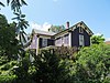 E.M. Phillips House E.M. Phillips House | June 22, 1989
(#89000532) | 35 Dresser St.
42°04′25″N 72°02′12″W / 42.073611°N 72.036667°W / 42.073611; -72.036667 (E.M. Phillips House) | |
|---|
| 65 | Simon Plimpton Farmhouse |  Simon Plimpton Farmhouse Simon Plimpton Farmhouse | June 22, 1989
(#89000550) | 561 South St.
42°04′29″N 72°03′18″W / 42.0747°N 72.055°W / 42.0747; -72.055 (Simon Plimpton Farmhouse) | |
|---|
| 66 | Stephen Richard House | 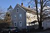 Stephen Richard House Stephen Richard House | June 22, 1989
(#89000522) | 239–241 Elm St.
42°04′06″N 72°02′11″W / 42.0683°N 72.0364°W / 42.0683; -72.0364 (Stephen Richard House) | |
|---|
| 67 | Sacred Heart Church Historic District |  Sacred Heart Church Historic District Sacred Heart Church Historic District | June 22, 1989
(#89000598) | Charlton St.
42°04′40″N 72°01′44″W / 42.077778°N 72.028889°W / 42.077778; -72.028889 (Sacred Heart Church Historic District) | |
|---|
| 68 | Smith-Lyon Farmhouse | 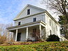 Smith-Lyon Farmhouse Smith-Lyon Farmhouse | June 22, 1989
(#89000546) | 400 N. Woodstock Rd.
42°03′18″N 72°01′00″W / 42.055°N 72.016667°W / 42.055; -72.016667 (Smith-Lyon Farmhouse) | |
|---|
| 69 | Southbridge Town Hall |  Southbridge Town Hall Southbridge Town Hall | November 20, 1987
(#87001378) | 41 Elm St.
42°04′23″N 72°02′05″W / 42.073056°N 72.034722°W / 42.073056; -72.034722 (Southbridge Town Hall) | |
|---|
| 70 | St. George's Greek Orthodox Church |  St. George's Greek Orthodox Church St. George's Greek Orthodox Church | June 22, 1989
(#89000579) | 55 North St.
42°04′36″N 72°01′48″W / 42.0767°N 72.03°W / 42.0767; -72.03 (St. George's Greek Orthodox Church) | |
|---|
| 71 | St. Peter's Roman Catholic Church-St. Mary's School |  St. Peter's Roman Catholic Church-St. Mary's School St. Peter's Roman Catholic Church-St. Mary's School | June 22, 1989
(#89000559) | 263 Hamilton St.
42°04′51″N 72°02′16″W / 42.080833°N 72.037778°W / 42.080833; -72.037778 (St. Peter's Roman Catholic Church-St. Mary's School) | Destroyed by fire in 1999.[4] |
|---|
| 72 | Lorenzo R. Stone House |  Lorenzo R. Stone House Lorenzo R. Stone House | June 22, 1989
(#89000537) | 218 South St.
42°04′35″N 72°02′48″W / 42.0764°N 72.0467°W / 42.0764; -72.0467 (Lorenzo R. Stone House) | |
|---|
| 73 | George Sumner House |  George Sumner House George Sumner House | June 22, 1989
(#89000577) | 32 Paige Hill Rd.
42°04′44″N 72°01′54″W / 42.0789°N 72.0317°W / 42.0789; -72.0317 (George Sumner House) | |
|---|
| 74 | Eugene Tapin House |  Eugene Tapin House Eugene Tapin House | June 22, 1989
(#89000549) | 215 Lebanon Hill Rd.
42°03′21″N 72°02′15″W / 42.0558°N 72.0375°W / 42.0558; -72.0375 (Eugene Tapin House) | |
|---|
| 75 | Tiffany-Leonard House |  Tiffany-Leonard House Tiffany-Leonard House | June 22, 1989
(#89000590) | 25 Elm St.
42°04′26″N 72°02′04″W / 42.0739°N 72.0344°W / 42.0739; -72.0344 (Tiffany-Leonard House) | |
|---|
| 76 | Twinehurst American Optical Company Neighborhood |  Twinehurst American Optical Company Neighborhood Twinehurst American Optical Company Neighborhood | June 22, 1989
(#89000593) | Twinehurst Place
42°04′42″N 72°01′57″W / 42.0783°N 72.0325°W / 42.0783; -72.0325 (Twinehurst American Optical Company Neighborhood) | Residential district on Twinehurst Place; does not include company factory buildings. |
|---|
| 77 | Upper Chapin Street Historic District |  Upper Chapin Street Historic District Upper Chapin Street Historic District | June 22, 1989
(#89000599) | Chapin St. at Forest Ave.
42°04′20″N 72°02′15″W / 42.0722°N 72.0375°W / 42.0722; -72.0375 (Upper Chapin Street Historic District) | |
|---|
| 78 | Vinton-Boardman Farmhouse |  Vinton-Boardman Farmhouse Vinton-Boardman Farmhouse | June 22, 1989
(#89000586) | 93 Torrey Rd.
42°05′07″N 72°00′33″W / 42.0853°N 72.0092°W / 42.0853; -72.0092 (Vinton-Boardman Farmhouse) | |
|---|
| 79 | Vinton-Torrey House | 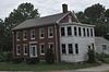 Vinton-Torrey House Vinton-Torrey House | June 22, 1989
(#89000588) | 5 Torrey Rd.
42°05′05″N 72°00′32″W / 42.0847°N 72.0089°W / 42.0847; -72.0089 (Vinton-Torrey House) | |
|---|
| 80 | George B. and Ruth D. Wells House |  George B. and Ruth D. Wells House George B. and Ruth D. Wells House | June 22, 1989
(#89000548) | Durfee Rd.
42°03′43″N 72°03′01″W / 42.0619°N 72.0503°W / 42.0619; -72.0503 (George B. and Ruth D. Wells House) | |
|---|
| 81 | H.C. Wells Double House |  H.C. Wells Double House H.C. Wells Double House | June 22, 1989
(#89000531) | 28–30 Dresser St.
42°04′26″N 72°02′10″W / 42.0739°N 72.0361°W / 42.0739; -72.0361 (H.C. Wells Double House) | |
|---|
| 82 | John M. Wells House |  John M. Wells House John M. Wells House | June 22, 1989
(#89000553) | 491 Eastford Rd.
42°03′32″N 72°02′55″W / 42.0589°N 72.0486°W / 42.0589; -72.0486 (John M. Wells House) | |
|---|
| 83 | Mary E. Wells School |  Mary E. Wells School Mary E. Wells School | May 3, 2023
(#100008958) | 80 Marcy St.
42°04′40″N 72°02′15″W / 42.0779°N 72.0374°W / 42.0779; -72.0374 (Mary E. Wells School) | |
|---|
| 84 | Albert H. Wheeler House |  Albert H. Wheeler House Albert H. Wheeler House | June 22, 1989
(#89000544) | 219 South St.
42°04′34″N 72°02′47″W / 42.0761°N 72.0464°W / 42.0761; -72.0464 (Albert H. Wheeler House) | |
|---|
| 85 | Windsor Court Historic District |  Windsor Court Historic District Windsor Court Historic District | June 22, 1989
(#89000596) | Windsor Ct. at North St.
42°04′33″N 72°01′52″W / 42.0758°N 72.0311°W / 42.0758; -72.0311 (Windsor Court Historic District) | |
|---|


