This is a list of the National Register of Historic Places listings in Will County, Illinois.

This is intended to be a complete list of the properties and districts on the National Register of Historic Places in Will County, Illinois, United States. Latitude and longitude coordinates are provided for many National Register properties and districts; these locations may be seen together in a map.[1]
There are 40 properties and districts listed on the National Register in the county, including 1 National Historic Landmark. Another property was once listed but has been removed.
This National Park Service list is complete through NPS recent listings posted May 10, 2024.[2]
Current listings
| [3] | Name on the Register | Image | Date listed[4] | Location | City or town | Description |
|---|---|---|---|---|---|---|
| 1 | Alternate Route 66, Wilmington to Joliet |  | May 5, 2006 (#06000381) | Illinois Route 53 between Wilmington and Joliet 41°24′16″N 88°06′27″W / 41.404444°N 88.1075°W | Joliet and Wilmington | This is the section of former U.S. Route 66 that traveled from Wilmington to Joliet. The road mostly traverses agricultural land, but does pass the former Joliet Army Ammunition Plant. Most of this 15.9-mile (25.6 km) stretch has been re-designated Illinois Route 53. One bridge, one overpass, and Four concrete box culverts along the road are also included in the listing. |
| 2 | Beecher Mausoleum |  | September 18, 2013 (#13000714) | Jct. of IL 1 & Horner Ln. 41°20′13″N 87°37′08″W / 41.336921°N 87.618908°W | Washington Township | |
| 3 | Brandon Road Lock and Dam Historic District |  | March 10, 2004 (#04000163) | 1100 Brandon Road 41°30′17″N 88°06′20″W / 41.504694°N 88.105667°W | Joliet | The Brandon Road Lock and Dam is one of eight locks and dams used to control water levels of the Illinois Waterway. The waterway connects the Chicago River to the Mississippi River. |
| 4 | Briscoe Mounds |  | December 22, 1978 (#78001198) | Front St. along the Des Plaines River[5] 41°25′10″N 88°13′08″W / 41.41944°N 88.21888°W | Channahon | The mounds are an archeological site located along the north side of the Des Plaines River. Surveys and excavations from 1938 to 1964 revealed Mississippian pottery and bodies dating from 1200-1500 AD. |
| 5 | Chicago Sanitary and Ship Canal Historic District |  | December 20, 2011 (#11000907) | Illinois Waterway miles 290.0-321.7 41°38′31″N 88°03′37″W / 41.641867°N 88.060208°W | Lemont, Romeoville and Lockport | part of the Illinois Waterway Navigation System Facilities MPS; extends from the West Side of Chicago through Cook County west of Chicago and DuPage County to Lockport |
| 6 | Christ Episcopal Church |  | August 12, 1982 (#82002603) | 75 West Van Buren Street 41°31′33″N 88°05′03″W / 41.525833°N 88.084167°W | Joliet | The church was built in 1885 to serve the Episcopalian religious congregation. Designed by F. S. Allen, the congregation met in the church until 2004. It was destroyed in a 2006 fire.[6] |
| 7 | Downtown Joliet Historic District | December 26, 2023 (#100009642) | Roughly bounded by the western terminus of the Jefferson Street and Jackson Street bridges over the Des Plaines River and Ottawa and Joliet Streets on the west, Jefferson Street on the south, Scott and Chicago Streets on the east, and Cass and Irving Street 41°31′30″N 88°04′59″W / 41.5250°N 88.0830°W | Joliet | ||
| 8 | Downtown Peotone Historic District |  | November 16, 2005 (#05001253) | Roughly North First Street and both sides of North Second Street, roughly bounded by the alley south of Main and north by North Street 41°20′03″N 87°47′29″W / 41.334167°N 87.791389°W | Peotone | The Illinois Central Railroad opened in 1856 with a station in eastern Will County. The surrounding area became known as Peotone and featured a lively commercial district along the tracks. This district later expanded in response to growing use of automobiles. |
| 9 | Downtown Plainfield Historic District |  | September 18, 2013 (#13000719) | Lockport bounded by Division & Main Sts. 41°36′30″N 88°12′18″W / 41.608432°N 88.205134°W | Plainfield | |
| 10 | Eagle Hotel |  | February 16, 1994 (#94000021) | 100–104 Water Street 41°18′28″N 88°08′51″W / 41.307778°N 88.1475°W | Wilmington | Eagle Hotel opened in the late 1830s to accommodate farmers traveling to Wilmington to use the local grist mill. The Chicago and Alton Railroad and U.S. Route 66 were later constructed near the hotel, providing further commerce. The interior was badly damaged in a 1990 fire. |
| 11 | Fitzpatrick House |  | February 9, 1984 (#84001170) | Illinois Route 53 41°36′02″N 88°04′15″W / 41.600556°N 88.070833°W | Romeoville[7] | |
| 12 | Flanders House |  | November 14, 1991 (#91001688) | 405 West Main Street 41°36′45″N 88°12′10″W / 41.6125°N 88.202778°W | Plainfield | |
| 13 | Ron George Round Barn |  | December 7, 1982 (#82000401) | Northeast of Romeoville off of U.S. Route 66 41°39′28″N 88°09′52″W / 41.657778°N 88.164444°W | Bolingbrook | Relocated in 1998 to Essington Road.[8] |
| 14 | John Heck House |  | August 16, 1994 (#94000978) | 1225 South Hamilton Street 41°35′07″N 88°03′29″W / 41.585278°N 88.058056°W | Lockport | |
| 15 | Jacob H. Henry House |  | May 14, 1979 (#79000875) | 20 South Eastern Avenue 41°31′23″N 88°04′35″W / 41.523056°N 88.076389°W | Joliet | |
| 16 | Illinois and Michigan Canal |  | October 15, 1966 (#66000332) | 7 miles (11 km) southwest of Joliet on U.S. Route 6, in Channahon State Park 41°34′11″N 88°04′11″W / 41.569722°N 88.069722°W | Joliet | |
| 17 | Illinois State Penitentiary-Joliet Historic District |  | September 25, 2023 (#100009371) | 1125 Collins St. 41°32′49″N 88°04′27″W / 41.5469°N 88.0742°W | Joliet | |
| 18 | Joliet YMCA |  | February 9, 2006 (#06000010) | 215 North Ottawa Street 41°31′50″N 88°05′01″W / 41.530556°N 88.083611°W | Joliet | |
| 19 | Joliet East Side Historic District |  | August 15, 1980 (#80001418) | Roughly bounded by Washington and Union Streets, 4th and Eastern Avenues 41°31′08″N 88°04′28″W / 41.518889°N 88.074444°W | Joliet | |
| 20 | Joliet Municipal Airport |  | December 10, 1980 (#80001419) | 4000 West Jefferson Street 41°31′24″N 88°10′46″W / 41.523333°N 88.179444°W | Joliet | |
| 21 | Joliet Steel Works |  | February 28, 1991 (#91000088) | 927 Collins Street 41°32′28″N 88°04′30″W / 41.541111°N 88.075°W | Joliet | |
| 22 | Joliet Township High School | .jpg) | August 12, 1982 (#82002604) | 201 East Jefferson Street 41°31′32″N 88°04′28″W / 41.525556°N 88.074444°W | Joliet | |
| 23 | Louis Joliet Hotel |  | February 9, 1990 (#90000101) | 22 East Clinton Street 41°31′36″N 88°04′48″W / 41.526667°N 88.08°W | Joliet | |
| 24 | Lockport Historic District |  | May 12, 1975 (#75000676) | Area between 7th and 11th Streets and Canal and Washington Streets 41°35′22″N 88°03′25″W / 41.589444°N 88.056944°W | Lockport | |
| 25 | Lockport Lock, Dam and Power House Historic District |  | March 10, 2004 (#04000167) | 2502 Channel Drive 41°34′10″N 88°04′44″W / 41.569444°N 88.078889°W | Lockport | |
| 26 | McGovney–Yunker Farmstead |  | May 31, 2006 (#06000448) | 10824 LaPorte Road 41°31′36″N 87°52′53″W / 41.526667°N 87.881389°W | Mokena | |
| 27 | Robert Milne House |  | December 17, 1979 (#79000876) | 535 East 7th Street 41°35′22″N 88°02′57″W / 41.589444°N 88.049167°W | Lockport | |
| 28 | Peotone Mill |  | March 19, 1982 (#82002605) | 433 West Corning Avenue 41°19′56″N 87°47′53″W / 41.332222°N 87.798056°W | Peotone | |
| 29 | Joseph Ferris Perry House | 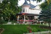 | December 20, 2022 (#100008486) | 365 West Exchange St. 41°26′43″N 87°37′33″W / 41.4454°N 87.6259°W | Crete | |
| 30 | Plainfield Halfway House |  | September 29, 1980 (#80001421) | 503 Main Street 41°36′41″N 88°12′15″W / 41.611389°N 88.204167°W | Plainfield | |
| 31 | Rubens Rialto Square Theater |  | July 24, 1978 (#78001199) | 102 North Chicago Street 41°31′34″N 88°04′53″W / 41.526111°N 88.081389°W | Joliet | |
| 32 | Hiram B. Scutt Mansion |  | February 5, 2003 (#02001760) | 206 N Broadway 41°31′37″N 88°05′18″W / 41.526944°N 88.088333°W | Joliet | |
| 33 | Small–Towle House |  | May 12, 2004 (#04000419) | 515 County Road 41°18′39″N 88°08′31″W / 41.310833°N 88.141944°W | Wilmington | |
| 34 | Standard Oil Gasoline Station |  | November 13, 1984 (#84000340) | 600 West Lockport Street 41°36′29″N 88°12′20″W / 41.608056°N 88.205556°W | Plainfield | |
| 35 | Stone Manor |  | November 26, 1980 (#80001420) | Southeast of Lockport 41°34′23″N 87°56′10″W / 41.573056°N 87.936111°W | Homer Glen | |
| 36 | U.S. Post Office |  | August 20, 1981 (#81000223) | 150 North Scott Street 41°31′39″N 88°04′49″W / 41.5275°N 88.080278°W | Joliet | |
| 37 | Union Station |  | August 1, 1978 (#78001200) | 50 East Jefferson Street 41°31′28″N 88°04′47″W / 41.524444°N 88.079722°W | Joliet | |
| 38 | Upper Bluff Historic District |  | June 5, 1991 (#91000687) | Roughly bounded by Taylor, Center and Campbell Streets and Raynor Avenue 41°31′45″N 88°05′47″W / 41.529167°N 88.096389°W | Joliet | |
| 39 | Will County Courthouse | May 22, 2023 (#100009005) | 14 West Jefferson St. 41°31′30″N 88°04′56″W / 41.5249°N 88.0823°W | Joliet | ||
| 40 | Will County Historical Society Headquarters |  | May 17, 1972 (#72000467) | 803 South State Street 41°35′21″N 88°03′17″W / 41.589167°N 88.054722°W | Lockport |
Former listing
| [3] | Name on the Register | Image | Date listed | Date removed | Location | City or town | Description |
|---|---|---|---|---|---|---|---|
| 1 | Ninth Street Seven Arch Stone Bridge | August 20, 2004 (#04000866) | August 28, 2012 | Ninth Street spanning Deep Run Creek 41°35′36″N 88°03′53″W / 41.593333°N 88.064722°W | Lockport | Destroyed in a 2011 storm.[9] |
See also
References
Wikimedia Commons has media related to National Register of Historic Places in Will County, Illinois.
🔥 Top keywords: Main PageSpecial:SearchWikipedia:Featured picturesYasukeHarrison ButkerRobert FicoBridgertonCleopatraDeaths in 2024Joyce VincentXXXTentacionHank AdamsIt Ends with UsYouTubeNew Caledonia2024 Indian general electionHeeramandiDarren DutchyshenSlovakiaKingdom of the Planet of the ApesAttempted assassination of Robert FicoLawrence WongBaby ReindeerXXX: Return of Xander CageThelma HoustonFuriosa: A Mad Max SagaMegalopolis (film)Richard GaddKepler's SupernovaWicked (musical)Sunil ChhetriXXX (2002 film)Ashley MadisonAnya Taylor-JoyPlanet of the ApesNava MauYoung SheldonPortal:Current eventsX-Men '97