Río Arriba Saliente is a rural barrio in the municipality of Manatí, Puerto Rico. Its population in 2010 was 3,592.[3][4][5]
Río Arriba Saliente | |
|---|---|
Barrio | |
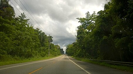
 Río Arriba Saliente barrio from bridge on PR-642, near junction with Puerto Rico Highway 6685 | |
 Location of Río Arriba Saliente within the municipality of Manatí shown in red | |
 Río Arriba Saliente Location of Puerto Rico | |
| Coordinates: 18°23′12″N 66°28′13″W / 18.386628°N 66.470319°W[1] | |
| Commonwealth | |
| Municipality | |
| Area | |
| • Total | 6.62 sq mi (17.1 km2) |
| • Land | 6.55 sq mi (17.0 km2) |
| • Water | 0.07 sq mi (0.2 km2) |
| Elevation | 614 ft (187 m) |
| Population (2010) | |
| • Total | 3,592 |
| • Density | 549.2/sq mi (212.0/km2) |
| Source: 2010 Census | |
| Time zone | UTC−4 (AST) |
| Census | Pop. | Note | %± |
|---|---|---|---|
| 1900 | 1,593 | — | |
| 1910 | 2,041 | 28.1% | |
| 1920 | 2,467 | 20.9% | |
| 1930 | 2,619 | 6.2% | |
| 1940 | 3,096 | 18.2% | |
| 1950 | 3,087 | −0.3% | |
| 1960 | 2,051 | −33.6% | |
| 1970 | 0 | −100.0% | |
| 1980 | 2,298 | — | |
| 1990 | 2,445 | 6.4% | |
| 2000 | 3,119 | 27.6% | |
| 2010 | 3,592 | 15.2% | |
| U.S. Decennial Census 1899 (shown as 1900)[6] 1910-1930[7] 1930-1950[8] 1980-2000[9] 2010[10] | |||
History
Río Arriba Saliente was in Spain's gazetteers[11] until Puerto Rico was ceded by Spain in the aftermath of the Spanish–American War under the terms of the Treaty of Paris of 1898 and became an unincorporated territory of the United States. In 1899, the United States Department of War conducted a census of Puerto Rico finding that the population of Río Arriba Saliente barrio was 1,593.[12]
Gallery
 Puerto Rico Highway 149 in Río Arriba Saliente barrio
.jpg)
