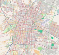
Xola (Spanish pronunciation: [ʃo.la]) is a station on Line 2 of the Mexico City Metro system.[2][3] It is located in the Colonia Moderna and Colonia Alamos districts of the Benito Juárez borough of Mexico City, directly south of the city centre on Calzada de Tlalpan.[2] It is a surface station.
| STC rapid transit | |||||||||||
 View of Metro Xola from Calzada Tlalpan | |||||||||||
| General information | |||||||||||
| Location | Calzada de Tlalpan Benito Juárez Mexico City Mexico | ||||||||||
| Coordinates | 19°23′43″N 99°08′16″W / 19.3952°N 99.1377°W | ||||||||||
| Line(s) | |||||||||||
| Platforms | 1 island platform | ||||||||||
| Tracks | 2 | ||||||||||
| Connections | |||||||||||
| Construction | |||||||||||
| Structure type | At grade | ||||||||||
| Platform levels | 1 | ||||||||||
| Parking | No | ||||||||||
| Bicycle facilities | No | ||||||||||
| Accessible | Yes | ||||||||||
| History | |||||||||||
| Opened | 1 August 1970 | ||||||||||
| Passengers | |||||||||||
| 2023 | 6,002,611[1] | ||||||||||
| Rank | 76/195[1] | ||||||||||
| Services | |||||||||||
| |||||||||||
| |||||||||||
General information
The station logo shows a coconut palm tree.[2] The name comes from the 19th century "Xola" hacienda that existed in the current site of the station.[2] The hacienda housed an enormous specimen of coconut palm tree, of which some still stand on the sidewalk of the nearby Xola Avenue. The station opened on 1 August 1970.[4]
Ridership
| Annual passenger ridership | |||||
|---|---|---|---|---|---|
| Year | Ridership | Average daily | Rank | % change | Ref. |
| 2023 | 6,002,611 | 16,445 | 76/195 | +15.18% | [1] |
| 2022 | 5,211,609 | 14,278 | 83/195 | +59.50% | [1] |
| 2021 | 3,267,474 | 8,951 | 100/195 | −22.96% | [5] |
| 2020 | 4,241,010 | 11,587 | 85/195 | −47.94% | [6] |
| 2019 | 8,146,220 | 22,318 | 73/195 | +1.35% | [7] |
| 2018 | 8,037,593 | 22,020 | 75/195 | +4.41% | [8] |
| 2017 | 7,698,179 | 21,090 | 79/195 | −1.12% | [9] |
| 2016 | 7,785,715 | 21,272 | 84/195 | −2.13% | [10] |
| 2015 | 7,954,990 | 21,794 | 78/195 | +5.52% | [11] |
| 2014 | 7,539,018 | 20,654 | 86/195 | −5.09% | [12] |
Exits
- East: Calzada de Tlalpan between Juana de Arco street and Napoleón street, Colonia Moderna
- West: Calzada de Tlalpan between Toledo street and Xola, Colonia Álamos
See also
References
External links

Wikimedia Commons has media related to Xola (station).
🔥 Top keywords: Main PageSpecial:SearchWikipedia:Featured picturesYasukeHarrison ButkerRobert FicoBridgertonCleopatraDeaths in 2024Joyce VincentXXXTentacionHank AdamsIt Ends with UsYouTubeNew Caledonia2024 Indian general electionHeeramandiDarren DutchyshenSlovakiaKingdom of the Planet of the ApesAttempted assassination of Robert FicoLawrence WongBaby ReindeerXXX: Return of Xander CageThelma HoustonFuriosa: A Mad Max SagaMegalopolis (film)Richard GaddKepler's SupernovaWicked (musical)Sunil ChhetriXXX (2002 film)Ashley MadisonAnya Taylor-JoyPlanet of the ApesNava MauYoung SheldonPortal:Current eventsX-Men '97

