
Peru_site_locations.png (২৫৪ × ৩৩৪ পিক্সেল, ফাইলের আকার: ৩৫ কিলোবাইট, এমআইএমই ধরন: image/png)
| এই ফাইলটি উইকিমিডিয়া কমন্স থেকে নেওয়া। সেখানের বর্ণনা পাতার বিস্তারিত নিম্নে দেখানো হলো। (সম্পাদনা) |
 | This locator map image could be re-created using vector graphics as an SVG file. This has several advantages; see Commons:Media for cleanup for more information. If an SVG form of this image is available, please upload it and afterwards replace this template with {{vector version available|new image name}}.It is recommended to name the SVG file “Peru site locations.svg”—then the template Vector version available (or Vva) does not need the new image name parameter. |
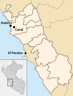
| বিবরণPeru site locations.png | English: Archaeological Site locations within Peru, including El Paraiso, Caral, and Aspero |
| তারিখ | |
| উৎস | নিজের কাজ |
| লেখক | Ontrvet |
যেকোনো তারিখ/সময়ে ক্লিক করে দেখুন ফাইলটি তখন কী অবস্থায় ছিল।
| তারিখ/সময় | সংক্ষেপচিত্র | মাত্রা | ব্যবহারকারী | মন্তব্য | |
|---|---|---|---|---|---|
| বর্তমান | ২৩:৩৩, ১৭ মার্চ ২০১২ | | ২৫৪ × ৩৩৪ (৩৫ কিলোবাইট) | Ontrvet |
নিচের পৃষ্ঠা(গুলো) থেকে এই ছবিতে সংযোগ আছে:
নিচের অন্যান্য উইকিগুলো এই ফাইলটি ব্যবহার করে:
এই ফাইলে অতিরিক্ত কিছু তথ্য আছে। সম্ভবত যে ডিজিটাল ক্যামেরা বা স্ক্যানারের মাধ্যমে এটি তৈরি বা ডিজিটায়িত করা হয়েছিল, সেটি কর্তৃক তথ্যগুলি যুক্ত হয়েছে। যদি ফাইলটি তার আদি অবস্থা থেকে পরিবর্তিত হয়ে থাকে, কিছু কিছু বিবরণ পরিবর্তিত ফাইলটির জন্য প্রযোজ্য না-ও হতে পারে।
| অনুভূমিক রেজোলিউশন | ৩৭.৮ dpc |
|---|---|
| উল্লম্ব রেজোলিউশন | ৩৭.৮ dpc |