
Original file (1,798 × 1,584 pixels, file size: 2.72 MB, MIME type: image/png)
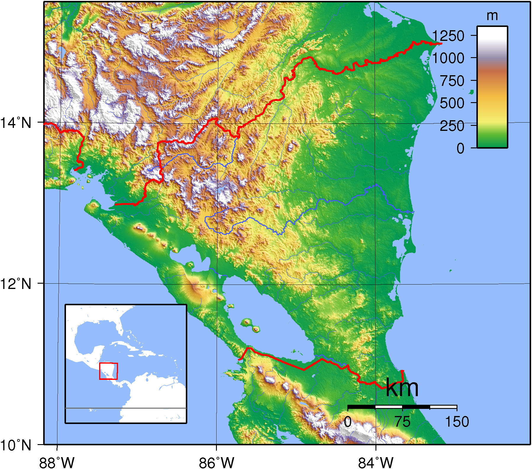
| DescriptionNicaragua Topography.png | Topographic map of Nicaragua. Created with GMT from SRTM data. |
| Date | |
| Source | Own work |
| Author | Sadalmelik |
 | Permission is granted to copy, distribute and/or modify this document under the terms of the GNU Free Documentation License, Version 1.2 or any later version published by the Free Software Foundation; with no Invariant Sections, no Front-Cover Texts, and no Back-Cover Texts. A copy of the license is included in the section entitled GNU Free Documentation License.http://www.gnu.org/copyleft/fdl.htmlGFDLGNU Free Documentation Licensetruetrue |
Click on a date/time to view the file as it appeared at that time.
| Date/Time | Thumbnail | Dimensions | User | Comment | |
|---|---|---|---|---|---|
| current | 16:50, 16 September 2007 | | 1,798 × 1,584 (2.72 MB) | Sadalmelik | {{Information |Description=Topographic map of Nicaragua. Created with GMT from SRTM data. |Source=self-made |Date=Sep 16, 2007 |Author= Sadalmelik }} Category:Maps of Nicaragua Category:Topographic maps of the Americas |
The following other wikis use this file:
This file contains additional information, probably added from the digital camera or scanner used to create or digitize it.
If the file has been modified from its original state, some details may not fully reflect the modified file.
| Horizontal resolution | 102.75 dpc |
|---|---|
| Vertical resolution | 102.75 dpc |
| Software used |
|