
LocationSaintLucia.png (250 × 115 pixel, file ke size: 3 KB, MIME type: image/png)
Ii file Wikimedia Commons se aais hai aur duusra projects me bhi kaam me lawa jaae sake hai.Iske baare me aur jaankari file description page ke niche dekhawa jaae hai.
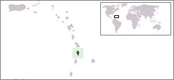
Location map for the Saint Lucia.
Originally created for English Wikipedia by Vardion.
| Public domainPublic domainfalsefalse |
| | This work has been released into the public domain by its author, Vardion, at the English Wikipedia project. This applies worldwide. In case this is not legally possible: |
 | This locator map image could be re-created using vector graphics as an SVG file. This has several advantages; see Commons:Media for cleanup for more information. If an SVG form of this image is available, please upload it and afterwards replace this template with {{vector version available|new image name}}.It is recommended to name the SVG file “LocationSaintLucia.svg”—then the template Vector version available (or Vva) does not need the new image name parameter. |
File ke dekhe khatir, jaise uu time dekhe me lagat rahaa, date/time pe click karo.
| Din/Time | Chhota chapa | Lambai aur chaurai | Sadasya | Tiprrin | |
|---|---|---|---|---|---|
| abhi waala | 18:28, 16 Janwari 2008 | | 250 × 115 (3 KB) | Mahahahaneapneap | pngcrushed |
| 03:03, 20 Disambar 2004 |  | 250 × 115 (5 KB) | EugeneZelenko | Location map for the Saint Lucia.<br/>Originally created for English Wikipedia by Vardion.<br/>{{PD}}<br/>Category:Country locator maps |
Niche ke panna kaam me laae hai ii file ke:
Ii aur duusra wiki ii file ke use kare hai:
Ii file ke more global usage kedekho.