
Sua resolutio (1 467 × 1 000 elementa imaginalia, magnitudo fasciculi: 1.41 megaocteti, typus MIME: image/png)
Hic fasciculus apud Vicimedia Communia iacet; in aliis inceptis adhiberi potest.Contenta paginae descriptionis fasciculi subter monstrantur.
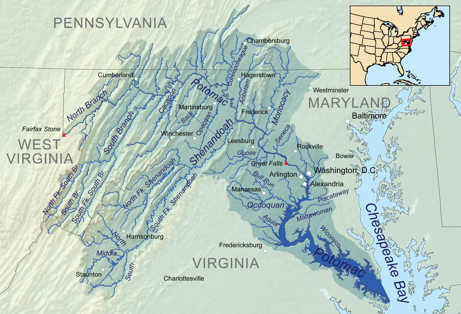
| DescriptioPotomacwatershedmap.png | Map showing the Potomac River drainage basin. |
| Datum | |
| Fons | Opus proprium, Elevation data from SRTM, hydrologic data from the National Hydrography Dataset, urban areas from Vector Map, all other features from the National Atlas. |
| Auctor | Kmusser |
| Other versions | File:Potomac watershed.png |
Presso die vel tempore fasciculum videbis, sicut tunc temporis apparuit.
| Dies/Tempus | Minutio | Dimensiones | Usor | Sententia | |
|---|---|---|---|---|---|
| recentissima | 00:10, 4 Ianuarii 2011 | | 1 467 × 1 000 (1.41 megaocteti) | Kmusser | == Summary == {{Information |Description=Map showing the Potomac River drainage basin. |Source={{own}}, Elevation data from SRTM, hydrologic data from the [[:w:National Hydrography Dataset|Natio |
Ad hunc fasciculum nectit:
Quae incepta Vici fasciculo utuntur:
View more global usage of this file.