

Oorspronkelijk bestand (2.388 × 1.668 pixels, bestandsgrootte: 696 kB, MIME-type: image/png)
| Dit is een bestand van Wikimedia Commons. Onderstaande beschrijving komt van de beschrijving van het bestand daar. |
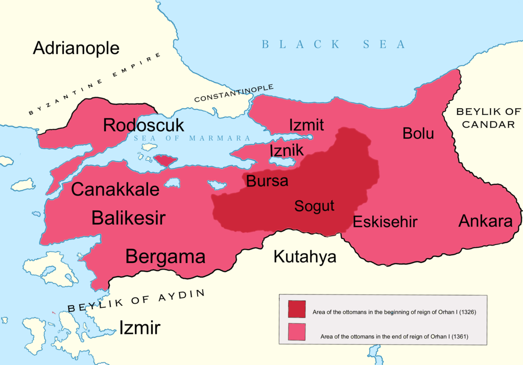
| BeschrijvingOrhan I area map.png | English: Map showing the area of the Ottoman Empire during the reign of Orhan I and his conquests. I used the information of various historical books and these maps:http://www.forumalev.net/tarihi-resimler/384265-orhan-gazi-donemi-osmanli-haritasi.htmlhttp://aygunhoca.com/images/sunular/orhan%20gazi%20dnemi.jpg http://europelostandfound.net/files/elf/images/637px-OttomanEmpireIn1683.png |
| Datum | |
| Bron | Eigen werk |
| Auteur | DragonTiger23 |
| Andere versies | العربيَّة |
Klik op een datum/tijd om het bestand te zien zoals het destijds was.
| Datum/tijd | Miniatuur | Afmetingen | Gebruiker | Opmerking | |
|---|---|---|---|---|---|
| huidige versie | 18 mei 2020 14:16 | | 2.388 × 1.668 (696 kB) | SPQR10 | Color scheme Clear Graphics Detailing |
| 1 jun 2011 21:58 |  | 735 × 472 (35 kB) | DragonTiger23 |
Dit bestand wordt op de volgende 3 pagina's gebruikt:
De volgende andere wiki's gebruiken dit bestand:
Globaal gebruik van dit bestand bekijken.
Dit bestand bevat metadata met EXIF-informatie, die door een fotocamera, scanner of fotobewerkingsprogramma toegevoegd kan zijn.
| Pixelcompositie | RGB |
|---|---|
| Horizontale resolutie | 51,97 dpi |
| Verticale resolutie | 51,97 dpi |