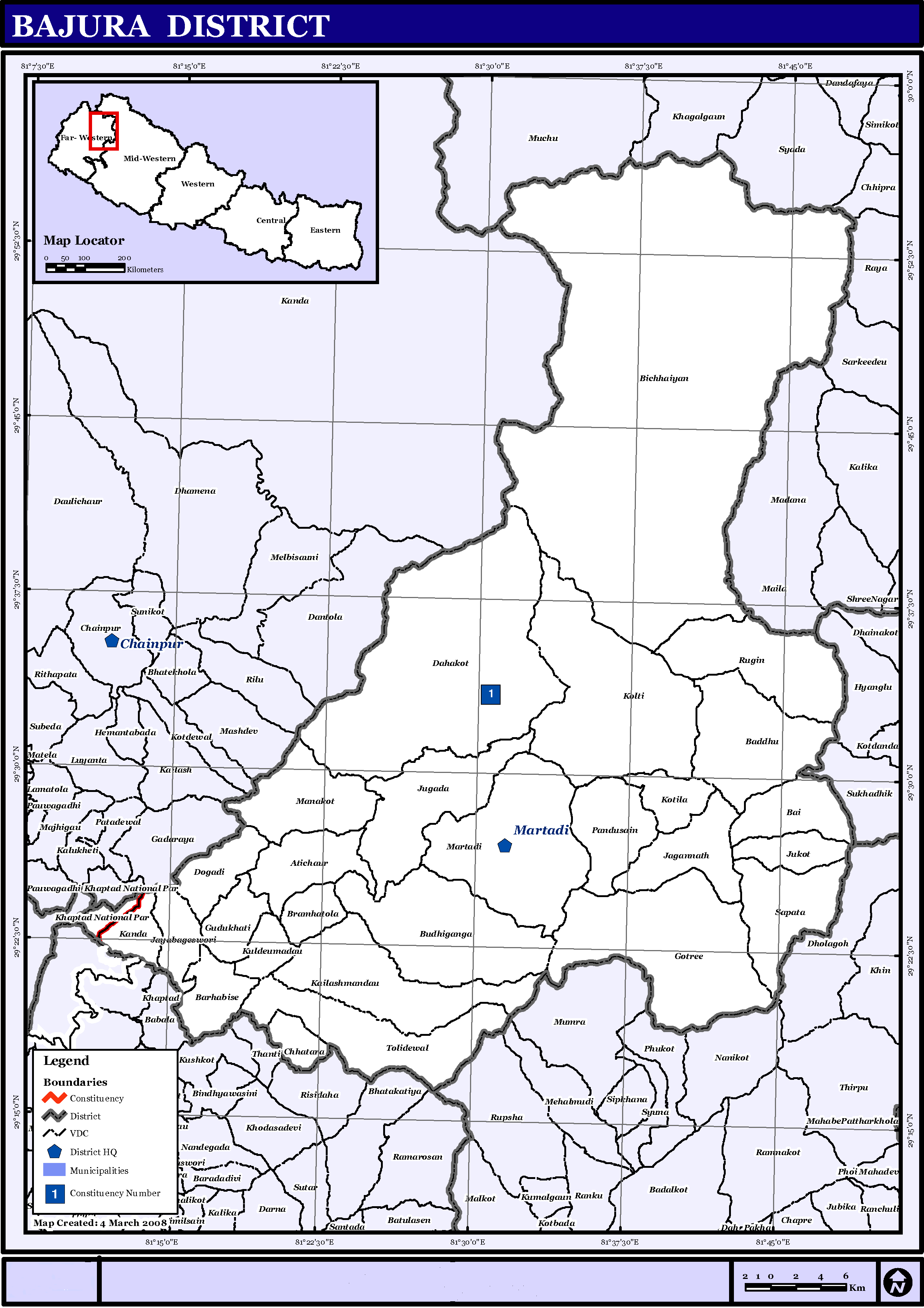
Tập tin:NepalBajuraDistrictmap.png
Tập tin gốc (2.479×3.508 điểm ảnh, kích thước tập tin: 249 kB, kiểu MIME: image/png)
| Miêu tả | English: Map displaying Village Development Committees in Bajura District, Nepal | |||
| Ngày | ||||
| Nguồn gốc | http://www.un.org.np/maps/district-maps/far-western/Bajura.pdf | |||
| Tác giả | United Nations | |||
| Giấy phép (Dùng lại tập tin) |
|

Lịch sử tập tin
Nhấn vào ngày/giờ để xem nội dung tập tin tại thời điểm đó.
| Ngày/giờ | Hình xem trước | Kích cỡ | Thành viên | Miêu tả | |
|---|---|---|---|---|---|
| hiện tại | 15:21, ngày 21 tháng 5 năm 2016 | | 2.479×3.508 (249 kB) | Timeshifter | Removed UN logo and info. Only UN maps without UN info are allowed. |
| 01:40, ngày 6 tháng 11 năm 2008 |  | 2.479×3.508 (272 kB) | Sadalmelik | {{Information |Description={{en|1=Map displaying Village Development Committees in Bajura District, Nepal}} |Source=http://www.un.org.np/maps/district-maps/far-western/Bajura.pdf |Date=March 4, 2008 |Author=United Nations |Permission={{PD-UN}} |other_ |
Trang sử dụng tập tin
Sử dụng tập tin toàn cục
Những wiki sau đang sử dụng tập tin này:
- Trang sử dụng tại de.wikipedia.org
- Trang sử dụng tại en.wikipedia.org
- Trang sử dụng tại fi.wikipedia.org
- Trang sử dụng tại it.wikipedia.org
- Trang sử dụng tại mai.wikipedia.org
- Trang sử dụng tại ms.wikipedia.org
- Trang sử dụng tại ne.wikipedia.org
Xem thêm các trang toàn cục sử dụng tập tin này.