
Curacao-CIA_WFB_Map.png (325 × 349 像素,檔案大細:11 KB ,MIME類型:image/png)
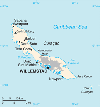
| 描述Curacao-CIA WFB Map.png | English: Map of Curaçao from the 2010-10-22 revision of the World Factbook |
| 日期 | |
| 來源 | World Factbook website |
| 作者 | Directorate of Intelligence, CIA |
| Public domainPublic domainfalsefalse |
This image is in the public domain because it contains materials that originally came from the United States Central Intelligence Agency's World Factbook. Bahasa Indonesia ∙ čeština ∙ Deutsch ∙ eesti ∙ English ∙ español ∙ Esperanto ∙ français ∙ galego ∙ hrvatski ∙ italiano ∙ Nederlands ∙ norsk nynorsk ∙ polski ∙ português ∙ sicilianu ∙ slovenščina ∙ suomi ∙ Türkçe ∙ Zazaki ∙ беларуская (тарашкевіца) ∙ македонски ∙ русский ∙ српски / srpski ∙ українська ∙ ქართული ∙ বাংলা ∙ தமிழ் ∙ മലയാളം ∙ 한국어 ∙ 日本語 ∙ 中文 ∙ 中文(简体) ∙ 中文(繁體) ∙ العربية ∙ +/− |  |
撳個日期/時間去睇響嗰個時間出現過嘅檔案。
| 日期/時間 | 縮圖 | 尺寸 | 用戶 | 註解 | |
|---|---|---|---|---|---|
| 現時 | 2018年5月23號 (三) 11:13 | | 325 × 349(11 KB) | Ras67 | cropped, opt. |
| 2010年10月23號 (六) 11:21 |  | 330 × 353(13 KB) | Hoshie | {{Information |Description= Map of {{w|Curaçao}} from the 2010-10-22 revision of the World Factbook |Source= [https://www.cia.gov/library/publications/the-world-factbook/maps/maptemplate_cc.html World Factbook website] |Date= 2010-10-22 |Author= Director |
以下嘅1版用到呢個檔:
下面嘅維基都用緊呢個檔案:
睇呢個檔案嘅更多全域使用情況。
呢個檔案有額外嘅資料。佢應該係數碼相機或者掃描器整出來嘅。如果佢整咗之後畀人改過,裏面嘅資料未必同改過之後相符。
| 橫解像度 | 28.35 dpc |
|---|---|
| 直解像度 | 28.35 dpc |