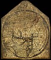
MAPPAE MUNDI
.gif)


 Globale Meeresströmungen
 Telefonvorwahlen nach Staat
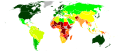 Index der menschlichen Entwicklung nach Staat
 UN-Flagge mit mittabstandstreuer Azimutalprojektion


- Globale Meeresströmungen
- Telefonvorwahlen nach Staat
- Index der menschlichen Entwicklung nach Staat
 Geolocated_images_in Wikimedia Commons 2015-01-07


Weblinks Ligações externas
de.wikipedia.org
- Liste historischer Weltkarten (de.wikipedia.org)


- Weltkarte 1:2.500.000 (de.wikipedia.org)
-
 Internationale_Weltkarte (de.wikipedia.org)
 - [[|border|160px]] Category:Old maps of the world (commons.wikimedia.org)
- [[|border|160px]] [ ()]


pt.wikipedia.org
-
 Cartografia (pt.wikipedia.org)
 - [[|border|160px]] (pt.wikipedia.org)
- [[|border|160px]] [ ()]

en.wikipedia.org
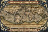
- Ancient world maps Ancient world maps (en.wikipedia.org)
- Mappa_mundi (en.wikipedia.org)
- Category:World_maps (en.wikipedia.org)
- World_Map_1:2,500,000 (en.wikipedia.org)
- International Map of the World (en.wikipedia.org)
- [[|border|160px]] (en.wikipedia.org)
-
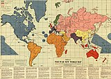 Outline of the Post-War New World Map (en.wikipedia.org)
 -
 Mapa-múndi World map (en.wikipedia.org)
 - [[|border|160px]] Category:Historic maps of the world (en.wikipedia.org)
- [[|border|160px]] Category:Africa (en.wikipedia.org)
- Early_world_maps (en.wikipedia.org)
- (en.wikipedia.org)
- [[|border|160px]] [ ()]
- [[|border|160px]] [ ()]


commons.wikimedia.org
- Category:Maps of the world (commons.wikimedia.org)
- [[|border|160px]] Blank SVG maps of the world for historical use (commons.wikimedia.org)
- [[|border|160px]] (commons.wikimedia.org)
- [[|border|160px]] Template:Historic world map series (commons.wikimedia.org)
- Category:Old maps of the world (commons.wikimedia.org)
Facsimile atlas (commons.wikimedia.org)

BlankMap-World gray.svg[5]

BlankMap-World-with-Circles.svg[6]
World Map Index of perception of corruption 2009.svg</ref>]]
Datei:2018 HDI.svg Index der menschlichen Entwicklung[7] - Commons: Maps of the world before Columbus – Sammlung von Bildern, Videos und Audiodateien
- [[|border|160px]] Category:Old_maps (commons.wikimedia.org)
- [[|border|160px]] [ ()]

Externe
- Mapa-Múndi - Pangéia, representações cartográficas, coordenadas geográficas e planisfério
- Index of Maps of the Early Medieval Period 400-1300 A.D
- Mapping History - a learning resource from the British Library
- Geography And Map Reading Room at the Library of Congress
- [[|border|160px]] Index of Cartographic Images Illustrating Maps of the Early Medieval Period 400-1300 A.D. (www.henry-davis.com)
- [[|border|160px]] Editable Digital Maps(digital-vector-maps.com)
- [[|border|160px]] Vector World Maps in Adobe Illustrator & PDF Vector Format (digital-vector-maps.com)
- [[|border|160px]] Um planisfério da Terra (www.guiageo.com)
Categoria:Mapas
- Karta mira online (only the USSR and the vicinity)
-

- [[|border|160px]] (pt.wikipedia.org)
- [[|border|160px]] Map History / History of Cartography (www.maphistory)

- [[|border|160px]] [ ()]
- [[|border|160px]] [ ()]
- [[|border|160px]] [ ()]
- [[|border|160px]] [ ()]
- [[|border|160px]] [ ()]
- [[|mini|[8]]]
- [[|mini|[9]]]
- [[|mini|[10]]]
- [[|mini|[11]]]
[ ()][ ()][ ()][ ()]dateien rev links


.svg)


[[File:|mini|[49]]]

.svg)


[[74]]


- Colonization 1945.png|mini|Colonization 1945.png[85]]]


[[|mini|[94]]]

[[96]]


mini|[100]


[[|mini|[112]]]

[[114]]


[[117]]
.jpg)


mini|[125]rev links ende
[[|mini|[126]]][[|mini|[127]]][[|mini|[128]]][[|mini|[129]]][[|mini|[130]]][[|mini|[131]]][[|mini|[132]]][[|mini|[133]]]
Colonialism
[Atlas of colonialism]
 1898
1898 1920
1920 1936
1936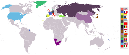 1975
1975


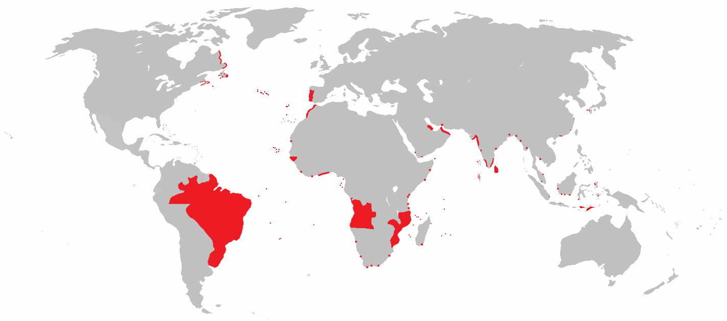
Portuguese Colonies
 All areas of the world that were once part of the Portuguese Empire
 Anachronous map of the Portuguese Empire (1415-1999)
 The Portuguese Empire in 1500 AD and the before discovered areas
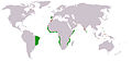 Portuguese colonial possessions in the XVI century
 Portuguese territory in the XVIII century
 Territorial demarcations between the Portuguese and Spanish empire, resulting from the treaties of Tordesilhas, Saragoça and Alcáçovas (in German)
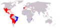 the Spanish and Portuguese Empires in the period of their personal union (1581-1640)
 Portuguese posessions during the spanish rule (1583-1640)(in blue)
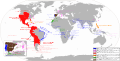 Portuguese posessions during the spanish rule (1583-1640)(in blue)
 Dutch-Portuguese War 1588-1654
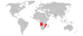 Portuguese Empire 20th century
 Portuguese Empire 1916-1974
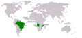 Portuguese speaking countries resulting from the colonization process
 Portuguese linguistic sphere resulting from the colonization process


Siehe auch
AFRICA
- África][[134]]]
- História da África][[135]]]
- Geografia da África][[136]]]
- Norte de África][[137]]]
- África Ocidental[[138]]]
- África Central[[139]]]
- África Oriental[[140]]]
- África Austral[[141]]]
- Demografia da África][[142]]]
- Povo africano[[143]]]
- Grupos étnicos da África][[144]]]
- Diáspora africana[[145]]]
- Afro-latino-americanos[[146]]]
- Lista de grupos étnicos da África][[147]]]
- Cronologia da abolição da escravidão e servidão[[148]]]
- [ [[149]]]
- [ [[150]]]
- Categoria:África[[151]]]
- [ [[152]]]
- Categoria:Países de África][[153]]]
- Index of Africa-related articles[[154]]]
- Category:Topographic maps of Africa by country[[155]]]
- Categoria:Listas da África][[156]]]
- [ [[157]]]
- [ [[158]]]
- Afrika
- [ ]
- [ ]
- Staat_in_Afrika de.wikipedia
- Category:Topographic maps of Africa by country
- [ ]
Guinea-Bissau Weblinks
- Category:Topographic maps of Africa by country
- Atlas_of_Guinea-Bissau
- Category:Guinea-Bissau
- Guinea-Bissau de wikivoyage
- en.wikivoyage
- pt.wikivoyage
- [ ]
- [ ]
- Atlas_of_Mozambique commons.wikimedia
- [ ]
- [ ]
- [ ]
São Tomé und Príncipe
][[168]]
- [ [[169]]]
][[170]]
- African Development Perspectives Yearbook – ein in Deutschland herausgegebenes Jahrbuch mit Studien zur afrikanischen Wirtschaft, erscheint seit 1990, Band 18: 2015
- Africa Economic Analysis
- African Development Bank Group
- Southern and Eastern African Trade Information and Negotiations Institute
- IMF World Economic Outlook (WEO) -- September 2003 -- Public Debt in Emerging Markets
Wikimedia Foundation
- [[|border|160px]] wikimediafoundation (wikimediafoundation.org)
- [[|border|160px]] WIKIMEDIA PROJECTS (en.)
- [[|border|160px]] phabricator (phabricator.wikimedia.org)
- [[|border|160px]] visualeditor (phabricator.wikimedia.org)
Originaldateien ( HÖCHSTE AUFLÖSUNG ODER SVG QUELLTEXT )
🔥 Top keywords: Wikipedia:HauptseiteSpezial:SucheGeborgtes WeißSpecial:MyPage/toolserverhelferleinconfig.jsPornhubWichart von RoëllFallout (Fernsehserie)HalvaListe der größten AuslegerbrückenUEFA Champions LeagueKatastrophe auf der EnterpriseSeparatorenfleischBernd HölzenbeinXHamsterBørsen (Gebäude)Louis SalomonChatGPTSusanne WolffLiebe (2012)17. AprilHauptseiteNekrolog 2024BarockDatei:Germany adm location map.svgFriedrichshafenDeutschlandTian’anmen-MassakerRockyFallout (Computerspielreihe)Halyna HutchinsIranUEFA Champions League 2023/24Antonio RüdigerAnnalena BaerbockO. J. SimpsonJerrie MockNosferatu-SpinneMarcel SabitzerKlimbim