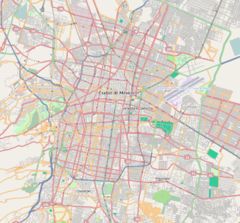
División del Norte is a metro station along Line 3 of the Mexico City Metro.[2][3] It is located in the Benito Juárez borough of Mexico City.[2]
| STC rapid transit | |||||||||||
 | |||||||||||
| General information | |||||||||||
| Location | Av. División del Norte Colonia del Valle, Benito Juárez Mexico City Mexico | ||||||||||
| Coordinates | 19°22′48″N 99°09′32″W / 19.380021°N 99.158885°W | ||||||||||
| Line(s) | |||||||||||
| Platforms | 2 side platforms | ||||||||||
| Tracks | 2 | ||||||||||
| Connections | |||||||||||
| Construction | |||||||||||
| Structure type | Underground | ||||||||||
| Platform levels | 1 | ||||||||||
| Parking | No | ||||||||||
| Bicycle facilities | No | ||||||||||
| Accessible | No | ||||||||||
| History | |||||||||||
| Opened | 25 August 1980 | ||||||||||
| Passengers | |||||||||||
| 2023 | 4,541,805[1] | ||||||||||
| Rank | 104/195[1] | ||||||||||
| Services | |||||||||||
| |||||||||||
| |||||||||||
General information
The station logo represents Revolutionary hero Pancho Villa, leader of the División del Norte of revolutionary soldiers during the Mexican Revolution of 1910.[2][3] Its name is taken from the nearby Avenida División del Norte.[2] The station has a cultural display.[2] The station opened on 25 August 1980.[4]
Until trolleybus service was discontinued on line "O" in 2010,[5] this metro station was served by trolleybus line "O", which runs between Metro Mixcoac and the Central de Abasto wholesale market.[6]
División del Norte serves Del Valle, Letrán Valle, Vertiz Narvarte and Santa Cruz Atoyac neighborhoods. It is located in the crossing between Avenida Universidad, Avenida División del Norte and Avenida Cuauhtemoc, in what used to be "Glorieta del Riviera".[2]
On 16 February 1994, Cuban Mexican vedette Judith Velasco killed herself in this station by jumping to the tracks dying instantly when she was hit by the train.[7]
Ridership
| Annual passenger ridership | |||||
|---|---|---|---|---|---|
| Year | Ridership | Average daily | Rank | % change | Ref. |
| 2023 | 4,541,805 | 12,433 | 104/195 | +8.76% | [1] |
| 2022 | 4,176,143 | 11,441 | 103/195 | +48.32% | [1] |
| 2021 | 2,815,721 | 7,714 | 116/195 | −19.55% | [8] |
| 2020 | 3,499,805 | 9,562 | 106/195 | −46.58% | [9] |
| 2019 | 6,552,063 | 17,950 | 100/195 | −3.24% | [10] |
| 2018 | 6,771,499 | 18,552 | 94/195 | +0.96% | [11] |
| 2017 | 6,706,794 | 18,374 | 95/195 | −5.62% | [12] |
| 2016 | 7,106,344 | 19,416 | 89/195 | −0.02% | [13] |
| 2015 | 7,107,748 | 19,473 | 91/195 | −1.93% | [14] |
| 2014 | 7,247,832 | 19,857 | 90/195 | −4.82% | [15] |
Nearby
- Parque de las Arboledas, public park.
- Parroquia de la Medalla Milagrosa, church designed by Félix Candela.
Exits
- Northeast: Av. División del Norte and Matías Romero street, Letrán Valle
- Southeast: Av. División del Norte and Chichen Itzá street, Letrán Valle
- South: Av. Cuauhtémoc and Av. Universidad, Santa Cruz Atoyac
- Northwest: Av. División del Norte, Santa Cruz Atoyac
- Southwest: Matías Romero street, Colonia del Valle
References
External links


