Kirovohrad Oblast (Ukrainian: Кіровоградська область, romanized: Kirovohradska oblast), also known as Kirovohradshchyna (Ukrainian: Кіровоградщина), is an oblast (region) in central Ukraine. The administrative center of the oblast is the city of Kropyvnytskyi. Its population is 903,712 (2022 estimate).[2] It is Ukraine's second least populated oblast, behind Chernivtsi.
Kirovohrad Oblast Кіровоградська область | |
|---|---|
| Kirovohradska oblast[1] | |
 Flag  Coat of arms | |
| Nickname: Кіровоградщина (Kirovohradshchyna) | |
 | |
| Coordinates: 48°28′N 32°16′E / 48.46°N 32.27°E | |
| Country | |
| Established | 10 January 1939 |
| Administrative center | Kropyvnytskyi |
| Government | |
| • Governor | Andriy Raykovych |
| • Oblast council | 64 seats |
| • Chairperson | Yuriy Drozd (Servant of the People) |
| Area | |
| • Total | 24,588 km2 (9,493 sq mi) |
| • Rank | Ranked 15th |
| Population (2022)[2] | |
| • Total | |
| • Rank | Ranked 25th |
| GDP | |
| • Total | ₴ 100 billion (€2.579 billion) |
| • Per capita | ₴ 109,183 (€2,828) |
| Time zone | UTC+2 (EET) |
| • Summer (DST) | UTC+3 (EEST) |
| Postal code | |
| Area code | +380-52 |
| ISO 3166 code | UA-35 |
| Vehicle registration | ВA |
| Raions | 4 |
| Cities (total) | 12 |
| • Regional cities | 0 |
| Urban-type settlements | 26 |
| Villages | 1015 |
| FIPS 10-4 | UP10 |
| Website | kr-admin.gov.ua |
In 2019, the Constitutional Court of Ukraine approved the change of the oblast's name to Kropyvnytskyi Oblast (Ukrainian: Кропивницька область, romanized: Kropyvnytska oblast, unofficially Kropyvnychchyna (Ukrainian: Кропивниччина)).[4] The change is not yet implemented. The largest cities of the region are Kropyvnytskyi, Oleksandriia, Znamianka and Svitlovodsk.
Geography
The area of the province is 24,600 square kilometres (9,500 sq mi).
The city of Dobrovelychkivka is the geographical center of Ukraine.
History
In the 1800s, majority of the landed was owned by the noble Skarzynski family.[5] They played a large role in the development of the region. An emphasis was placed on the development of its agriculture and the Skarzynskis opened a school in Migeya dedicated to this.[6]
The oblast was created as part of the Ukrainian SSR on January 10, 1939 out of the northern raions of Mykolaiv Oblast. Before establishment, its territory was part of Kherson Governorate (most of it) and Podolia Governorate (smaller portion) until 1925. Earlier before occupation of Ukraine in 1920s, in 1918 there were plans to introduce own Ukrainian administrative territorial division with territory of modern Kirovohrad Oblast being split between lands of Nyz (Lower land), Pobozhia (Boh land), and Cherkasy.
In 1954, the oblast lost some raions to the newly created Cherkasy Oblast, but later that year received its western raions from the Odesa Oblast.
Between 1939 and 2016, the oblast administrative center, Kropyvnytskyi, was called Kirovohrad and was named after the First Secretary of the Leningrad City Committee of the All-Union Communist Party (Bolsheviks) Sergei Kirov.[7] Due to decommunization laws (on 14 July 2016) the name of the city was changed to Kropyvnytskyi.[7] Kirovohrad Oblast was not renamed because as such it is mentioned in the Constitution of Ukraine, and the Oblast can only be renamed by a constitutional amendment by the Verkhovna Rada.[8]
On 20 June 2018, the Committee on State Building, Regional Policy and Local Self-Government of the Ukrainian parliament backed the proposal to rename Kirovohrad Oblast to Kropyvnytskyi Oblast.[9] In February 2019, the Constitutional Court of Ukraine declared constitutional the bill on renaming Kirovohrad Oblast to Kropyvnytskyi Oblast.[10][11] The renaming was supported by the local Oblast Council in March 2021.[12][13] The process then stalled in the parliament, with the oblast council asking the Verkhovna Rada to speed up the process in September 2022.[14]
Points of interest
The following sites were nominated for the Seven Wonders of Ukraine:
- Khutir Nadiia, outskirts of Mykolaivka village
The oblast also has a number of archaeological sites, such as Nebelivka site and Melgunov Kurgan.
Administrative divisions

| Kirovohrad Oblast | |
| As of January 1, 2022 | |
| Number of districts (райони) | 4 |
| Number of hromadas (громади) | 49 |
| No. | Name | Coat of arms | Population, (2020). | Area, km² | Density, per km² | Administrative center | Map | Subdivisions |
|---|---|---|---|---|---|---|---|---|
| 1 | Holovanivsk |  | 122,952 | 4,244 | 28.97 | Holovanivsk |  | 10 hromadas |
| 2 | Kropyvnytskyi |  | 442,997 | 9,709 | 45.62 | Kropyvnytskyi |  | 17 hromadas |
| 3 | Novoukrainka |  | 140,539 | 5,196 | 27 | Novoukrainka |  | 13 hromadas |
| 4 | Oleksandriia |  | 226,721 | 5,405 | 41.94 | Oleksandriia |  | 9 hromadas |
Before the July 2020 reform, Kirovohrad Oblast was administratively subdivided into 21 raions (districts) as well as 4 cities (municipalities) which were directly subordinate to the oblast government: Oleksandriia, Svitlovodsk, Znamianka, and the administrative center of the oblast, Kropyvnytskyi.
Demographics
Language
According to the 2001 Ukrainian census, Ukrainian was the mother tongue of 88.9% of the population, for 10.0% it was Russian, and for 1.1% it was another language.
According to a survey "Is the language (ir)relevant?" (Ukrainian: "Мова (не) на часі?"), which took place in Kirovohrad Oblast from 12 to 22 October 2023, 96.7% of respondents named Ukrainian as their mother tongue, while 2.6% named Russian as their mother tongue. In everyday life, 66.4% of respondents spoke Ukrainian, 29.4% spoke Surzhyk, and 3.4% spoke Russian.[15]
Age structure
- 0-14 years: 14.3%
 (male 72,646/female 68,970)
 - 15-64 years: 68.7%
 (male 324,698/female 355,058)
 - 65 years and over: 17.0%
 (male 55,718/female 111,666) (2013 official)
Median age
- total: 41.2 years
- male: 37.7 years
- female: 44.5 years (2013 official)
Nomenclature
Most of Ukraine's oblasts are named after their capital cities, officially referred to as "oblast centers" (Ukrainian: обласний центр, translit. oblasnyi tsentr). The name of each oblast is a relative adjective, formed by adding a feminine suffix to the name of the respective center city: Kirovohrad was the former name of the center of the Kirovohrads’ka oblast’ (Kirovohrad Oblast). Most oblasts are also sometimes referred to in a feminine noun form, following the convention of traditional regional place names, ending with the suffix "-shchyna", as is the case with the Kirovohrad Oblast, Kirovohradshchyna.
Gallery
 Hospital in Novomyrhorod
 Former hospital in Nova Praha
 Khutir Nadiia museum
 Cathedral of Nativity of Mary in Kropyvnytskyi
 Near Inhul River
 Panski Hory landscape reserve
 Confluence of Berezivka and Inhul rivers
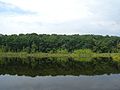 Black Forest
,_01.jpg)
.jpg)

.jpg)


See also
References
External links
- "Main". Official web-site of the Kirovohrad Oblast State Administration (in Ukrainian). Archived from the original on 13 August 2006. Retrieved 7 April 2014.