The US Highways in Michigan are the segments of the national United States Numbered Highway System[4] that are owned and maintained by the state of Michigan,[5] totaling 2,300 miles (3,701 km).[3] The longest of these is US Highway 23 (US 23) at around 362 miles (583 km). On a national level, the standards and numbering for the system are handled by the American Association of State Highway and Transportation Officials (AASHTO), while the highways in Michigan are maintained by the Michigan Department of Transportation (MDOT).
| United States Numbered Highways of the State Trunkline Highway System | |
|---|---|
Highway markers from different years for former US Highway 102 (1926), former US Highway 16 (1948), and current US Highway 23 (1973) | |
 US Highways in Michigan highlighted in red | |
| System information | |
| Maintained by MDOT | |
| Length | 2,299.653 mi[3] (3,700.933 km) Plus 159.621 mi [3] (256.885 km) of business routes |
| Formed | November 11, 1926[1][2] |
| Highway names | |
| US Highways | US Highway nn (US nn) |
| Special Routes: |
|
| System links | |


The original highways were approved on November 11, 1926, by AASHTO including 14 mainline highways. A handful of these original highway designations no longer run within Michigan, and a few numbers have been added since the 1930s. Since 1999, there have been 13 mainline highways, and with the creation of a business route for Constantine, there are a total of 30 special routes in the state. Several highways have been converted to freeways, some of which are now Interstate Highways and no longer part of the US Highway System. These freeway conversions started in the 1940s and 1950s and continued through to the turn of the 21st century.
Description
MDOT is the agency responsible for the day-to-day maintenance and operations of the State Trunkline Highway System, which includes the U.S. Highways in Michigan. The numbering for these highways is coordinated through AASHTO,[6] an organization composed of the various state departments of transportation in the United States.[7] Under the scheme finalized in 1926, two-digit US Highways are numbered in a grid; east–west highways have even numbers while north–south routes have odd numbers. The lowest numbers are in the east and the north. The east–west highways in Michigan number in the single digits up to the low 20s. The north–south highways range from the low 20s into the 40s. There are also three three-digit highways numbered in the 100s and one in the 200s as branches of related two-digit highways.[8]
In Michigan, the US Highway System covers about 2,300 miles (3,701 km) of mainline highways and another 160 miles (257 km) of special routes.[3] There are 13 mainline highways and 30 special routes in total, including one business route that is unsigned.[8][9] Two of the mainline highways in the Upper Peninsula exit the state and re-enter, resulting in two discontinuous segments of highway for each in Michigan.[10] The longest US Highway in the state is US Highway 23 (US 23) at just over 362 miles (583 km) spanning from the Ohio state line north to the Straits of Mackinac in the Lower Peninsula, while the shortest is the 2.3-mile (3.7 km) segment of US 8 south of Norway in Dickinson County. Special routes range in length from about 1+1⁄4 miles (2.0 km) for Business US 2 (Bus. US 2) in Ironwood to 10 miles (16 km) for Bus. US 131 in Kalamazoo.[3]
History

The US Highway System was approved on November 11, 1926.[1] At the time, 14 mainline highways were designated in Michigan.[2] Just two years later on November 12, 1928, US 102 was renumbered as part of an extended US 141, and the former designation was decommissioned.[11] Since then, another four designations were added in the state during the 1930s. One of these, US 112S was a suffixed, directional branch of the US 112 mainline; it was removeda few years[12] after being designated in 1931.[13] Around the same time period, the first alternate routes were designated, numbered with an "A" suffix.[a]
During World War II, the Michigan State Highway Department (MSHD)[b] built the Willow Run Expressway to carry workers from Detroit to the defense plants at Willow Run Airport.[19] This expressway was numbered as a part of US 112 initially.[20] During the 1950s, additional highways were converted to freeways before the coming of the Interstate Highway System in 1957. The first highway renumbered as an Interstate was US 24A in the southeastern corner of the state, which became part of Interstate 75 (I-75) in 1959.[21]
Major numbering changes started in the 1960s as Michigan retired or rerouted its US Highways with the completion of Interstates. US 12 replaced US 112 in 1962 when the I-94 designation supplanted most of the original US 12.[22] Later that year, US 16 was decommissioned in favor of I-96.[23] This trend continued into the 1970s when US 25 was decommissioned as redundant to sections of I-75 and I-94.[24]
Not all freeway conversions of existing US Highways resulted in the removal of US Highway numbers. In 1968, the state submitted a request for additional Interstate Highway mileage to the federal government, including a proposal to convert US 131.[25] This specific project was not approved although the state continued its own efforts to convert the highway, including various segments opened in the 1970s[26] and 1980s.[27] Other highways converted to freeways included US 10, US 23, US 27, US 31 and US 127.[8]
At the end of the 1970s, MDOT took part in a Federal Highway Administration-backed initiative called the Positive Guidance Demonstration Project, and the two agencies audited signage practices in the vicinity of the I-96/M-37 and I-296/US 131 interchange in Walker, north of Grand Rapids. MDOT determined that usage of the I-296 designation was "a potential source of confusion for motorists".[28] Following this program, the Reflective Systems Unit at MDOT reviewed the state of two- and three-way concurrencies along the highway system in Michigan. They approached the department's Trunkline Numbering Committee and the district traffic and safety engineers on October 19, 1982, for proposals to reduce or eliminate the various overlapping designations to "avoid driver confusion and save funds".[29] The initial discussion report included the various remaining overlaps between Interstate and US Highways.[29] When the unit released its final recommendations on March 17, 1983, various changes were proposed.[30] In 1983, US 2 was truncated, removing the overlap with I-75,[31] and in 1986, US 10 was similarly shortened to remove an overlap with I-75.[32] US 33 was all but eliminated in the state in 1986 as well, eliminating its overlap with US 31.[33] Over a decade later, two highway designations were completely removed from the state in 1990s when US 33 and US 27 were truncated to end in Indiana in 1997[34] and 1999,[35] respectively. The latter also removed an overlap with I-69.[36]
Additional freeway sections opened around the turn of the 21st century. The St. Johns Bypass along then-US 27 opened on August 31, 1998;[37] and bypasses of Cadillac and Manton on US 131 opened in 2001[38] and 2003.[39] A 9.5-mile (15.3 km) freeway segment of US 31 north from Berrien Springs to Napier Avenue also opened in 2003.[40][41] Plans still had support to convert the expressway segment of US 127 between Ithaca and St. Johns into a full freeway as of 2009.[42] MDOT completed a re-evaluation of the environmental studies for the conversion, but future activities were limited to right-of-way acquisition without any commitments for actual construction.[43] Plans are also still in place to complete the rest of the US 31 freeway near Benton Harbor,[44] but funding has not been available.[45]
Mainline highways
| Number | Length (mi)[3] | Length (km) | Southern or western terminus | Northern or eastern terminus | Formed | Removed | Notes | |
|---|---|---|---|---|---|---|---|---|
 US 2 US 2 | 109.177 | 175.703 | US 2 at Ironwood | US 2/US 141 at Mastodon Township south of Crystal Falls | 1926[2] | current | Western segment | |
| US 2 | 195.974 | 315.390 | US 2/US 141 at Breitung Township near Iron Mountain | I-75 and BL I-75 in St. Ignace | 1926[2] | current | Eastern segment | |
 US 8 US 8 | 2.322 | 3.737 | US 8 at Norway Township | US 2 in Norway | 1926[2] | current | Shortest US Highway in Michigan | |
 US 10 US 10 | 139.656 | 224.755 | Car ferry docks in Ludington | I-75/US 23 and BS I-75/M-25 in Monitor Township near Bay City | 1926[2] | current | Connects to US 10 in Wisconsin via the SS Badger car ferry | |
 US 12 US 12 | 210.077 | 338.086 | US 12 at New Buffalo Township | Michigan and Cass avenues in Detroit | 1926[2] | current | Michigan Avenue | |
 US 16 US 16 | 210.643 | 338.997 | Car ferry docks in Muskegon | US 10, US 12, US 25 and US 112 in Detroit | 1926[2] | 1962[23] | Replaced by I-96 | |
 US 23 US 23 | 362.152 | 582.827 | US 23/US 223 at Whiteford Township near Temperance | I-75 in Mackinaw City | 1926[2] | current | Longest US Highway in Michigan | |
 US 24 US 24 | 79.828 | 128.471 | US 24 at Bedford Township near Erie | I-75 in Springfield Township near Clarkston | 1926[2] | current | Telegraph Road | |
 US 25 US 25 | 190.953 | 307.309 | US 25 at Erie Township | M-25 and M-53 in Port Austin | 1926[2] | 1973[24] | Replaced by M-125, I-75, M-3, I-94, and M-25[24] | |
 US 27 US 27 | 218.195 | 351.151 | I-69/US 27 at Kinderhook Township | I-75 in Beaver Creek Township near Grayling | 1926[2] | 1999[35] | Replaced by I-69 and US 127; signage removed in 2002[46] | |
 US 31 US 31 | 355.179 | 571.605 | US 31 at Bertrand Township near Niles | I-75 in Mackinaw Township near Mackinaw City | 1926[2] | current | ||
 US 33 US 33 | 2.835 | 4.562 | US 33 at Milton Township | US 12 in Milton Township south of Niles | 1938[47] | 1997[34] | Replaced by M-51; signage removed in 1998[48] | |
 US 41 US 41 | 278.769 | 448.635 | US 41 at Menominee | Cul-de-sac at Fort Wilkins State Park near Copper Harbor | 1926[2] | current | ||
 US 45 US 45 | 54.759 | 88.126 | US 45/WIS 32 at Watersmeet Township | Ontonagon and River streets in Ontonagon | c. 1935[49] | current | ||
 US 102 US 102 | 44.094 | 70.962 | US 2 in Crystal Falls | US 41/M-28 in Covington Township | 1926[2] | 1928[11] | Replaced by US 141 | |
 US 112 US 112 | 205.507 | 330.731 | US 12 in New Buffalo Township | US 10, US 12, US 16 and US 25 in Detroit | 1926[2] | 1962[22] | Replaced by US 12 when I-94 replaced US 12 | |
 US 112S US 112S | 1.709 | 2.750 | US 112S at Mason Township | US 112 in Mason Township near Adamsville | 1933[13] | 1935[12] | Replaced by M-205, now a county road | |
| 212.168 | 341.451 | US 127 at the Wright–Medina township line near Waldron | I-75 in Beaver Creek Township near Grayling | 1926[2] | current | |||
| 269.313 | 433.417 | US 131 at Mottville Township near White Pigeon | US 31 in Petoskey | 1926[2] | current | |||
| 7.892 | 12.701 | US 141 at Quinnesec | US 2/US 141 in Breitung Township near Iron Mountain | 1928[11] | current | Southern segment | ||
| 43.602 | 70.171 | US 2/US 141 at Mastodon Township south of Crystal Falls | US 41/M-28 in Covington Township | 1928[11] | current | Northern segment | ||
| 45.695 | 73.539 | US 23/US 223 at Whiteford Township near Temperance | US 127 in Woodstock Township near Somerset | 1930[50] | current | |||
| ||||||||
- Mainline US Highways
 US 2 along Lake Michigan near Brevort
 Eastern terminus of US 8 in Norway
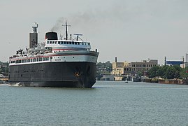 The SS Badger connects US 10 in Ludington to Manitowoc, Wisconsin, across Lake Michigan.
 Iron Brigade Memorial Highway sign along US 12 in Pittsfield Township
 I-75/US 23 approaching the Zilwaukee Bridge
 US 24 (Telegraph Road) approaching the Mixing Bowl interchange in Southfield
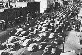 US 25 (Gratiot Avenue) in Detroit in 1941
 US 27 near Clare before conversion to a freeway
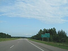 US 31 freeway near Rothbury
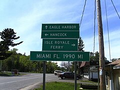 US 41 mileage sign in Copper Harbor showing the mileage to Miami, Florida
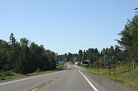 US 45 entering Paulding
 US 127 through East Lansing
 Northern terminus of US 141 near Covington
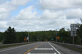
 US 23/US 223 in Monroe County


.jpg)


Special routes
| Number | Length (mi)[3] | Length (km) | Southern or western terminus | Northern or eastern terminus | Formed | Removed | Notes | |
|---|---|---|---|---|---|---|---|---|
 Bus. US 2 Bus. US 2 | 1.270 | 2.044 | Wisconsin state line at Ironwood | US 2 in Ironwood | 1942[51] | current | Business spur; previously included a connection across the state line into Hurley, Wisconsin[52] | |
| Bus. US 10 | 2.095 | 3.372 | US 10 in Reed City | US 10 in Reed City | c. 1960[53] | current | ||
| Bus. US 10 | 5.002 | 8.050 | US 127/US 10 on the Grant–Sheridan township line | US 10 in Wise Township | 1975[54] | current | Serves Clare | |
| Bus. US 10 | 7.200 | 11.587 | US 10 in Midland | US 10 and M-20 in Midland | 1960[55] | current | Western end is in Midland County and eastern end is in Bay County[3] | |
  Bus. US 10 Bus. US 10 | 14.767 | 23.765 | US 10 in Mount Morris Township | US 10 in Grand Blanc Township | 1941[56] | 1962[57] | Served Flint; replaced by Bus. M-54, also since returned to local control | |
| Bus. US 10 | 6.925 | 11.145 | US 10 in Waterford Township | US 10 in Bloomfield Township | 1961[58] | 1986[59] | Served Pontiac; replaced by Bus. US 24 | |
 US 12A US 12A | 3.767 | 6.062 | US 12 in Kalamazoo | US 12 in Comstock | 1931[15] | 1954[60] | Replaced by M-96 | |
 Bus. US 12 Bus. US 12 | 11.955 | 19.240 | I-94/US 12 in Texas Township | I-94/US 12 in Comstock Township | 1959[61] | 1961[62] | Served Kalamazoo; replaced by BL I-94 | |
| Bus. US 12 | 9.678 | 15.575 | I-94/US 12 in Battle Creek Township | I-94/US 12 in Emmett Township | 1940[63] | 1961[64] | Served Battle Creek; replaced by BL I-94 | |
| Bus. US 12 | 3.716 | 5.980 | I-94/US 12 in Marshall Township | I-94/US 12 in Marengo Township | 1960[65] | 1961[66] | Served Marshall; replaced by BL I-94 | |
| Bus. US 12 | 4.520 | 7.274 | I-94/US 12 in Albion | I-94/US 14 in Parma Township | 1960[65] | 1961[66] | Replaced by BL I-94 | |
| Bus. US 12 | 10.274 | 16.534 | I-94/US 12 in Blackman Township | I-94/US 12 in Leoni Township | c. 1951[67] | 1960[68] | Served Jackson; replaced by BL I-94 | |
| Bus. US 12 | 5.327 | 8.573 | US 12 in Bertrand Township | US 12 and M-51 in Niles Township | 1962[22] | 2010[69] | Served Niles; replaced by M-51, M-139 | |
| Bus. US 12 | 8.020 | 12.907 | I-94/US 12 in Ypsilanti | US 12 in Van Buren Township | 1962[22] | current | Replaced Bus. US 112 | |
 Byp. US 16 Byp. US 16 | 20.197 | 32.504 | US 16 in Walker Township | US 16 in Cascade Township | 1942[70] | 1953[71] | Bypassed Grand Rapids; replaced by the US 16 mainline, now part of M-11 | |
| Bus. US 16 | 17.102 | 27.523 | US 16 in Walker | US 16 in Cascade Township | 1953[71] | 1962[72] | Served Grand Rapids; returned to local control | |
 US 16A US 16A | 3.863 | 6.217 | US 16 in Farmington Hills | US 16 in Farmington Hills | 1933[13] | 1956[73] | Bypassed Farmington; replaced by the US 16 mainline, now part of M-5 | |
| Bus. US 16 | 4.129 | 6.645 | US 16 in Farmington Hills | US 16 in Farmington Hills | 1956[73] | 1961[74] | Served Farmington; replaced by BL I-96, now unsigned | |
| Bus. US 23 | 5.781 | 9.304 | BL I-94/US 23 and M-17 in Pittsfield Township | US 23/M-14 in Ann Arbor Township | 1962[75] | current | Serves Ann Arbor | |
| Bus. US 23 | 3.009 | 4.843 | US 23 in Fenton | US 23 in Fenton | c. 1958[76] | 2006[77] | Southern 1.723 mi (2.773 km) unsigned after 1975;[78] now under city control | |
 Bus. US 23 Bus. US 23 | 8.006 | 12.884 | US 10/US 23 in Bridgeport Township | US 23/M-81 in Saginaw | 1953[79] | 1961[80] | Replaced by BL I-75 | |
| Bus. US 23 | 2.714 | 4.368 | US 23 in Bay City | US 23/M-47 and M-20 in Bay City | 1941[81] | 1961[82] | Replaced by BL I-75/M-25 and M-84 | |
| Bus. US 23 | 4.074 | 6.556 | US 23 in Belknap Township | US 23 in Rogers City | 1942[83] | current | ||
 US 24A US 24A | 33.783 | 54.368 | Ohio state line south of Erie | US 25 in Taylor | 1945[84] | 1959[21] | Replaced by I-75 | |
| Bus. US 24 | 7.121 | 11.460 | US 24 in Bloomfield Township | US 24 in Waterford Township | 1986[59] | current | Serves Pontiac; formerly Bus. US 10 | |
 US 25A US 25A | 5.111 | 8.225 | Ohio state line in Erie Township | US 25 in Erie Township | 1937[85] | 1945[84] | Replaced by US 24A and later I-75 | |
| US 25A | 2.481 | 3.993 | M-51 in Fort Gratiot Township | US 25 in Fort Gratiot Township | 1940[86] | 1963[87] | Replaced by US 25 and later M-25 | |
| Bus. US 25 | 8.382 | 13.490 | I-94/US 25 in Kimball Township | US 25 in Fort Gratiot Township | 1963[87] | 1973[88] | Served Marysville and Port Huron; replaced by M-25 and later BL I-94 | |
 Bus. US 27 Bus. US 27 | 2.986 | 4.806 | I-69/US 27 and BL I-94 in Marshall Township | I-94 in Marshall Township | 1967[89] | 1972[90] | Served Marshall; sections not concurrent with BL I-94 turned over to local control | |
| Bus. US 27 | 4.891 | 7.871 | I-69/US 27 on the Carmel–Eaton township line | I-69/US 27 in Charlotte | 1961[91] | 1974[92] | Replaced by BL I-69 | |
 Truck US 27 Truck US 27 | 1.529 | 2.461 | US 27/M-78 in Lansing | US 27/M-78 in Lansing | 1936[93] | 1950[94] | Replaced by US 27 | |
| Bus. US 27 | 4.725 | 7.604 | BL I-96 in Lansing | I-69/US 27 in DeWitt Township | 1984[95] | 2002[96] | Replaced by unsigned Bus. US 127 in Lansing | |
| Bus. US 27 | 8.808 | 14.175 | US 27 in Olive Township | US 27 in Bingham Township | 1998[97] | 2002[36] | Served St. Johns; replaced by Bus. US 127 | |
| Bus. US 27 | 3.745 | 6.027 | US 27 on the Ithaca–North Star Township line | US 27 in Emerson Township | 1961[98] | 2002[36] | Replaced by Bus. US 127 | |
 US 27A US 27A | 5.255 | 8.457 | US 27 east of Alma | US 27 and M-46 west of St. Louis | 1929[14] | 1961[98] | Replaced by Bus. US 27 | |
| Bus. US 27 | 5.631 | 9.062 | US 27 on the Emerson–Bethany township line | US 27 in Pine River Township | 1961[98] | 2002[36] | Served Alma; replaced US 27A and replaced by Bus. US 127 | |
| Bus. US 27 | 4.711 | 7.582 | US 27 on the Pine River–Bethany township line | US 27 in Pine River Township | 1961[98] | 2002[36] | Served St. Louis; replaced by Bus. US 127 | |
| Bus. US 27 | 5.688 | 9.154 | US 127 in Union Township | US 127 in Union Township | 1961[98] | 2002[36] | Served Mt. Pleasant; replaced by Bus. US 127 | |
| Bus. US 27 | 3.374 | 5.430 | US 127 in Vernon Township | US 127/US 10 in Grant Township | 1961[98] | 2002[36] | Served Clare; replaced by Bus. US 127 | |
| Bus. US 27 | 6.903 | 11.109 | US 127 and M-61 in Hayes Township | US 127 in Hayes Township | 1961[98] | 2002[36] | Served Harrison; replaced by Bus. US 127 | |
| Bus. US 31 | 3.587 | 5.773 | Bus. US 12 in Niles | Old US 31 in Niles Township | 1987[99] | 2010[100] | Replaced by M-139 | |
 Bus. US 31 Bus. US 31 | 3.992 | 6.425 | US 31 in South Haven Township | US 31 in Casco Township | c. 1942[101] | 1963[102] | Served South Haven; replaced by BL I-196 | |
| Bus. US 31 | 4.120 | 6.630 | BL I-196/US 31 in Holland | US 31 and BL I-196 in Holland Township | 1954[103] | 2004[104] | Returned to city control | |
 US 31A US 31A | 4.763 | 7.665 | US 16 and US 31 in Muskegon Heights | US 31 in Muskegon | 1932[16] | c. 1941[105] | Replaced by Bus. US 31 | |
| Bus. US 31 | 9.870 | 15.884 | I-96 and US 31 in Norton Shores | US 31 in North Muskegon | c. 1941[105] | current | Serves Muskegon; replaced US 31A | |
| Bus. US 31 | 4.680 | 7.532 | US 31 in Whitehall Township | US 31 in Montague Township | 1964[106] | current | Serves Whitehall and Montague | |
| Bus. US 31 | 2.138 | 3.441 | US 31 in Hart Township | Johnson and State streets in Hart | 1987[107] | current | Business spur | |
| Bus. US 31 | 7.151 | 11.508 | US 31 in Weare Township | US 31 on the Pentwater–Weare township line | 1955[108] | 2023[109] | Served Pentwater | |
| Bus. US 31 | 3.172 | 5.105 | US 31 in Pere Marquette Township | US 10 in Ludington | 2005[110] | current | Business spur | |
| Bus. US 41 | 2.343 | 3.771 | US 41/M-28 in Marquette | US 41/M-28 in Marquette | 1963[111] | 2005[112] | Returned to city control | |
 Bus. US 41 Bus. US 41 | 4.873 | 7.842 | US 41/M-28 in Ishpeming | US 41/M-28 in Negaunee | 1937[113] | 1958[114] | Replaced by Bus. M-28 | |
| Bus. US 41 | 4.256 | 6.849 | US 41 in Baraga | US 41 in Baraga Township | 1940[115] | 1942[116] | Returned to local control | |
 Bus. US 112 Bus. US 112 | 5.434 | 8.745 | US 112 in Bertrand Township | US 112 and M-60 in Milton Township | c. 1956[117] | 1962[22] | Served Niles; replaced by Bus. US 12 | |
| Byp. US 112 | 8.023 | 12.912 | US 112 and M-17 in Pittsfield Township | US 112 in Van Buren Township | c. 1942[118] | 1956[119] | Bypassed Ypsilanti; replaced by I-94 | |
| Bus. US 112 | 8.020 | 12.907 | US 112 in Ypsilanti | US 112 in Van Buren Township | 1956[119] | 1962[22] | Replaced by Bus. US 12 | |
| | 6.443 | 10.369 | US 127 and M-50 in Summit Township | I-94, US 127 and M-50 in Blackman Township | c. 1959[120] | current | Seves Jackson | |
 Bus. US 127 Bus. US 127 | 2.369 | 3.813 | US 127 in Mason | US 127 and M-36 in Mason | c. 1946[121] | 1964[122] | Sections not concurrent with M-36 turned over to local control | |
 Bus. US 127 Bus. US 127 | 4.725 | 7.604 | BL I-96 in Lansing | I-69 in DeWitt Township | 2002[96] | current | Unsigned; replaced Bus. US 27 | |
| | 8.808 | 14.175 | US 127 in Olive Township | US 127 in Bingham Township | 2002[36] | current | Serves St. Johns; replaced Bus. US 27 | |
| | 3.745 | 6.027 | US 127 on the Ithaca–North Star Township line | US 127 in Emerson Township | 2002[36] | current | Replaced Bus. US 27 | |
| | 5.631 | 9.062 | US 127 on the Emerson–Bethany township line | US 127 in Pine River Township | 2002[36] | current | Serves Alma; replaced Bus. US 27 | |
| | 4.711 | 7.582 | US 127 on the Pine River–Bethany township line | US 127 in Pine River Township | 2002[36] | current | Serves St. Louis; replaced Bus. US 27 | |
| | 5.688 | 9.154 | US 127 in Union Township | US 127 in Union Township | 2002[36] | current | Serves Mt. Pleasant; replaced Bus. US 27 | |
| | 3.374 | 5.430 | US 127 in Vernon Township | US 127/US 10 in Grant Township | 2002[36] | current | Serves Clare; replaced Bus. US 27 | |
| | 6.903 | 11.109 | US 127 and M-61 in Hayes Township | US 127 in Hayes Township | 2002[36] | current | Serves Harrison; replaced Bus. US 27 | |
| | 3.656 | 5.884 | US 131 in Constantine Township | US 131 in Constantine Township | 2013[123] | current | Serves Constantine | |
| | 2.982 | 4.799 | US 131/M-60 in Three Rivers | US 131 in Three Rivers | 1953[124] | current | ||
| | 4.198 | 6.756 | Westnedge Avenue and Park Street in Kalamazoo Township | US 131 in Kalamazoo Township | 1964[125] | current | Serves Kalamazoo | |
 Byp. US 131 Byp. US 131 | 14.253 | 22.938 | US 131 in Grand Rapids | US 131 in Plainfield Township | 1945[126] | 1953[71] | Replaced by M-11, M-37 and M-44 | |
| | 2.419 | 3.893 | US 131 in Grand Rapids | I-296/US 131 in Grand Rapids | 1953[71] | 2017[127] | Returned to local control | |
| | 6.860 | 11.040 | US 131/M-20 in Big Rapids Township | US 131 and B-96 in Big Rapids Township | 1983[128] | current | Serves Big Rapids | |
| | 5.597 | 9.007 | US 131/M-55 in Clam Lake Township | US 131 in Haring Township | 2001[38] | current | Serves Cadillac | |
| | 5.667 | 9.120 | US 131 and M-42 in Cedar Creek Township | US 131 in Liberty Township | 2003[39] | current | Serves Manton | |
| | 3.751 | 6.037 | US 223 and M-52 in Adrian | US 223 in Adrian | c. 1956[129] | current | ||
| ||||||||