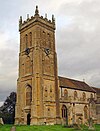
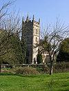
List of ecclesiastical parishes in the Diocese of Bath and Wells

The ecclesiastical parishes within the Diocese of Bath and Wells cover the majority of the English county of Somerset and small areas of Devon, Dorset, Gloucestershire and Wiltshire. The episcopal seat of the Bishop of Bath and Wells is in the Cathedral Church of Saint Andrew in the city of Wells in Somerset.

Diocese of Bath and Wells
Location
Ecclesiastical provinceCanterbury
ArchdeaconriesBath, Wells, Taunton
Statistics
Parishes477
Churches569
Information
CathedralCathedral Church of Saint Andrew
Current leadership
BishopMichael Beasley, Bishop of Bath and Wells
SuffraganRuth Worsley, Bishop of Taunton[1]
ArchdeaconsSimon Hill, Archdeacon of Taunton
Anne Gell, Archdeacon of Wells
Adrian Youings, Archdeacon of Bath
Website
bathandwells.org.uk

The diocesan offices, the bishops' offices and residences and the cathedral are all located around the Bishop's Palace in Wells. The diocese is not referred to as "Bath diocese" or "Wells diocese", but as "Bath and Wells diocese".[2] The ordinary of the diocese is the diocesan Bishop of Bath and Wells, Michael Beasley; he is assisted throughout the diocese by the Bishop suffragan of Taunton, Ruth Worsley. Her See was created in 1911.

Alternative episcopal oversight (for parishes in the diocese that reject the ministry of women priests) is provided by the provincial episcopal visitor (PEV), the Bishop suffragan of Ebbsfleet, Jonathan Goodall. He is licensed as an honorary assistant bishop of the diocese in order to facilitate his work there.[3]

The parish with its local parish church is the basic unit of the Church of England. The parish within the Church of England structure has its roots in the Roman Catholic Church and survived the Reformation largely untouched. Church of England parishes are currently each within one of 44 dioceses divided between the provinces of Canterbury, with 30 dioceses, and York with 14. In 2017 there were approximately 12,600 Church of England parishes in all, with 477 being within this diocese.[4]

Each parish is administered by a parish priest who may be assisted in his pastoral duties by a curate or curates, who are also ordained but not parish priests. There are wide variations in the size of parishes and church-going populations. A parish priest may have responsibility for one parish or for two or more, and some are part of a team ministry. By extension, the term parish refers not only to the territorial unit but to the people of its community or congregation. A benefice or "living" in the Church of England describes any ecclesiastical parish or group of ecclesiastical parishes under a single stipendiary minister.[5] The holder of a benefice owns the "freehold" of the post (the church and the parsonage house) for life.

Until the late 19th century, the parishes were the smallest area for local government and administrative functions. Following the Local Government Act 1894, the civil duties of the church were abolished and separate civil parishes were established.[6] As a result of the different needs of the civil community and the church, in many cases the boundaries of the ecclesiastical parishes and their equivalent civil parish have diverged with time.

Archdeaconry of Bath

The archdeaconry covers most of the two unitary authorities of North Somerset and Bath and North East Somerset, and also includes sections of neighbouring districts in Somerset and Wiltshire. The Archdeacon of Bath is Adrian Youings.[7]

Deanery of Bath

The deanery is mostly within Bath and North East Somerset, but includes one civil parish in Wiltshire and a small section in South Gloucestershire. As well as covering the city of Bath, it also includes the surrounding suburbs of the city and neighbouring villages.[8]

Ecclesiastical parishBeneficeParish churchLocationImageCivil parish(es)District(s)
Bath Abbey with St JamesBath Abbey with St JamesBath Abbey[9]51°22′53″N 2°21′31″W / 51.3815°N 2.3587°W / 51.3815; -2.3587 (Bath Abbey)

Bath Abbey
Bath (unparished)Bath and North East Somerset
Bath, Bathwick: St JohnBath BathwickSt John[10]51°23′18″N 2°21′19″W / 51.3883°N 2.3554°W / 51.3883; -2.3554 (Church of St John the Baptist, Bathwick)

St John: Bathwick
Bath (unparished)Bath and North East Somerset
Bath, Bathwick: St MaryBath BathwickSt Mary[11]51°23′05″N 2°21′04″W / 51.3847°N 2.3511°W / 51.3847; -2.3511 (St Mary the Virgin's Church, Bathwick)

St Mary, Bathwick
Bath (unparished)Bath and North East Somerset
Bath: The AscensionBath Marlbrook TeamThe Ascension[12]51°22′26″N 2°22′57″W / 51.3738°N 2.3824°W / 51.3738; -2.3824 (Church of the Ascension, Bath)
-
Bath (unparished)Bath and North East Somerset
Bath: Twerton-on-AvonBath Marlbrook TeamSt Michael[13]51°22′51″N 2°23′54″W / 51.3809°N 2.3982°W / 51.3809; -2.3982 (Church of St Michael, Twerton)

St Michael: Twerton
Bath (unparished)Bath and North East Somerset
Bath Combe HayBath Odd Down with Combe HayCombe Hay[14]51°20′15″N 2°22′53″W / 51.3374°N 2.3815°W / 51.3374; -2.3815 (Combe Hay Church)

Combe Hay Church
All of Combe Hay[a]Bath and North East Somerset
Bath, Odd DownBath Odd Down with Combe HaySt Philip & St James[15]51°21′41″N 2°22′51″W / 51.3613°N 2.3809°W / 51.3613; -2.3809 (Church of St Philip & St James, Odd Down)

St Philip & St James, Odd Down
Bath (unparished)Bath and North East Somerset
Bath St Michael WithoutBath St Michael WithoutSt Michael[16]51°23′03″N 2°21′36″W / 51.3842°N 2.3601°W / 51.3842; -2.3601 (St Michael's Church, Bath)

St Michael: Bath
Bath (unparished)Bath and North East Somerset
Bath: St BarnabasBath St Barnabas with EnglishcombeSt Barnabas[17]51°22′10″N 2°23′41″W / 51.3695°N 2.3946°W / 51.3695; -2.3946 (Church of St Barnabas, Bath)

St Barnabas: Bath
Bath (unparished)Bath and North East Somerset
EnglishcombeBath St Barnabas with EnglishcombeSt Peter[18]51°21′52″N 2°24′32″W / 51.3644°N 2.4089°W / 51.3644; -2.4089 (Church of St Peter, Englishcombe)

St Peter: Englishcombe
All of Englishcombe.
Small part of Bath (unparished)
Bath and North East Somerset
Bath St BartholomewBath St BartholomewSt Bartholomew[19]51°22′30″N 2°22′28″W / 51.3751°N 2.3745°W / 51.3751; -2.3745 (Church of St Bartholomew, Bath)

St Bartholomew, Bath
Bath (unparished)Bath and North East Somerset
Bath St LukeBath St LukeSt Luke[20]51°22′07″N 2°22′00″W / 51.3687°N 2.3667°W / 51.3687; -2.3667 (Church of St Luke, Bath)

St Luke: Bath
Bath (unparished)Bath and North East Somerset
Bath St SaviourBath St Saviour with Swainswick and WoolleySt Saviour[21]51°23′45″N 2°20′47″W / 51.3958°N 2.3465°W / 51.3958; -2.3465 (Church of St Saviour, Bath)

St Saviour: Bath
Bath (unparished)Bath and North East Somerset
Swainswick with WoolleyBath St Saviour with Swainswick and WoolleySt Mary[22]
All Saints[23]
51°24′51″N 2°21′06″W / 51.4143°N 2.3516°W / 51.4143; -2.3516 (St Mary, Swainswick)

St Mary: Swainswick
All of Swainswick
Charlcombe
Bath (unparished)
Bath and North East Somerset
Bath, WalcotBath WalcotSt Swithin[24]
St Andrew[25]
Christ Church[26]
51°23′19″N 2°21′33″W / 51.3886°N 2.3593°W / 51.3886; -2.3593 (Church of St Swithin, Bath)

St Swithin: Bath
Bath (unparished)Bath and North East Somerset
Bath, Weston: All SaintsBath Weston All Saints with North Stoke and LangridgeAll Saints[27]51°23′44″N 2°23′18″W / 51.3956°N 2.3883°W / 51.3956; -2.3883 (All Saints' Church, Weston)

All Saints: Bath
Bath (unparished)
Charlcombe
Kelston
Bath and North East Somerset
LangridgeBath Weston All Saints with North Stoke and LangridgeSt Mary[28]51°25′26″N 2°22′05″W / 51.4239°N 2.3681°W / 51.4239; -2.3681 (St Mary Magdalene's Church, Langridge)

St Mary: Langridge
CharlcombeBath and North East Somerset
North StokeBath Weston All Saints with North Stoke and LangridgeSt Martin[29]51°25′13″N 2°25′39″W / 51.4203°N 2.4274°W / 51.4203; -2.4274 (Church of St Martin, North Stoke)

St Martin: North Stoke
All of North Stoke
Small part of Bitton
Bath and North East Somerset, South Gloucestershire
Bath, Weston: St JohnBath Weston St John with KelstonSt John[30]
Emmanuel[31]
51°23′07″N 2°22′54″W / 51.3852°N 2.3817°W / 51.3852; -2.3817 (Church of St John, Weston, Bath)

St John, Weston, Bath
Bath (unparished)
Small part of Kelston
Bath and North East Somerset
KelstonBath Weston St John with KelstonSt Nicholas[32]51°24′01″N 2°26′03″W / 51.4004°N 2.4342°W / 51.4004; -2.4342 (Church of St Nicholas, Kelston)

St Nicholas: Kelston
Most of KelstonBath and North East Somerset
Bath, WidcombeBath WidcombeSt Thomas à Becket[33]
St Matthew[34]
51°22′24″N 2°20′47″W / 51.3734°N 2.3465°W / 51.3734; -2.3465 (St Thomas à Becket Church, Widcombe)

St Thomas à Becket: Widcombe
Bath (unparished)Bath and North East Somerset
BathamptonBathampton with ClavertonSt Nicholas[35]51°23′51″N 2°19′18″W / 51.3975°N 2.3217°W / 51.3975; -2.3217 (Church of St Nicholas, Bathampton)

St Nicholas: Bathampton
All of Bathampton[a]Bath and North East Somerset
ClavertonBathampton with ClavertonSt Mary[36]51°22′33″N 2°18′22″W / 51.3759°N 2.3061°W / 51.3759; -2.3061 (Church of St Mary the Virgin, Claverton)

St Mary: Claverton
All of Claverton
Bath (unparished)
Bath and North East Somerset
Batheaston (LEP)Batheaston with St CatherineSt John: Batheaston[37]
St Catherine: St Catherine[38]
51°24′35″N 2°19′17″W / 51.4097°N 2.3214°W / 51.4097; -2.3214 (Church of St John The Baptist, Batheaston)

St John: Batheaston
All of Batheaston
All of St Catherine
Bath (unparished)
Bath and North East Somerset
BathfordBathfordSt Swithin[39]51°23′54″N 2°18′22″W / 51.3983°N 2.3062°W / 51.3983; -2.3062 (Church of St Swithun, Bathford)

St Swithin: Bathford
All of Bathford[a]Bath and North East Somerset
Bath: St StephenCharlcombe with Bath St StephenSt Stephen[40]51°23′34″N 2°21′49″W / 51.3928°N 2.3636°W / 51.3928; -2.3636 (Church of St Stephen, Bath)

St Stephen: Bath
2 sections -
1 in Bath (unparished).
1 in Bath (unparished)
Charlcombe
Bath and North East Somerset
CharlcombeCharlcombe with Bath St StephenSt Mary[41]51°24′16″N 2°21′46″W / 51.4044°N 2.3628°W / 51.4044; -2.3628 (Church of St Mary, Charlcombe)

St Mary: Charlecombe
Charlcombe, Bath (unparished)Bath and North East Somerset
Combe DownCombe Down with Monkton Combe and South StokeHoly Trinity[42]
St Andrew[43]
51°21′33″N 2°20′45″W / 51.3592°N 2.3457°W / 51.3592; -2.3457 (Church of the Holy Trinity, Combe Down)

Holy Trinity: Combe Down
Bath (unparished)
Monkton Combe
Bath and North East Somerset
Monkton CombeCombe Down with Monkton Combe and South StokeSt Michael[44]51°21′22″N 2°19′43″W / 51.3561°N 2.3286°W / 51.3561; -2.3286 (St Michael's Church, Monkton Combe)

St Michael: Monkton Combe
Most of Monkton Combe
Bath (unparished)
Bath and North East Somerset
South StokeCombe Down with Monkton Combe and South StokeSt James[45]51°20′59″N 2°21′55″W / 51.3497°N 2.3653°W / 51.3497; -2.3653 (Church of St James, Southstoke)

St James: South Stoke
All of Southstoke[a]Bath and North East Somerset
Freshford with Limpley Stoke and Hinton CharterhouseFreshford, Limpley Stoke and Hinton CharterhouseSt Peter: Freshford[46]
St John: Hinton Charterhouse[47]
St Mary[48]
51°20′24″N 2°18′12″W / 51.34°N 2.3033°W / 51.34; -2.3033 (Church of St Peter, Freshford)

St John: Hinton Charterhouse
All of Freshford
All of Hinton Charterhouse
All of Limpley Stoke
Bath and North East Somerset, Wiltshire

Deanery of Chew Magna

The area covered includes the Chew Valley, and surrounding areas. The deanery is mostly within Bath and North East Somerset, and also includes a portion of North Somerset, Mendip and Sedgemoor. Part of the area falls within the Mendip Hills Area of Outstanding Natural Beauty. Most of the rural area is within the Bristol and Bath Green Belt.

Ecclesiastical parishBeneficeParish churchLocationImageCivil parish(es)District(s)
BlagdonBlagdon with Compton Martin and UbleySt Andrew[49][50]
St Hugh[51]
51°19′40″N 2°42′47″W / 51.3277°N 2.7131°W / 51.3277; -2.7131 (Church of St Andrew, Blagdon)

St Andrew: Blagdon
All of Blagdon
Priddy
Cheddar
Butcombe
Bath and North East Somerset, Mendip, North Somerset
Compton MartinBlagdon with Compton Martin and Ubley[52]St Michael[53]51°18′37″N 2°39′15″W / 51.3103°N 2.6542°W / 51.3103; -2.6542 (Church of St Michael the Archangel, Compton Martin)

St Michael: Compton Martin
Compton Martin
Priddy
Bath and North East Somerset, Mendip
UbleyBlagdon with Compton Martin and Ubley[52]St Bartholomew[54]51°19′17″N 2°40′36″W / 51.3214°N 2.6767°W / 51.3214; -2.6767 (Church of St Bartholomew, Ubley)

St Batholomew: Ubley
All of Ubley
Priddy
Bath and North East Somerset, Mendip
Chew MagnaChew Magna with Dundry, Norton Malreward and Stanton DrewSt Andrew[55][56]51°22′00″N 2°36′35″W / 51.3667°N 2.6097°W / 51.3667; -2.6097 (St Andrew's Church, Chew Magna)

St Andrew: Chew Magna
Chew Magna
Norton Malreward
Bath and North East Somerset
DundryChew Magna with Dundry, Norton Malreward and Stanton DrewSt Michael[57]51°23′56″N 2°38′14″W / 51.399°N 2.6373°W / 51.399; -2.6373 (Church of St Michael, Dundry)

St Michael: Dundry
Dundry
Winford
Bath and North East Somerset, North Somerset
Norton MalrewardChew Magna with Dundry, Norton Malreward and Stanton DrewHoly Trinity[58]51°22′59″N 2°34′16″W / 51.3831°N 2.5711°W / 51.3831; -2.5711 (Holy Trinity Church, Norton Malreward)

Holy Trinity: Norton Malreward
Norton Malreward
Stanton Drew
Bath and North East Somerset
Stanton DrewChew Magna with Dundry, Norton Malreward and Stanton DrewSt Mary[58]51°21′57″N 2°34′45″W / 51.3658°N 2.5791°W / 51.3658; -2.5791 (Church of St Mary the Virgin, Stanton Drew)

St Mary: Stanton Drew
Stanton Drew
Publow
Bath and North East Somerset
Chew StokeChew Stoke with Nempnett Thrubwell[59]St Andrew[60]51°21′03″N 2°38′18″W / 51.3507°N 2.6383°W / 51.3507; -2.6383 (St Andrew's Church, Chew Stoke)

St Andrew: Chew Stoke
Chew Stoke
Chew Magna
Bath and North East Somerset
Nempnett ThrubwellChew Stoke with Nempnett Thrubwell[59]St Mary[61]51°20′27″N 2°40′20″W / 51.3408°N 2.6722°W / 51.3408; -2.6722 (Church of St Mary, Nempnett Thrubwell)

St Mary: Nempnett Thrubwell
Nempnett Thrubwell
Chew Stoke
Bath and North East Somerset
Bishop SuttonBishop Sutton and StoweyHoly Trinity[62]51°20′03″N 2°35′46″W / 51.3341°N 2.5960°W / 51.3341; -2.5960 (Holy Trinity Church, Bishop Sutton)

Holy Trinity: Bishop Sutton
Stowey-Sutton
Chew Magna
Bath and North East Somerset
Clutton with CameleyFarmborough with Marksbury and Stanton Prior, Clutton with CameleySt Augustine: Clutton[63]
& St James: Cameley
51°19′41″N 2°32′35″W / 51.3281°N 2.5431°W / 51.3281; -2.5431 (Church of St Augustine, Clutton)

St Augustine of Hippo: Clutton
Clutton
Cameley
Hinton Blewett
Bath and North East Somerset
StoweyBishop Sutton and StoweySt Nicholas and St Mary[64]51°19′57″N 2°34′36″W / 51.3325°N 2.5767°W / 51.3325; -2.5767 (Church of St Nicholas and the Blessed Virgin Mary, Stowey)

St Nicholas and St Mary: Stowey
Stowey-Sutton
Chew Magna
Bath and North East Somerset
East Harptree with West Harptree and Hinton BlewettEast with West Harptree and Hinton Blewett[65]St Laurence: East Harptree,[66]
St Mary: West Harptree[67]
& St Margaret: Hinton Blewett[68]
51°18′04″N 2°37′29″W / 51.3011°N 2.6247°W / 51.3011; -2.6247 (Church of St Laurence, East Harptree)

St Laurence:East Harptree
All of East Harptree,
all of West Harptree,
Hinton Blewett
Priddy
Bath and North East Somerset
FarmboroughFarmborough with Marksbury and Stanton Prior, Clutton with CameleyAll Saints[69]51°20′35″N 2°29′16″W / 51.3431°N 2.4878°W / 51.3431; -2.4878 (Church of All Saints, Farmborough)

All Saints: Farmborough
All of Farmborough[a]Bath and North East Somerset
MarksburyFarmborough with Marksbury and Stanton Prior, Clutton with CameleySt Peter[70]51°21′33″N 2°28′49″W / 51.3592°N 2.4803°W / 51.3592; -2.4803 (Church of St Peter, Marksbury)

St Peter: Marksbury
MarksburyBath and North East Somerset
Stanton PriorFarmborough with Marksbury and Stanton Prior, Clutton with CameleySt Lawrence[71]51°21′46″N 2°27′50″W / 51.3628°N 2.4639°W / 51.3628; -2.4639 (Church of St Lawrence, Stanton Prior)

St Lawrence: Stanton Prior
MarksburyBath and North East Somerset
KeynshamKeynshamSt John[72]
Chewton Keynsham Mission Church[73]
St Francis[74]
St Michael[75]
St Margaret[76]
51°25′03″N 2°29′55″W / 51.4175°N 2.4986°W / 51.4175; -2.4986 (Church of St John the Baptist, Keynsham)

St John: Keynsham
Keynsham
Compton Dando
Whitchurch
Bath and North East Somerset
Compton Dando and ChelwoodPublow with Pensford, Compton Dando and Chelwood[77]St Mary: Compton Dando[78]
& St Leonard: Chelwood[79]
51°22′47″N 2°30′38″W / 51.3797°N 2.5106°W / 51.3797; -2.5106 (Church of St Mary, Compton Dando)

St Mary: Compton Dando
Compton Dando
& all of Chelwood
Bath and North East Somerset
Publow with PensfordPublow with Pensford, Compton Dando and Chelwood[77]All Saints: Publow[80]51°22′34″N 2°32′32″W / 51.3761°N 2.5422°W / 51.3761; -2.5422 (Church of All Saints, Publow)

All Saints: Publow
Publow
Stanton Drew
Bath and North East Somerset
CorstonSaltford with Corston and Newton St Loe[81]All Saints[82]51°23′09″N 2°26′23″W / 51.3858°N 2.4398°W / 51.3858; -2.4398 (All Saints' Church, Corston)

All Saints: Corston
All of Corston[a]Bath and North East Somerset
Newton St LoeSaltford with Corston and Newton St Loe[81]Holy Trinity[83]51°22′56″N 2°25′51″W / 51.3822°N 2.4308°W / 51.3822; -2.4308 (Church of the Holy Trinity, Newton St Loe)

Holy Trinity: Newton St Loe
All of Newton St Loe[a]Bath and North East Somerset
SaltfordSaltford with Corston and Newton St Loe[81]St Mary[84]51°24′20″N 2°27′15″W / 51.4056°N 2.4542°W / 51.4056; -2.4542 (St Mary's Church, Saltford)

St Mary: Saltford
Saltford
Keynsham
Bath and North East Somerset
Felton Common HillWinford with Felton Common HillSt Katherine[85]51°23′16″N 2°41′52″W / 51.3878°N 2.6977°W / 51.3878; -2.6977 (Church of St Katharine and the Noble Army of Martyrs, Felton)

St Katherine: Felton
Backwell
Winford
Wrington
North Somerset
WinfordWinford with Felton Common HillSt Mary and St Peter[86]
St James[87]
51°22′57″N 2°39′29″W / 51.3825°N 2.6581°W / 51.3825; -2.6581 (Church of St Mary and St Peter, Winford)

St Mary and St Peter: Winford
Winford
Nempnett Thrubwell
Dundry
North Somerset, Bath and North East Somerset

Deanery of Locking

The Deanery of Locking covers Weston-super-Mare and the surrounding villages. It is mostly within North Somerset, but includes sections of Mendip and Sedgemoor.

Ecclesiastical parishBeneficeParish churchLocationImageCivil parish(es)District(s)
BanwellBanwellSt Andrew[88]51°19′40″N 2°51′48″W / 51.3279°N 2.8633°W / 51.3279; -2.8633 (St Andrew's Church, Banwell)

St Andrew: Banwell
Banwell
Hutton, Somerset
Locking
Weston-super-Mare
North Somerset
Bournville (LEP)Bleadon and BournvilleSt Andrew[89][90]51°19′55″N 2°57′57″W / 51.3319°N 2.9657°W / 51.3319; -2.9657 (Church of St Andrew, Bourneville)
-
Weston-super-MareNorth Somerset
St Peter and St Paul, BleadonBleadon and BournvilleSt Peter & St Paul[91]51°18′27″N 2°56′46″W / 51.3075°N 2.9462°W / 51.3075; -2.9462 (Church of St Peter & St Paul, Bleadon)

St Andrew: Bleadon
All of Bleadon
Weston-super-Mare
Lympsham
North Somerset, Sedgemoor
Churchill and LangfordChurchill and LangfordSt John: Churchill[92]
St Mary: Lower Langford[93]
51°20′19″N 2°48′32″W / 51.3385°N 2.8088°W / 51.3385; -2.8088 (Church of St John the Baptist, Churchill)

St John: Churchill
All of ChurchillNorth Somerset
CongresburyCongresbury with Puxton and Hewish St AnnSt Andrew[94]51°22′11″N 2°48′33″W / 51.3697°N 2.8091°W / 51.3697; -2.8091 (St Andrew's Church, Congresbury)

St Andrew: Congresbury
All of Congresbury
All of Puxton
Banwell
Weston-super-Mare
North Somerset
HuttonHutton and LockingSt Mary[95]51°19′22″N 2°55′51″W / 51.3228°N 2.9307°W / 51.3228; -2.9307 (Church of Saint Mary The Virgin, Hutton)

St Mary: Hutton
Hutton
Weston-super-Mare
North Somerset
LockingHutton and LockingSt Augustine[96]51°19′56″N 2°54′55″W / 51.3322°N 2.9152°W / 51.3322; -2.9152 (Church of St Augustine, Locking)

St Augustine: Locking
Locking
Weston-super-Mare
North Somerset
KewstokeMilton and KewstokeSt Paul[97]51°21′56″N 2°57′25″W / 51.3655°N 2.957°W / 51.3655; -2.957 (Church of St Paul, Kewstoke)

St Paul: Kewstoke
Kewstoke
Weston-super-Mare
North Somerset
Milton St Peter with St JudeMilton and KewstokeSt Peter and St Jude[98]51°21′11″N 2°56′25″W / 51.3530°N 2.9402°W / 51.3530; -2.9402 (Church of St Peter and St Jude, Milton)

St Peter and St Jude: Milton
Weston-super-MareNorth Somerset
Weston-super-Mare: Saint Nicholas with Saint BarnabasSaint Nicholas with Saint Barnabas, Weston-super-MareSt Nicholas[99]
St Barnabas[100]
51°19′28″N 2°58′41″W / 51.3244°N 2.9781°W / 51.3244; -2.9781 (Church of St Nicholas, Weston-super-Mare)

St Barnabas: Weston-super-Mare
Weston-super-MareNorth Somerset|
Weston-super-Mare: All Saints with St SaviourWeston-super-Mare All SS and St SaviourAll Saints[101]51°21′11″N 2°58′35″W / 51.3531°N 2.9765°W / 51.3531; -2.9765 (All Saints Church, Weston-super-Mare)
-
Weston-super-MareNorth Somerset
Weston-super-Mare: Christ ChurchWeston-super-Mare Christ Church and EmmanuelChrist Church[102]51°21′02″N 2°58′10″W / 51.3505°N 2.9695°W / 51.3505; -2.9695 (Christ Church, Weston-super-Mare)

Christ Church, Weston-super-Mare
Weston-super-MareNorth Somerset
Weston-super-Mare: EmmanuelWeston-super-Mare Christ Church and EmmanuelEmmanuel Church[103]51°20′45″N 2°58′38″W / 51.3458°N 2.9771°W / 51.3458; -2.9771 (Emmanuel Church, Weston-super-Mare)

St Emmanuel: Weston-super-Mare
Weston-super-MareNorth Somerset
Weston-super-Mare: St JohnWeston-super-Mare St JohnSt John[104]51°21′09″N 2°58′51″W / 51.3525°N 2.9809°W / 51.3525; -2.9809 (Church of St John the Baptist, Weston-super-Mare)

St John: Weston-super-Mare
Weston-super-MareNorth Somerset
Weston-super-Mare: St PaulWeston-super-Mare St PaulSt Paul[105]51°20′16″N 2°58′41″W / 51.3377°N 2.9781°W / 51.3377; -2.9781 (Church of St Paul, Weston-super-Mare)

St Paul: Weston-super-Mare
Weston-super-MareNorth Somerset
Winscombe and SandfordWinscombe and SandfordSt James[106]
All Saints[107]
51°18′42″N 2°50′03″W / 51.3116°N 2.8342°W / 51.3116; -2.8342 (Church of St James, Winscombe)

St James: Winscombe
Winscombe and Sandford
Shipham
North Somerset, Sedgemoor
Worle (LEP)WorleSt Martin[108]
St Lawrence Chapel[109]
St Lawrence Church[110]
Chapel[111]
St Mark's Church Centre[112]
Locking Castle[113]
51°21′41″N 2°55′50″W / 51.3614°N 2.9306°W / 51.3614; -2.9306 (Church of St Martin, Worle)

St Martin: Worle
All of Wick St Lawrence
Weston-super-Mare
Kewstoke
St Georges
Locking
North Somerset
BurringtonWrington with Butcombe and BurringtonHoly Trinity[114]51°19′51″N 2°44′59″W / 51.3307°N 2.7497°W / 51.3307; -2.7497 (Church of Holy Trinity, Burrington)

Holy Trinity: Burrington
All of Burrington, Somerset[a]North Somerset
ButcombeWrington with Butcombe and BurringtonSt Michael and All Angels[115]51°21′14″N 2°41′50″W / 51.3539°N 2.6973°W / 51.3539; -2.6973 (Church of St Michael and All Angels, Butcombe)

St Michael: Butcombe
ButcombeNorth Somerset
WringtonWrington with Butcombe and BurringtonAll Saints[116]
Christ Church[117]
51°21′40″N 2°45′57″W / 51.361°N 2.7658°W / 51.361; -2.7658 (Church of All Saints, Wrington)

All Saints: Wrington
WringtonNorth Somerset

Deanery of Midsomer Norton

The deanery covers Midsomer Norton, Radstock and the surrounding villages which made up the part of the Somerset Coalfield. The area is split between the local government areas of Bath and North East Somerset and Mendip.

Ecclesiastical parishBeneficeParish churchLocationImageCivil parish(es)District(s)
Chilcompton with DownsideChilcompton with Downside and Stratton on the FosseSt John[118]51°16′11″N 2°30′27″W / 51.2697°N 2.5075°W / 51.2697; -2.5075 (Church of St John The Baptist, Chilcompton)

St John: Chilcompton
Chilcompton
Ston Easton
Mendip
Stratton-on-the-FosseChilcompton with Downside and Stratton on the FosseSt Vigor[119]51°15′19″N 2°29′23″W / 51.2552°N 2.4896°W / 51.2552; -2.4896 (Church of St Vigor, Stratton-on-the-Fosse)

St Vigor: Stratton-on-the-Fosse
Stratton-on-the-FosseMendip
ColefordColeford with Holcombe[120]Holy Trinity[121]51°14′21″N 2°27′00″W / 51.2393°N 2.4500°W / 51.2393; -2.4500 (Holy Trinity Church, Coleford)

Holy Trinity: Coleford
Coleford
Holcombe
Mendip
HolcombeColeford with Holcombe[120]St Andrew[122]51°15′17″N 2°28′33″W / 51.2547°N 2.4758°W / 51.2547; -2.4758 (Church of St Andrew, Holcombe)

St Andrew:Holcombe
Holcombe
Coleford
Kilmersdon
Stratton-on-the-Fosse
Mendip
Kilmersdon with BabingtonKilmersdon with BabingtonSt Peter and St Paul[123]51°16′13″N 2°26′13″W / 51.2702°N 2.437°W / 51.2702; -2.437 (Church of St Peter and St Paul, Kilmersdon)

St Peter and St Paul: Kilmersdon
Kilmersdon
Coleford, Somerset
Radstock
Mendip, Bath and North East Somerset
Midsomer Norton with ClandownMidsomer Norton with ClandownSt John[124]51°17′09″N 2°29′07″W / 51.2858°N 2.4853°W / 51.2858; -2.4853 (Church of St John the Baptist, Midsomer Norton)

St John: Midsomer Norton
Midsomer Norton
Paulton
Radstock
Ston Easton
Mendip, Bath and North East Somerset
Farrington GurneyPaulton with Farrington Gurney & High Littleton[125]St John[126]51°17′58″N 2°31′29″W / 51.2995°N 2.5248°W / 51.2995; -2.5248 (Church of St John the Baptist, Farrington Gurney)

St John: Farrington Gurney
All of Farrington Gurney[a]Bath and North East Somerset
High LittletonPaulton with Farrington Gurney & High Littleton[125]Holy Trinity[127]51°19′11″N 2°30′36″W / 51.3198°N 2.5099°W / 51.3198; -2.5099 (Holy Trinity Church, High Littleton)

Holy Trinity: High Littleton
High Littleton
Clutton
Bath and North East Somerset
PaultonPaulton with Farrington Gurney & High Littleton[125]Holy Trinity[128]51°18′27″N 2°30′15″W / 51.3075°N 2.5042°W / 51.3075; -2.5042 (Church of the Holy Trinity, Paulton)

Holy Trinity: Paulton
Paulton
Midsomer Norton
Bath and North East Somerset
Foxcote with ShoscombePeasedown Saint John with Wellow and Foxcote with Shoscombe[129]St James: Foxcote[130]51°17′55″N 2°24′32″W / 51.2986°N 2.4090°W / 51.2986; -2.4090 (Church of St James the Less, Foxcote)Hemington
Peasedown St John
Shoscombe
Bath and North East Somerset
Peasedown: St JohnPeasedown Saint John with Wellow and Foxcote with Shoscombe[129]St John[131]51°18′59″N 2°25′59″W / 51.3164°N 2.4331°W / 51.3164; -2.4331 (St John's Church, Peasedown St John)

St John: Peasedown St John
Peasedown St JohnBath and North East Somerset
WellowPeasedown Saint John with Wellow and Foxcote with Shoscombe[129]St Julian[132]51°19′28″N 2°22′21″W / 51.3244°N 2.3725°W / 51.3244; -2.3725 (Church of St Julian, Wellow)

St Julian: Wellow
Wellow
Shoscombe
Norton St Philip
Bath and North East Somerset, Mendip
Radstock with WrithlingtonRadstock with Writhlington[133]St Nicholas[134]51°17′24″N 2°26′54″W / 51.2899°N 2.4483°W / 51.2899; -2.4483 (Church of St Nicholas, Radstock)

St Nicholas: Radstock
Radstock
Kilmersdon
Westfield
Bath and North East Somerset
CamertonTimsbury with Priston, Camerton and DunkertonSt Peter[135]51°18′54″N 2°27′02″W / 51.3151°N 2.4505°W / 51.3151; -2.4505 (Church of St Peter, Camerton Park)

St Peter: Camerton
Camerton
Peasedown St John
Bath and North East Somerset
DunkertonTimsbury with Priston, Camerton and DunkertonAll Saints[136]51°19′55″N 2°24′57″W / 51.3319°N 2.4158°W / 51.3319; -2.4158 (Church of All Saints, Dunkerton)

All Saints: Dunkerton
Dunkerton and TunleyBath and North East Somerset
PristonTimsbury with Priston, Camerton and DunkertonSt Luke and St Andrew[137]51°20′36″N 2°26′19″W / 51.3433°N 2.4386°W / 51.3433; -2.4386 (Church of St Luke and St Andrew, Priston)

St Luke & St Andrew: Priston
All of Priston
Dunkerton and Tunley
Bath and North East Somerset
TimsburyTimsbury with Priston, Camerton and DunkertonSt Mary[138]51°19′32″N 2°28′44″W / 51.3256°N 2.4789°W / 51.3256; -2.4789 (Church of St Mary The Virgin, Timsbury)

St Mary: Timsbury
TimsburyBath and North East Somerset
WestfieldWestfieldSt Peter[139]51°16′54″N 2°28′15″W / 51.2818°N 2.4709°W / 51.2818; -2.4709 (St Peter's Church, Westfield)

St Peter: Westfield
Westfield
Kilmersdon
Midsomer Norton
Bath and North East Somerset, Mendip

Deanery of Portishead

The deanery covers the coastal towns of Portishead and Clevedon and the surrounding area. It is wholly within North Somerset.

Ecclesiastical parishBeneficeParish churchLocationImageCivil parish(es)District(s)
BackwellBackwell with Chelvey and Brockley[140]St Andrew[141]51°24′41″N 2°43′50″W / 51.4114°N 2.7306°W / 51.4114; -2.7306 (St Andrew's Church, Backwell)

St Andrew: Backwell
BackwellNorth Somerset
Chelvey and BrockleyBackwell with Chelvey and Brockley[140]St Bridget: Chelvey[142]51°24′43″N 2°46′04″W / 51.4119°N 2.7678°W / 51.4119; -2.7678 (Church of St Bridget, Chelvey)

St Bridget: Chelvey
All of BrockleyNorth Somerset
Clevedon: Christ Church (LEP)Clevedon St Andrew and Christ Church[143]Christ Church[144]51°26′20″N 2°51′07″W / 51.439°N 2.8519°W / 51.439; -2.8519 (Christ Church, Clevedon)

Christ Church: Clevedon
ClevedonNorth Somerset
Clevedon: St AndrewClevedon St Andrew and Christ Church[143]St Andrew[145]51°25′58″N 2°52′21″W / 51.4329°N 2.8725°W / 51.4329; -2.8725 (St Andrew's Church, Clevedon)

St Andrew: Clevedon
ClevedonNorth Somerset
Clevedon: St PeterClevedon St Andrew and Christ Church[143]St Peter[146]51°26′31″N 2°51′35″W / 51.442°N 2.8596°W / 51.442; -2.8596 (Church of St Peter, Clevedon)

St Peter: Clevedon
ClevedonNorth Somerset
Clevedon: St John the EvangelistClevedon St JohnSt John[147]51°26′12″N 2°51′18″W / 51.4367°N 2.8549°W / 51.4367; -2.8549 (Church of St John, Clevedon)

St John: Clevedon
Clevedon
Kenn
North Somerset
East Clevedon with Clapton-in-GordanoEast Clevedon with Clapton in Gordano, Walton in Clevedano[148]All Saints: Clevedon[149]51°26′33″N 2°50′26″W / 51.4426°N 2.8406°W / 51.4426; -2.8406 (All Saints Church, Clevedon)

St Michael: Clapton in Gordano
Clevedon
Clapton in Gordano
North Somerset
Walton-in-GordanoEast Clevedon with Clapton in Gordano, Walton in Clevedano[148]St Paul[150]51°27′14″N 2°49′41″W / 51.454°N 2.828°W / 51.454; -2.828 (Church of St Paul, Walton in Gordano)

St Paul: Walton in Gordano
All of Walton in Gordano
Clevedon
North Somerset
Walton-in-Gordano: St. MaryEast Clevedon with Clapton in Gordano, Walton in Gordano[148]St Mary[151]51°26′51″N 2°50′46″W / 51.4474°N 2.8462°W / 51.4474; -2.8462 (Church of St Mary, Walton Clevedon)

St Mary: Walton St Mary
ClevedonNorth Somerset
Weston-in-GordanoEast Clevedon with Clapton in Gordano, Walton in Clevedano[148]St Peter and St Paul[152]51°27′51″N 2°48′07″W / 51.4642°N 2.802°W / 51.4642; -2.802 (Church of St Peter and St Paul, Weston in Gordano)

St Peter and St Paul: Weston-in-Gordano
Weston in Gordano
Portishead
North Somerset
Barrow GurneyLong Ashton with Barrow Guerney and Flax BourtonSt Mary and St Edward[153]51°24′47″N 2°50′29″W / 51.4131°N 2.8414°W / 51.4131; -2.8414 (Church of St Mary and St Edward, Barrow Gurney)

St Mary and St Edward: Barrow Gurney
Barrow Gurney
Long Ashton
Wraxall and Failand
North Somerset
Flax-BourtonLong Ashton with Barrow Guerney and Flax BourtonSt Michael and All Angels[154]51°25′16″N 2°42′40″W / 51.4212°N 2.711°W / 51.4212; -2.711 (Church of St Michael and All Angels, Flax Bourton)

St Michael and All Angels: Flax Bourton
Flax BourtonNorth Somerset
Long AshtonLong Ashton with Barrow Guerney and Flax BourtonAll Saints[155]
Ascension[156]
51°26′09″N 2°38′38″W / 51.4358°N 2.6438°W / 51.4358; -2.6438 (Church of All Saints, Long Ashton)

All Saints: Long Ashton
Long Ashton
Barrow Gurney
North Somerset
Nailsea: Christ ChurchNailsea Christ Church with Tickenham[157]Christ Church[158]51°26′00″N 2°45′42″W / 51.4332°N 2.7618°W / 51.4332; -2.7618 (Christ Church, Nailsea)
-
NailseaNorth Somerset
TickenhamNailsea Christ Church with Tickenham[157]SS Quiricus & Julietta[159]51°26′22″N 2°46′53″W / 51.4394°N 2.7814°W / 51.4394; -2.7814 (Church of SS Quiricus & Julietta, Tickenham)

St Quiricus & St Julietta: Tickenham
All of Tickenham[a]North Somerset
Nailsea: Holy TrinityNailsea Holy TrinityHoly Trinity[160]51°25′33″N 2°46′09″W / 51.4258°N 2.7693°W / 51.4258; -2.7693 (Holy Trinity Church, Nailsea)

Holy Trinity: Nailsea
NailseaNorth Somerset
Easton-in-GordanoPill, Portbury & Easton in Gordano[161]St George[162]51°28′43″N 2°42′03″W / 51.4786°N 2.7008°W / 51.4786; -2.7008 (Church of St George, Easton in Gordano)

St George: Easton in Gordano
Pill and Easton-in-GordanoNorth Somerset
Pill (LEP)Pill, Portbury & Easton in Gordano[161]Christ Church[163]51°28′47″N 2°41′10″W / 51.4796°N 2.6862°W / 51.4796; -2.6862 (Christ Church, Pill)

Christ Church: Pill
Pill and Easton-in-GordanoNorth Somerset
PortburyPill, Portbury & Easton in Gordano[161]St Mary[164]51°28′32″N 2°43′02″W / 51.4756°N 2.7173°W / 51.4756; -2.7173 (St Mary's Church, Portbury)

St Mary: Portbury
PortburyNorth Somerset
PortisheadPortisheadSt Peter[165]
St Peter[166]
51°28′50″N 2°46′13″W / 51.4806°N 2.7702°W / 51.4806; -2.7702 (Church of St Peter, Portishead)

St Peter: Portishead
Portishead
Portbury
Weston in Gordano
North Somerset
WraxallWraxall with FailandAll Saints[167]
St Bartholomew[168]
51°26′40″N 2°44′05″W / 51.4444°N 2.7348°W / 51.4444; -2.7348 (All Saints Church, Wraxall)

All Saints: Wraxall
Wraxall and Failand
Clapton in Gordano
Nailsea
North Somerset
Cleeve with ClaverhamYatton Moor[169]Holy Trinity: Cleeve[170]
St Barnabas: Claverham[171]
51°23′28″N 2°46′39″W / 51.391°N 2.7774°W / 51.391; -2.7774 (Church Of Holy Trinity, Cleeve)

Holy Trinity: Cleeve
All of Cleeve
Yatton
Nailsea
North Somerset
Yatton MoorYatton Moor[169]St Mary[172]
All Saints[173]
St John[174]
51°23′06″N 2°49′07″W / 51.385°N 2.8185°W / 51.385; -2.8185 (Church of St Mary, Yatton)

St Mary: Yatton
Yatton
Kenn, Somerset
All of Kingston Seymour
North Somerset

Archdeaconry of Taunton

The archdeaconry is centred on Taunton and covers the west of Somerset. It also includes small sections of Devon and Dorset. The Archdeacon of Taunton is Simon Hill.[7]

Deanery of Crewkerne

The deanery covers areas of South Somerset including Crewkerne and North Perrott, with many of the surrounding villages. Some of the parishes are just over the county border in West Dorset.

Ecclesiastical parishBeneficeParish churchLocationImageCivil parish(es)District(s)
Hinton St George with DinningtonMerriott with Hinton Dinnington and LopenSt George: Hinton St George[175]
& St Nicholas: Dinnington[176]
50°54′39″N 2°49′38″W / 50.9108°N 2.8272°W / 50.9108; -2.8272 (Church of St George, Hinton St George)

St George: Hinton St George
All of Hinton St George
& Dinnington, Lopen
South Somerset
LopenMerriott with Hinton Dinnington and LopenAll Saints[177]50°55′38″N 2°48′59″W / 50.9271°N 2.8165°W / 50.9271; -2.8165 (Church of All Saints, Lopen)

All Saints: Lopen
LopenSouth Somerset
MerriottMerriott with Hinton Dinnington and LopenAll Saints[178]50°54′45″N 2°47′39″W / 50.9124°N 2.7941°W / 50.9124; -2.7941 (Church of All Saints, Merriott)

AllSaints: Merriot
MerriottSouth Somerset
South Petherton with the Seavingtons and the LambrooksSouth Petherton with the Seavingtons and the LambrooksSt Peter and St Paul: South Petherton[179]
& St Michael: Seavington St Michael[180]
St James's[181]
50°56′54″N 2°48′34″W / 50.9483°N 2.8094°W / 50.9483; -2.8094 (Church of St Peter and St Paul, South Petherton)

St Peter & St Paul: South Petherton
All of South Petherton
All of Seavington St Mary
All of Seavington St Michael
& Kingsbury Episcopi
South Somerset
CrewkerneThe Wulfric Benefice[182]St Bartholomew[183]
Church of the Good Shepherd[184]
50°52′53″N 2°47′33″W / 50.8814°N 2.7925°W / 50.8814; -2.7925 (Church of St Bartholomew, Crewkerne)

St Batholomew: Crekerne
All of Crewkerne
All of West Crewkerne
Merriott
Broadwindsor
South Somerset, West Dorset
Haselbury PlucknettThe Wulfric Benefice[182]St Michael and All Angels[185]50°53′43″N 2°45′11″W / 50.8954°N 2.753°W / 50.8954; -2.753 (Church of St Michael and All Angels, Haselbury Plucknett)

St Michael: Haselbury Plucknett
All of Haselbury Plucknett[a]South Somerset
MistertonThe Wulfric Benefice[182]St Leonard: Misterton[186]50°52′12″N 2°46′47″W / 50.8700°N 2.7796°W / 50.8700; -2.7796 (Church of St Leonard, Misterton)

St John: Seaborough
All of Misterton
Seaborough
South Somerset, West Dorset
North PerrottThe Wulfric Benefice[182]St Martin[187]50°52′57″N 2°45′00″W / 50.8825°N 2.75°W / 50.8825; -2.75 (Church of St Martin, North Perrott)

St Martin: North Perrott
All of North Perrott[a]South Somerset
WayfordThe Wulfric Benefice[182]St Michael and All Angels[188]50°51′23″N 2°50′49″W / 50.8563°N 2.847°W / 50.8563; -2.847 (Church of St Michael and All Angels, Wayford)
-
All of Wayford
Broadwindsor
South Somerset, West Dorset
BarringtonWinsmoorSt Mary[189]50°57′34″N 2°52′16″W / 50.9594°N 2.8711°W / 50.9594; -2.8711 (Church of St Mary the Virgin, Barrington)

St Mary: Barrington
BarringtonSouth Somerset
ChillingtonWinsmoorSt James[190]50°53′46″N 2°52′09″W / 50.8961°N 2.8692°W / 50.8961; -2.8692 (Church of St James, Chillington)

St James: Chillington
All of Chillington[a]South Somerset
CudworthWinsmoorSt Michael[191]50°53′38″N 2°53′34″W / 50.8939°N 2.8927°W / 50.8939; -2.8927 (Church of St Michael, Cudworth)

St James: Cudworth
All of Cudworth[a]South Somerset
Dowlish WakeWinsmoorSt Andrew[192]50°54′37″N 2°53′19″W / 50.9103°N 2.8886°W / 50.9103; -2.8886 (Church of St Andrew, Dowlish Wake)

St Andrew: Dowlish Wake
All of Dowlish Wake[a]South Somerset
KingstoneWinsmoorSt John and All Saints[193]50°55′08″N 2°53′06″W / 50.9188°N 2.8851°W / 50.9188; -2.8851 (Church of St John the Evangelist and All Saints, Kingstone)

St John: Kingstone
All of Kingstone[a]South Somerset
PuckingtonWinsmoorSt Andrew[194]50°57′38″N 2°53′18″W / 50.9606°N 2.8884°W / 50.9606; -2.8884 (Church of St Andrew, Puckington)

St Andrew: Puckington
All of Puckington[a]South Somerset
Shepton BeauchampWinsmoorSt Michael[195]50°57′01″N 2°50′57″W / 50.9503°N 2.8492°W / 50.9503; -2.8492 (Church of St Michael, Shepton Beauchamp)

St Michael: Shepton Beauchamp
All of Shepton Beauchamp[a]South Somerset
StocklinchWinsmoorSt Mary[196]50°56′57″N 2°52′24″W / 50.9492°N 2.8733°W / 50.9492; -2.8733 (Church of St Mary Magdalene, Stocklinch)

St Mary: Stocklinch
All of Stocklinch[a]South Somerset

Deanery of Exmoor

The deanery covers large areas of Exmoor in West Somerset. The population is sparse and clustered around small towns and villages.

Ecclesiastical parishBeneficeParish churchLocationImageCivil parish(es)District(s)
AlcombeAlcombeSt Michael[197]51°11′46″N 3°27′59″W / 51.196°N 3.4663°W / 51.196; -3.4663 (Church of St Michael the Archangel, Alcombe)

St Michael: Alcombe
MineheadWest Somerset
Brompton Regis with Withiel FloreyDulverton with Brushford, Brompton Regis, Upton, Withiel Florey and Skilgate[198]St Mary: Brompton Regis[199]
St Mary: Withiel Florey[200]
51°04′23″N 3°29′53″W / 51.0731°N 3.4981°W / 51.0731; -3.4981 (Church of St Mary, Brompton Regis)

St Mary: Brompton Regis
Brompton RegisWest Somerset
BrushfordDulverton with Brushford, Brompton Regis, Upton, Withiel Florey and Skilgate[198]St Nicholas[201]51°01′15″N 3°32′31″W / 51.0208°N 3.5419°W / 51.0208; -3.5419 (Church of St Nicholas, Brushford)

St Nicholas: Brushford
All of Brushford
Dulverton
Brompton Regis
West Somerset
DulvertonDulverton with Brushford, Brompton Regis, Upton, Withiel Florey and Skilgate[198]All Saints[202]51°02′28″N 3°32′59″W / 51.0411°N 3.5496°W / 51.0411; -3.5496 (Church of All Saints, Dulverton)

All Saints: Dulverton
DulvertonWest Somerset
SkilgateDulverton with Brushford, Brompton Regis, Upton, Withiel Florey and Skilgate[198]St John[203]51°02′08″N 3°26′47″W / 51.0355°N 3.4463°W / 51.0355; -3.4463 (Church of St John, Skilgate)

St John: Skilgate
All of Skilgate[a]West Somerset
UptonDulverton with Brushford, Brompton Regis, Upton, Withiel Florey and Skilgate[198]St James[204]51°03′04″N 3°25′45″W / 51.0512°N 3.4292°W / 51.0512; -3.4292 (Church of St James, Upton)

St James: Upton
UptonWest Somerset
CarhamptonDunster, Carhampton, Withycombe with Roduish, Timberscombe and Wootton CourtenaySt John[205]51°10′29″N 3°25′07″W / 51.1746°N 3.4186°W / 51.1746; -3.4186 (Church of St John the Baptist, Carhampton)

St John: Carhampton
CarhamptonWest Somerset
DunsterDunster, Carhampton, Withycombe with Roduish, Timberscombe and Wootton CourtenaySt George[206]51°11′00″N 3°26′45″W / 51.1832°N 3.4459°W / 51.1832; -3.4459 (Priory Church of St George, Dunster)

St George: Dunster
All of Dunster
Carhampton
Minehead
West Somerset
TimberscombeDunster, Carhampton, Withycombe with Roduish, Timberscombe and Wootton CourtenaySt Petrock[207]51°08′17″N 3°32′20″W / 51.1381°N 3.5389°W / 51.1381; -3.5389 (Church of St Petrock, Timberscombe)

St Petrock: Timberscombe
All of Timberscombe
Selworthy
Cutcombe
West Somerset
Withycombe with RodhuishDunster, Carhampton, Withycombe with Roduish, Timberscombe and Wootton CourtenaySt Nicholas: Withycombe[208]
St Bartholomew[209]
51°09′51″N 3°24′36″W / 51.1642°N 3.41°W / 51.1642; -3.41 (Church of St Nicholas, Withycombe)

St Nicholas: Withcombe
All of Withycombe
Carhampton
West Somerset
Wootton CourtenayDunster, Carhampton, Withycombe with Roduish, Timberscombe and Wootton CourtenayAll Saints[210]51°10′49″N 3°31′13″W / 51.1802°N 3.5204°W / 51.1802; -3.5204 (Church of All Saints, Wootton Courtenay)

All Saints: Wootton Courtenay
Wootton Courtenay
Minehead
West Somerset
CutcombeExmoorSt John[211]51°08′33″N 3°31′46″W / 51.1424°N 3.5295°W / 51.1424; -3.5295 (Church of St John, Cutcombe)

St John: Cutcombe
CutcombeWest Somerset
ExfordExmoorSt Mary[212]51°08′04″N 3°38′03″W / 51.1344°N 3.6341°W / 51.1344; -3.6341 (Church of St Mary Magdelene, Exford)

St Mary: Exford
All of Exford[a]West Somerset
ExmoorExmoorSt Luke[213]51°08′28″N 3°45′06″W / 51.141°N 3.75156°W / 51.141; -3.75156 (Church of St Luke, Simonsbath)

St Luke: Simonsbath
All of Exmoor (civil parish)[a]West Somerset
ExtonExmoorSt Peter[214]51°05′33″N 3°32′07″W / 51.0925°N 3.5353°W / 51.0925; -3.5353 (St Peter's Church, Exton)

St Peter: Exton
Exton
Winsford
West Somerset
HawkridgeExmoorSt Giles[215]51°03′50″N 3°37′36″W / 51.0638°N 3.6266°W / 51.0638; -3.6266 (Church of St Giles, Hawkridge)

St Giles: Hawkridge
Withypool and HawkridgeWest Somerset
LuxboroughExmoorSt Mary[216]51°07′56″N 3°28′05″W / 51.1322°N 3.4680°W / 51.1322; -3.4680 (St Mary's Church, Luxborough)

St Mary: Luxborough
All of Luxborough[a]West Somerset
WinsfordExmoorSt Mary[217]51°06′13″N 3°33′57″W / 51.1037°N 3.5659°W / 51.1037; -3.5659 (Church of St Mary Magdalene, Winsford)

St Mary: Winsford
Winsford
Exton
Withypool and Hawkridge
West Somerset
WithypoolExmoorSt Andrew[218]51°06′29″N 3°38′58″W / 51.108°N 3.6494°W / 51.108; -3.6494 (Church of St Andrew, Withypool)

St Andrew: Withypool
Withypool and HawkridgeWest Somerset
MineheadMineheadSt Michael[219]
St Andrew[220]
St Peter[221]
51°12′39″N 3°28′50″W / 51.2109°N 3.4805°W / 51.2109; -3.4805 (Church of St Michael, Minehead)

St Michael: Minehead
Minehead
All of Minehead Without
Wootton Courtenay
West Somerset
OareOare with CulboneSt Mary: Oare[222]
St Beuno: Culbone[223]
51°13′17″N 3°39′32″W / 51.2213°N 3.659°W / 51.2213; -3.659 (Culbone Church)

St Beuno: Culbone
Oare[a]West Somerset
LeighlandOld Cleeve Leighland and Treborough[224]St Giles[225][226]51°08′09″N 3°23′06″W / 51.1357°N 3.3850°W / 51.1357; -3.3850 (Church of St Giles, Leighland)

St Giles: Leighland
Old CleeveWest Somerset
Old CleeveOld Cleeve Leighland and Treborough[224]St Andrew[227]
St Luke[228]
St Mary[229]
51°10′06″N 3°22′31″W / 51.1683°N 3.3753°W / 51.1683; -3.3753 (St Andrew's Church, Old Cleeve)

St Andrew: Old Cleeve
Old Cleeve
Watchet
West Somerset
TreboroughOld Cleeve Leighland and Treborough[224]St Peter[230]51°07′05″N 3°24′53″W / 51.1181°N 3.4147°W / 51.1181; -3.4147 (St Peter's Church, Treborough)

St peter: Treborough
All of Treborough[a]West Somerset
LuccombePorlock and Porlock Weir with Stoke Pero, Selworthy and LuccombeSt Mary[231]51°11′22″N 3°33′33″W / 51.1894°N 3.5593°W / 51.1894; -3.5593 (Church of St Mary, Luccombe)

St Mary: Luccombe
LuccombeWest Somerset
Porlock and Porlock Weir with Stoke PeroPorlock and Porlock Weir with Stoke Pero, Selworthy and LuccombeSt Dubricius: Porlock[232]
St Nicholas[233]
Stoke Pero Church[234]
51°12′31″N 3°35′44″W / 51.2087°N 3.5955°W / 51.2087; -3.5955 (Church of St Dubricius, Porlock)

St Dubricius
All of Porlock
Selworthy
Luccombe
West Somerset
SelworthyPorlock and Porlock Weir with Stoke Pero, Selworthy and LuccombeAll Saints[235]
Lynch Chapel[236]
St Leonard[237]
51°12′37″N 3°32′51″W / 51.2102°N 3.5476°W / 51.2102; -3.5476 (Church of All Saints, Selworthy)

All Saints: Selworthy
SelworthyWest Somerset

Deanery of Ilminster

The deanery covers villages in South Somerset and Taunton Deane, as well as a single parish in West Dorset and a small section of East Devon.

Ecclesiastical parishBeneficeParish churchLocationImageCivil parish(es)District(s)
BeercrocombeBeercrocombe with Curry Mallet, Hatch Beauchamp, Orchard Portman[238]St James[239]50°58′44″N 2°57′39″W / 50.9789°N 2.9608°W / 50.9789; -2.9608 (Church of St James, Beercrocombe)

St James: Beercrocombe
All of Beercrocombe[a]South Somerset
Curry MalletBeercrocombe with Curry Mallet, Hatch Beauchamp, Orchard Portman[238]St James[239]50°59′01″N 2°56′59″W / 50.9836°N 2.9497°W / 50.9836; -2.9497 (Church of St James, Curry Mallet)

St James: Curry Mallet
All of Curry Mallet
Fivehead
South Somerset
Hatch BeauchampBeercrocombe with Curry Mallet, Hatch Beauchamp, Orchard Portman[238]St John[240]50°59′08″N 2°59′25″W / 50.9856°N 2.9902°W / 50.9856; -2.9902 (Church of St John the Baptist, Hatch Beauchamp)

St John: Hatch Beauchamp
Hatch BeauchampTaunton Deane
Orchard PortmanBeercrocombe with Curry Mallet, Hatch Beauchamp, Orchard Portman[238]St Michael[241]50°59′21″N 3°04′44″W / 50.9893°N 3.0789°W / 50.9893; -3.0789 (Church of St Michael, Orchard Portman)

St Michael: Orchard Portman
Orchard PortmanTaunton Deane
Staple FitzpaineBeercrocombe with Curry Mallet, Hatch Beauchamp, Orchard Portman[238]St Peter[242]50°57′32″N 3°02′59″W / 50.9588°N 3.0496°W / 50.9588; -3.0496 (Church of St Peter, Staple Fitzpaine)

St Peter: Staple Fitzpaine
All of Staple Fitzpaine
All of Curland
All of Bickenhall
Hatch Beauchamp
Taunton Deane
Stoke Saint Mary with ThurlbearBeercrocombe with Curry Mallet, Hatch Beauchamp, Orchard Portman[238]St Mary[243]50°59′45″N 3°02′51″W / 50.9957°N 3.0476°W / 50.9957; -3.0476 (Church of St Mary, Stoke St Mary)

St Mary: Stoke Saint Mary
Stoke St Mary
Orchard Portman
Taunton Deane
West HatchBeercrocombe with Curry Mallet, Hatch Beauchamp, Orchard Portman[238]St Andrew[244]50°59′03″N 3°01′10″W / 50.9842°N 3.0194°W / 50.9842; -3.0194 (Church of St Andrew, West Hatch)

St Andrew: West Hatch
All of West Hatch[a]Taunton Deane
Chard the Good Shepherd FurnhamChard, the Good Shepherd FurnhamGood Shepherd[245]50°52′26″N 2°57′34″W / 50.8739°N 2.9595°W / 50.8739; -2.9595 (Church of the Good Shepherd, Chard)

Good Shepherd: Chard
Chard
Chaffcombe
Combe St Nicholas
Knowle St Giles
Tatworth and Forton
South Somerset
Chard: St MaryChard, St. Mary with Combe St Nicholas, Wambrook and WhitestauntonSt Mary[246]50°52′09″N 2°57′48″W / 50.8692°N 2.9633°W / 50.8692; -2.9633 (Church of St Mary the Virgin, Chard)

St Mary: Chard
Chard
Combe St Nicholas
Tatworth and Forton
South Somerset
Combe St NicholasChard, St. Mary with Combe St Nicholas, Wambrook and WhitestauntonSt Nicholas[247]
St Barnabas[248]
50°53′45″N 2°59′36″W / 50.8958°N 2.9933°W / 50.8958; -2.9933 (Church of St Nicholas, Combe St Nicholas)

St Nicholas: Combe St Nicholas
Combe St Nicholas
Knowle St Giles
Wambrook
Whitestaunton
South Somerset
WambrookChard, St. Mary with Combe St Nicholas, Wambrook and WhitestauntonSt Mary[249]50°51′52″N 3°00′17″W / 50.8645°N 3.0047°W / 50.8645; -3.0047 (Church of St Mary, Wambrook)

St Mary: Wambrook
WambrookSouth Somerset
WhitestauntonChard, St. Mary with Combe St Nicholas, Wambrook and WhitestauntonSt Andrew[250]50°53′20″N 3°01′21″W / 50.8889°N 3.0225°W / 50.8889; -3.0225 (St Andrew's Church, Whitestaunton)

St Andrew: Whitestaunton
WhitestauntonSouth Somerset
Cricket St ThomasCricket Saint ThomasSt Thomas[251]50°52′24″N 2°53′33″W / 50.8733°N 2.8926°W / 50.8733; -2.8926 (Church of St Thomas, Cricket St Thomas)

St Thomas: Cricket St Thomas
All of Cricket St Thomas[a]South Somerset
IlminsterIlminster and WhitelackingtonSt Mary[252]50°55′38″N 2°54′41″W / 50.9272°N 2.9114°W / 50.9272; -2.9114 (Church of St Mary, Ilminster)

St Mary: Ilminster
All of Ilminster[a]South Somerset
WhitelackingtonIlminster and WhitelackingtonSt Mary[253]50°56′01″N 2°53′03″W / 50.9335°N 2.8843°W / 50.9335; -2.8843 (Church of St Mary the Virgin, Whitelackington)

St Mary: Whitelackington
All of Whitelackington[a]South Somerset
AshillIsle ValleySt Mary[254]50°57′03″N 2°58′04″W / 50.9508°N 2.9678°W / 50.9508; -2.9678 (Church of the Virgin Mary, Ashill)

St Mary: Ashill
All of Ashill[a]South Somerset
BroadwayIsle ValleySt Aldhelm and St Eadburgha[255]50°56′19″N 2°57′16″W / 50.9386°N 2.9544°W / 50.9386; -2.9544 (Church of St Aldhelm and St Eadburgha, Broadway)

St Aldhelm and St Eadburgha: Broadway
All of Broadway[a]South Somerset
DonyattIsle ValleySt Mary[256]50°55′20″N 2°56′30″W / 50.9222°N 2.9416°W / 50.9222; -2.9416 (Church of St Mary, Donyatt)

St Mary: Donyatt
All of Donyatt[a]South Somerset
Hambridge with EarnshillIsle ValleySt James[257]50°59′06″N 2°52′00″W / 50.985°N 2.8668°W / 50.985; -2.8668 (Church of St James the Less, Hambridge)

St James: Hambridge
Hambridge and Westport
Drayton
South Somerset
Horton (LEP)Isle ValleySt Peter[258]50°55′47″N 2°57′49″W / 50.9297°N 2.9635°W / 50.9297; -2.9635 (Church of St Peter, Horton)

St Peter: Horton
All of Horton[a]South Somerset
IltonIsle ValleySt Peter[259]50°57′09″N 2°55′26″W / 50.9526°N 2.924°W / 50.9526; -2.924 (Church of St Peter, Ilton)

St Peter: Ilton
All of Ilton[a]South Somerset
Isle AbbottsIsle ValleySt Mary[260]50°59′02″N 2°55′21″W / 50.9839°N 2.9225°W / 50.9839; -2.9225 (Church of St Mary the Virgin, Isle Abbotts)

St Mary: Isle Abbotts
All of Isle Abbotts[a]South Somerset
Isle BrewersIsle ValleyAll Saints[261]50°59′06″N 2°54′01″W / 50.985°N 2.9003°W / 50.985; -2.9003 (All Saints church, Isle Brewers)

All Saints: Isle Brewers
All of Isle Brewers[a]South Somerset
Buckland St MaryThe Blackdown Benefice[262]St Mary[263]
Mission Church[264]
50°54′56″N 3°02′19″W / 50.9155°N 3.0386°W / 50.9155; -3.0386 (Church of St Mary, Buckland St Mary)

St Mary: Buckland St Mary
Buckland St Mary
Combe St Nicholas
South Somerset
ChurchstantonThe Blackdown Benefice[262]St Peter & St Paul[265]50°55′27″N 3°08′48″W / 50.9242°N 3.1467°W / 50.9242; -3.1467 (Church of St Peter & St Paul, Churchstanton)

St Peter & St Paul: Churchstanton
Churchstanton
Upottery
Taunton Deane, East Devon
CorfeThe Blackdown Benefice[262]St Nicholas[266]50°58′17″N 3°05′40″W / 50.9715°N 3.0945°W / 50.9715; -3.0945 (Church of St Nicholas, Corfe)

St Nicholas: Corfe
All of Corfe[a]Taunton Deane
OtterfordThe Blackdown Benefice[262]St Leonard[267]50°55′23″N 3°06′28″W / 50.9231°N 3.1077°W / 50.9231; -3.1077 (Church of St Leonard, Otterford)

St Leonard: Otterford
All of Otterford[a]Taunton Deane
PitminsterThe Blackdown Benefice[262]St Andrew & St Mary: Pitminster[268]50°57′58″N 3°06′40″W / 50.9661°N 3.111°W / 50.9661; -3.111 (Church of St Andrew & St Mary, Pitminster)

St Andrew & St Mary: Pitminster
Pitminster
Trull
Taunton Deane
ChaffcombeTwo ShiresSt Michael and All Angels[269]50°53′15″N 2°55′11″W / 50.8875°N 2.9198°W / 50.8875; -2.9198 (Church of St Michael and All Angels, Chaffcombe)

St Michael: Chaffcombe
ChaffcombeSouth Somerset
Cricket Malherbie with Knowle St GilesTwo ShiresSt Mary[270]50°53′59″N 2°54′35″W / 50.8998°N 2.9096°W / 50.8998; -2.9096 (Church of St Mary Magdalene, Cricket Malherbie)

St Mary: Cricket Malherbie
Knowle St GilesSouth Somerset
Tatworth: St John the EvangelistTwo ShiresSt John[271]50°50′52″N 2°57′27″W / 50.8477°N 2.9575°W / 50.8477; -2.9575 (Church of St John, Tatworth)

St John: Tatworth
Tatworth and FortonSouth Somerset
ThorncombeTwo ShiresSt Mary[272]50°49′35″N 2°53′14″W / 50.8263°N 2.8873°W / 50.8263; -2.8873 (Church of St Mary, Thorncombe)

St Mary: Thorncombe
Thorncombe
Tatworth and Forton
West Dorset
South Somerset
WinshamTwo ShiresSt Stephen[273]50°51′09″N 2°53′23″W / 50.8526°N 2.8898°W / 50.8526; -2.8898 (Church of St Stephen, Winsham)

St Stephen: Winsham
All of Winsham
Tatworth and Forton
South Somerset

Deanery of Quantock

The deanery covers parishes in Sedgemoor and West Somerset.

Ecclesiastical parishBeneficeParish churchLocationImageCivil parish(es)District(s)
AisholtAisholt, Enmore, Goathurst, Nether Stowey, Over Stowey and Spaxton with Charlynch[274]All Saints[275]51°06′47″N 3°09′05″W / 51.1131°N 3.1514°W / 51.1131; -3.1514 (Church of All Saints, Aisholt)

All Saints: Aisholt
SpaxtonSedgemoor
EnmoreAisholt, Enmore, Goathurst, Nether Stowey, Over Stowey and Spaxton with Charlynch[274]St Michael[276]51°06′40″N 3°05′14″W / 51.1111°N 3.0872°W / 51.1111; -3.0872 (Church of St Michael, Enmore)

St Michael: Enmore
EnmoreSedgemoor
GoathurstAisholt, Enmore, Goathurst, Nether Stowey, Over Stowey and Spaxton with Charlynch[274]St Edward King and Martyr[277]51°06′11″N 3°03′43″W / 51.103°N 3.062°W / 51.103; -3.062 (Church of St Edward King and Martyr, Goathurst)

St Edward: Goathurst
Goathurst
Durleigh
Enmore
Spaxton
Sedgemoor
Nether StoweyAisholt, Enmore, Goathurst, Nether Stowey, Over Stowey and Spaxton with Charlynch[274]St Mary[278]51°09′01″N 3°08′59″W / 51.1503°N 3.1498°W / 51.1503; -3.1498 (Church of St Mary the Virgin, Nether Stowey)

St Mary: Nether Stowey
All of Nether Stowey
Fiddington
Spaxton
Sedgemoor
Over StoweyAisholt, Enmore, Goathurst, Nether Stowey, Over Stowey and Spaxton with Charlynch[274]St Peter and St Paul[279]51°09′07″N 3°09′14″W / 51.152°N 3.154°W / 51.152; -3.154 (Church of St Peter and St Paul, Over Stowey)

St Peter and St Paul: Over Stowey
All of Over Stowey[a]Sedgemoor
Spaxton with CharlynchAisholt, Enmore, Goathurst, Nether Stowey, Over Stowey and Spaxton with Charlynch[274]St Margaret[280]51°07′37″N 3°06′25″W / 51.1269°N 3.1069°W / 51.1269; -3.1069 (Church of St Margaret, Spaxton)

St Margaret: Spaxton
Spaxton
Broomfield
Enmore
Sedgemoor
CanningtonCannington Otterhampton Combwich and Stockland[281]St Mary[282]51°09′01″N 3°03′45″W / 51.1502°N 3.0624°W / 51.1502; -3.0624 (Church of St Mary, Cannington)

St Mary: Cannington
Cannington
Durleigh
Wembdon
Sedgemoor
Otterhampton with CombwichCannington Otterhampton Combwich and Stockland[281]St Peter: Combwich[283]51°10′30″N 3°03′44″W / 51.175°N 3.0622°W / 51.175; -3.0622 (Church of St Peter, Combwich)

St Peter: Combwich
Otterhampton
Stockland Bristol
Sedgemoor
Stockland with Steart BayCannington Otterhampton Combwich and Stockland[281]St Mary[284]
St Andrew[285]
51°11′13″N 3°05′18″W / 51.1869°N 3.0884°W / 51.1869; -3.0884 (Church of St Mary Magdalene, Stockland Bristol)

St Mary: Stockland Bristol
Stockland Bristol
Otterhampton
Sedgemoor
BicknollerQuantock Towers[286]St George[287]51°08′50″N 3°16′22″W / 51.1471°N 3.2727°W / 51.1471; -3.2727 (Church of St George, Bicknoller)

St George: Bicknoller
BicknollerWest Somerset
CrowcombeQuantock Towers[286]Holy Ghost[288]51°07′24″N 3°13′46″W / 51.1233°N 3.2294°W / 51.1233; -3.2294 (Church of the Holy Ghost, Crowcombe)

Holy Ghost: Crowcombe
All of Crowcombe[a]West Somerset
MonksilverQuantock Towers[286]All Saints[289]51°07′43″N 3°19′35″W / 51.1286°N 3.3263°W / 51.1286; -3.3263 (Church of All Saints, Monksilver)

All Saints: Monksilver
All of Monksilver
Elworthy
Stogumber
West Somerset
NettlecombeQuantock Towers[286]St Mary[290]51°07′44″N 3°21′06″W / 51.1289°N 3.3518°W / 51.1289; -3.3518 (Church of St Mary the Virgin, Nettlecombe)

St Mary: Nettlecombe
Nettlecombe
Old Cleeve
West Somerset
Sampford BrettQuantock Towers[286]St George[291]51°09′14″N 3°18′12″W / 51.1538°N 3.3033°W / 51.1538; -3.3033 (Church of St George, Sampford Brett)

St George: Sampford Brett
Sampford Brett
Stogumber
Williton
West Somerset
StogumberQuantock Towers[286]St Mary[292]51°07′40″N 3°17′25″W / 51.1278°N 3.2903°W / 51.1278; -3.2903 (Church of St Mary, Stogumber)

St Mary: Stogumber
Stogumber
Bicknoller
Elworthy
West Somerset
East QuantoxheadThe Quantock Coast Benefice[293]St Mary[294]51°11′08″N 3°14′13″W / 51.1856°N 3.237°W / 51.1856; -3.237 (Church of St Mary, East Quantoxhead)

St Mary: East Quantoxhead
All of East Quantoxhead[a]West Somerset
FiddingtonThe Quantock Coast Benefice[293]St Martin[295]51°09′33″N 3°07′22″W / 51.1592°N 3.1229°W / 51.1592; -3.1229 (Church of St Martin, Fiddington)

St Martin: Fiddington
Fiddington
Spaxton
Sedgemoor
Holford with DoddingtonThe Quantock Coast Benefice[293]St Mary: Holford[296]51°09′46″N 3°12′27″W / 51.1628°N 3.2076°W / 51.1628; -3.2076 (Church of St Mary the Virgin, Holford)

St Mary: Holford
Holford
Kilve
West Somerset
Kilve with Kilton & LilstockThe Quantock Coast Benefice[293]St Mary[297]51°11′17″N 3°13′21″W / 51.188°N 3.2224°W / 51.188; -3.2224 (Church of Saint Mary, Kilve)

St Mary: Kilve
Kilve
Holford
Stringston
West Somerset
StogurseyThe Quantock Coast Benefice[293]St Andrew[298]
St Peter[299]
51°10′46″N 3°08′20″W / 51.1795°N 3.1389°W / 51.1795; -3.1389 (St Andrew's Church, Stogursey)

St Andrew: Stogursey
All of Stogursey[a]West Somerset
StringstonThe Quantock Coast Benefice[293]St Mary[300]51°10′32″N 3°10′40″W / 51.1756°N 3.1778°W / 51.1756; -3.1778 (St Mary's Church, Stringston)

St Mary: Stringston
StringstonWest Somerset
West QuantoxheadThe Quantock Coast Benefice[293]St Audries (now St Ethel Dreda)[301]51°10′14″N 3°16′11″W / 51.1705°N 3.2696°W / 51.1705; -3.2696 (St Audries Church, West Quantoxhead)

St Audries: West Quantoxhead
West QuantoxheadWest Somerset
WatchetWatchet and Williton[302]St Decuman[303]
Holy Cross[304]
51°10′47″N 3°19′49″W / 51.1796°N 3.3302°W / 51.1796; -3.3302 (Church of St Decuman, Watchet)

St Decuman: Watchet
WatchetWest Somerset
WillitonWatchet and Williton[302]St Peter[305]51°07′05″N 3°24′54″W / 51.118°N 3.415°W / 51.118; -3.415 (Church of St Peter, Williton)

St Peter: Williton
Williton
Watchet
West Quantoxhead
West Somerset

Deanery of Sedgemoor

The deanery covers areas of Sedgemoor around Bridgwater, and the easternmost part of Taunton Deane.

Ecclesiastical parishBeneficeParish churchLocationImageCivil parish(es)District(s)
DurstonAlfred Jewel[306]St John[307]51°02′52″N 3°00′45″W / 51.0479°N 3.0126°W / 51.0479; -3.0126 (3.0125)

St John: Durston
Durston
North Petherton
Taunton Deane, Sedgemoor
North NewtonAlfred Jewel[306]St Peter[308]51°04′31″N 2°59′56″W / 51.0753°N 2.999°W / 51.0753; -2.999 (Church of St Peter, North Newton)

St Peter: North Newton
North PethertonSedgemoor
North PethertonAlfred Jewel[306]St Mary[309]51°05′32″N 3°00′53″W / 51.0922°N 3.0148°W / 51.0922; -3.0148 (Church of St Mary, North Petherton)

St Mary: North Petherton
North PethertonSedgemoor
Northmoor GreenAlfred Jewel[306]St Peter and St John[310]
St Michaelchurch[311]
51°05′03″N 2°56′57″W / 51.0843°N 2.9491°W / 51.0843; -2.9491 (Church of St Peter and St John, Northmoor Green)

St Peter & St John: Northmoor Green
North Petherton
Bridgwater Without
Westonzoyland
Sedgemoor
ThurloxtonAlfred Jewel[306]Church of St Giles[312]51°04′07″N 3°02′12″W / 51.0685°N 3.0367°W / 51.0685; -3.0367 (Church of St Giles, Thurloxton)

St Giles: Thurloxton
Thurloxton
North Petherton
Creech St Michael
Sedgemoor, Taunton Deane
Bridgwater: Holy TrinityBridgwater Holy Trinity and Durleigh Saint Hugh[313]Holy Trinity[314]51°07′09″N 3°00′11″W / 51.1191°N 3.0030°W / 51.1191; -3.0030 (Church of the Holy Trinity, Bridgwater)

Holy Trinity: Hamp
Bridgwater
Durleigh
North Petherton
Sedgemoor
DurleighBridgwater Holy Trinity and Durleigh Saint Hugh[313]St Hugh[315]51°07′12″N 3°02′15″W / 51.1199°N 3.0375°W / 51.1199; -3.0375 (Church of St Hugh, Durleigh)

St Hugh: Durleigh
Durleigh
Chilton Trinity
Sedgemoor
Bridgwater: St FrancisBridgwater St Francis[313]St Francis[316]51°07′39″N 2°58′53″W / 51.1276°N 2.9814°W / 51.1276; -2.9814 (Church of St Francis, Bridgwater)
-
Bridgwater
Bridgwater Without
Sedgemoor
Bridgwater: St JohnBridgwater St John[313]St John[317]51°07′52″N 2°59′50″W / 51.1311°N 2.9972°W / 51.1311; -2.9972 (Church of St John, Bridgwater)

St John, Bridgwater
Bridgwater
Bridgwater Without
Sedgemoor
Bridgwater: St MaryBridgwater St Mary and Chilton Trinity[313]St Mary[318]51°07′40″N 3°00′17″W / 51.1279°N 3.0048°W / 51.1279; -3.0048 (Church of St Mary, Bridgwater)

St Mary: Bridgwater
BridgwaterSedgemoor
Chilton TrinityBridgwater St Mary and Chilton Trinity[313]Holy Trinity[319]51°08′51″N 3°00′26″W / 51.1474°N 3.0072°W / 51.1474; -3.0072 (Church of the Holy Trinity, Chilton Trinity)

Holy Trinity: Chilton Trinity
Chilton Trinity
Wembdon
Sedgemoor
PawlettPuriton and Pawlett[313]St John[320]51°10′44″N 3°00′05″W / 51.1788°N 3.0014°W / 51.1788; -3.0014 (Church of St John the Baptist, Pawlett)

St John: Pawlett
All of Pawlett[a]Sedgemoor
PuritonPuriton and Pawlett[313]St Michael and All Angels[321]51°10′44″N 2°58′25″W / 51.1788°N 2.9735°W / 51.1788; -2.9735 (Church of St Michael and All Angels, Puriton)

St Michael: Puriton
Puriton
Bridgwater Without
Sedgemoor
BurrowbridgeThe Athelney Benefice[313]St Michael[322]51°04′11″N 2°55′03″W / 51.0697°N 2.9176°W / 51.0697; -2.9176 (Church of St Michael, Burrowbridge)

St Michael: Burrowbridge
Burrowbridge
North Petherton
Westonzoyland
Taunton Deane, Sedgemoor
LyngThe Athelney Benefice[313]St Bartholomew[323]51°03′19″N 2°57′13″W / 51.0553°N 2.9537°W / 51.0553; -2.9537 (Church of St Bartholomew, Lyng)

St Bartholomew
All of Lyng[a]Sedgemoor
North CurryThe Athelney Benefice[313]St Peter & St Paul[324]51°01′32″N 2°58′19″W / 51.0255°N 2.9719°W / 51.0255; -2.9719 (Church of St Peter & St Paul, North Curry)

St Peter & St Paul: North Curry
All of North Curry[a]Taunton Deane
Stoke St GregoryThe Athelney Benefice[313]St Gregory[325]51°02′24″N 2°55′52″W / 51.04°N 2.9311°W / 51.04; -2.9311 (Church of St Gregory, Stoke St Gregory)

St Gregory: Stoke St Gregory
Stoke St Gregory
Burrowbridge
Taunton Deane
WembdonWembdon[313]St George[326]51°08′11″N 3°01′02″W / 51.1364°N 3.0172°W / 51.1364; -3.0172 (St George's Church, Wembdon)

St George: Wembdon
Wembdon
Bridgwater
Sedgemoor
ChedzoyWeston Zoyland with Chedzoy[313]St Mary[327]51°08′04″N 2°56′34″W / 51.1345°N 2.9429°W / 51.1345; -2.9429 (Church of St Mary, Chedzoy)

St Mary: Chedzoy
Chedzoy
Bridgwater Without
Sedgemoor
Weston ZoylandWeston Zoyland with Chedzoy[313]St Mary[328]51°06′31″N 2°55′35″W / 51.1087°N 2.9264°W / 51.1087; -2.9264 (Church of St Mary the Virgin, Westonzoyland)

St Mary: Westonzoyland
Westonzoyland
Bridgwater Without
Stawell
Sedgemoor
BawdripWoolavington with Cossington and Bawdrip[313]St Michael and All Angels[329]51°09′06″N 2°56′34″W / 51.1517°N 2.9429°W / 51.1517; -2.9429 (Church of St Michael and All Angels, Bawdrip)

St Michael: Bawdrip
All of Bawdrip
Bridgwater Without
Woolavington
Sedgemoor
CossingtonWoolavington with Cossington and Bawdrip[313]St Mary[330]51°09′29″N 2°55′17″W / 51.1581°N 2.9215°W / 51.1581; -2.9215 (Church of St Mary, Cossington)

St Mary: Cossington
All of Cossington[a]Sedgemoor
WoolavingtonWoolavington with Cossington and Bawdrip[313]St Mary[331]51°10′13″N 2°56′03″W / 51.1704°N 2.9341°W / 51.1704; -2.9341 (Church of St Mary, Woolavington)

St Mary: Woolavington
WoolavingtonSedgemoor

Deanery of Taunton

The deanery covers the area around Taunton. It is mostly within Taunton Deane and includes a small section of Sedgemoor.

Ecclesiastical parishBeneficeParish churchLocationImageCivil parish(es)District(s)
Bishop's HullBishops HullSt Peter and St Paul[332]51°01′00″N 3°08′06″W / 51.0166°N 3.135°W / 51.0166; -3.135 (Church of St Peter and St Paul, Bishop's Hull)

St Peter and St Paul: Bishop's Hull
Bishop's Hull
Comeytrowe
Taunton (unparished)
Taunton Deane
Creech St MichaelCreech Saint Michael and Ruishton with Thornfalcon[333]St Michael[334]51°01′21″N 3°02′07″W / 51.0224°N 3.0354°W / 51.0224; -3.0354 (Church of St Michael, Creech St Michael)

St Michael: Creech St Michael
Creech St MichaelTaunton Deane
RuishtonCreech Saint Michael and Ruishton with Thornfalcon[333]St George[335]51°01′14″N 3°03′04″W / 51.0206°N 3.0512°W / 51.0206; -3.0512 (Church of St George, Ruishton)

St George: Ruishton
Ruishton
West Monkton
Taunton Deane
ThornfalconCreech Saint Michael and Ruishton with Thornfalcon[333]Holy Cross[336]51°00′36″N 3°01′22″W / 51.0101°N 3.0229°W / 51.0101; -3.0229 (Church of the Holy Cross, Thornfalcon)

Holy Cross: Thornfalcon
Thornfalcon[a]Taunton Deane
GalmingtonGalmingtonSt Michael[337]51°00′20″N 3°07′18″W / 51.0056°N 3.1218°W / 51.0056; -3.1218 (Church of St Michael, Galmington)

St Michael: Galmington
Comeytrowe
Bishops Hull
Taunton (unparished)
Taunton Deane
St John the Evangelist, TauntonSaint Mary Magdalene and Saint John the EvangelistSt John[338]51°00′49″N 3°06′30″W / 51.0135°N 3.1083°W / 51.0135; -3.1083 (Church of St John the Evangelist, Taunton)

St John: Taunton
Taunton (unparished)Taunton Deane
Taunton: St Mary MagdaleneSaint Mary Magdalene and Saint John the EvangelistSt Mary[339]51°00′59″N 3°06′00″W / 51.0163°N 3.1001°W / 51.0163; -3.1001 (St Mary Magdalene, Taunton)

St Mary: Taunton
Taunton (unparished)
Stoke St Mary
Taunton Deane
Norton FitzwarrenStaplegrove with Norton FitzwarrenAll Saints[340]51°01′42″N 3°08′45″W / 51.0282°N 3.1457°W / 51.0282; -3.1457 (Church of All Saints, Norton Fitzwarren)

All Saints: Norton Fitzwarren
Norton FitzwarrenTaunton Deane
StaplegroveStaplegrove with Norton FitzwarrenSt John[341]51°01′55″N 3°07′29″W / 51.0320°N 3.1248°W / 51.0320; -3.1248 (Church of St John, Staplegrove)

St John: Staplegrove
Staplegrove
Taunton (unparished)
Taunton Deane
Taunton: All SaintsTaunton All SaintsAll Saints[342]51°01′13″N 3°04′40″W / 51.0204°N 3.0779°W / 51.0204; -3.0779 (Church of All Saints, Taunton)
-
Taunton (unparished)
Cheddon Fitzpaine
West Monkton
Taunton Deane
Taunton: Holy TrinityTaunton Holy TrinityHoly Trinity[343]51°00′51″N 3°05′28″W / 51.0143°N 3.0910°W / 51.0143; -3.0910 (Holy Trinity Church, Taunton)

Holy Trinity: Taunton
Taunton (unparished)Taunton Deane
Taunton: St Peter, LyngfordTaunton Lyngford: St PeterSt Peter[344]51°01′56″N 3°05′32″W / 51.0322°N 3.0923°W / 51.0322; -3.0923 (Church of St Peter, Lyngford)

St Peter: Lyngford
Taunton (unparished)
Cheddon Fitzpaine
Taunton Deane
Taunton: St AndrewTaunton St AndrewSt Andrew[345]51°01′32″N 3°06′17″W / 51.0255°N 3.1046°W / 51.0255; -3.1046 (Church of St Andrew, Taunton)

St Andrew: Taunton
Taunton (unparished)
Cheddon Fitzpaine
Staplegrove
Taunton Deane
Taunton: St JamesTaunton St JamesSt. James[346]51°01′05″N 3°06′04″W / 51.018°N 3.101°W / 51.018; -3.101 (Church of St. James, Taunton)

St James: Taunton
Taunton (unparished)Taunton Deane
AngersleighTrull with AngersleighSt Michael and All Angels[347]50°57′44″N 3°08′31″W / 50.9621°N 3.1419°W / 50.9621; -3.1419 (Church of St Michael, Angersleigh)

St Michael: Angersleigh
PitminsterTaunton Deane
TrullTrull with AngersleighAll Saints[348]50°59′38″N 3°07′05″W / 50.9938°N 3.1181°W / 50.9938; -3.1181 (Church of All Saints, Trull)

All Saints: Trull
Trull
Comeytrowe
West Buckland
Taunton (unparished)
Taunton Deane
BroomfieldWest Monkton with Kingston Saint Mary, Broomfield[349]St Mary & All Saints[350]51°04′57″N 3°06′32″W / 51.0824°N 3.1088°W / 51.0824; -3.1088 (Church of St Mary & All Saints, Broomfield)

St Mary & All Saints: Broomfield
All of Broomfield
Enmore
Spaxton
Sedgemoor
Cheddon FitzpaineWest Monkton with Kingston Saint Mary, Broomfield[349]St Mary[351]51°02′34″N 3°04′53″W / 51.0427°N 3.0813°W / 51.0427; -3.0813 (Church of St Mary, Cheddon Fitzpaine)

St Mary: Cheddon Fitzpaine
Cheddon Fitzpaine
Kingston St Mary
Taunton Deane
Kingston St MaryWest Monkton with Kingston Saint Mary, Broomfield[349]St Mary[352]51°03′41″N 3°06′37″W / 51.0615°N 3.1103°W / 51.0615; -3.1103 (Church of St Mary, Kingston St Mary)

St Mary: Kingston St Mary
Kingston St Mary
Cheddon Fitzpaine
Cothelstone
Taunton Deane
West MonktonWest Monkton with Kingston Saint Mary, Broomfield[349]St Augustine[353]51°03′03″N 3°03′10″W / 51.0507°N 3.0528°W / 51.0507; -3.0528 (Church of St Augustine, West Monkton)

St Augustine: West Monkton
West MonktonTaunton Deane
WiltonWiltonSt George[354]51°00′32″N 3°06′26″W / 51.009°N 3.1072°W / 51.009; -3.1072 (Church of St George, Wilton)

St George: Wilton
Taunton (unparished)
Comeytrowe
Taunton Deane

Deanery of Tone

The deanery covers parishes in the western half of Taunton Deane and part of West Somerset.

Ecclesiastical parishBeneficeParish churchLocationImageCivil parish(es)District(s)
BagboroughBishop's Lydeard with Lydeard Saint Lawrence, Combe Florey and Cothelstone[355]St Pancras[356]51°05′48″N 3°11′20″W / 51.0966°N 3.1888°W / 51.0966; -3.1888 (Church of St Pancras, West Bagborough)

St Pancras: West Bagborough
West BagboroughTaunton Deane
Bishop's LydeardBishop's Lydeard with Lydeard Saint Lawrence, Combe Florey and Cothelstone[355]St Mary[357]51°03′41″N 3°11′14″W / 51.0614°N 3.1872°W / 51.0614; -3.1872 (Church of St Mary, Bishops Lydeard)

St Mary: Bishops Lydeard
Bishops Lydeard
Kingston St Mary
West Bagborough
Taunton Deane
Combe FloreyBishop's Lydeard with Lydeard Saint Lawrence, Combe Florey and Cothelstone[355]St Peter & St Paul[358]51°04′25″N 3°12′50″W / 51.0736°N 3.2139°W / 51.0736; -3.2139 (Church of St Peter & St Paul, Combe Florey)

St Peter & St Paul: Combe Florey
All of Combe Florey[a]Taunton Deane
CothelstoneBishop's Lydeard with Lydeard Saint Lawrence, Combe Florey and Cothelstone[355]St Thomas[359]51°04′48″N 3°10′12″W / 51.0801°N 3.17°W / 51.0801; -3.17 (Church of St Thomas of Canterbury, Cothelstone)

St Thomas: Cothelstone
CothelstoneTaunton Deane
Lydeard St LawrenceBishop's Lydeard with Lydeard Saint Lawrence, Combe Florey and Cothelstone[355]St Lawrence[360]51°04′55″N 3°14′46″W / 51.082°N 3.2461°W / 51.082; -3.2461 (Church of St Lawrence, Lydeard St Lawrence)

St Lawrence: Lydeard St Lawrence
Lydeard St LawrenceTaunton Deane
Ash PriorsMilverton with Halse, Fitzhead and Ash PriorsHoly Trinity[361]51°03′30″N 3°12′42″W / 51.0584°N 3.2117°W / 51.0584; -3.2117 (Church of the Holy Trinity, Ash Priors)

Holy Trinity: Ash Priors
Ash Priors
Bishops Lydeard
Lydeard St Lawrence
Taunton Deane
FitzheadMilverton with Halse, Fitzhead and Ash PriorsSt James[362]51°02′53″N 3°15′26″W / 51.0481°N 3.2571°W / 51.0481; -3.2571 (Church of St James the Great, Fitzhead)

St James: Fitzhead
All of Fitzhead[a]Taunton Deane
HalseMilverton with Halse, Fitzhead and Ash PriorsSt James[363]51°02′33″N 3°13′42″W / 51.0425°N 3.2283°W / 51.0425; -3.2283 (Church of St James, Halse)

St James: Halse
Halse
Ash Priors
Taunton Deane
MilvertonMilverton with Halse, Fitzhead and Ash PriorsSt Michael[364]51°01′32″N 3°15′13″W / 51.0256°N 3.2537°W / 51.0256; -3.2537 (Church of St Michael, Milverton)

St Michael: Milverton
All of Milverton
Oake
Ashbrittle
Taunton Deane
Heathfield with Cotford St. LukeThe Deane Vale BeneficeSt John[365]51°01′53″N 3°11′57″W / 51.0313°N 3.1992°W / 51.0313; -3.1992 (Church of St John the Baptist, Heathfield)

St John: Heathfield
Oake
All of Cotford St Luke
Norton Fitzwarren
Taunton Deane
HillfarranceThe Deane Vale BeneficeHoly Cross[366]51°00′54″N 3°11′18″W / 51.0151°N 3.1882°W / 51.0151; -3.1882 (Church of the Holy Cross, Hillfarrance)

Holy Cross: Hillfarrance
Oake
Norton Fitzwarren
Taunton Deane
OakeThe Deane Vale BeneficeSt Bartholomew[367]51°01′11″N 3°12′35″W / 51.0197°N 3.2096°W / 51.0197; -3.2096 (Church of St Bartholomew, Oake)

St Bartholomew: Oake
Oake
Norton Fitzwarren
Taunton Deane
AshbrittleWellington and District[368]St John[369]
St Peter[370]
50°59′02″N 3°21′07″W / 50.9838°N 3.3519°W / 50.9838; -3.3519 (Church of St John the Baptist, Ashbrittle)

St John: Ashbrittle
Ashbrittle
Stawley
Taunton Deane
BathealtonWellington and District[368]St Bartholomew[371]51°00′31″N 3°18′47″W / 51.0086°N 3.3131°W / 51.0086; -3.3131 (Church of St Bartholomew, Bathealton)

St Bartholomew: Bathealton
All of Bathealton[a]Taunton Deane
Bradford-on-ToneWellington and District[368]St Giles[372]51°00′01″N 3°10′47″W / 51.0003°N 3.1797°W / 51.0003; -3.1797 (Church of St Giles, Bradford on Tone)

St Giles: Bradford on Tone
All of Bradford on Tone
Norton Fitzwarren
West Buckland
Taunton Deane
KittisfordWellington and District[368]St Nicholas[373]50°59′34″N 3°18′53″W / 50.9929°N 3.3148°W / 50.9929; -3.3148 (Church of St Nicholas, Kittisford)

St Nicholas: Kittisford
StawleyTaunton Deane
Langford BudvilleWellington and District[368]St Peter[374]50°59′56″N 3°16′01″W / 50.9988°N 3.2669°W / 50.9988; -3.2669 (Church of St. Peter, Langford Budville)

St Peter: Langford Budville
Langford BudvilleTaunton Deane
NyneheadWellington and District[368]All Saints[375]50°59′51″N 3°13′48″W / 50.9974°N 3.23°W / 50.9974; -3.23 (Church of All Saints, Nynehead)

All Saints: Nynehead
NyneheadTaunton Deane
Rockwell Green: All SaintsWellington and District[368]All Saints[376]50°58′21″N 3°14′45″W / 50.9725°N 3.2459°W / 50.9725; -3.2459 (Church of All Saints, Rockwell Green)

All Saints, Rockwell Green
Wellington
Wellington Without
Taunton Deane
RunningtonWellington and District[368]St Peter and St Paul[377]50°59′22″N 3°15′24″W / 50.9895°N 3.2566°W / 50.9895; -3.2566 (Church of St Peter and St Paul, Runnington)

St Peter and St Paul: Runnington
Langford BudvilleTaunton Deane
Sampford ArundelWellington and District[368]Holy Cross[378]50°57′46″N 3°16′19″W / 50.9627°N 3.2719°W / 50.9627; -3.2719 (Church of the Holy Cross, Sampford Arundel)

Holy Cross: Sampford Arunde
All of Sampford Arundel[a]Taunton Deane
StawleyWellington and District[368]St Michael[379]50°59′44″N 3°20′25″W / 50.9955°N 3.3404°W / 50.9955; -3.3404 (Church of St Michael, Stawley)

St Michael: Stawley
StawleyTaunton Deane
Thorne St MargaretWellington and District[368]St Margaret[380]50°58′56″N 3°17′07″W / 50.9822°N 3.2854°W / 50.9822; -3.2854 (Church of St Margaret, Thorne St Margaret)

St Margaret: Thorne St Margaret
Wellington WithoutTaunton Deane
Wellington: St John the BaptistWellington and District[368]St John[381]50°58′44″N 3°13′44″W / 50.9788°N 3.2288°W / 50.9788; -3.2288 (Church of St John the Baptist, Wellington)

St John: Wellington
Wellington
Wellington Without
Nynehead
Taunton Deane
West BucklandWellington and District[368]St Mary[382]50°58′40″N 3°10′44″W / 50.9778°N 3.1789°W / 50.9778; -3.1789 (Church of St Mary, West Buckland)

St Mary: West Buckland
West Buckland
Nynehead
Wellington
Taunton Deane
Brompton RalphWiveliscombe and the Hills[383]St Mary[384]51°04′59″N 3°18′27″W / 51.0831°N 3.3076°W / 51.0831; -3.3076 (Church of St Mary, Brompton Ralph)

St Mary: Brompton Ralph
All of Brompton Ralph[a]West Somerset
ChipstableWiveliscombe and the Hills[383]All Saints[385]
St Michael[386]
51°02′08″N 3°22′00″W / 51.0356°N 3.3667°W / 51.0356; -3.3667 (Church of All Saints, Chipstable)

All Saints: Chipstable
All of Chipstable
Huish Champflower
Taunton Deane, West Somerset
ClatworthyWiveliscombe and the Hills[383]St Mary[387]51°04′12″N 3°21′13″W / 51.0699°N 3.3535°W / 51.0699; -3.3535 (Church of St Mary Magdalene, Clatworthy)

St Mary: Clatworthy
ClatworthyWest Somerset
Huish ChampflowerWiveliscombe and the Hills[383]St Peter[388]51°03′15″N 3°21′29″W / 51.0543°N 3.358°W / 51.0543; -3.358 (Church of St Peter, Huish Champflower)

St Peter: Huish Champflower
Huish ChampflowerWest Somerset
TollandWiveliscombe and the Hills[383]St John[389]51°04′58″N 3°17′09″W / 51.0828°N 3.2857°W / 51.0828; -3.2857 (Church of St John the Baptist, Tolland)

St John: Tolland
All of Tolland[a]Taunton Deane
WiveliscombeWiveliscombe and the Hills[383]St Andrew[390]
St Luke[391]
51°02′28″N 3°18′35″W / 51.0411°N 3.3097°W / 51.0411; -3.3097 (Church of St Andrew, Wiveliscombe)

St Andrew: Wiveliscombe
All of Wiveliscombe[a]Taunton Deane

Archdeaconry of Wells

The archdeaconry covers the majority of Mendip, the eastern halves of Sedgemoor and South Somerset, as well as small sections in neighbouring districts in Somerset, Dorset and Wiltshire. Wells Cathedral is within the geographic extent of the archdeaconry, but is excluded from it. The Archdeacon of Wells is Anne Gell.[7]

Deanery of Axbridge

The deanery is split between Sedgemoor and Mendip, and also includes one civil parish in North Somerset.

Ecclesiastical parishBeneficeParish churchLocationImageCivil parish(es)District(s)
AxbridgeAxbridge with Shipham and RowberrowSt John[392]51°17′16″N 2°49′00″W / 51.2877°N 2.8166°W / 51.2877; -2.8166 (Church of St John the Baptist, Axbridge)

St John: Axbridge
Most of AxbridgeSedgemoor
RowberrowAxbridge with Shipham and RowberrowSt Michael and All Angels[393]51°19′26″N 2°47′29″W / 51.324°N 2.7915°W / 51.324; -2.7915 (Church of St Michael and All Angels, Rowberrow)

St Michael and All Angels: Rowberrow
Shipham
Isolated section of Priddy (dubious)
Sedgemoor, Mendip
ShiphamAxbridge with Shipham and RowberrowSt Leonard[394]51°18′48″N 2°48′01″W / 51.3133°N 2.8004°W / 51.3133; -2.8004 (Church of St Leonard, Shipham)

St Leonard: Shipham
Shipham
Winscombe and Sandford
Sedgemoor, North Somerset
BerrowBerrow and Brean[395]St Mary[396]51°16′01″N 3°00′49″W / 51.267°N 3.0135°W / 51.267; -3.0135 (Church of St Mary, Berrow)

St Bridget: Brean
All of Berrow
Brean
Burnham-on-Sea and Highbridge
Sedgemoor
Brean (LEP)Berrow and Brean[395]St Bridget[397]51°17′54″N 3°00′36″W / 51.2983°N 3.0099°W / 51.2983; -3.0099 (St Bridget's Church, Brean)

St Bridget: Brean
BreanSedgemoor
Three SaintsBrent Knoll, East Brent and Lympsham[398]St Michael: Brent Knoll[399]
St Mary: East Brent[400]
& St Christopher: Lympsham[401]
51°15′07″N 2°57′14″W / 51.252°N 2.9539°W / 51.252; -2.9539 (Church of St Michael, Brent Knoll)

St Michael: Brent Knoll
Brent Knoll
East Brent
Lympsham
Burnham-on-Sea and Highbridge
Mark
Sedgemoor
Burnham on SeaBurnham on SeaSt Andrew[402]51°14′23″N 2°59′53″W / 51.2396°N 2.9981°W / 51.2396; -2.9981 (St Andrew's Church, Burnham-on-Sea)

St Andrew: Burnham-on-Sea
Burnham-on-Sea and Highbridge
Burnham Without
Sedgemoor
CheddarCheddar, Draycott and Rodney Stoke[403]St Andrew[404]51°16′25″N 2°46′34″W / 51.2737°N 2.7761°W / 51.2737; -2.7761 (St Andrew's Church, Cheddar)

St Andrew: Cheddar
Cheddar, small part of AxbridgeSedgemoor
DraycottCheddar, Draycott and Rodney Stoke[403]St Peter[405]51°15′29″N 2°45′08″W / 51.2581°N 2.7521°W / 51.2581; -2.7521 (Church of St Peter, Draycott)
-
Cheddar, Rodney StokeMendip
Rodney StokeCheddar, Draycott and Rodney Stoke[403]St Leonard[406]51°14′42″N 2°44′29″W / 51.2449°N 2.7414°W / 51.2449; -2.7414 (Church of St Leonard, Rodney Stoke)

St Leonard: Rodney Stoke
Rodney StokeMendip
Crook PeakCrook PeakSt Andrew: Compton Bishop[407]
St Andrew: Loxton[408]
St Mary: Christon[409]
St John: Biddisham[410]
St Congar: Badgworth[411]
St Gregory: Weare[412]
51°17′40″N 2°52′03″W / 51.2945°N 2.8676°W / 51.2945; -2.8676 (St Andrew's Church, Compton Bishop)

St Andrew: Compton Bishop
All of Badgworth
All of Compton Bishop
All of Loxton
Weare
East Brent
Mark
Sedgemoor, North Somerset
HighbridgeHighbridgeSt John[413]51°12′06″N 2°56′24″W / 51.2016°N 2.9401°W / 51.2016; -2.9401 (Church of St John, Highbridge)

St John: Highbridge
Burnham-on-Sea and Highbridge
Burnham Without
Sedgemoor
East HuntspillHuntspill and East HuntspillAll Saints[414]51°12′06″N 2°56′25″W / 51.2016°N 2.9402°W / 51.2016; -2.9402 (Church of All Saints, East Huntspill)

All Saints: East Huntspill
East HuntspillSedgemoor
HuntspillHuntspill and East HuntspillSt Peter[415]51°12′15″N 2°59′44″W / 51.2043°N 2.9956°W / 51.2043; -2.9956 (Church of St Peter, West Huntspill)

St Peter: West Huntspill
All of West Huntspill
East Huntspill
Otterhampton
Burnham-on-Sea and Highbridge
Sedgemoor
AllertonMark with AllertonAllerton Church[416]51°14′52″N 2°50′54″W / 51.2478°N 2.8484°W / 51.2478; -2.8484 (Allerton Church, Chapel Allerton)

Allerton Church: Chapel Allerton
All of Chapel Allerton
Mark
Weare, Somerset
Sedgemoor
MarkMark with AllertonSt Mark (Holy Cross)[417]51°13′34″N 2°53′18″W / 51.2262°N 2.8883°W / 51.2262; -2.8883 (Church of St Mark, Mark)

St Mark: Mark
Mark
East Brent
Burtle
Sedgemoor
PriddyPriddySt Lawrence[418]51°15′35″N 2°40′33″W / 51.2597°N 2.6758°W / 51.2597; -2.6758 (Church of St Lawrence, Priddy)Priddy
St Lawrence: Priddy Chewton Mendip
St Cuthbert Out
Mendip
BlackfordWedmore with Theale and BlackfordHoly Trinity[419]51°13′32″N 2°50′51″W / 51.2256°N 2.8476°W / 51.2256; -2.8476 (Church of the Holy Trinity, Blackford)

Holy Trinity: Blackford
WedmoreSedgemoor
ThealeWedmore with Theale and BlackfordChrist Church[420]51°12′41″N 2°45′48″W / 51.2114°N 2.7632°W / 51.2114; -2.7632 (Christ Church, Theale)

Christ Church: Theale
WedmoreSedgemoor
WedmoreWedmore with Theale and BlackfordSt Mary[421]51°13′40″N 2°48′40″W / 51.2277°N 2.811°W / 51.2277; -2.811 (Church of St Mary, Wedmore)

St Mary: Wedmore
Wedmore
Isolated parts of Mark
Sedgemoor
EastonWestbury sub Mendip with EastonSt Paul[422]51°13′34″N 2°41′54″W / 51.2261°N 2.6983°W / 51.2261; -2.6983 (Church of St Paul, Easton)

St Paul: Easton
St Cuthbert OutMendip
Westbury sub MendipWestbury sub Mendip with EastonSt Lawrence[423]51°14′07″N 2°43′06″W / 51.2353°N 2.7182°W / 51.2353; -2.7182 (Church of St Lawrence, Westbury-sub-Mendip)

St Lawrence: Westbury sub Mendip
All of Westbury-sub-Mendip
Rodney Stoke
Mendip

Deanery of Bruton and Cary

The deanery is mostly in South Somerset, but includes some civil parishes in Mendip and a small part of West Dorset.

Ecclesiastical parishBeneficeParish churchLocationImageCivil parish(es)District(s)
Abbas & TemplecombeAbbas and Templecombe, Henstridge and HorsingtonSt Mary[424]51°00′10″N 2°25′00″W / 51.0028°N 2.4167°W / 51.0028; -2.4167 (Church of St Mary, Abbas and Templecombe)

St Mary: Abbas Combe
All of Abbas and Templecombe[a]South Somerset
HenstridgeAbbas and Templecombe, Henstridge and HorsingtonSt Nicholas[425]50°58′36″N 2°23′46″W / 50.9766°N 2.3962°W / 50.9766; -2.3962 (Church of St Nicholas, Henstridge)

St Nicholas: Henstridge
All of Henstridge
Milborne Port
South Somerset
HorsingtonAbbas and Templecombe, Henstridge and HorsingtonSt John[426]51°00′48″N 2°25′29″W / 51.0134°N 2.4248°W / 51.0134; -2.4248 (Church of St John the Baptist, Horsington)

St John: Horsington
All of Horsington
Stoke Trister
Wincanton
South Somerset
BatcombeBruton and District Team MinistrySt Mary[427]51°08′57″N 2°26′38″W / 51.1493°N 2.4439°W / 51.1493; -2.4439 (Church of St Mary the Virgin, Batcombe)

St Mary: Batcombe
All of Batcombe[a]Mendip
BrewhamBruton and District Team MinistrySt John[428]51°07′26″N 2°24′07″W / 51.1239°N 2.4019°W / 51.1239; -2.4019 (Church of Saint John the Baptist, South Brewham)

St John: South Brewham
All of Brewham[a]South Somerset
BrutonBruton and District Team MinistrySt Mary[429]
Holy Trinity[430]
St Peter[431]
51°06′42″N 2°27′07″W / 51.1117°N 2.4519°W / 51.1117; -2.4519 (Church of St Mary, Bruton)

St Mary: Bruton
BrutonSouth Somerset
LamyattBruton and District Team MinistrySt Mary and St John[432]51°07′26″N 2°29′07″W / 51.1239°N 2.4853°W / 51.1239; -2.4853 (Church of St Mary and St John, Lamyat)

St Mary and St John: Lamyat
All of Lamyatt[a]Mendip
PitcombeBruton and District Team MinistrySt Leonard[433]51°05′34″N 2°28′07″W / 51.0928°N 2.4685°W / 51.0928; -2.4685 (St Leonards Church, Pitcombe)

St Leonard: Pitcombe
All of Pitcombe
Bruton
South Somerset
Shepton MontagueBruton and District Team MinistrySt Peter[434]51°05′03″N 2°27′19″W / 51.0841°N 2.4553°W / 51.0841; -2.4553 (Church of St Peter, Shepton Montague)

St Peter: Shepton Montague
All of Shepton Montague
Charlton Musgrove
South Somerset
Upton NobleBruton and District Team MinistrySt Mary Magdalene[435]51°09′26″N 2°24′43″W / 51.1572°N 2.4119°W / 51.1572; -2.4119 (Church of St Mary Magdalene, Upton Noble)

St Mary: Upton Noble
All of Upton Noble[a]Mendip
Corton DenhamCam Vale[436]St Andrew[437]51°00′06″N 2°31′13″W / 51.0016°N 2.5202°W / 51.0016; -2.5202 (Church of St Andrew, Corton Denham)

St Andrew: Corton Denham
Corton Denham
Sandford Orcas
South Somerset, West Dorset
Queen CamelCam Vale[436]St Barnabas[438]51°01′19″N 2°34′26″W / 51.0219°N 2.5739°W / 51.0219; -2.5739 (Church of St Barnabas, Queen Camel)

St Barnabas: Queen Camel
Queen Camel
Marston Magna
South Somerset
SparkfordCam Vale[436]St Mary[439]51°01′44″N 2°33′32″W / 51.029°N 2.5589°W / 51.029; -2.5589 (Church of St Mary Magdalene, Sparkford)

St Mary: Sparkford
Sparkford
Queen Camel
South Somerset
Sutton MontisCam Vale[436]Holy Trinity[440]51°01′15″N 2°32′13″W / 51.0208°N 2.5369°W / 51.0208; -2.5369 (Church of the Holy Trinity, Sutton Montis)

Holy Trinity: Sutton Montis
South Cadbury and Sutton Montis (CP recently renamed)South Somerset
West CamelCam Vale[436]All Saints[441]51°01′06″N 2°35′53″W / 51.0183°N 2.5981°W / 51.0183; -2.5981 (Church of All Saints, West Camel)

All Saints: West Camel
All of West Camel[a]South Somerset
Weston BampfyldeCam Vale[436]Holy Cross[442]51°01′21″N 2°33′24″W / 51.0225°N 2.5566°W / 51.0225; -2.5566 (Church of the Holy Cross, Weston Bampfylde)

Holy Cross: Weston Bampfylde
SparkfordSouth Somerset
BlackfordCamelot Parishes[443]St Michael[444]51°02′01″N 2°29′21″W / 51.0337°N 2.4891°W / 51.0337; -2.4891 (Church of St Michael, Blackford)

St Michael: Blackford
Compton PauncefootSouth Somerset
Bratton St. MaurCamelot Parishes[443]St Nicholas[445]51°04′09″N 2°27′44″W / 51.0691°N 2.4622°W / 51.0691; -2.4622 (Church of St Nicholas, Bratton Seymour)

St Nicholas: Bratton Seymour
All of Bratton Seymour[a]South Somerset
Compton PauncefootCamelot Parishes[443]St Mary[446]51°02′01″N 2°30′32″W / 51.0337°N 2.5090°W / 51.0337; -2.5090 (Church of the Blessed Virgin Mary, Compton Pauncefoot)

St Mary: Compton Pauncefoot
Compton PauncefootSouth Somerset
HoltonCamelot Parishes[443]St Nicholas[447]51°02′24″N 2°27′01″W / 51.0401°N 2.4503°W / 51.0401; -2.4503 (Church of St Nicholas, Holton)

St Nicholas: Holton
Holton
Wincanton
South Somerset
MapertonCamelot Parishes[443]St Peter and St Paul[448]51°02′02″N 2°28′08″W / 51.0338°N 2.4690°W / 51.0338; -2.4690 (Church of St Peter and St Paul, Maperton)

St Peter and St Paul: Maperton
All of Maperton[a]South Somerset
North CadburyCamelot Parishes[443]St Michael[449]51°02′30″N 2°31′17″W / 51.0417°N 2.5214°W / 51.0417; -2.5214 (Church of St Michael, North Cadbury)

St Michael: North Cadbury
All of North Cadbury[a]South Somerset
North CheritonCamelot Parishes[443]St John[450]51°01′51″N 2°26′51″W / 51.0309°N 2.4474°W / 51.0309; -2.4474 (Church of St John the Baptist, North Cheriton)

St John: North Cheriton
North Cheriton
Holton
South Somerset
South CadburyCamelot Parishes[443]Thomas Becket[451]51°01′39″N 2°31′34″W / 51.0274°N 2.5261°W / 51.0274; -2.5261 (Church of Thomas Becket, South Cadbury)

Thomas Becket: South Cadbury
South Cadbury and Sutton Montis (CP recently renamed)South Somerset
YarlingtonCamelot Parishes[443]St Mary[452]51°03′44″N 2°29′39″W / 51.0621°N 2.4941°W / 51.0621; -2.4941 (Church of St Mary, Yarlington)

St Mary: Yarlington
All of Yarlington[a]South Somerset
AnsfordCastle Cary with AnsfordSt Andrew[453]51°05′39″N 2°31′05″W / 51.0943°N 2.518°W / 51.0943; -2.518 (Church of St Andrew, Ansford)

St Andrew: Ansford
AnsfordSouth Somerset
Castle CaryCastle Cary with AnsfordAll Saints[454]51°05′12″N 2°31′00″W / 51.0867°N 2.5167°W / 51.0867; -2.5167 (Church of All Saints, Castle Cary)

All Saints: Castle Cary
All of Castle Cary
Ansford
North Barrow
South Somerset
Charlton MusgroveCharlton Musgrove, Cucklington and Stoke Trister[455]St Stephen[456]
St John[457]
51°04′04″N 2°24′03″W / 51.0678°N 2.4008°W / 51.0678; -2.4008 (Church of St Stephen, Charlton Musgrove)

St Stephen: Charlton Musgrove
Charlton Musgrove
Wincanton
South Somerset
CucklingtonCharlton Musgrove, Cucklington and Stoke Trister[455]St Lawrence[458]51°02′56″N 2°21′02″W / 51.0488°N 2.3506°W / 51.0488; -2.3506 (Church of St Lawrence, Cucklington)
{
St Lawrence: Cucklington
Cucklington
Penselwood
South Somerset
Stoke TristerCharlton Musgrove, Cucklington and Stoke Trister[455]St Andrew[459]51°03′27″N 2°22′37″W / 51.0575°N 2.3770°W / 51.0575; -2.3770 (Church of St Andrew, Stoke Trister)

St Andrew: Stoke Trister
Stoke TristerSouth Somerset
EvercreechEvercreech with Chesterblade and Milton ClevedonSt Peter[460]
St Mary[461]
51°08′46″N 2°30′10″W / 51.1462°N 2.5027°W / 51.1462; -2.5027 (Church of St Peter, Evercreech)

St Peter: Evercreech
All of Evercreech[a]Mendip
Milton ClevedonEvercreech with Chesterblade and Milton ClevedonSt James[462]51°08′18″N 2°28′51″W / 51.1383°N 2.4808°W / 51.1383; -2.4808 (Church of St James, Milton Clevedon)

St James: Milton Clevedon
All of Milton Clevedon[a]Mendip
Charlton Horethorne with StowellMilborne Port with Goathill & Charlton Horethorne[463]St Peter and St Paul[464]
St Mary Magdalene[465]
51°00′22″N 2°28′43″W / 51.0061°N 2.4785°W / 51.0061; -2.4785 (Church of St Peter and St Paul, Charlton Horethorne)

St Peter and St Paul: Charlton Horethorne
All of Charlton Horethorne[a]South Somerset
GoathillMilborne Port with Goathill & Charlton Horethorne[463]St Peter[466]50°57′13″N 2°27′47″W / 50.9535°N 2.4630°W / 50.9535; -2.4630 (St Peter's church, Goathill)

St Peter: Goathill
All of Goathill[a]West Dorset
Milborne Port (LEP)Milborne Port with Goathill & Charlton Horethorne[463]St John the Evangelist[467]
Milborne Wick Mission Church[468]
50°57′59″N 2°27′40″W / 50.9665°N 2.461°W / 50.9665; -2.461 (Church of St John the Evangelist, Milborne Port)

St John: Milborne Port
Milborne Port
Corton Denham
South Somerset
PenselwoodPen SelwoodSt Michael[469]51°04′55″N 2°20′59″W / 51.0820°N 2.3496°W / 51.0820; -2.3496 (St Michael's Church, Penselwood)

St Michael: Penselwood
Penselwood
Stoke Trister
South Somerset
AlfordSix Pilgrims[470]All Saints[471]51°05′29″N 2°33′58″W / 51.0914°N 2.5661°W / 51.0914; -2.5661 (Church of All Saints, Alford)

All Saints: Alford
Alford
Ditcheat
South Somerset, Mendip
BabcarySix Pilgrims[470]Holy Cross[472]51°03′24″N 2°37′38″W / 51.0566°N 2.6271°W / 51.0566; -2.6271 (Church of the Holy Cross, Babcary)

Holy Cross: Babcary
All of Babcary[a]South Somerset
HornblottonSix Pilgrims[470]St Peter[473]51°06′17″N 2°35′01″W / 51.1046°N 2.5835°W / 51.1046; -2.5835 (Church of St Peter, Hornblotton)

St Peter: Hornblotton
West BradleyMendip
LovingtonSix Pilgrims[470]St Thomas[474]51°04′31″N 2°34′38″W / 51.0754°N 2.5771°W / 51.0754; -2.5771 (Church of St Thomas of Canterbury, Lovington)

St Thomas: Lovington
LovingtonSouth Somerset
North BarrowSix Pilgrims[470]St Nicholas[475]51°03′45″N 2°33′39″W / 51.0624°N 2.5608°W / 51.0624; -2.5608 (Church of St Nicholas, North Barrow)

St Nicholas: North Barrow
North Barrow
Isolated part of Compton Pauncefoot
South Somerset
South BarrowSix Pilgrims[470]St Peter[476]51°02′56″N 2°34′10″W / 51.049°N 2.5694°W / 51.049; -2.5694 (Church of St Peter, South Barrow)

St Peter: South Barrow
All of South Barrow[a]South Somerset
WincantonWincantonSt Peter and St Paul[477]51°03′18″N 2°24′49″W / 51.055°N 2.4136°W / 51.055; -2.4136 (Church of St Peter and St Paul, Wincanton)

St Peter and St Paul: Wincanton
Wincanton
Charlton Musgrove
South Somerset

Deanery of Frome

The deanery covers areas of Mendip around Frome, with one parish which stretches into Wiltshire.

Ecclesiastical parishBeneficeParish churchLocationImageCivil parish(es)District(s)
Beckington with StanderwickBeckington with Standerwick Berkley Rodden etc.St George[478]51°15′49″N 2°17′08″W / 51.2635°N 2.2855°W / 51.2635; -2.2855 (Church of St George, Beckington)

St George: Beckington
Beckington
Berkley
Mendip
BerkleyBeckington with Standerwick Berkley Rodden etc.St Mary[479]51°14′37″N 2°16′19″W / 51.2436°N 2.2719°W / 51.2436; -2.2719 (Church of St Mary, Berkley)

St Mary: Berkley
Berkley
Beckington
Selwood
Frome
Mendip
Lullington with OrchardleighBeckington with Standerwick Berkley Rodden etc.All Saints[480]
Church of St Mary[481]
51°15′59″N 2°18′43″W / 51.2663°N 2.312°W / 51.2663; -2.312 (Church of All Saints, Lullington)

All Saints: Lullington
LullingtonMendip
RoddenBeckington with Standerwick Berkley Rodden etc.All Saints[482]51°13′42″N 2°17′22″W / 51.2283°N 2.2895°W / 51.2283; -2.2895 (Church of All Saints, Rodden)
-
Selwood
Frome
Mendip
Frome: Christ ChurchChrist Church with Saint Mary's FromeChrist Church[483]51°13′46″N 2°19′34″W / 51.2295°N 2.326°W / 51.2295; -2.326 (Christ Church, Frome)

Christ Church: Frome
Frome
Selwood
Mendip
Frome: St MaryChrist Church with Saint Mary's FromeSt Mary[484]51°13′47″N 2°19′33″W / 51.2296°N 2.3259°W / 51.2296; -2.3259 (Church of St Mary, Frome)

St Mary: Frome
Frome
Berkley
Selwood
Mendip
Frome: Holy TrinityFrome (Holy Trinity)Holy Trinity[485]51°14′02″N 2°19′41″W / 51.2338°N 2.328°W / 51.2338; -2.328 (Church of the Holy Trinity, Frome)

Holy Trinity: Frome
Frome
Selwood
Mendip
Frome St JohnFrome (St John the Baptist)St John[486]51°13′47″N 2°19′14″W / 51.2297°N 2.3206°W / 51.2297; -2.3206 (Church of St John the Baptist, Frome)

St John: Frome
Frome
Selwood
Mendip
Hardington ValeHardington Vale[487]St Mary[488]
All Saints[489]
St Mary[490]
St Lawrence[491]
St Leonard[492]
St Philip and St James[493]
51°16′31″N 2°23′27″W / 51.2754°N 2.3907°W / 51.2754; -2.3907 (Church of St Mary, Hemington)

St Mary: Hemington
All of Hemington
Lullington
Norton St Philip
Rode
Tellisford
Southwick
Mendip, Wiltshire
Leigh-on-MendipLeigh upon Mendip with Stoke St MichaelSt Giles[494]
All Saints[495]
51°13′26″N 2°26′30″W / 51.2239°N 2.4416°W / 51.2239; -2.4416 (Church of St Giles, Leigh-on-Mendip)

St Giles: Leigh-on-Mendip
All of Leigh-on-Mendip
All of Downhead
Cranmore
Mendip
Stoke St MichaelLeigh upon Mendip with Stoke St MichaelSt Michael[496]51°13′16″N 2°28′55″W / 51.221°N 2.4819°W / 51.221; -2.4819 (Church of St Michael, Stoke St Michael)

St Michael: Stoke St Michael
Stoke St MichaelMendip
Buckland DinhamMells with Buckland Dinham, Elm, Whatley etc.[497]St Michael[498]51°15′36″N 2°21′09″W / 51.26°N 2.3524°W / 51.26; -2.3524 (Church of St Michael, Buckland Dinham)

St Michael: Buckland Dinham
All of Buckland Dinham[a]Mendip
ChantryMells with Buckland Dinham, Elm, Whatley etc.[497]Holy Trinity[499]51°13′37″N 2°22′56″W / 51.227°N 2.3822°W / 51.227; -2.3822 (Church of the Holy Trinity, Chantry)

Holy Trinity, Chantry
Whatley
Mells
Mendip
ElmMells with Buckland Dinham, Elm, Whatley etc.[497]St Mary[500]51°14′32″N 2°21′48″W / 51.2422°N 2.3632°W / 51.2422; -2.3632 (Church of St Mary Magdalene, Great Elm)

St Mary: Great Elm
All of Great Elm[a]Mendip
Mells with VobsterMells with Buckland Dinham, Elm, Whatley etc.[497]St Andrew's Church[501]51°14′31″N 2°23′26″W / 51.2419°N 2.3905°W / 51.2419; -2.3905 (St Andrew's Church, Mells)

St Andrew: Mells
Mells
Kilmersdon
Mendip
WhatleyMells with Buckland Dinham, Elm, Whatley etc.[497]St George[502]51°13′37″N 2°22′56″W / 51.2269°N 2.3822°W / 51.2269; -2.3822 (Church of St George, Whatley)

St George: Whatley
WhatleyMendip
PostleburyPostleburyAll Saints[503]
St Mary, St John and All Saints[504]
St Leonard[505]
St Mary[506]
St Mary[507]
51°12′36″N 2°22′38″W / 51.2099°N 2.3771°W / 51.2099; -2.3771 (Church of All Saints, Nunney)

All Saints: Nunney
All of Nunney
all of Trudoxhill
All of Wanstrow
All of Witham Priory
Selwood
Mendip
WoodlandsWoodlandsSt Katherine[508]51°11′45″N 2°18′05″W / 51.1958°N 2.3014°W / 51.1958; -2.3014 (Church of St Katherine, East Woodlands)

St Katherine: East Woodlands
SelwoodMendip

Deanery of Glastonbury

The deanery covers parishes in several districts around Glastonbury and Street on the Somerset Levels.

Ecclesiastical parishBeneficeParish churchLocationImageCivil parish(es)District(s)
BaltonsboroughBaltonsborough with Butleigh, West Bradley and West Pennard (known as the Brue Benefice)[509]St Dunstan[510]51°06′38″N 2°39′22″W / 51.1106°N 2.656°W / 51.1106; -2.656 (Church of St Dunstan, Baltonsborough)

St Dunstan: Baltonsborough
BaltonsboroughMendip
ButleighBaltonsborough with Butleigh, West Bradley and West Pennard[509]St Leonard[511]51°06′09″N 2°41′13″W / 51.1025°N 2.6869°W / 51.1025; -2.6869 (Church of St Leonard, Butleigh)

St Leonard: Butleigh
Butleigh
Walton
Mendip
West Bradley with LottishamBaltonsborough with Butleigh, West Bradley and West Pennard[509]St Andrew: West Bradley[512]
St Mary: Lottisham[513]
51°07′46″N 2°38′00″W / 51.1294°N 2.6333°W / 51.1294; -2.6333 (Church of St Andrew, West Bradley)

St Andrew: West Bradley
All of West Bradley
Baltonsborough
West Pennard
Mendip
West PennardBaltonsborough with Butleigh, West Bradley and West Pennard[509]St Nicholas[514]51°08′28″N 2°38′23″W / 51.1412°N 2.6397°W / 51.1412; -2.6397 (Church of St Nicholas, West Pennard)

St Nicholas: West Pennard
West PennardMendip
Glastonbury: St BenedictGlastonbury St. John the Baptist and St. BenedictSt Benedict[515]51°08′48″N 2°43′11″W / 51.1467°N 2.7197°W / 51.1467; -2.7197 (Church of St Benedict, Glastonbury)Glastonbury
Butleigh
Sharpham
St Benedict: Glastonbury Street
Mendip
Glastonbury: St John the BaptistGlastonbury St. John the Baptist and St. BenedictSt John[516]51°08′54″N 2°42′58″W / 51.1482°N 2.7162°W / 51.1482; -2.7162 (Church of St John the Baptist, Glastonbury)

St John: Glastonbury
Glastonbury
Meare
Mendip
MeareGlastonbury St. John the Baptist and St. BenedictSt Mary[517]51°10′18″N 2°46′44″W / 51.1718°N 2.7789°W / 51.1718; -2.7789 (Church of St Mary, Meare)

St Mary: Meare
Meare
Godney
Mendip
GreintonMiddlezoy with Othery, Moorlinch and GreintonSt Michael & All Angels[518]51°07′24″N 2°50′26″W / 51.1233°N 2.8405°W / 51.1233; -2.8405 (Church of St Michael & All Angels, Greinton)

St Michael & All Angels: Greinton
All of Greinton
Ashcott
Sedgemoor
MiddlezoyMiddlezoy with Othery, Moorlinch and GreintonHoly Cross[519]51°05′38″N 2°53′39″W / 51.0939°N 2.8942°W / 51.0939; -2.8942 (Church of the Holy Cross, Middlezoy)

Holy Cross: Middlezoy
All of Middlezoy
Othery
Sedgemoor
MoorlynchMiddlezoy with Othery, Moorlinch and GreintonSt Mary[520]
St Francis[521]
51°07′41″N 2°51′42″W / 51.128°N 2.8616°W / 51.128; -2.8616 (Church of St Mary, Moorlinch)

St Mary: Moorlinch
Moorlinch
Stawell
Sedgemoor
OtheryMiddlezoy with Othery, Moorlinch and GreintonSt Michael[522]51°04′50″N 2°52′59″W / 51.0806°N 2.883°W / 51.0806; -2.883 (Church of St Michael, Othery)

St Michael: Othery
Othery
Burrowbridge
Sedgemoor, Taunton Deane
Compton DundonStreet with Walton and Compton Dundon[523]St Andrew[524]51°05′23″N 2°44′41″W / 51.0897°N 2.7447°W / 51.0897; -2.7447 (Church of St Andrew, Compton Dundon)

St Andrew: Compton Dundon
Compton DundonSouth Somerset
StreetStreet with Walton and Compton Dundon[523]Holy Trinity[525]
Mission Church[526]
51°07′53″N 2°43′58″W / 51.1313°N 2.7329°W / 51.1313; -2.7329 (Church of the Holy Trinity, Street)

Holy Trinity: Street
Street
Butleigh
Sharpham
Mendip
WaltonStreet with Walton and Compton Dundon[523]Holy Trinity[527]51°07′25″N 2°46′16″W / 51.1236°N 2.7710°W / 51.1236; -2.7710 (Church of The Holy Trinity, Walton)

Holy Trinity: Walton
WaltonMendip
Polden WheelThe Polden Wheel[528]St Edward[529]
All Saints[530]
St George[531]
St Peter[532]
St Philip and St James[533]
St Mary[534]
51°09′21″N 2°53′50″W / 51.1559°N 2.8971°W / 51.1559; -2.8971 (Church of St Edward, Chilton Polden)

St Edward: Chilton Polden
All of Catcott
All of Chilton Polden
All of Edington, Somerset
All of Shapwick
Ashcott
Burtle
Moorlinch
Stawell
Sedgemoor
Barton St DavidWheathill[535]St David[536]51°04′58″N 2°39′31″W / 51.0827°N 2.6585°W / 51.0827; -2.6585 (Church of St David, Barton St David)

St David: Barton St David
Barton St David
Keinton Mandeville
South Somerset
Keinton Mandeville with KingwestonWheathill[535]St Mary: Keinton Mandeville[537]
All Saints: Kingweston[538]
51°04′05″N 2°38′48″W / 51.0681°N 2.6468°W / 51.0681; -2.6468 (Church of St Mary Magdalene, Keinton Mandeville)

St Mary: Keinton Mandeville
Keinton Mandeville
All of Kingweston
Barton St David
South Somerset
Lydford on FosseWheathill[535]St Peter[539]51°05′05″N 2°37′22″W / 51.0846°N 2.6227°W / 51.0846; -2.6227 (Church of St Peter, West Lydford)

St Peter
Lydford-on-Fosse
Lovington
Mendip, South Somerset

Deanery of Ivelchester

The deanery covers parishes in South Somerset.

Ecclesiastical parishBeneficeParish churchLocationImageCivil parish(es)District(s)
Curry RivelCurry Rivel with Fivehead and SwellSt Andrew[540]51°01′29″N 2°52′04″W / 51.0247°N 2.8678°W / 51.0247; -2.8678 (St Andrew's Church, Curry Rivel)

St Andrew: Curry Rivel
Curry Rivel
Drayton
Hambridge and Westport
South Somerset
FiveheadCurry Rivel with Fivehead and SwellSt Martin[541]51°00′06″N 2°55′22″W / 51.0017°N 2.9228°W / 51.0017; -2.9228 (Church of St Martin, Fivehead)

St Martin: Fivehead
FiveheadSouth Somerset
SwellCurry Rivel with Fivehead and SwellSt Catherine[542]51°00′30″N 2°54′01″W / 51.0083°N 2.9003°W / 51.0083; -2.9003 (Church of St Catherine, Fivehead)

St Catherine: Swell
FiveheadSouth Somerset
Ilchester with NorthoverIlchester with Northover, Limington, Yeovilton etc.[543]St Mary Major[544]51°00′03″N 2°40′54″W / 51.0009°N 2.6818°W / 51.0009; -2.6818 (Church of St Mary Major, Ilchester)

St Mary: Ilchester
Ilchester
Tintinhull
South Somerset
LimingtonIlchester with Northover, Limington, Yeovilton etc.[543]St Mary[545]50°59′50″N 2°39′12″W / 50.9972°N 2.6533°W / 50.9972; -2.6533 (Church of Saint Mary, Limington)

St Mary: Limington
All of Limington[a]South Somerset
Yeovilton with PodimoreIlchester with Northover, Limington, Yeovilton etc.[543]St Peter: Podimore[546]51°01′18″N 2°38′57″W / 51.0217°N 2.6492°W / 51.0217; -2.6492 (Church of St Peter, Podimore, Yeovilton)

St Peter: Podimore
YeoviltonSouth Somerset
AllerLangport Area Team Ministry[547]St Andrew[548]51°03′19″N 2°51′46″W / 51.0554°N 2.8627°W / 51.0554; -2.8627 (Church of St Andrew, Aller)

St Andrew: Aller
All of Aller[a]South Somerset
DraytonLangport Area Team Ministry[547]St Catherine[549]51°01′10″N 2°50′57″W / 51.0194°N 2.8492°W / 51.0194; -2.8492 (Church of St Catherine, Drayton)

St Catherine: Drayton
Drayton
Curry Rivel
South Somerset
High Ham with Low HamLangport Area Team Ministry[547]St Andrew: High Ham[550]51°04′35″N 2°49′18″W / 51.0764°N 2.8217°W / 51.0764; -2.8217 (St Andrew's Church, High Ham)

St Andrew: High Ham
High HamSouth Somerset
Huish Episcopi cum LangportLangport Area Team Ministry[547]St Mary: Huish Episcopi[551]51°02′09″N 2°49′05″W / 51.0358°N 2.8181°W / 51.0358; -2.8181 (Church of the Blessed Virgin Mary, Huish Episcopi)

St Mary: Huish Episcopi
All of Huish Episcopi
All of Langport, High Ham
South Somerset
Long LoadLangport Area Team Ministry[547]Christ Church51°00′14″N 2°45′47″W / 51.004°N 2.7631°W / 51.004; -2.7631 (Christ Church, Long Load)

Christ Church, Long Load
All of Long Load[a]South Somerset
Long SuttonLangport Area Team Ministry[547]Holy Trinity[552]51°01′58″N 2°45′23″W / 51.0328°N 2.7564°W / 51.0328; -2.7564 (Church of the Holy Trinity, Long Sutton)

Holy Trinity: Long Laod
Long Sutton
Somerton
South Somerset
MuchelneyLangport Area Team Ministry[547]St Peter and St Paul[553]51°01′14″N 2°48′54″W / 51.0206°N 2.815°W / 51.0206; -2.815 (Church of St Peter and St Paul, Muchelney)

St Peter and St Paul: Muchelney
All of Muchelney[a]South Somerset
PitneyLangport Area Team Ministry[547]St John[554]51°03′10″N 2°47′37″W / 51.0529°N 2.7935°W / 51.0529; -2.7935 (Church of St John the Baptist, Pitney)

St John: Pitney
PitneySouth Somerset
AshMartock with Kingsbury Episocpi & Ash[555]Holy Trinity[556]50°59′01″N 2°45′10″W / 50.9835°N 2.7528°W / 50.9835; -2.7528 (Holy Trinity Church, Ash)

Holy Trinity: Ash
AshSouth Somerset
Kingsbury EpiscopiMartock with Kingsbury Episocpi & Ash[555]St Martin[557]50°59′08″N 2°48′10″W / 50.9856°N 2.8028°W / 50.9856; -2.8028 (Church of St Martin, Kingsbury Episcopi)

St Martin: Kingsbury Episcopi
Kingsbury EpiscopiSouth Somerset
MartockMartock with Kingsbury Episocpi & Ash[555]All Saints[558]50°58′10″N 2°46′08″W / 50.9694°N 2.7689°W / 50.9694; -2.7689 (Church of All Saints, Martock)

All Saints: Martock
Martock
Ash
South Somerset
ChiselboroughNorton-sub-Hamdon, West Chinnock, Chiselborough and Middle Chinnock[559]St Peter and St Paul[560]50°55′51″N 2°45′33″W / 50.9308°N 2.7591°W / 50.9308; -2.7591 (Church of St Peter and St Paul, Chiselborough)

St Peter and St Paul: Chiselborough
All of Chiselborough[a]South Somerset
Middle ChinnockNorton-sub-Hamdon, West Chinnock, Chiselborough and Middle Chinnock[559]St Margaret[561]50°54′55″N 2°45′08″W / 50.9152°N 2.7522°W / 50.9152; -2.7522 (Church of Saint Margaret, West Chinnock)

St Margaret: Milddle Chinnock
West and Middle ChinnockSouth Somerset
Norton-sub-HamdonNorton-sub-Hamdon, West Chinnock, Chiselborough and Middle Chinnock[559]St Mary[562]50°56′24″N 2°45′13″W / 50.94°N 2.7536°W / 50.94; -2.7536 (Church of St Mary the Virgin, Norton Sub Hamdon)

St Mary: Norton-sub-Hamdon
Norton-sub-HamdonSouth Somerset
West ChinnockNorton-sub-Hamdon, West Chinnock, Chiselborough and Middle Chinnock[559]St Mary[563]50°55′00″N 2°45′32″W / 50.9168°N 2.7588°W / 50.9168; -2.7588 (Church of Saint Mary, West Chinnock)

St Mary: West Chinnock
West ChinnockSouth Somerset
KingsdonSomerton with the Charltons and Kingsdon[564]All Saints[565]51°01′59″N 2°41′31″W / 51.0331°N 2.692°W / 51.0331; -2.692 (All Saints Church, Kingsdon)

All Saints: Kingsdon
KingsdonSouth Somerset
SomertonSomerton with the Charltons and Kingsdon[564]St Michael and All Angels[566]51°03′16″N 2°43′37″W / 51.0544°N 2.7269°W / 51.0544; -2.7269 (Church of St Michael and All Angels, Somerton)

St Michael and All Angels, Somerton
Somerton
High Ham
Kingsdon
Long Sutton
South Somerset
The CharltonsSomerton with the Charltons and Kingsdon[564]St Mary: Charlton Mackrell[567]
St Peter and St Paul: Charlton Adam[568]
51°03′09″N 2°40′28″W / 51.0524°N 2.6744°W / 51.0524; -2.6744 (Church of St Mary, Charlton Mackrell)

St Peter and St Paul, Charlton Adam
All of Charlton Mackrell
Compton Dundon
South Somerset
Stoke-sub-HamdonStoke sub Hamdon[559]St Mary[569]50°57′07″N 2°44′07″W / 50.9519°N 2.7353°W / 50.9519; -2.7353 (Church of St Mary the Virgin, East Stoke)

St Mary: Stoke-sub-Hamdon
All of Stoke-sub-Hamdon[a]South Somerset

Deanery of Shepton Mallet

The deanery covers parishes in the Mendip area.

Ecclesiastical parishBeneficeParish churchLocationImageCivil parish(es)District(s)
AshwickAshwick with Oakhill and BinegarSt James[570]51°14′02″N 2°31′16″W / 51.2339°N 2.5212°W / 51.2339; -2.5212 (Church of St James, Ashwick)

St Janes: Ashwick
Ashwick
Chilcompton
Stratton on the Fosse
Mendip
BinegarAshwick with Oakhill and BinegarHoly Trinity[571]51°14′35″N 2°33′08″W / 51.243°N 2.5523°W / 51.243; -2.5523 (Church of the Holy Trinity, Binegar)

Holy Trinity: Binegar
Binegar
Ashwick
Chilcompton
Emborough
St Cuthbert Out
Mendip
OakhillAshwick with Oakhill and BinegarAll Saints[572]51°13′25″N 2°31′22″W / 51.2235°N 2.5227°W / 51.2235; -2.5227 (Church of All Saints, Oakhill)
-
Ashwick
Stoke St Michael
Mendip
Chewton Mendip with EmboroughChewton Mendip with Ston Easton Litton etc.St Mary:Chewton Mendip[573]51°16′34″N 2°34′48″W / 51.2761°N 2.5799°W / 51.2761; -2.5799 (Church of St Mary Magdalene, Chewton Mendip)

St Mary: Chewton Mendip
Chewton Mendip
Emborough
Binegar
Chilcompton
Ston Easton
Mendip
LittonChewton Mendip with Ston Easton Litton etc.St Mary[574]51°17′24″N 2°34′59″W / 51.2899°N 2.583°W / 51.2899; -2.583 (Church of St Mary, Litton)

St Mary: Litton
All of Litton[a]Mendip
Ston EastonChewton Mendip with Ston Easton Litton etc.St Mary[575]51°16′44″N 2°32′27″W / 51.2789°N 2.5408°W / 51.2789; -2.5408 (Church of St Mary The Virgin, Ston Easton)

St Mary: Ston Easton
Ston Easton
Chilcompton
Mendip
Coxley with GodneyCoxley with Godney, Henton and Wookey[576]Christ Church: Coxley[577]51°11′13″N 2°40′46″W / 51.1870°N 2.6794°W / 51.1870; -2.6794 (Christ Church, Coxley)

Christ Church: Coxley
St Cuthbert Out
Godney
Wookey
Mendip
HentonCoxley with Godney, Henton and Wookey[576]Christ Church[578]51°12′21″N 2°43′35″W / 51.2058°N 2.7265°W / 51.2058; -2.7265 (Christ Church, Henton)

Christ Church: Henton
Wookey
Godney
Mendip
WookeyCoxley with Godney, Henton and Wookey[576]St Matthew[579]51°12′33″N 2°41′21″W / 51.2093°N 2.6893°W / 51.2093; -2.6893 (Church of St Matthew, Wookey)

St Matthew: Wookey
Wookey
St Cuthbert Out
Mendip
DitcheatFosse TrinitySt Mary[580]
Mission Church[581]
51°07′30″N 2°32′10″W / 51.125°N 2.5361°W / 51.125; -2.5361 (Church of St Mary Magdalene, Ditcheat)

St Mary: Ditcheat
All of Ditcheat[a]Mendip
East PennardFosse TrinityAll Saints[582]51°08′07″N 2°34′42″W / 51.1352°N 2.5782°W / 51.1352; -2.5782 (Church of All Saints, East Pennard)

All Saints: East Pennard
East PennardMendip
PylleFosse TrinityThomas à Becket[583]51°08′34″N 2°33′47″W / 51.1429°N 2.5631°W / 51.1429; -2.5631 (Church of St Thomas à Becket, Pylle)

St Thomas: Pylle
All of Pylle[a]Mendip
CroscombePilton with Croscombe, North Wootton and Dinder[584]St Mary[585]51°11′51″N 2°35′14″W / 51.1974°N 2.5872°W / 51.1974; -2.5872 (Church of St Mary the Virgin, Croscombe)

St Mary: Croscombe
CroscombeMendip
DinderPilton with Croscombe, North Wootton and Dinder[584]St Michael[586]51°11′56″N 2°36′34″W / 51.199°N 2.6094°W / 51.199; -2.6094 (Church of St Michael, Dinder)

St Michael: Dinder
St Cuthbert OutMendip
North WoottonPilton with Croscombe, North Wootton and Dinder[584]St Peter[587]51°10′26″N 2°37′31″W / 51.1738°N 2.6254°W / 51.1738; -2.6254 (Church of St Peter, North Wootton)

St Peter: North Wootton
North Wootton
St Cuthbert Out
Mendip
PiltonPilton with Croscombe, North Wootton and Dinder[584]St John[588]51°09′54″N 2°35′23″W / 51.165°N 2.5898°W / 51.165; -2.5898 (Church of St John the Baptist, Pilton)

St John: Pilton
Pilton
North Wootton
Mendip
DoultingShepton Mallet with Doulting[589]St Aldhelm[590]
St Bartholomew[591]
51°11′09″N 2°30′21″W / 51.1859°N 2.5058°W / 51.1859; -2.5058 (Church of St Aldhelm, Doulting)

St Aldhelm: Doulting
All of Doulting
Cranmore
Mendip
Shepton MalletShepton Mallet with Doulting[589]St Peter and St Paul[592]51°11′28″N 2°32′45″W / 51.191°N 2.5457°W / 51.191; -2.5457 (Church of St Peter and St Paul, Shepton Mallet)

St Peter and St Paul: Shepton Mallet
All of Shepton Mallet
Ashwick
Croscombe
Pilton
Mendip
Wells: St CuthbertWells St Cuthbert with Wookey Hole[593]St Cuthbert[594]51°12′30″N 2°39′01″W / 51.2083°N 2.6503°W / 51.2083; -2.6503 (Church of St Cuthbert, Wells)

St Cuthbert: Wells
Wells
St Cuthbert Out
Mendip
Wookey HoleWells St Cuthbert with Wookey Hole[593]St Mary[595]51°13′30″N 2°40′16″W / 51.2250°N 2.6710°W / 51.2250; -2.6710 (Church of St Mary Magdalen, Wookey Hole)

St Mary: Wookey Hole
St Cuthbert OutMendip
Wells; St Thomas with HorringtonWells St Thomas with HorringtonSt Thomas[596]51°12′46″N 2°38′13″W / 51.2129°N 2.637°W / 51.2129; -2.637 (Church of St Thomas, Wells)

St Thomas: Wells
Wells
St Cuthbert Out
Mendip

Deanery of Yeovil

The deanery includes parishes in South Somerset.

Ecclesiastical parishBeneficeParish churchLocationImageCivil parish(es)District(s)
AshingtonChilton Cantelo, Ashington, Mudford, Rimpton etc.St Vincent[597]50°59′38″N 2°37′32″W / 50.9938°N 2.6255°W / 50.9938; -2.6255 (Church of St Vincent, Ashington)

St Vincent: Ashington
Chilton CanteloSouth Somerset
Chilton CanteloChilton Cantelo, Ashington, Mudford, Rimpton etc.St James[598]50°59′51″N 2°36′50″W / 50.9974°N 2.6138°W / 50.9974; -2.6138 (Church of St James, Chilton Cantelo)

St James, Chilton Cantelo
Chilton Cantelo
Yeovilton
South Somerset
Marston MagnaChilton Cantelo, Ashington, Mudford, Rimpton etc.St Mary[599]50°59′55″N 2°34′46″W / 50.9986°N 2.5794°W / 50.9986; -2.5794 (Church of St Mary, Marston Magna)

St Mary: Marston Magna
Marston MagnaSouth Somerset
MudfordChilton Cantelo, Ashington, Mudford, Rimpton etc.St Mary[600]50°58′37″N 2°36′27″W / 50.9769°N 2.6075°W / 50.9769; -2.6075 (Church of St Mary, Mudford)

St Mary: Mudford
MudfordSouth Somerset
RimptonChilton Cantelo, Ashington, Mudford, Rimpton etc.St Mary[601]50°59′39″N 2°33′18″W / 50.9942°N 2.555°W / 50.9942; -2.555 (Church of St Mary, Rimpton)

St Mary: Rimpton
All of Rimpton[a]South Somerset
BrymptonOdcombe Brympton Lufton and MontacuteSt Andrew[602]50°56′06″N 2°41′02″W / 50.935°N 2.6839°W / 50.935; -2.6839 (St Andrew's Church, Brympton)

St Andrew: Brympton
BrymptonSouth Somerset
LuftonOdcombe Brympton Lufton and MontacuteSt Peter & St Paul[603]50°56′57″N 2°41′30″W / 50.9491°N 2.6918°W / 50.9491; -2.6918 (Church of St Peter & St Paul, Lufton)

St Peter & St Paul: Lufton
BrymptonSouth Somerset
MontacuteOdcombe Brympton Lufton and MontacuteSt Catherine[604]50°56′59″N 2°43′04″W / 50.9497°N 2.7178°W / 50.9497; -2.7178 (Church of St Catherine, Montacute)

St Catherine: Montacute
Montacute
Norton-sub-Hamdon
South Somerset
OdcombeOdcombe Brympton Lufton and MontacuteSt Peter and St Paul[605]50°56′11″N 2°42′11″W / 50.9365°N 2.7031°W / 50.9365; -2.7031 (Church of St Peter and St Paul, Odcombe)

St Peter and St Paul: Odcombe
Odcombe
Brympton
South Somerset
Preston PlucknettPreston Plucknett[606]St James[607]
St Peter[608]
50°56′37″N 2°39′49″W / 50.9436°N 2.6636°W / 50.9436; -2.6636 (Church of St James, Preston Plucknett)

St James: Preston Plucknett
Brympton
Yeovil
Yeovil Without
South Somerset
ClosworthThe Coker Ridge[609]All Saints: Closworth[610]50°53′18″N 2°37′17″W / 50.8884°N 2.6213°W / 50.8884; -2.6213 (Church of All Saints, Closworth)

All Saints: Closworth
ClosworthSouth Somerset
East ChinnockThe Coker Ridge[609]St Mary[611]50°54′59″N 2°42′53″W / 50.9165°N 2.7146°W / 50.9165; -2.7146 (Church of St Mary, East Chinnock)

St Mary: East Chinnock
All of East Chinnock
Odcombe
South Somerset
East CokerThe Coker Ridge[609]St Michael and All Angels[612]50°54′26″N 2°39′26″W / 50.9073°N 2.6573°W / 50.9073; -2.6573 (St Michael and All Angels' Church, East Coker)

St Michael: East Coker
East Coker
Closworth
South Somerset
Hardington MandevilleThe Coker Ridge[609]St Mary[613]50°54′17″N 2°41′42″W / 50.9048°N 2.6949°W / 50.9048; -2.6949 (Church of St Mary, Hardington Mandeville)

St Mary: Hardington Mandeville
All of Hardington Mandeville[a]South Somerset
PendomerThe Coker Ridge[609]St Roch[614]50°53′28″N 2°40′55″W / 50.891°N 2.6819°W / 50.891; -2.6819 (Church of St Roch, Pendomer)

St Roch: Pendomer
ClosworthSouth Somerset
Sutton BinghamThe Coker Ridge[609]All Saints[615]50°53′51″N 2°38′37″W / 50.8975°N 2.6436°W / 50.8975; -2.6436 (Church of All Saints, Sutton Bingham)

All Saints: Sutton Bingham
ClosworthSouth Somerset
West CokerThe Coker Ridge[609]St Martin of Tours[616]50°55′11″N 2°41′21″W / 50.9196°N 2.6891°W / 50.9196; -2.6891 (St Martin of Tours' Church, West Coker)

St Martin: West Coker
West CokerSouth Somerset
Chilthorne DomerTintinhull, Chilthorne Domer, Yeovil Marsh & Thorne Coffin[617]St Mary[618]50°58′20″N 2°40′41″W / 50.9723°N 2.6781°W / 50.9723; -2.6781 (Church of St Mary, Chilthorne Domer)

St Mary, Chilthorne Domer
All of Chilthorne Domer[a]South Somerset
Thorne CoffinTintinhull, Chilthorne Domer, Yeovil Marsh & Thorne Coffin[617]St Andrew[619]50°57′21″N 2°40′34″W / 50.9559°N 2.6762°W / 50.9559; -2.6762 (Church of St Andrew, Thorne Coffin)

St Andrew: Thorne Coffin
BrymptonSouth Somerset
TintinhullTintinhull, Chilthorne Domer, Yeovil Marsh & Thorne Coffin[617]St Margaret[620]50°58′28″N 2°42′57″W / 50.9744°N 2.7158°W / 50.9744; -2.7158 (Church of St Margaret, Tintinhull)

St Margaret: Tintinhull
TintinhullSouth Somerset
Yeovil Marsh: All SaintsTintinhull, Chilthorne Domer, Yeovil Marsh & Thorne Coffin[617]All Saints[621]50°58′01″N 2°39′03″W / 50.9669°N 2.6509°W / 50.9669; -2.6509 (Church of All Saints, Yeovil Marsh)

All Saints: Yeovil Marsh
Yeovil Without
Mudford
South Somerset
BarwickYeovil Holy Trinity with BarwickSt Mary[622]50°55′21″N 2°37′48″W / 50.9225°N 2.6299°W / 50.9225; -2.6299 (Church of St Mary, Barwick)

St Mary, Barwick
BarwickSouth Somerset
Yeovil: Holy TrinityYeovil Holy Trinity with BarwickHoly Trinity[623]50°56′02″N 2°39′05″W / 50.9338°N 2.6515°W / 50.9338; -2.6515 (Church of the Holy Trinity, Yeovil)
-
Yeovil
Barwick
East Coker
West Coker
South Somerset
Yeovil: St Michael & All AngelsYeovil St Michael & All AngelsSt Michael & All Angels[624]50°56′50″N 2°37′12″W / 50.9472°N 2.6200°W / 50.9472; -2.6200 (Church of St Michael & All Angels, Yeovil)

St Michael: Yeovil
Yeovil
Yeovil Without
South Somerset
Yeovil with Kingston PitneyYeovil with Kingston PitneySt John: Yeovil[625]
St Andrew: Yeovil[626]
50°56′30″N 2°37′53″W / 50.9417°N 2.6314°W / 50.9417; -2.6314 (Church of St John the Baptist, Yeovil)

St John: Yeovil
Yeovil
Yeovil Without
South Somerset

Extra-parochial areas

The area of central Wells, forming Wells St Andrew, a liberty around the cathedral and the Bishop's Palace is the only extra-parochial area within the diocese.

Ecclesiastical parishBeneficeParish churchLocationImageCivil parish(es)District(s)
St Andrew Extra Parochial PlaceNoneNone51°12′37″N 2°38′31″W / 51.2104°N 2.642°W / 51.2104; -2.642 (Wells St Andrew)

Wells Cathedral
WellsMendip

Footnotes

References