The highway system in Puerto Rico is composed of approximately 14,400 kilometers (8,900 mi)[1] of roads in Puerto Rico, maintained by the Puerto Rico Department of Transportation and Public Works (Spanish: Departmento de Transportación y Obras Públicas) or DTOP. The highway system in Puerto Rico is divided into four networks: primary, urban primary, secondary or inter-municipal, and tertiary or local (Spanish: red primaria, red primaria urbana, red secundaria o intermunicipal, and red terciaria o local).[1] Highways may change between networks and retain their same numbers.
| Puerto Rico Highway System | |
|---|---|
Highway shields for primary, urban primary, secondary and tertiary sections of PR-1 | |
| Highway names | |
| Interstates | Interstate PRnn (PRI-nn) (unsigned) |
| Commonwealth: | Puerto Rico Highway nn (PR-nn) |
| System links | |
Highway markers
Puerto Rico roads are classified according to the network they belong to. There are four types: primary, urban primary, secondary, and tertiary.[1][2]
In this regard, a primary road is one which is part of the primary network, an urban primary road is part of the urban primary network, etc. Generally, the same highway may change between networks, but the highway will continue to have the same number. For example, PR-1, connecting Ponce and San Juan, is signed as urban primary inside the Ponce city limits, then it is signed as secondary in Ponce's rural barrio Capitanejo, and then it is again signed as urban primary on its entry into the town of Santa Isabel.
Primary roads are numbered 1 through 99, secondary roads are numbered 100 to 299, and tertiary roads are numbered 300 to 9999.[3] In 2009, primary routes comprise about 14% of the total Commonwealth system mileage, secondary about 30%, and tertiary (municipal) about 56% of the total mileage.[3]
 Route number markers on PR-191 in 2009; on the left is the tertiary highway marker, in the middle is a Forest Highway marker, and on the right is a pre-1999 marker.
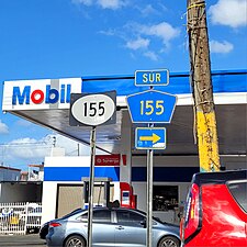 An example of route transition between networks


| Highway network | Highway marker for Route 1 | Purpose[1] | Route numbers[3] |
|---|---|---|---|
| Primary roads |  | Facilitate movement of passengers and freight between major regions in the Island (north, south, east, west) | 1–99[a] |
| Urban primary roads |  | Complement the primary network inside a metro area (San Juan, Ponce, Mayagüez, Arecibo, Aguadilla, Humacao, Caguas and Guayama) | Any (1–9999) |
| Secondary (or inter-municipal) roads |  | Provide access to municipalities from primary network roads | 100–299[a] |
| Tertiary (or intra-municipal) roads |  | Provide access to a municipality's main urban area from peripheral communities | 300–9999 |
Less common markers

.svg)
At least two[1] other markers can be observed in Puerto Rico roads today (2019). The first is the older style road marker which, above the route number, also had the outline of the main island of Puerto Rico with the words Puerto Rico on the outline as shown here. Until 1999,[4] all non-tolled numbered highways in Puerto Rico had the same route marker, a square with a white-on-black half-circle with the route number in the bottom two thirds and a map of Puerto Rico with the words Puerto Rico written inside in the top third. A second road marker, used on the road through El Yunque National Forest, is the brown-colored upside-down trapezoidal marker with the road number on the top two-thirds of the sign and the words Bosque Nacional (national forest) on the bottom one-third, as shown.
Roadway maintenance
All Puerto Rico Highway System roads, regardless of the classification used, are maintained by the centralized, Commonwealth-level, Departmento de Transportación y Obras Públicas (DTOP). Municipal governments are not responsible for maintenance of the Puerto Rico Highway System roads within their territory; whether or not the municipal government is an autonomous government, DTOP is the responsible agency.[5] The DTOP maintains a network of regional offices throughout the island which carry out DTOP work within their multi-municipality region. Municipal governments are only responsible for maintenance of city and town streets within their jurisdictions.[6] On occasion, the central government has entered into memoranda of agreement with municipal governments for the collaborative maintenance of some Puerto Rico Highway System roadways within their municipalities.[7][8]
Municipal roads
In Puerto Rico, the term municipal road may be encountered occasionally. This is not a “fourth” network of State roads. Roadways that have both their terminus within the same municipality are called tertiary roads and are, by convention, numbered PR-300 through PR-9999. Tertiary roads are also sometimes called Carreteras de la red local (English: Local network roads).[2]
However, the term municipal road or municipal highway (Spanish: Carretera municipal) refers to any public roadway that is not marked with a Puerto Rico road marker.[9] Roadways marked with a Puerto Rico road marker are those public roadways that include PR followed by a number in its markers. Such roads are considered State roads and part of the Puerto Rico Highway System. Public roadways that do not include such markings are termed municipal roadways. Unlike State roads, which are signed with numbers, municipal roads are signed with names, such as Calle Hostos, Calle De Diego, Calle San Jorge, Calle León M. Acuña.[9]
Tertiary roads are not municipal roads even though at times the term municipal road has been used (as a shortcut to intra-municipal road)—even by the Government of Puerto Rico—to refer to a tertiary State road.[3] The confusion comes from the context in which the phrase municipal road occurs. When the term municipal road occurs in the context of roads owned and maintained by the State government, municipal roads means tertiary State network roads. In this context, a municipal road and a State tertiary road both refer to the same network of State roads. However, if the term occurs in the context of roadways owned and maintained by a municipal government, it refers to the network of local streets and roadways that make up the urban landscape of a municipality.
Another context sometimes encountered is the context of how a road is used, that is, the purpose of a road. The purpose of a road is indicative of whether a road is a municipal road or not. In its strictest meaning, the term municipal roads refers to roads within a municipality's urban center that provide access from one urban neighborhood to another urban neighborhood within the same urban area (city, town, poblado, etc.), while in the larger context of the State highway system, municipal roads refers to roads that “provide access to the main urban area of a municipality from peripheral communities” (that is, tertiary roads).[1] Municipal roads are maintained by the municipal government where those roads occur, while tertiary roads are maintained by the State government. As stated under the section Road maintenance, at times the State government has entered into Memorandums of Agreement with municipal governments for the upkeep of a State tertiary roadway (note this is a State-owned road that runs entirely within a single municipality), but this does not make it a municipal road—the road continues to maintain its State signage and ownership.[7][8]
Expressways
Highways with control access fall into three types: An expressway is an arterial highway with full or partial control of access. Expressways with full control of access are termed freeways. If the freeway charges a toll for its use, it is called an autopista.[3] Most tollbooths accept the AutoExpreso, an electronic toll collection system, to avoid traffic congestion.[10][11] Toll roads between San Juan and Arecibo, and between San Juan and Ponce were envisioned by J. Raymond Watson, a Puerto Rican engineer, in 1970.[12]
All Puerto Rico expressways are signed either as primary or as urban primary routes.
.jpg)


| Route | Name | Terminus | Maximum speed limit | Notes |
|---|---|---|---|---|
| PR-2 | Expreso Kennedy | Starts from San Patricio Plaza (Guaynabo) to Santurce (San Juan, aka Parada 18). | 50 mph (80 km/h) | Guaynabo to San Juan section only. |
| PR-2 | Roberto Sánchez Vilella | Starts from Mayagüez Mall (Mayagüez) to PR-1 in Ponce | 55 mph (90 km/h) | Mostly converted to expressway from Mayagüez Mall to Ponce. |
| PR-5 | Expreso Río Hondo | Bayamón, PR-22 to Naranjito, PR-147 and PR-149 with discontinuity between PR-199 in Bayamón and PR-167 in Toa Alta. | 50 mph (80 km/h) | Tolled. This road has three expressway segments as of April 2012—these are between PR-29 and PR-22 and between PR-2 and PR-199 (both in Bayamón), an unbuilt portion in southern Bayamón and a portion between PR-167 (Toa Alta) and the town of Naranjito. |
| PR-9 | Baldorioty de Castro | PR-10 Barrio Portugués to PR-2 Barrio El Tuque | 55 miles per hour (89 km/h) to 65 miles per hour (105 km/h) | From PR-123 to PR-2 still under construction |
| PR-12 | Santiago de los Caballeros | PR-14 Barrio Machuelo Abajo to PR-123 Barrio Playa | 55 miles per hour (89 km/h) | |
| PR-18 | Expreso Las Américas | PR-22 San Juan and PR-52 San Juan | 55 to 65 mph (90 to 110 km/h) | |
| PR-20 | Expreso Rafael Martínez Nadal | PR-2 in the San Patricio area in Guaynabo to PR-1 in La Muda sector in Caguas | 55 mph (90 km/h) | Tolled |
| PR-22 | Autopista José de Diego | Hatillo, PR-2 to San Juan, PR-26 | 65 mph (105 km/h) | Extension to Aguadilla in planning. Tolled |
| PR-26 | Expreso Román Baldorioty de Castro | San Antonio Bridge (Bridge to Old San Juan Island) to PR-3 in Carolina. | 65 mph (105 km/h) | |
| PR-30 | Expreso Cruz Ortiz Stella | Caguas, PR-1 to Humacao, PR-53 | 55 mph (90 km/h) | |
| PR-52 | Autopista Luis A. Ferré | Ponce, PR-2 to San Juan, PR-1 and PR-18 | 65 mph (105 km/h) | Tolled. This highway is the longest tolled freeway in Puerto Rico. |
| PR-53 | Autopista Dr. José Celso Barbosa | Fajardo through Ceiba to Yabucoa, and then Guayama to Salinas. | 65 mph (105 km/h) | Maunabo tunnels constructed in October 2008. The segments between Yabucoa and Maunabo still incomplete. |
| PR-60 | Avenida Dionisio Casillas | Humacao, PR-30 to Humacao, PR-3 | 55 mph (90 km/h) | |
| PR-66 | Autopista Roberto Sánchez Vilella | PR-3 in Carolina and Río Grande | 65 mph (105 km/h) | Second half opened in October 2012 to Río Grande. Tolled. |
| PR-165 | Expreso El Caño | Guaynabo, PR-2 and PR-23 to Cataño | 50 mph (80 km/h) |
List of highways
Below is a list of some highways in Puerto Rico along with the municipalities where they begin and end.
Primary highways
Primary roads are numbered in the 1 to 99 range and are distributed randomly throughout the island.
| Number | Length (mi) | Length (km) | Southern or western terminus | Northern or eastern terminus | Formed | Removed | Notes | |
|---|---|---|---|---|---|---|---|---|
 PR-1 PR-1 | 79.6 | 128.1 | PR-123 in Ponce | Calle Tanca in San Juan | — | — | Carretera Central | |
 PR-2 PR-2 | 143.0 | 230.1 | PR-1 / PR-133 in Ponce | PR-26 in San Juan | — | — | ||
 PR-2R PR-2R | 0.5 | 0.80 | PR-440 in Aguadilla | PR-2 in Aguadilla | — | — | Aguadilla business spur | |
| PR-2R | — | — | PR-2 / PR-114 in Mayagüez | PR-2 in Mayagüez | — | — | Mayagüez business loop; renumbered to PR-239[13] | |
| PR-2R | 1.01[14] | 1.63 | PR-2 / PR-5549 in Ponce | PR-123 in Ponce | — | — | Ponce business spur; formerly PR-2 | |
 PR-3 PR-3 | 99.9 | 160.8 | PR-1 in Salinas | PR-1 in San Juan | — | — | ||
 PR-3R PR-3R | 0.87 | 1.40 | PR-3 in Humacao | PR-3 in Humacao | — | — | Humacao business loop | |
 PR-4 PR-4 | — | — | PR-17 in San Juan | PR-26 in Carolina | — | — | Became part of PR-8 | |
| PR-4 | — | — | PR-114 in Hormigueros | PR-102 in San Germán | — | — | Renumbered to PR-103 and PR-101[15] | |
 PR-5 PR-5 | 16.0 | 25.7 | PR-152 / PR-164 in Naranjito | Calle Canal in Cataño | — | — | Tolled in Bayamón. Exists in two segments due to an unconstructed portion in Bayamón. | |
| PR-5 | — | — | PR-2 in Aguadilla | PR-2 in Aguadilla | 1953[16] | — | Renumbered to PR-107 and PR-110[16] | |
 PR-6 PR-6 | 1.1 | 1.8 | PR-2 in Bayamón | PR-5 in Bayamón | — | — | Formerly PR-21 | |
 PR-8 PR-8 | 2.5 | 4.0 | PR-17 in San Juan | PR-3 in San Juan | — | — | Formerly PR-4 | |
 PR-9 PR-9 | 4.52[17] | 7.27 | PR-2 / PR-52 in Ponce | PR-10 in Ponce | — | — | Exists in two portions, as the portion between PR-123 and PR-500 is actually under construction. | |
 PR-10 PR-10 | 42.42[18] | 68.27 | PR-5506 in Ponce | PR-2 in Arecibo | — | — | Exists in two segments due to a still-under-construction portion between Adjuntas and Utuado. Much of old route now PR-123; the current alignment dates from 1974. | |
 PR-12 PR-12 | 3.28[19] | 5.28 | Port of Ponce | PR-14 in Ponce | 1960[20][a] | current | ||
 PR-14 PR-14 | 45.4 | 73.1 | PR-123 / PR-123P in Ponce | PR-1 in Cayey | — | — | Carretera Central | |
| 0.56 | 0.90 | PR-123 / PR-123P in Ponce | PR-14 / PR-14P in Ponce | — | — | Ponce business spur | ||
 PR-15 PR-15 | 16.03 | 25.80 | PR-3 in Guayama | PR-14 in Cayey | 1953[21] | current | Part of the Ruta Panorámica | |
 PR-16 PR-16 | 0.53 | 0.85 | Calle Miraflores in San Juan | PR-1 / PR-26 in San Juan | — | — | ||
 PR-17 PR-17 | 7.1 | 11.4 | PR-19 in San Juan | PR-26 in Carolina | — | — | Tolled at the Teodoro Moscoso Bridge. | |
 PR-18 PR-18 | 3.78[19] | 6.08 | PR-1 / PR-52 in San Juan | PR-22 in San Juan | — | — | ||
 PR-19 PR-19 | 1.2 | 1.9 | PR-21 in San Juan | PR-2 in Guaynabo | — | — | PR-19 is the main avenue in San Patricio, Guaynabo. | |
 PR-20 PR-20 | 6.03[19] | 9.70 | PR-1 in Guaynabo | PR-2 in Guaynabo | — | — | Tolled | |
 PR-21 PR-21 | 3.1 | 5.0 | PR-19 in San Juan | PR-1 / PR-176 in San Juan | — | — | ||
 PR-22 PR-22 | 52.01[19] | 83.70 | PR-2 in Hatillo | PR-26 in San Juan | 1969[22] | current | Tolled; portion of unsigned Interstate PRI-2 | |
 PR-23 PR-23 | 4.0 | 6.4 | PR-2 / PR-165 in Guaynabo | PR-27 in San Juan | — | — | ||
 PR-24 PR-24 | 1.1 | 1.8 | PR-165 in Guaynabo | PR-888 in Cataño | — | — | ||
 PR-25 PR-25 | 6.9 | 11.1 | PR-3 in San Juan | Calle Fortaleza / Calle Recinto Sur in San Juan | — | — | Avenida Juan Ponce de León | |
| 1.7 | 2.7 | PR-1 in San Juan | PR-25 in San Juan | — | — | |||
 PR-26 PR-26 | 9.63[19] | 15.50 | PR-1 / PR-16 in San Juan | PR-3 / PR-66 in Carolina | — | — | ||
 PR-27 PR-27 | 3.0 | 4.8 | PR-3 in San Juan | PR-36 in San Juan | — | — | ||
 PR-28 PR-28 | 3.7 | 6.0 | PR-5 in Bayamón | PR-2 in San Juan | — | — | ||
 PR-29 PR-29 | 2.2 | 3.5 | PR-2 in Bayamón | PR-5 in Bayamón | — | — | ||
 PR-30 PR-30 | 19.08[19] | 30.71 | PR-1 in Caguas | PR-53 in Humacao | — | — | ||
 PR-31 PR-31 | 15.88 | 25.56 | PR-30 / PR-189 in Juncos | PR-3 in Naguabo | 1953[23] | current | ||
 PR-32 PR-32 | 4.5 | 7.2 | PR-172 in Caguas | PR-1 in Caguas | — | — | ||
 PR-33 PR-33 | 1.37 | 2.20 | PR-183 in Caguas | PR-1 / PR-189 in Caguas | — | — | ||
 PR-34 PR-34 | 3.7 | 6.0 | PR-196 in Caguas | PR-183 in Caguas | — | — | ||
 PR-35 PR-35 | 2.5 | 4.0 | PR-1 in San Juan | PR-16 in San Juan | — | — | ||
 PR-36 PR-36 | 0.93 | 1.50 | PR-25 in San Juan | PR-27 in San Juan | — | — | ||
 PR-37 PR-37 | 4.2 | 6.8 | PR-35 in San Juan | PR-187 in Carolina | — | — | ||
 PR-38 PR-38 | 0.67 | 1.08 | Calle Recinto Sur in San Juan | PR-25 in San Juan | — | — | ||
 PR-39 PR-39 | 0.56 | 0.90 | PR-1 in San Juan | PR-25 in San Juan | — | — | ||
 PR-40 PR-40 | 0.56 | 0.90 | PR-25 in San Juan | PR-27 in San Juan | — | — | ||
 PR-41 PR-41 | 1.5 | 2.4 | PR-17 in San Juan | PR-25 in San Juan | — | — | ||
 PR-42 PR-42 | 0.62 | 1.00 | PR-39 in San Juan | Calle Lafayette in San Juan | — | — | ||
 PR-47 PR-47 | 1.7 | 2.7 | Calle Ferrocarril / Paseo De Diego in San Juan | PR-3 in San Juan | — | — | ||
 PR-52 PR-52 | 67.30[19] | 108.31 | PR-2 / PR-9 in Ponce | PR-1 / PR-18 in San Juan | 1968[22] | current | Tolled; portion of unsigned Interstate PRI-1 | |
 PR-53 PR-53 | 58.4 | 94.0 | PR-52 in Salinas | PR-3 in Fajardo | 1988[22] | current | Tolled. Exists in four portions due to unconstructed segments between Guayama and Yabucoa; portion of unsigned Interstate PRI-3 | |
 PR-54 PR-54 | 3.85 | 6.20 | PR-53 in Guayama | PR-3 / PR-748 in Guayama | — | — | ||
 PR-60 PR-60 | 2.21[19] | 3.56 | PR-30 in Humacao | PR-3 in Humacao | — | — | Former portion of PR-30 | |
 PR-63 PR-63 | 0.37 | 0.60 | PR-102 in Mayagüez | PR-2 in Mayagüez | — | — | ||
 PR-64 PR-64 | 3.4 | 5.5 | PR-102 / PR-3342 in Mayagüez | PR-2 / PR-342 in Mayagüez | — | — | ||
 PR-65 PR-65 | 0.57 | 0.92 | PR-239 in Mayagüez | PR-106 in Mayagüez | — | — | ||
 PR-66 PR-66 | 12.1 | 19.5 | PR-3 / PR-26 in Carolina | PR-3 / PR-187 in Río Grande | 2006[24] | current | Tolled; portion of unsigned Interstate PRI-3 | |
| ||||||||
Secondary highways
Secondary roads are numbered in the 100 to 299 range. Unlike primary highways, which are numbered randomly throughout the island, secondary highways generally follow a grid pattern. They begin from the southwest portion of the island with PR-100 and increase in number as you progress in a northeasterly fashion. PR-100 is located in the southwestern town of Cabo Rojo, whilst PR-198 is in Juncos, Las Piedras and Humacao in the eastern part of Puerto Rico. The highest secondary highway number assigned so far (February 2014) is 252 (PR-252), located in the northeastern municipality-island of Culebra. A few roads “violate” this grid order; for example, PR-199 lies in Guaynabo and San Juan.
| Number | Length (mi) | Length (km) | Southern or western terminus | Northern or eastern terminus | Formed | Removed | Notes | |
|---|---|---|---|---|---|---|---|---|
| 10.1 | 16.3 | PR-301 in Cabo Rojo | PR-2 in Hormigueros | — | — | |||
| 11.9 | 19.2 | Calle José de Diego in Cabo Rojo | PR-102 in San Germán | — | — | |||
| 25.8 | 41.5 | PR-104 in Mayagüez | PR-121 / PR-368 in Sabana Grande | — | — | |||
| 8.1 | 13.0 | PR-101 in Cabo Rojo | PR-114 in Cabo Rojo | 1953[25] | current | |||
| 1.1 | 1.8 | PR-3108 in Mayagüez | PR-2 in Mayagüez | — | — | |||
| 27.5 | 44.3 | Calle Tamarindo in Mayagüez | PR-128 in Maricao | — | — | Part of the Ruta Panorámica | ||
| 11.7 | 18.8 | Calle Méndez Vigo / Calle Oriente in Mayagüez | PR-120 in Las Marías | — | — | Part of the Ruta Panorámica | ||
| 2.8 | 4.5 | PR-2 in Aguadilla | Borinquen Road in Aguadilla | — | — | |||
| 13.7 | 22.0 | Calle Méndez Vigo in Mayagüez | PR-109 in Añasco | — | — | |||
| 18.3 | 29.5 | PR-2 in Añasco | PR-119 in San Sebastián | — | — | |||
| 20.5 | 33.0 | PR-2 in Añasco | Cliff Road / San Antonio Road in Aguadilla | — | — | |||
| — | — | PR-110 in Moca | PR-110 in Moca | — | — | Moca business loop; renumbered to PR-4025[26] | ||
| — | — | PR-110 in Aguadilla | Ramey Air Force Base in Aguadilla | — | — | Aguadilla spur; renumbered to PR-4010 | ||
| 41.9 | 67.4 | PR-2 / PR-1107 in Aguadilla | PR-140 in Utuado | 1953[27] | current | |||
| — | — | PR-111 in Aguadilla | PR-111 in Aguadilla | — | — | Aguadilla business loop; renumbered to PR-1107P | ||
| — | — | PR-119 / PR-125 in San Sebastián | PR-111 in San Sebastián | — | — | San Sebastián spur; renumbered to PR-125 | ||
| — | — | PR-111 in Lares | PR-111 in Lares | — | — | Lares business loop; renumbered to PR-1111 | ||
| — | — | PR-123 in Utuado | PR-111 in Utuado | — | — | Utuado business loop; renumbered to PR-6111 | ||
| 11.2 | 18.0 | PR-125 in Moca | PR-113 / PR-459 in Isabela | — | — | |||
| 12.3 | 19.8 | PR-112 / PR-459 in Isabela | PR-119 in Camuy | 1953[28] | current | |||
| 9.1 | 14.6 | PR-2 / PR-239 in Mayagüez | PR-102 in San Germán | — | — | |||
| 17.3 | 27.8 | PR-2 / PR-109 in Añasco | PR-1107 in Aguadilla | — | — | |||
| — | — | PR-417 in Aguada | PR-115 in Aguada | — | — | Aguada business spur; renumbered to PR-4415[29] | ||
| 16.5 | 26.6 | PR-101 in Lajas | PR-2 in Guánica | 1953[30] | current | |||
| — | — | PR-116 in Guánica | PR-116 in Guánica | — | — | Guánica business loop; renumbered to PR-4116 | ||
| — | — | PR-116 in Guánica | PR-121 in Yauco | — | — | Renumbered to PR-1116, now PR-326[31] | ||
| 8.1 | 13.0 | PR-315 in Lajas | PR-121 in Sabana Grande | — | — | |||
| 3.1 | 5.0 | PR-117 in Lajas | PR-102 in San Germán | — | — | |||
| 49.5 | 79.7 | PR-2 in San Germán | PR-2 in Hatillo | 1953[28] | current | Part of the Ruta Panorámica | ||
| 20.4 | 32.8 | Calle Neponucema Santiago / Calle 65 de Infantería in Sabana Grande | PR-124 in Las Marías | — | — | Part of the Ruta Panorámica | ||
| 9.6 | 15.4 | PR-102 / PR-368 in Sabana Grande | PR-127 / PR-128 in Yauco | — | — | |||
| 4.2 | 6.8 | PR-116 in Lajas | PR-2 in San Germán | — | — | Exists in two segments due to a still-under-construction portion between Lajas and San Germán. | ||
| 48.72 | 78.41 | PR-12 in Ponce | PR-10 / PR-6609 in Arecibo | c. 1910 | current | Was PR-10 until 1974 | ||
| 16.7 | 26.9 | PR-119 in Las Marías | PR-1111 in Lares | 1953[27] | current | |||
| 13.1 | 21.1 | PR-111 in Aguadilla | PR-111 in San Sebastián | — | — | Formerly PR-111 | ||
| 0.59 | 0.95 | PR-125 in San Sebastián | PR-109 in San Sebastián | — | — | San Sebastián business spur | ||
| 11.0 | 17.7 | PR-121 / PR-128 in Yauco | PR-2 in Peñuelas | — | — | |||
| 36.5 | 58.7 | PR-2 / PR-3334 in Yauco | PR-1111 / PR-4128 in Lares | 1953[27] | current | Part of the Ruta Panorámica | ||
| 26.8 | 43.1 | PR-135 in Adjuntas | PR-2 in Arecibo | 1953[32] | current | |||
| 7.5 | 12.1 | PR-129 in Hatillo | PR-119 in Hatillo | 1953[32] | current | |||
| 5.0 | 8.0 | Guilarte Forest in Adjuntas | PR-135 in Adjuntas | 1953[33] | current | Part of the Ruta Panorámica | ||
| 16.1 | 25.9 | PR-2 / PR-136 in Guayanilla | PR-123 in Ponce | 1953[34] | current | |||
| 1.2 | 1.9 | PR-123 / PR-1P in Ponce | PR-1 / PR-2 in Ponce | — | — | |||
| 10.9 | 17.5 | PR-111 in Lares | PR-129 in Hatillo | — | — | Formerly PR-129 | ||
| 14.0 | 22.5 | PR-128 in Lares | PR-123 in Adjuntas | 1953[33] | current | Part of the Ruta Panorámica | ||
| 0.21 | 0.34 | PR-127 in Guayanilla | PR-2 / PR-132 in Guayanilla | — | — | |||
| 11.1 | 17.9 | PR-155 in Morovis | PR-2 in Vega Baja | — | — | |||
| 1.6 | 2.6 | PR-14 / PR-153 in Coamo | PR-155 in Coamo | — | — | |||
| 15.7 | 25.3 | PR-10 / PR-14 in Ponce | PR-143 in Ponce | — | — | |||
| 1.8 | 2.9 | PR-139 / PR-5139 in Ponce | Parque Luis A. "Wito" Morales in Ponce | — | — | Spur to Parque Luis A. "Wito" Morales and Cerillos Dam | ||
| 43.4 | 69.8 | PR-143 in Jayuya | PR-2 in Barceloneta | 1953[35] | current | |||
| 12.9 | 20.8 | PR-144 in Jayuya | PR-140 in Utuado | 1953[35] | current | |||
| 5.10[36] | 8.21 | PR-159 in Corozal | PR-2 in Dorado | — | — | |||
| 36.5 | 58.7 | PR-123 in Adjuntas | PR-162 in Barranquitas | 1953[37] | current | Part of the Ruta Panorámica | ||
| 11.4 | 18.3 | PR-140 in Jayuya | PR-149 in Ciales | 1953[35] | current | |||
| 4.7 | 7.6 | PR-146 / PR-149 in Ciales | PR-155 / PR-634 in Morovis | — | — | |||
| 17.6 | 28.3 | PR-123 in Arecibo | PR-145 / PR-149 in Ciales | — | — | |||
| — | — | PR-152 / PR-164 in Naranjito | PR-164 in Naranjito | — | — | Became part of PR-5 | ||
| 0.5 | 0.80 | PR-164 / PR-167 in Naranjito | PR-5 / PR-826 in Naranjito | — | — | |||
| 45.3 | 72.9 | PR-1 in Juana Díaz | PR-22 in Manatí | 1953[38] | current | |||
| 0.7 | 1.1 | PR-149 in Villalba | PR-149 in Villalba | — | — | Villalba business loop; formerly PR-149 | ||
| 13.5 | 21.7 | PR-149R in Villalba | PR-14 in Coamo | 1953[38] | current | |||
| 7.8 | 12.6 | PR-150 in Villalba | PR-143 in Villalba | 1953[38] | current | |||
| 12.6 | 20.3 | PR-156 in Barranquitas | PR-5 / PR-164 in Naranjito | 1953[39] | current | |||
| 2.0 | 3.2 | PR-143 in Barranquitas | PR-152 in Barranquitas | — | — | Barranquitas bypass | ||
| 8.9 | 14.3 | PR-1 in Santa Isabel | PR-14 / PR-138 in Coamo | 1953[40] | current | |||
| 2.5 | 4.0 | PR-153 in Coamo | PR-543 in Coamo | 1953[40] | current | |||
| 42.9 | 69.0 | PR-14 in Coamo | PR-2 / PR-688 in Vega Baja | 1953[41] | current | |||
| 36.5 | 58.7 | PR-597 / PR-5155 in Orocovis | PR-1P in Caguas | 1953[42] | current | |||
| 15.1 | 24.3 | PR-149 in Ciales | PR-155 in Orocovis | 1953[37] | current | |||
| — | — | PR-52 in Cayey | PR-1 in Cayey | proposed[43] | — | |||
| — | — | PR-1 in Juana Díaz | Fort Allen in Juana Díaz | — | — | Now Calle 158 | ||
| 12.8 | 20.6 | PR-155 / PR-6623 in Morovis | PR-165 in Toa Alta | 1953[41] | current | |||
| 9.5 | 15.3 | PR-159 in Morovis | PR-2 in Vega Baja | 1953[44] | current | |||
| 1.5 | 2.4 | PR-1 in Santa Isabel | PR-1 in Santa Isabel | — | — | Santa Isabel northern bypass | ||
| 11.8 | 19.0 | PR-1 in Aibonito | PR-156 in Barranquitas | 1953[45] | current | |||
| 2.8 | 4.5 | PR-500 in Ponce | PR-2 in Ponce | 1960[46] | current | Part of the Avenida Las Américas | ||
| 10.2 | 16.4 | PR-159 in Corozal | PR-148 / PR-167 in Naranjito | 1953[47] | current | |||
| 24.2 | 38.9 | PR-164 in Naranjito | PR-2 / PR-23 in Guaynabo | 1953[39] | current | |||
| 0.4 | 0.64 | PR-165 in Toa Alta | PR-861 in Toa Alta | — | — | Toa Alta business spur | ||
| 1.7 | 2.7 | PR-102 in San Germán | PR-122 in San Germán | — | — | |||
| 17.6 | 28.3 | PR-156 / PR-7167 in Comerío | PR-165 in Toa Baja | 1953[42] | current | |||
| 1.1 | 1.8 | PR-2 in Bayamón | Calle Reverendo Domingo Marrero Navarro / Calle Río Cialitos in Bayamón | — | — | |||
| 3.1 | 5.0 | PR-1 / PR-8834 in Guaynabo | PR-20 in Guaynabo | — | — | |||
| 1.4 | 2.3 | PR-206 in Cayey | PR-14 / PR-731 in Cayey | 1953[21] | current | |||
| 5.2 | 8.4 | PR-14 in Cayey | PR-172 / PR-734 in Cidra | 1953[21] | current | |||
| 17.6 | 28.3 | PR-156 in Comerío | PR-1 in Caguas | 1953[42] | current | |||
| 20.0 | 32.2 | PR-14 in Aibonito | PR-1 / PR-8834 in Guaynabo | 1953[45] | current | |||
| 14.1 | 22.7 | PR-156 in Aguas Buenas | PR-5 in Bayamón | — | — | |||
| 8.1 | 13.0 | PR-1 in Caguas | PR-181 / PR-8860 in Trujillo Alto | 1953[48] | current | |||
| 7.3 | 11.7 | PR-175 in Trujillo Alto | PR-1 / PR-21 in San Juan | 1953[48] | current | |||
| 6.5 | 10.5 | PR-174 in Bayamón | PR-176 in San Juan | — | — | |||
| 2.0 | 3.2 | PR-3 in Arroyo | PR-3 / PR-753 in Arroyo | 1953[49] | current | Arroyo business loop | ||
| 12.6 | 20.3 | PR-15 in Guayama | PR-184 in Cayey | — | — | Part of the Ruta Panorámica | ||
| 1.7 | 2.7 | PR-701 in Salinas | PR-1 / PR-52 in Salinas | — | — | Salinas bypass | ||
| 42.66 | 68.65 | PR-3 in Patillas | PR-17 in San Juan | 1953[50] | current | Part of the Ruta Panorámica | ||
| 9.9 | 15.9 | PR-181 in Yabucoa | PR-3 in Yabucoa | 1953[51] | current | Part of the Ruta Panorámica | ||
| 13.9 | 22.4 | PR-1 in Caguas | PR-198 in Las Piedras | 1953[23] | current | |||
| 20.8 | 33.5 | PR-3 in Patillas | PR-1 in Cidra | 1953[21] | current | Part of the Ruta Panorámica | ||
| 13.1 | 21.1 | PR-30 in Juncos | PR-9959 in Canóvanas | 1953[23] | current | |||
| 16.7 | 26.9 | PR-185 in Canóvanas | PR-3 in Río Grande | 1953[52] | current | |||
| 18.7 | 30.1 | PR-26 in Carolina | PR-3 / PR-66 in Río Grande | 1953[52] | current | |||
| 0.68 | 1.09 | PR-3 in Río Grande | PR-187 in Río Grande | — | — | Río Grande business spur | ||
| 3.6 | 5.8 | PR-3 / PR-9188 in Canóvanas | PR-187 in Loíza | — | — | |||
| 9.4 | 15.1 | PR-1 / PR-33 in Caguas | PR-30 / PR-31 in Juncos | — | — | |||
| 2.5 | 4.0 | PR-3 / PR-8887 in Carolina | PR-26 in Carolina | — | — | |||
| 14.9 | 24.0 | PR-31 in Naguabo | PR-3 in Río Grande | 1953[52] | current | Exists in two segments in the El Yunque National Forest. | ||
| 1.9 | 3.1 | PR-3 in Naguabo | PR-31 in Naguabo | 1953[53] | current | |||
| 1.5 | 2.4 | PR-3 in Luquillo | PR-3 / PR-992 in Luquillo | — | — | Luquillo business loop | ||
| 3.0 | 4.8 | PR-3 in Fajardo | PR-3 / PR-940 in Fajardo | — | — | |||
| 2.1 | 3.4 | PR-3 in Fajardo | Port of Fajardo | — | — | |||
| 1.7 | 2.7 | PR-156 in Caguas | PR-1 in Caguas | — | — | |||
| 9.2 | 14.8 | PR-31 in Juncos | PR-3 in Humacao | — | — | |||
| 0.50 | 0.80 | PR-198 in Humacao | PR-198 in Humacao | — | — | |||
| 13.4 | 21.6 | Urbanización Portobello in Toa Alta | PR-181 / PR-876 in Trujillo Alto | — | — | PR-199 exists into two segments due to an unconstructed portion between Bayamón and Guaynabo. | ||
| 3.91[54] | 6.29 | PR-994 in Vieques | Barrio Puerto Diablo in Vieques | — | — | |||
| 0.93[54] | 1.50 | PR-200 in Vieques | Sector Santa María in Vieques | — | — | |||
| 4.47[54] | 7.19 | Barrio Llave in Vieques | PR-200 in Vieques | — | — | |||
| 4.2 | 6.8 | PR-183 / PR-9931 in San Lorenzo | PR-30 in Gurabo | — | — | |||
| 1.4 | 2.3 | PR-183 in Las Piedras | PR-198 in Las Piedras | — | — | |||
| — | — | PR-2 in Barceloneta | PR-140 in Barceloneta | — | — | Renumbered to PR-140 | ||
| 0.25 | 0.40 | PR-31 in Naguabo | PR-53 in Naguabo | — | — | |||
| 1.1 | 1.8 | PR-1 in Cayey | PR-14 in Cayey | — | — | |||
| — | — | PR-156 in Aguas Buenas | PR-156 in Aguas Buenas | proposed[55] | — | Aguas Buenas northern bypass | ||
| 1.6 | 2.6 | PR-2 / PR-4494 in Isabela | PR-4472 in Isabela | — | — | Formerly portion of PR-4494 extension | ||
| 3.1 | 5.0 | PR-153 in Coamo | PR-14 in Coamo | — | — | Former portion of PR-138 | ||
| 3.3 | 5.3 | PR-2 / PR-114 in Mayagüez | PR-2 in Mayagüez | — | — | Formerly PR-2R[13] | ||
| 5.47[56] | 8.80 | Port of Culebra | Zoni Beach in Culebra | — | — | Formerly PR-998[57] | ||
| 1.74[56] | 2.80 | PR-250 in Culebra | Flamenco Beach in Culebra | — | — | Formerly PR-999[57] | ||
| 0.93 | 1.50 | PR-250 in Culebra | Barrio Playa Sardinas I in Culebra | — | — | |||
| 1.99[56] | 3.20 | Calle Punta Soldado in Culebra | PR-250 in Culebra | — | — | |||
| ||||||||
Tertiary highways


Tertiary highways also follow a general grid. Towns which do not border the Atlantic Ocean or the Caribbean Sea, especially in the mountainous area, may overlap this grid, for example Ciales may have both highways in the 600-699 grid and the 500-599 grid, depending where they begin further north or further south. Generally along the areas where the highways are, the lower the number, the more south it is. Culebra is the only town in Puerto Rico that does not fall in any of the regions, for only PR-250 and PR-251 are the main routes. The entire immediate metropolitan area of San Juan with the exception of Caguas falls in the 800 region, while the entire east coast (north and south) east of San Juan, Caguas and Patillas fall in the 900 region. This is because the eastern portion of Puerto Rico has a southeastern coast which goes to the west from Humacao, which roughly defines where the Vieques Passage and the Caribbean Sea meet along the coast. Yabucoa is in the exact south-southeast area and lies in the 900 region, while Maunabo overlaps the 700's and 900's regions. Vieques, an offshore island-municipality, has some highways in the 900 order.
Some roads are numbered using four digits. For example, PR-5506. These are branches, or spurs, of tertiary roads by the same last three digit number. Thus, PR-5506 is a branch of PR-506. They are often dead end branches, and are common in the mountain regions of the main island. Sometimes they are loops branching off the main road and eventually connecting back to the same main tertiary road. The “fourth” digit is generally a repeat of the first digit of the main tertiary road in question. Thus, a branch of PR-301 would be signed PR-3301, with the added 3 prefixing the number of the main tertiary road associated with the spur, 301, because 3 is the first digit of the main road. When the road has more than one distinct spur, an additional unrelated digit is used (example, PR-4301).
| Number | Length (mi) | Length (km) | Southern or western terminus | Northern or eastern terminus | Formed | Removed | Notes | |
|---|---|---|---|---|---|---|---|---|
| 7.1 | 11.4 | Los Morrillos Light in Cabo Rojo | PR-101 in Cabo Rojo | — | — | |||
| 2.7 | 4.3 | PR-116 in Guánica | PR-121 in Yauco | 2015 | current | Formerly PR-1116[31] | ||
| 3.1 | 5.0 | PR-105 in Mayagüez | PR-119 in Mayagüez | — | — | Part of the Ruta Panorámica | ||
| 4.0 | 6.4 | PR-345 in Hormigueros | PR-348 in Mayagüez | 1953[25] | current | |||
| — | — | PR-368 in Sabana Grande | PR-105 in Maricao | — | — | Part of the Ruta Panorámica | ||
| — | — | PR-120 in Sabana Grande | PR-365 in Maricao | — | — | Part of the Ruta Panorámica | ||
| 3.29 | 5.29 | PR-127 in Peñuelas | PR-132 in Peñuelas | 1953[34] | current | |||
| 3.8 | 6.1 | PR-115 in Rincón | PR-115 in Rincón | — | — | |||
| — | — | PR-119 in San Sebastián | PR-124 in Lares | — | — | |||
| 1.1 | 1.8 | PR-111 in San Sebastián | Barrio Juncal in San Sebastián | — | — | |||
| — | — | PR-1111 in Lares | PR-119 in Quebradillas | 1953[27] | current | |||
| 1.50 | 2.41 | PR-2 / PR-463 in Aguadilla | PR-110 in Moca | — | — | |||
| — | — | PR-107 in Aguadilla | PR-459 in Aguadilla | — | — | |||
| 5.4 | 8.7 | PR-129 in Hatillo | PR-130 / PR-488 in Hatillo | 1953[32] | current | |||
| 1.8 | 2.9 | Sector La Cotorra in Ponce | PR-132 in Ponce | — | — | |||
| 6.4 | 10.3 | PR-123 in Ponce | PR-123 in Ponce | — | — | |||
| 3.2 | 5.1 | PR-132 in Ponce | PR-501 in Ponce | — | — | |||
| 10.6 | 17.1 | Calle Salsa in Ponce | PR-143 in Utuado | — | — | |||
| 4.3 | 6.9 | PR-10 / PR-503 in Ponce | PR-505 in Ponce | — | — | |||
| 10.2 | 16.4 | PR-139 in Ponce | PR-503 in Ponce | — | — | |||
| 1.2 | 1.9 | Urbanización Hacienda Juliana in Ponce | PR-14 in Ponce | — | — | |||
| — | — | Sector Buyones in Ponce | PR-1 in Ponce | — | — | |||
| 6.4 | 10.3 | PR-1 in Ponce | PR-14 in Juana Díaz | — | — | |||
| 11.7 | 18.8 | PR-14 in Ponce | PR-143 in Ponce | — | — | |||
| 0.93 | 1.50 | PR-123 in Ponce | PR-10 in Ponce | — | — | |||
| 1.9 | 3.1 | Sector Santas Pascuas in Ponce | PR-123 in Ponce | — | — | |||
| 7.5 | 12.1 | PR-131 in Adjuntas | PR-123 in Adjuntas | 1953[33] | current | Part of the Ruta Panorámica | ||
| — | — | PR-391 in Peñuelas | PR-502 in Ponce | — | — | |||
| 3.6 | 5.8 | PR-135 in Adjuntas | PR-131 in Adjuntas | 1953[33] | current | Part of the Ruta Panorámica | ||
| — | — | PR-1 / PR-537 in Santa Isabel | PR-14 in Juana Díaz | 1953[40] | current | |||
| 1.1 | 1.8 | Calle Vista Mar in Santa Isabel | PR-1 in Santa Isabel | 1953[40] | current | |||
| 2.1 | 3.4 | Sector Ranchete in Ponce | PR-132 in Ponce | — | — | |||
| 10.1 | 16.3 | PR-157 in Orocovis | PR-145 / PR-6622 in Morovis | 1953[41] | current | |||
| 18.7 | 30.1 | PR-5155 in Orocovis | PR-159 in Corozal | 1953[47] | current | |||
| 0.12 | 0.19 | PR-143 in Ponce | Cerro Maravilla in Ponce | — | — | |||
| 0.50 | 0.80 | PR-1 in Ponce | Calle Húcar in Ponce | — | — | |||
| — | — | Sector Tiburones in Ponce | PR-1 in Ponce | — | — | |||
| 1.7 | 2.7 | PR-123 in Ponce | PR-2R in Ponce | — | — | |||
| 1.1 | 1.8 | PR-504 in Ponce | Camino La Zarza in Ponce | — | — | Spur of PR-504 | ||
| 1.9 | 3.1 | PR-2 in Ponce | PR-2 in Ponce | — | — | |||
| — | — | PR-155 / PR-618 in Morovis | PR-155 / PR-159 in Morovis | 1953[41] | current | |||
| 2.7 | 4.3 | PR-149 in Ciales | PR-155 in Morovis | 1953[41] | current | |||
| — | — | PR-140 in Florida | PR-6685 in Manatí | 1953[58] | current | |||
| 8.0 | 12.9 | PR-159 / PR-5568 in Corozal | PR-676 in Vega Alta | 1953[59] | current | |||
| 1.7 | 2.7 | PR-677 / PR-823 in Dorado | PR-2 in Dorado | 1953[60] | current | |||
| 4.7 | 7.6 | PR-676 in Vega Alta | Calle Principal in Vega Alta | 1953[59] | current | |||
| 9.6 | 15.4 | PR-2 / PR-165 in Dorado | PR-690 in Vega Alta | 1953[60] | current | |||
| 3.5 | 5.6 | Sector Cercadillo in Cayey | PR-1 in Cayey | 1953[21] | current | Part of the Ruta Panorámica | ||
| 4.8 | 7.7 | PR-162 / PR-7718 in Aibonito | PR-14 in Aibonito | 1953[45] | current | Part of the Ruta Panorámica | ||
| 6.0 | 9.7 | PR-143 in Coamo | PR-14 in Aibonito | 1953[45] | current | Ruta Panorámica | ||
| 1.7 | 2.7 | PR-1 in Cayey | PR-1 in Cayey | 1953[21] | current | Part of the Carretera Central | ||
| — | — | PR-15 in Cayey | Barrio Culebras Alto in Cayey | 1953[21] | current | Part of the Ruta Panorámica | ||
| — | — | PR-179 in Guayama | PR-738 in Cayey | — | — | Part of the Ruta Panorámica | ||
| 1.7 | 2.7 | Sector Central Machete in Guayama | PR-3 in Guayama | — | — | |||
| 2.4 | 3.9 | PR-3 in Maunabo | Punta Tuna Light in Maunabo | 1953[61] | current | Part of the Ruta Panorámica | ||
| — | — | PR-172 in Caguas | PR-34 in Caguas | — | — | |||
| 2.9 | 4.7 | PR-1 in Caguas | PR-1 in San Juan | — | — | Part of the Carretera Central | ||
| 4.1 | 6.6 | PR-801 in Corozal | PR-152 / PR-803 in Naranjito | 1953[47] | current | |||
| 6.3 | 10.1 | PR-152 / PR-802 in Naranjito | PR-164 in Corozal | — | — | |||
| 4.5 | 7.2 | PR-568 in Corozal | PR-803 in Corozal | — | — | |||
| — | — | PR-159 in Corozal | PR-823 in Toa Alta | — | — | |||
| 4.3 | 6.9 | PR-805 in Corozal | Calle San Manuel in Corozal | — | — | |||
| — | — | PR-803 in Corozal | PR-811 in Naranjito | — | — | |||
| 2.3 | 3.7 | PR-152 in Naranjito | PR-164 in Naranjito | — | — | Formerly PR-152 | ||
| — | — | PR-152 in Naranjito | PR-164 in Naranjito | — | — | |||
| 2.7 | 4.3 | Sector Baja del Palo in Corozal | PR-159 in Corozal | 1953[47] | current | |||
| 2.6 | 4.2 | PR-861 in Toa Alta | PR-863 in Toa Baja | — | — | |||
| — | — | PR-677 / PR-678 in Vega Alta | PR-823 in Toa Alta | 1953[59] | current | |||
| 3.7 | 6.0 | PR-891 in Corozal | PR-630 in Corozal | 1953[47] | current | |||
| 4.5 | 7.2 | PR-677 / PR-679 in Dorado | PR-165 in Toa Alta | — | — | |||
| 2.2 | 3.5 | PR-861 in Bayamón | PR-864 in Bayamón | — | — | |||
| 1.6 | 2.6 | PR-2 in Toa Baja | PR-862 in Toa Baja | — | — | |||
| 1.3 | 2.1 | PR-2 in Bayamón | PR-2 in Bayamón | — | — | |||
| 4.8 | 7.7 | PR-2 in Toa Baja | PR-167 in Toa Baja | — | — | |||
| 2.9 | 4.7 | PR-5 in Cataño | PR-165 in Cataño | — | — | |||
| 1.3 | 2.1 | PR-165 in Toa Baja | Isla de Cabras in Toa Baja | — | — | |||
| 1.1 | 1.8 | PR-1 in San Juan | PR-1 in San Juan | — | — | Part of the Carretera Central | ||
| 2.2 | 3.5 | PR-165 in Cataño | PR-5 in Cataño | — | — | |||
| 1.1 | 1.8 | PR-159 in Corozal | PR-159 in Corozal | — | — | Formerly PR-159[47] | ||
| 9.4 | 15.1 | PR-760 in Maunabo | PR-9910 in Yabucoa | 1953[61] | current | Part of the Ruta Panorámica | ||
| — | — | PR-3 in Yabucoa | PR-3 in Humacao | 1953[51] | current | |||
| 8.4 | 13.5 | PR-3 in Yabucoa | PR-3 in Humacao | 1953[62] | current | |||
| 1.8 | 2.9 | PR-760 in Maunabo | Sector Quebrada Arenas in Maunabo | — | — | Part of the Ruta Panorámica | ||
| — | — | PR-189 in Gurabo | PR-181 in Gurabo | 1953[50] | current | |||
| 3.8 | 6.1 | PR-3 in Río Grande | PR-3 / PR-968 in Río Grande | — | — | |||
| — | — | PR-988 in Luquillo | PR-940 in Luquillo | — | — | |||
| 1.3[54] | 2.1 | PR-201 in Vieques | PR-201 in Vieques | — | — | |||
| — | — | Port of Culebra | Zoni Beach in Culebra | — | — | Renumbered to PR-250[56] | ||
| — | — | PR-250 in Culebra | Flamenco Beach in Culebra | — | — | Renumbered to PR-251[56] | ||
| 3.9 | 6.3 | PR-2 / PR-111 in Aguadilla | PR-107 in Aguadilla | — | — | Formerly PR-111 | ||
| 2.8 | 4.5 | PR-111 in Lares | Barrio Lares in Lares | — | — | Formerly PR-111; Lares business loop | ||
| — | — | PR-116 in Guánica | PR-121 in Yauco | — | — | Formerly PR-116R; renumbered to PR-326[31] | ||
| — | — | PR-5520 in Villalba | PR-150 in Coamo | — | — | |||
| — | — | PR-3 in Patillas | PR-3 in Patillas | — | — | |||
| 0.93 | 1.50 | Calle San Blas in Lajas | PR-101 in Lajas | — | — | |||
| 0.93 | 1.50 | PR-2 in Mayagüez | PR-108 in Mayagüez | — | — | |||
| 2.1 | 3.4 | PR-116 in Guánica | PR-116 in Guánica | — | — | Formerly PR-116 | ||
| 3.3 | 5.3 | PR-132 in Guayanilla | Sector Malpaso in Peñuelas | — | — | |||
| 1.4 | 2.3 | PR-132 in Peñuelas | PR-132 in Peñuelas | — | — | Exists in two segments as the section between PR-3384 and PR-132 is under construction. | ||
| 1.8 | 2.9 | Calle Mariana Bracetti in Cabo Rojo | PR-301 in Cabo Rojo | — | — | |||
| 0.68 | 1.09 | PR-102 in Mayagüez | PR-64 / PR-102 in Mayagüez | — | — | Calle Concordia | ||
| 0.81 | 1.30 | PR-309 in Hormigueros | PR-344 in Hormigueros | — | — | Hormigueros spur | ||
| 0.87 | 1.40 | PR-110 in Aguadilla | Ramey Air Force Base in Aguadilla | — | — | Formerly PR-110R | ||
| 0.93 | 1.50 | PR-110 in Moca | PR-110 in Moca | — | — | Formerly PR-110R | ||
| 0.56 | 0.90 | PR-443 in Aguadilla | PR-110 in Moca | — | — | |||
| 0.56 | 0.90 | PR-111 in San Sebastián | PR-111 in San Sebastián | — | — | Formerly PR-111 | ||
| 0.93 | 1.50 | PR-116 in Guánica | PR-333 in Guánica | — | — | Formerly PR-116R; Guánica business route | ||
| 4.5 | 7.2 | PR-485 in Quebradillas | PR-119 in Camuy | — | — | Formerly PR-485 | ||
| 0.75 | 1.21 | PR-111 in Lares | PR-128 / PR-1111 in Lares | — | — | |||
| 0.62 | 1.00 | PR-413 in Rincón | Domes Beach in Rincón | — | — | |||
| 0.75 | 1.21 | PR-417 in Aguada | PR-115 in Aguada | — | — | Formerly PR-115R | ||
| — | — | Quebrada Las Cañas in San Sebastián | PR-435 in San Sebastián | — | — | |||
| — | — | Parque de Colón in Aguada | PR-1107 in Aguadilla | — | — | |||
| 1.7 | 2.7 | PR-14 in Ponce | PR-139 / PR-139R in Ponce | — | — | |||
| 1.3 | 2.1 | PR-144 in Jayuya | PR-141 in Jayuya | — | — | Jayuya northwest bypass | ||
| 0.47 | 0.76 | PR-144 in Jayuya | PR-141 in Jayuya | — | — | Jayuya east bypass | ||
| 0.81 | 1.30 | PR-155 in Orocovis | PR-155 in Orocovis | — | — | Formerly PR-155; Orocovis business route | ||
| 0.16 | 0.26 | PR-155 in Orocovis | PR-156 in Orocovis | — | — | |||
| 0.87 | 1.40 | PR-1 in Ponce | PR-10 in Ponce | — | — | |||
| 0.87 | 1.40 | PR-1 in Ponce | PR-510 in Juana Díaz | — | — | |||
| 0.68 | 1.09 | Barrio Limaní in Adjuntas | PR-525 in Adjuntas | — | — | |||
| 1.2 | 1.9 | PR-538 in Santa Isabel | PR-1 / PR-5507 in Santa Isabel | — | — | |||
| — | — | Barrio Canas Urbano in Ponce | PR-2 / PR-2R in Ponce | — | — | |||
| — | — | PR-149 in Villalba | PR-150 in Villalba | — | — | |||
| 1.7 | 2.7 | PR-567 in Morovis | Barrio Vaga in Morovis | — | — | |||
| 2.7 | 4.3 | PR-568 in Corozal | PR-159 / PR-647 in Corozal | — | — | |||
| 1.7 | 2.7 | PR-123 in Utuado | PR-111 in Utuado | — | — | Formerly PR-111R; Utuado business loop | ||
| — | — | PR-2 in Barceloneta | PR-140 in Barceloneta | — | — | Formerly PR-140 | ||
| 0.50 | 0.80 | PR-693 in Dorado | PR-165 in Dorado | — | — | Dorado business route | ||
| 0.14 | 0.23 | PR-6685 in Ciales | PR-149 in Ciales | — | — | |||
| — | — | PR-642 in Florida | PR-140 in Florida | — | — | |||
| 7.4 | 11.9 | PR-146 in Ciales | PR-2 in Manatí | — | — | Formerly PR-149 | ||
| 1.7 | 2.7 | PR-693 in Vega Alta | PR-690 in Vega Alta | — | — | |||
| 0.81 | 1.30 | PR-696 in Dorado | PR-693 in Dorado | — | — | Dorado southern bypass | ||
| — | — | PR-14 in Cayey | Calle Enramada in Cayey | — | — | |||
| 1.7 | 2.7 | PR-156 in Aguas Buenas | PR-156 in Caguas | — | — | Formerly PR-156 | ||
| — | — | PR-156 / PR-167 in Comerío | La Plata River in Comerío | — | — | Formerly PR-156 | ||
| 0.81 | 1.30 | Sector Las Corujas in Aguas Buenas | PR-173 in Aguas Buenas | — | — | |||
| — | — | PR-3 in Guayama | PR-53 in Guayama | — | — | |||
| — | — | PR-14 in Aibonito | PR-162 / PR-722 in Aibonito | — | — | Part of the Ruta Panorámica[63] | ||
| 3.9 | 6.3 | PR-722 in Aibonito | PR-1 in Cayey | — | — | Part of the Ruta Panorámica | ||
| — | — | PR-715 in Cayey | PR-15 in Cayey | — | — | Part of the Ruta Panorámica | ||
| — | — | PR-184 in Patillas | PR-181 in San Lorenzo | — | — | Part of the Ruta Panorámica | ||
| — | — | PR-741 in Cayey | PR-742 in Guayama | — | — | Ruta Panorámica | ||
| 1.2 | 1.9 | PR-760 in Maunabo | PR-901 in Maunabo | — | — | |||
| 0.87 | 1.40 | PR-176 in San Juan | PR-176 in San Juan | — | — | |||
| 0.50 | 0.80 | PR-177 in Guaynabo | PR-841 in Guaynabo | — | — | |||
| — | — | PR-164 in Naranjito | Sector Cuchillas Pacheco in Naranjito | — | — | |||
| — | — | PR-1 / PR-173 in Guaynabo | PR-1 / PR-169 in Guaynabo | — | — | Part of the Carretera Central | ||
| — | — | PR-177 in San Juan | PR-1 in San Juan | — | — | Part of the Carretera Central | ||
| — | — | PR-165 in Dorado | PR-2 in Toa Baja | — | — | |||
| 1.6 | 2.6 | PR-869 in Cataño | PR-5 in Cataño | — | — | |||
| — | — | PR-189 in Gurabo | PR-933 in Gurabo | — | — | |||
| 1.6 | 2.6 | PR-185 in Juncos | PR-31 in Juncos | — | — | |||
| 0.68 | 1.09 | PR-66 in Canóvanas | PR-3 / PR-188 in Canóvanas | — | — | |||
| 0.87 | 1.40 | PR-189 in Gurabo | Sector Preciosa in Gurabo | — | — | |||
| — | — | PR-182 in Yabucoa | PR-920 in Yabucoa | — | — | |||
| — | — | PR-973 / PR-9973 in Naguabo | PR-978 in Ceiba | — | — | |||
| ||||||||
Interstates

There are no Interstate-signed highways in Puerto Rico, but there are roadways that have received up to 90% of their funding from the US Interstate Highway System.[64] Still, at least as of 2007, none of such highways funded by the Interstate Highway program were planned or built to the standards of the Interstate Highway System.[65] As of March 2001, Puerto Rico had 410 km (250 mi) of such roadways.[66] As of 2001, there were three highways in Puerto Rico funded under the Interstate Highway Program.[67] These routes—such as with Interstate Highways in Alaska and Interstate Highways in Hawaii—do not connect to the Interstate Highway System in the contiguous United States.
Like Interstate routes in Alaska, Puerto Rico Interstate routes are unsigned. For administrative and funding purposes, the three routes have been designated as PRI-1, PRI-2 and PRI-3[67] and run along various combinations of Puerto Rico routes. They do not follow the even-and-odd-number rule used in mainland United States that indicates direction of travel. Per Section 103(c)(1)(B) (ii), Title 23, United States Code (23 U.S.C.) Puerto Rico is exempt from the design standards of Section 109(b).[64]
Puerto Rico's Interstate routes should not be confused with Puerto Rico Routes PR-1, PR-2, and PR-3, which are other major highways in Puerto Rico.[68]
| Route | Component routes | Length mi[69] | Length km | From | To |
|---|---|---|---|---|---|
 PR-1 PR-1 |  PR-52 PR-52 PR-18 PR-18 | 71.08 | 114.39 | PR-2 in Ponce | PR-2 in San Juan (PR-22/PR-18 interchange) |
 PR-2 PR-2 |  PR-2 PR-2 PR-22 PR-22 | 138.13 | 222.30 | PR-1 in Ponce | PR-3 in San Juan (PR-1/PR-26 interchange) |
 PR-3 PR-3 |  PR-53 PR-53 PR-3 PR-3 PR-66 PR-66 PR-26 PR-26 | 40.56 | 65.27 | PR-3 in Humacao | PR-2 in San Juan (PR-1/PR-26/PR-66 interchange) |
