List of lighthouses in Connecticut

The U.S. state of Connecticut has fourteen active lighthouses in the state, two of which are maintained as private aids; six are standing but inactive. Another was destroyed after its deactivation. The earliest lighthouse in the state was erected in 1760, but that tower, the first New London Harbor Light, was replaced in 1801, and its successor is the oldest surviving light in Connecticut, as well as the tallest.[1] The last officially recognized lighthouse in the state, the Avery Point Light, was constructed in 1943, but was not lit until the following year.[2] The Mystic Seaport Light, constructed in 1966, is a functioning replica housed with a historic Fresnel lens; it is classified as an unofficial and non-navigational aid.

NameLocationCoordinatesImageFocal
Height
Built[note 1]AutomatedDeactivatedStatus
Avery Point LightGroton41°18′55″N 72°03′49″W / 41.3153°N 72.0636°W / 41.3153; -72.0636 (Avery Point Light)55 ft (17 m)[3]1944[3]1967–2006[3]Active; private aid
Black Rock Harbor LightFayerweather Island41°08′32″N 73°13′02″W / 41.1423°N 73.2173°W / 41.1423; -73.2173 (Black Rock Harbor Light)A black and white photograph of Black Rock Harbor Light44 ft (13 m)[4]1808/1823[5]: 49 1932[5]: 49 Relit in 2000 as non-navigational light.[6]
Bridgeport Harbor LightBridgeport41°09′24″N 73°10′47″W / 41.1567°N 73.1798°W / 41.1567; -73.1798 (Bridgeport Harbor Light)A photograph of the Bridgeport Harbor Light52 ft (16 m)[7]1851/1871[8]1953Destroyed by fire in 1953 while dismantling the lighthouse; was replaced with a skeleton tower.[9]
Falkner Island LightGuilford41°12′44″N 72°39′13″W / 41.2121°N 72.6536°W / 41.2121; -72.6536 (Falkner Island Light)A black and white photograph of Faulkner Island Light94 ft (29 m)[10]: 30 1802[10]: 30 1978[11]Active
Five Mile Point Light[note 2]New Haven41°14′56″N 72°54′14″W / 41.2490°N 72.9038°W / 41.2490; -72.9038 (Five Mile Point Light)[13]A photograph of Five Mile Point Light97 ft (30 m)[10]: 30 1805/1845[10]: 30 1877[10]: 30 Inactive
Great Captain Island LightGreenwich40°58′57″N 73°37′25″W / 40.9825°N 73.6235°W / 40.9825; -73.6235 (Great Captain Island Light)A photograph of Great Captain Island Light51 ft (16 m)1830/1868[10]: 30 1970[10]: 30 Non-navigational light[14]
Greens Ledge LightNorwalk41°02′30″N 73°26′38″W / 41.0418°N 73.4438°W / 41.0418; -73.4438 (Greens Ledge Light)A photograph of Greens Ledge Light62 ft (19 m)[10]: 31 1902[10]: 31 1972[11]Active
Lynde Point Light[note 3]Old Saybrook41°16′17″N 72°20′35″W / 41.2715°N 72.3430°W / 41.2715; -72.3430 (Lynde Point Light)A photograph of Lynde Point Light71 ft (22 m)[10]: 32 1803/1838[10]: 32 1975[11]Active
Morgan Point LightNoank41°18′59″N 71°59′22″W / 41.3164°N 71.9894°W / 41.3164; -71.9894 (Morgan Point Light)[15]A photograph of Morgan Point Light61 ft (19 m)[16]1831/1868[10]: 33 1919[10]: 33 Inactive
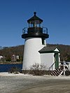
Mystic Seaport LightMystic, Connecticut41°12′51″N 71°34′52″W / 41.2141°N 71.5811°W / 41.2141; -71.5811 (Mystic Seaport Light)A photograph of the Mystic Seaport Light26 ft (7.9 m)[17]1966[18]museum replica of Brant Point Light; not an aid to navigation
New London Harbor LightNew London41°19′00″N 72°05′23″W / 41.3166°N 72.0898°W / 41.3166; -72.0898 (New London Harbor Light)A photograph of the New London Harbor Light89 ft (27 m)[10]: 34 1760/1801[10]: 34 1912[11]Active
New London Ledge LightNew London41°18′21″N 72°04′39″W / 41.3059°N 72.0774°W / 41.3059; -72.0774 (New London Ledge Light)A photograph of the New London Ledge Light58 ft (18 m)[10]: 34 1760/1909[10]: 34 1987[11]Active
Pecks Ledge LightNorwalk41°04′39″N 73°22′11″W / 41.0774°N 73.3697°W / 41.0774; -73.3697 (Pecks Ledge Light)A photograph of Pecks Ledge Light61 ft (19 m)[10]: 35 1906[10]: 35 1933[11]Active
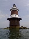
Penfield Reef LightFairfield41°07′02″N 73°13′20″W / 41.1171°N 73.2221°W / 41.1171; -73.2221 (Penfield Reef Light)A photograph of the Penfield Reef Light51 ft (16 m)[10]: 35 1874[10]: 35 1971[11]Active
Saybrook Breakwater Light[note 4]Old Saybrook41°15′48″N 72°20′34″W / 41.2632°N 72.3427°W / 41.2632; -72.3427 (Saybrook Breakwater Light)A photograph of the Saybrook Breakwater Light58 ft (18 m)[10]: 36 1886[10]: 36 1959[11]Active
Sheffield Island LightNorwalk41°02′56″N 73°25′09″W / 41.0488°N 73.4192°W / 41.0488; -73.4192 (Sheffield Island Light)[19]A photograph of the Sheffield Island Light51 ft (16 m)[20]1828/1868[20]1902[10]: 36 Inactive
Southwest Ledge LightNew Haven41°14′04″N 72°54′44″W / 41.2344°N 72.9122°W / 41.2344; -72.9122 (Southwest Ledge Light)A photograph of the Southwest Ledge Light57 ft (17 m)[21]1877[10]: 37 1973[11]Active
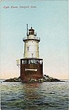
Stamford Harbor Ledge LightStamford41°00′49″N 73°32′34″W / 41.0136°N 73.5428°W / 41.0136; -73.5428 (Stamford Harbor Ledge Light)A postcard with a photograph of the Stamford Harbor Ledge Light80 ft (24 m)[22]1882[10]: 38 1953[10]: 38 Active; private aid
Stonington Harbor LightStonington41°19′43″N 71°54′20″W / 41.3285°N 71.9055°W / 41.3285; -71.9055 (Stonington Harbor Light)[23]A photograph of the Stonington Harbor Light62 ft (19 m)[24]1823/1840[10]: 39 1889[10]: 39 Inactive; museum[10]: 39 
Stratford Point LightStratford41°09′07″N 73°06′12″W / 41.1520°N 73.1032°W / 41.1520; -73.1032 (Stratford Point Light)A photograph of the Stratford Point Light52 ft (16 m)[10]: 39 1822/1881[10]: 39 1970[11]Active
Stratford Shoal LightLong Island Sound east of Bridgeport41°03′35″N 73°06′05″W / 41.0598°N 73.1013°W / 41.0598; -73.1013 (Stratford Shoal Light)A photograph of the Stratford Shoal Light60 ft (18 m)[10]: 40 1877[10]: 40 1970[11]Active
Tongue Point Light[note 5]Bridgeport41°10′00″N 73°10′39″W / 41.1666°N 73.1775°W / 41.1666; -73.1775 (Tongue Point Light)A photograph of Tongue Point Light31 ft (9.4 m)[10]: 29 1895[10]: 29 1954[10]: 29 1954[10]: 29 Active[10]: 29 

Notes

References