Masovian Voivodeship (Polish: województwo mazowieckie, pronounced [vɔjɛˈvut͡stfɔ mazɔˈvjɛt͡skʲɛ] ⓘ) is a voivodeship (province) in east-central Poland, containing Poland's capital Warsaw.


.svg)

Masovian Voivodeship has an area of 35,579 square kilometres (13,737 sq mi) and had a 2019 population of 5,411,446, making it Poland's largest and most populous province.[1] Its principal cities are Warsaw (1.783 million) in the center of the Warsaw metropolitan area, Radom (212,230) to the south, Płock (119,709) to the west, Siedlce (77,990) to the east, and Ostrołęka (52,071) to the north. It borders six other provinces: Warmia-Mazury to the north, Podlaskie to the northeast, Lublin to the southeast, Holy Cross to the south, Łódź to the southwest, and Kujawy-Pomorze to the northwest.
The name of the province recalls the region's traditional name, Mazovia (also spelled Masovia), with which it is roughly coterminous. However, the province's southern part, including Radom, historically belonged to Lesser Poland; while Łomża with environs, though historically part of Mazovia, is now part of Podlaskie Voivodeship. The Masovian Voivodeship was created on 1 January 1999, under the Polish local government reforms adopted in 1998, out of the former provinces of Warsaw, Płock, Ciechanów, Ostrołęka, Siedlce, and Radom.
Masovian Voivodeship is Poland's prime center of science, research, education, industry, and infrastructure.[4] It has Poland's lowest unemployment rate and is a very high-income province.[4] It is also popular with tourists due to the many historical monuments and its over 20% forested area of pine and oak.[5] The province's Kampinos National Park is a UNESCO biosphere reserve.
Administrative division
Masovian Voivodeship is divided into 42 counties, including five city counties and 37 land counties. These are subdivided into 314 gminas (municipalities), which include 85 urban gminas.
- The counties, shown on the numbered map, are described in the table below.
 | |||||||
| Map ref. | English and Polish names | Area | Population (2019) | Seat | Other towns | Total gminas | |
| (km²) | (sq mi) | ||||||
| City counties | |||||||
| 1 | Warsaw Warszawa | 517 | 200 | 1,783,321 | 1 | ||
| (2) | Ostrołęka | 29 | 11 | 52,071 | 1 | ||
| (3) | Płock | 88 | 34 | 119,709 | 1 | ||
| (4) | Radom | 112 | 43 | 212,230 | 1 | ||
| (5) | Siedlce | 32 | 12 | 77,990 | 1 | ||
| Land counties | |||||||
| 2 | Ostrołęka County powiat ostrołęcki | 2,099 | 810 | 88,717 | Ostrołęka * | Myszyniec | 11 |
| 3 | Płock County powiat płocki | 1,799 | 695 | 110,987 | Płock * | Gąbin, Drobin, Wyszogród | 15 |
| 4 | Radom County powiat radomski | 1,530 | 591 | 152,190 | Radom * | Pionki, Iłża, Skaryszew | 13 |
| 5 | Siedlce County powiat siedlecki | 1,603 | 619 | 81,265 | Siedlce * | Mordy | 13 |
| 6 | Żuromin County powiat żuromiński | 805 | 311 | 38,688 | Żuromin | Bieżuń, Lubowidz | 6 |
| 7 | Mława County powiat mławski | 1,182 | 456 | 72,906 | Mława | 10 | |
| 8 | Przasnysz County powiat przasnyski | 1,218 | 470 | 52,676 | Przasnysz | Chorzele | 7 |
| 9 | Ciechanów County powiat ciechanowski | 1,063 | 410 | 89,460 | Ciechanów | Glinojeck | 9 |
| 10 | Sierpc County powiat sierpecki | 853 | 329 | 52,077 | Sierpc | 7 | |
| 11 | Maków County powiat makowski | 1,065 | 411 | 45,076 | Maków Mazowiecki | Różan | 10 |
| 12 | Ostrów Mazowiecka County powiat ostrowski | 1,218 | 470 | 72,558 | Ostrów Mazowiecka | Brok | 11 |
| 13 | Płońsk County powiat płoński | 1,384 | 534 | 87,183 | Płońsk | Raciąż | 12 |
| 14 | Pułtusk County powiat pułtuski | 829 | 320 | 51,862 | Pułtusk | 7 | |
| 15 | Wyszków County powiat wyszkowski | 876 | 338 | 74,094 | Wyszków | 6 | |
| 16 | Gostynin County powiat gostyniński | 616 | 238 | 45,060 | Gostynin | # Sanniki (1,961) | 5 |
| 17 | Nowy Dwór County powiat nowodworski | 692 | 267 | 79,256 | Nowy Dwór Mazowiecki | Nasielsk, Zakroczym | 6 |
| 18 | Legionowo County powiat legionowski | 390 | 151 | 117,751 | Legionowo | Serock | 5 |
| 19 | Wołomin County powiat wołomiński | 955 | 369 | 247,288 | Wołomin | Ząbki, Marki, Kobyłka, Zielonka, Radzymin, Tłuszcz | 12 |
| 20 | Węgrów County powiat węgrowski | 1,219 | 471 | 66,037 | Węgrów | Łochów | 9 |
| 21 | Sokołów County powiat sokołowski | 1,131 | 437 | 53,992 | Sokołów Podlaski | Kosów Lacki | 9 |
| 22 | Sochaczew County powiat sochaczewski | 731 | 282 | 85,024 | Sochaczew | 8 | |
| 23 | Warsaw West County powiat warszawski zachodni | 533 | 206 | 117,783 | Ożarów Mazowiecki | Łomianki, Błonie | 7 |
| 24 | Mińsk County powiat miński | 1,164 | 449 | 154,054 | Mińsk Mazowiecki | Sulejówek, Halinów, Kałuszyn, # Mrozy (3,574) | 13 |
| 25 | Łosice County powiat łosicki | 772 | 298 | 30,895 | Łosice | 6 | |
| 26 | Żyrardów County powiat żyrardowski | 533 | 206 | 75,787 | Żyrardów | Mszczonów | 5 |
| 27 | Grodzisk Mazowiecki County powiat grodziski | 367 | 142 | 94,962 | Grodzisk Mazowiecki | Milanówek, Podkowa Leśna | 6 |
| 28 | Pruszków County powiat pruszkowski | 246 | 95 | 165,039 | Pruszków | Piastów, Brwinów | 6 |
| 29 | Piaseczno County powiat piaseczyński | 621 | 240 | 186,460 | Piaseczno | Konstancin-Jeziorna, Góra Kalwaria, Tarczyn | 6 |
| 30 | Otwock County powiat otwocki | 615 | 237 | 124,241 | Otwock | Józefów, Karczew | 8 |
| 31 | Grójec County powiat grójecki | 1,269 | 490 | 98,334 | Grójec | Warka, Nowe Miasto nad Pilicą, Mogielnica | 10 |
| 32 | Garwolin County powiat garwoliński | 1,284 | 496 | 108,909 | Garwolin | Łaskarzew, Pilawa, Żelechów | 14 |
| 33 | Białobrzegi County powiat białobrzeski | 639 | 247 | 33,524 | Białobrzegi | Wyśmierzyce | 6 |
| 34 | Kozienice County powiat kozienicki | 917 | 354 | 60,253 | Kozienice | 7 | |
| 35 | Przysucha County powiat przysuski | 801 | 309 | 41,721 | Przysucha | 8 | |
| 36 | Zwoleń County powiat zwoleński | 571 | 220 | 36,222 | Zwoleń | 5 | |
| 37 | Szydłowiec County powiat szydłowiecki | 452 | 175 | 39,766 | Szydłowiec | 5 | |
| 38 | Lipsko County powiat lipski | 748 | 289 | 34,028 | Lipsko | 6 | |
| * seat not part of the county | |||||||
Cities and towns

The voivodeship contains 10 cities and 78 towns. These are listed below in descending order of population (according to official figures for 2019):[1]
- Warsaw (1,783,321)
- Radom (212,230)
- Płock (119,709)
- Siedlce (77,990)
- Pruszków (62,076)
- Legionowo (54,049)
- Ostrołęka (52,071)
- Otwock (44,827)
- Ciechanów (44,118)
- Żyrardów (39,896)
Towns:
- Piaseczno (48,286)
- Mińsk Mazowiecki (40,836)
- Ząbki (37,219)
- Wołomin (37,082)
- Sochaczew (36,327)
- Marki (34,679)
- Grodzisk Mazowiecki (31,782)
- Mława (31,241)
- Nowy Dwór Mazowiecki (28,649)
- Wyszków (26,905)
- Kobyłka (24,096)
- Piastów (22,619)
- Ostrów Mazowiecka (22,489)
- Płońsk (22,130)
- Józefów (20,698)
- Milanówek (20,698)
- Sulejówek (19,766)
- Pułtusk (19,432)
- Sokołów Podlaski (18,946)
- Gostynin (18,588)
- Pionki (18,269)
- Sierpc (17,994)
- Zielonka (17,588)
- Garwolin (17,501)
- Przasnysz (17,264)
- Kozienice (17,208)
- Konstancin-Jeziorna (17,023)
- Łomianki (17,022)
- Grójec (16,745)
- Brwinów (13,601)
- Radzymin (13,005)
- Węgrów (12,628)
- Błonie (12,261)
- Góra Kalwaria (12,040)
- Warka (11,948)
- Szydłowiec (11,736)
- Ożarów Mazowiecki (11,719)
- Karczew (9,856)
- Maków Mazowiecki (9,776)
- Żuromin (8,867)
- Tłuszcz (8,156)
- Nasielsk (7,702)
- Zwoleń (7,698)
- Łosice (7,049)
- Białobrzegi (6,951)
- Łochów (6,825)
- Mszczonów (6,376)
- Przysucha (5,818)
- Lipsko (5,501)
- Łaskarzew (4,840)
- Iłża (4,733)
- Pilawa (4,578)
- Serock (4,506)
- Raciąż (4,384)
- Skaryszew (4,371)
- Gąbin (4,125)
- Tarczyn (4,116)
- Żelechów (3,988)
- Podkowa Leśna (3,851)
- Nowe Miasto nad Pilicą (3,755)
- Halinów (3,739)
- Mrozy (3,574)
- Myszyniec (3,408)
- Zakroczym (3,196)
- Chorzele (3,088)
- Glinojeck (3,019)
- Kałuszyn (2,899)
- Drobin (2,872)
- Różan (2,709)
- Wyszogród (2,601)
- Mogielnica (2,253)
- Kosów Lacki (2,089)
- Sanniki (1,961)
- Brok (1,941)
- Bieżuń (1,846)
- Mordy (1,788)
- Lubowidz (1,684)
- Wyśmierzyce (885)
 Warsaw is the capital of Poland.
 Radom is part of historical Lesser Poland.
 Siedlce is part of historical Lesser Poland.
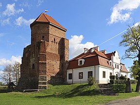
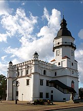
 Pułtusk is one of the oldest towns in Poland.
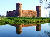 Ciechanów is a former royal city.
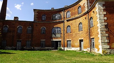
 Żyrardów is one of the youngest cities in the voivodeship, established in 1830.
 Mińsk Mazowiecki is part of the Warsaw metropolitan area.
 Pruszków is part of the Warsaw metropolitan area.


.jpg)


Politics
The Masovian voivodeship's government is headed by the province's voivode (governor) who is appointed by the Polish Prime Minister. The voivode is then assisted in performing his duties by the voivodeship's marshal, who is the appointed speaker for the voivodeship's executive and is elected by the sejmik (provincial assembly). The current voivode of Masovia is Konstanty Radziwiłł.
The Sejmik of Masovia consists of 51 members.
Voivodes
| Term start | Term end | Voivode | Party | Other high offices held | |
|---|---|---|---|---|---|
| 1 January 1999[6] | 20 October 2001 | Antoni Pietkiewicz | AWS | Voivode of Kalisz (1990–1991) | |
| 21 October 2001[7] | 10 January 2006 | Leszek Mizieliński | SLD | Masovian vice-marshal (1998–2001) | |
| 10 January 2006[8] | 17 January 2007 | Tomasz Koziński | PiS | Mayor of Praga-Południe (2002–2006) | |
| 18 January 2007[9] | 1 February 2007 | Wojciech Dąbrowski | PiS | Mayor of Żoliborz (2004–2006) | |
| 15 February 2007[10] | 29 November 2007 | Jacek Sasin | PiS | Deputy PM (since 2019), MP (since 2011) | |
| 29 November 2007[11] | 8 December 2015 | Jacek Kozłowski | PO | Vice-Chairman of Poland 2050 | |
| 8 December 2015 | 11 November 2019 | Zdzisław Sipiera | PiS | Mayor of Wola (2005–2006), MP (2019–2023) | |
| 25 November 2019 | 31 March 2023 | Konstanty Radziwiłł | PiS | Minister of Health (2015–2018), MP (2015–2019) | |
| 31 March 2023 | 13 December 2023 | Tobiasz Bocheński | PiS | Łódź Voivode (2019-2023) | |
| 13 December 2023 | Incumbent | Mariusz Frankowski | PO | Deputy director of strategy and regional development of the Masovian Vovoideship in the Marshal's Office (2007-2011) Warsaw city councilor (2018-2023), | |
Protected areas

Protected areas in Masovian Voivodeship include one National Park and nine Landscape Parks. These are listed below.
- Kampinos National Park (a UNESCO-designated biosphere reserve)
- Bolimów Landscape Park (partly in Łódź Voivodeship)
- Brudzeń Landscape Park
- Bug Landscape Park
- Chojnów Landscape Park
- Górzno-Lidzbark Landscape Park (partly in Kuyavian-Pomeranian and Warmian-Masurian Voivodeships)
- Gostynin-Włocławek Landscape Park (partly in Kuyavian-Pomeranian Voivodeship)
- Kozienice Landscape Park
- Masovian Landscape Park
- Podlaskie Bug Gorge Landscape Park (partly in Lublin Voivodeship)
Historical

Masovian Voivodeship (1526–1795)
Masovia Voivodeship, 1526–1795 (Polish: Województwo Mazowieckie) was an administrative region of the Kingdom of Poland, and of the Polish–Lithuanian Commonwealth, from the 15th century until the partitions of the Polish-Lithuanian Commonwealth (1795). Together with Płock and Rawa Voivodeships, it formed the province (prowincja) of Masovia.
Masovian Voivodeship (1816–1837)
Masovian Voivodeship was one of the voivodeships of Congress Poland. It was formed from the Warsaw Department and transformed into the Masovia Governorate.
Transport
,_%C5%BBmigr%C3%B3d,_2015-12-05.jpg)
Three major international road routes pass through the voivodeship: Cork–Berlin–Poznań–Warszawa–Minsk–Moscow–Omsk (European route E30), Prague–Wrocław–Warsaw–Białystok–Helsinki (E67) and Pskov–Gdańsk–Warsaw–Kraków–Budapest (E77).
Currently, there are various stretches of highways in the area, with the A2 highway connecting the region, and therefore the capital city, with the rest of Europe. The highway passes directly through the voivodeship from west to east, connecting it with Belarus and Germany. However, the A2 is yet to be built east of Warsaw to connect Poland with Belarus. The S7 expressway runs through Poland from the north to the south passing through Warsaw, the S8 connects Warsaw with Białystok, in the neighboring north-eastern province, also forming part of the Via Baltica which heads on to Lithuania, and to Wrocław in the south-west, and the S17 being built to connect Warsaw with Lublin in the south-east and on to Ukraine.
The two main railway carriers operating in the region are the regional Koleje Mazowieckie and nationwide PKP Intercity.
The main international airport in the region is Warsaw Frederic Chopin Airport.
Economy
Masovian Voivodeship is the wealthiest province in Poland. The gross domestic product (GDP) of the province was PLN 596 billion in 2021, accounting for 22.8% of the Polish economic output. GDP per capita adjusted for purchasing power was around PLN123,000in the same year.[12]
Unemployment
The unemployment rate stood at 4.8% in 2017 and was higher than the national and the European average.[13]
| Year | 2006 | 2007 | 2008 | 2009 | 2010 | 2011 | 2012 | 2013 | 2014 | 2015 | 2016 | 2017 |
|---|---|---|---|---|---|---|---|---|---|---|---|---|
| unemployment rate (in %) | 12.3 | 9.1 | 6.0 | 6.0 | 7.4 | 7.9 | 8.0 | 8.0 | 7.2 | 6.4 | 5.5 | 4.8 |
Gallery
 Płock Cathedral, burial site of Polish monarchs
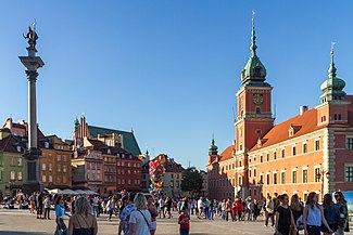
 Saint Catherine of Alexandria church in Radom

 Łyszkiewicz Apartment in Warsaw, birthplace of Marie Curie, presently a museum of the Nobel Prize winner
 Birthplace of Frédéric Chopin in Żelazowa Wola, presently a museum of the composer