Images by user Kbh3rd
These are images that I (Kbh3rd) have either taken (photos) or made (maps and graphs). Unless otherwise noted, I retain the copyright to these images and make them available for use under the terms of the license on the individual image description pages. I've found some being re-used on the web and in print, but usually without proper attribution. A link to the image description page would suffice, or text attribution to "Wikipedian Kbh3rd" or "Kbh3rd at Wikipedia" or such.
This gallery is no longer complete. A fuller collection is found in my category on Wikimedia Commons.
When reusing a copyrighted image with a license that requires attribution, that attribution may be given in one of these ways:
- A hyperlink to the description page for the image on Wikimedia Commons or, if only available there, to the image description page on the English Wikipedia.
- A hyperlink to my Wikipedia user page
- The text "Wikimedia Commons by Kbh3rd" if the image is from Wikimedia Commons
- The text "Wikipedian Kbh3rd" if the image is found on any Wikimedia Commons or on Wikipedia.
Different images have been uploaded with different licenses. I am more than happy to consider different licenses or custom terms to ease reuse for specific purposes.
Photos
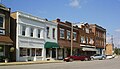 Pacific, Missouri
 Red Cedar Inn
 St. Peter Sandstone
 St. Peter Sandstone
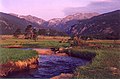 Moraine Park meadow in RMNP
 Looking from Proffit Mtn. to Taum Sauk Mtn.
 Old lime kiln
 How to tie a Carrick mat knot series
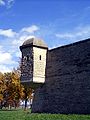 Fort de Chartres bastion
 Fort de Chartres gatehouse
 Ansari X Prize award
 Pizza
Pizza Pizza
Pizza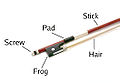 Violin bow
 Katy Trail
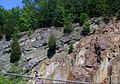 Geologic unconformity
 Taum Sauk power plant
 Elephant Rocks
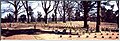 Shiloh Nat'l Cemetery
 Wheeler Peak
 Maramec Iron Works
 Maramec Spring branch
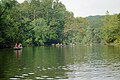 Canoers on the Meramec River
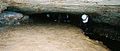 Caving
 Saint Joseph
 Johnson cemetery
 Pork steaks
 Great River Road
 St. Francis River
 Pikes Peak summit
 Barr Trail
 Pikes Peak view
 Knob Lick view
 Grand Gulf
 Government Bridge
 Shovelnose sturgeon
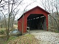 Sandy Creek Covered Bridge
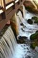
 Sandy Creek Covered Bridge
 Sandy Creek Covered Bridge
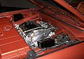 Chrysler Turbine engine
 Barrett's Tunnel
 Silver Charger
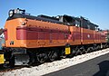 E-2 electric locomotive
 Norfolk & Western 2156
 Light Mikado locomotive
 Camelback locomotive
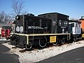 Gas turbine locomotive
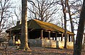 Babler State Park
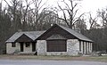 Babler State Park
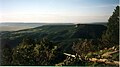 Urraca Mesa
 St. Louis wharf
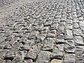 St. Louis wharf cobblestone
 Graham Cave panorama
- Katy Trail bikers
 Graham Cave excavation
 Mingo NWR
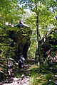 Devils Tollgate
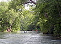 Current River
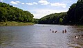 Cuivre River SP
 Dillard Mill SHS
 Dillard Mill SHS
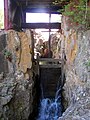 Dillard Mill SHS
 Dillard Mill SHS
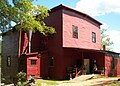 Dillard Mill SHS
 Dillard Mill SHS
 Taum Sauk reservoir construction
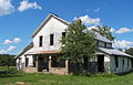 Dillard post office
 Johnson's Shut-ins
 Great River Road
 Old Taum Sauk reservoir
 Shaw Nature Reserve
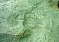 Petroglyph
 Mine LaMotte marker
 St. Francis River
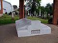 Moses Austin tomb
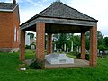 Moses Austin tomb
 Moses Austin tomb
 Sam Baker SP dining lodge
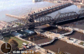 Government Bridge again
 Missouri French cabin
 La Société Historique de la Région de la Vieille Mine
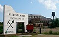 Missouri Mines SHS
 Missouri Mines SHS
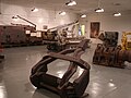 Missouri Mines SHS
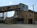 Missouri Mines SHS
 Missouri Mines SHS
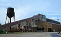 Missouri Mines SHS
 Mina Sauk Falls
 Mina Sauk Falls
 Trail blazes
 St Joachim Church
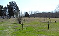 Old Mines cemetery
 Crowley's Ridge SP
 Catalpa tree
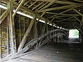 Union covered bridge
 Union covered bridge
 Union covered bridge
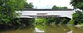 Union covered bridge
 Rte 66 bridge J421
 Virginia Creeper
 Camp Dubois
 Menard House
 Menard House
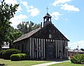 Log church
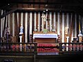 Log church
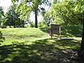 Fort Kaskaskia
 Fort de Chartres magazine
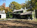 U.S. Grant historic site
 Pickwick Landing view
 Lead smelter
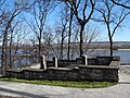 Dunklin gravesite
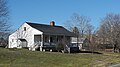 LaMarque house
 French Village church
 Washington S.P.
 Washington S.P.
 St. Joe S.P.
 Arch
Arch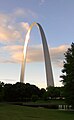 Arch
Arch
 Round Spring
 Kaskaskia bell
 Chester Bridge
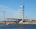 New Mississippi River bridge
 Vilander Bluff
 Ozark Trail
 Meramec River
 Taum Sauk Reservoir
 Greer Spring
 Climatron
 Deutschheim SHS
 Gasconade Co. courthouse
 Fults Hill Prairie et al.
 Crawford Co. courthouse

![Fort Belle Fontaine County Park]]](//upload.wikimedia.org/wikipedia/commons/thumb/2/2d/Belle_Fontaine_Staircase_50.jpg/120px-Belle_Fontaine_Staircase_50.jpg) Fort Belle Fontaine County Park]]
Fort Belle Fontaine County Park]]


.jpg)


![Fort Belle Fontaine County Park]]](https://www.search.com.vn/wiki/en/File:Belle_Fontaine_Staircase_50.jpg)
Panoramas


Video
- Derecho system
- Mina Sauk Falls
- Sun bears
- Perspective tutorial
- Eurasian tree sparrow
Maps
These are presented roughly in the order of creation. I hope there's a trend towards higher quality as I progress. I've written my own tool to create SVG maps directly from GIS data in shapefiles. It's a command-line Perl utility that's not for the faint of heart.
 Rockwoods Reservation
 West County greenbelt
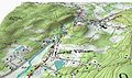 Topo relief example
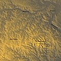 St. Francois Mountains
 Palmdale & surrounding geography
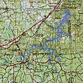 Meramec Lake planned extent
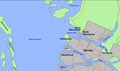 Vancouver area
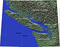 Vancouver Island
 Taum Sauk pumped storage plant
 Isthmus of Tehuantepec
 Weaubleau-Osceola structure
 Weaubleau-Osceola structure
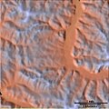 Crooked Creek crater
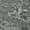 Crooked Creek crater
 Decaturville crater
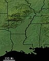 Mississippi embayment
 Crowley's Ridge
 Clingman's Dome
 Shaw' Nature Reserve
 Countries of the Caucasus
 Chechnya and Caucasus
 Ogallala aquifer
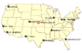 Meades Ranch
 Meads Ranch SVG
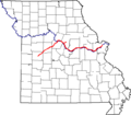 Katy Trail
 Katy Trail SVG
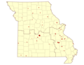 MO DNR lands
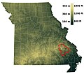 St. Francois Mountans
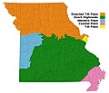 Physiographic map of Missouri
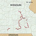 The Ozark Trail
 The Ozark Trail
 Shut-ins and reservoir
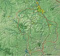 St. Francois Mtn. detail
 Crowley's Ridge, better
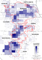 Ogallala withdrawals
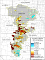 Ogallala Aquifer changes '80-'95
 Ogallala withdrawal rates
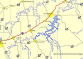 Meramec Lake
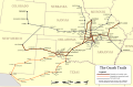 Ozark Trails auto routes
 Ozark Trail (hiking) v3
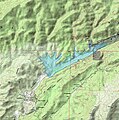 San Francisquito Reservoir
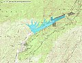 San Francisquito Reservoir
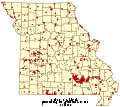 Mo. Dept. of Conservation lands
 Ogallala saturated depth
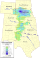 Ogallala saturated depth v.2
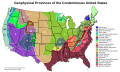 Physiographic provinces
 Physiographic divisions
 MO karst features
 38th parallel structures
 St. Louis rivers
 Dam locations
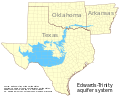 Edwards-Trinity aquifer system
 Lead deposits
 Copper mines
 Missouri geology
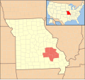 Lead belt
 Lead belt details
 Mississippi Embayment
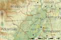 Missouri bootheel topo
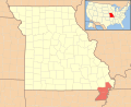 Missouri ootheel locator
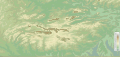 Ouachitas topo
 Ouachita topo locator
 Marathon Uplift
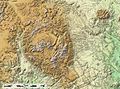 Solitario
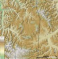 Decaturville Crater v2
 Dept of Conservation regions
 Taum Sauk area
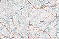 Old Mines
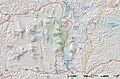 Sam A. Baker SP area
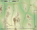 New Mexico bootheel
 Ozark Trail magnus opus
 Golan Heights
 Ouachitas hillshade
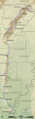 Crowleys Ridge PW
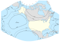 GS-50 projection
 Meramec Lake SVG
 Hicks Dome
 New Madrid quakes
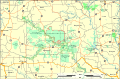 Pryor Pioneer Backcountry
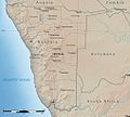 Namibia
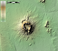 Brukkaros Mountain
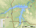 Irondale lake
 Pine Ford lake
 Pine Ford lake
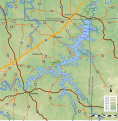 Meramec Park Lake again
 Union Lake
 Crooked Creek crater
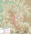 Crooked Creek crater et al.
 Llano Uplift
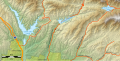 St. Francis Dam area


.png)


_approximate_extent.svg)


Graphs & Charts
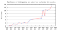 Mentions of Wikipedia on other web sites
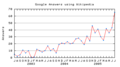 Google Answers using Wikipedia
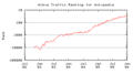 Alexa traffic ranking for Wikipedia
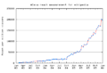 Alexa reach measurement for Wikipedia
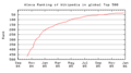 Alexa ranking of Wikipedia among global sites
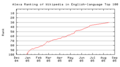 Alexa ranking of Wikipedia among English-language sites
 Usenet posts containing the word Wikipedia
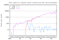 More specific Usenet posts containing Wikipedia
 Google News stories mentioning Wikipedia
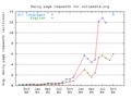 Daily pagae requests for Wikipedia
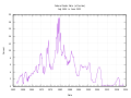 Federal funds rate
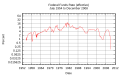 Fed funds rate log scale
 Fed funds rate log scale w/ fractions
 US copper production


_to_October_2004.png)
.svg)
_log_scale.svg)
_log_scale_fractions.svg)

Diagrams
 Belt problem
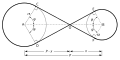 Belt problem relabeled
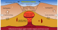 Yellowstone caldera
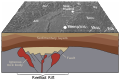 Reelfoot Rift


