Gerardus Mercator | |
|---|---|
 | |
| Born | Geert de Kremer 5 March 1512 |
| Died | 2 December 1594 (aged 82) |
| Nationality | Disputed See text below |
| Education | University of Leuven |
| Known for | 1569 World Map Mercator projection Atlas of 1595. |
| Spouse(s) | Barbara Schellekens (m.1534-d.1586) Gertrude Vierlings (m.1589) |
| Children | Arnold (eldest), Emerentia, Dorothes, Bartholomeus, Rumold, Catharina |
Gerardus Mercator was born 5 March 1512 in Rupelmonde, County of Flanders (in modern-day Belgium). He died 2 December 1594 in Duisburg, Duchy of Cleves (in modern-day Germany). He is renowned as the cartographer who created a world map based on a new projection which represented sailing courses of constant bearing as straight lines—an innovation which to this day enhances the simplicity and safety of navigation. In his own day he was the world's most famous geographer but in addition he had interests in theology, philosophy, history, mathematics and magnetism as well as being an accomplished engraver, calligrapher and maker of globes and scientific instruments.
Unlike other great scholars of the age he travelled little and his knowledge of geography came from his library of over one thousand books and maps, from his visitors and from his vast correspondence (in six languages) with other scholars, statesmen, travellers, merchants and seamen. Mercator's early maps were in large formats suitable for wall mounting but in the second half of his life he produced over 100 new regional maps in a smaller format suitable for binding into his Atlas of 1595. This was the first appearance of the word Atlas in a geographical context but Mercator used it as a neologism for a treatise (Cosmologia) on the creation, history and description of the universe, not simply a collection of maps. He chose the word as a commemoration of a King Atlas of Mauritania whom he considered to be the first great geographer. This King Atlas was a son of the Titan Atlas but the two myths very quickly coalesced.
A large part of Mercator's income came from the sales of his terrestrial and celestial globes. For sixty years they were considered to be the finest in the world and they were sold in such great numbers that there are many surviving examples. This was a substantial enterprise involving making the spheres, printing the gores, building substantial stands, packing and distributing all over Europe. He was also renowned for his scientific instruments, particularly his astrolabes and the sets of "rings" used to study the geometry of astronomy and astrology.
Mercator wrote on geography, philosophy, chronology and theology. All of the wall maps were engraved with copious text on the the region concerned. As an example the famous world map of 1569 is inscribed with over 5000 words in fifteen legends. The 1595 Atlas has about 120 pages of maps and illustrated title pages but a greater number of pages are devoted to his account of the creation of the universe and descriptions of all the countries portrayed. His table of chronology ran to some 400 pages fixing the dates (from the time of creation) of earthly dynasties, major political and military events, volcanic eruptions and earthquakes, and eclipses. He also wrote on the gospels and the old testament.
Mercator was a very devout Christian born into a Catholic family at a time when Luther's Protestantism was gaining ground. He never declared himself as a Lutheran but he was clearly sympathetic and he was accused of heresy (Lutheranye). He spent six months in prison but he emerged unscathed. This period of persecution is probably the major factor in his move from catholic Louvain to a more tolerant Duisberg where he lived for the last thirty years of his life. Walter Ghim, Mercator's friend and first biographer, describes him as sober in his behaviour, yet cheerful and witty in company, and never more happy than in debate with other scholars, but above all he was pious and studious until his dying days.[1]
Mercator's life
Early years

Gerardus Mercator, (pronounced /dʒ[invalid input: 'ɨ']ˈrɑːrdəs mərˈkeɪtər/[2]), was born Geert (or Gerhard) De Kremer (or Cremer), the seventh child of Hubert De Kremer and his wife Emerance. Their home town was Gangelt in the Duchy of Julich but, at the time of the birth, they were visiting Hubert's brother (or uncle[3]) Gisbert De Kremer in the small town of Rupelmonde in the county of Flanders. Hubert was a poor artisan, a shoemaker by trade, but Gisbert, a priest, was a man of some importance in the community. Their stay in Rupelmonde was brief and within six months they returned to Gangelt and there Mercator spent his early childhood.[4]Six years later, in 1518, the Kremers moved back to Rupelmonde,[5] possibly motivated by the deteriorating conditions in Gangelt—famine, plague and lawlessness.[6] Mercator would have attended the local school in Rupelmonde from the age of seven, when he arrived from Gangelt, and there he would have been taught the basics of reading, writing, arithmetic and Latin.
The question of nationality
The nationality of Mercator is contentious. In 1868, just before the 300th anniversary of the famous world map, the Belgian Jean Van Raemdonck had just published a biography of Mercator, the Flemish geographer, in which he presented a speculative Cremer family tree with ancestors in Rupelmonde.[7] In 1869, in Duisberg, Arthur Breusing published a small book on Mercator, the German geographer, in which he claimed that the family was from Gangelt, Mercator was conceived there, and consequently his birth during the visit to Rupelmonde didn't invalidate his German nationality.[8] The debate continued in 1914 when Heinrich Averdunk attacked Raemdonck's 'fictions' and argued that the many occurrences of the name Kremer in Julich in the sixteenth century supported Breusing's claim that the family was German.[9] Today, many Belgians and Germans still claim Mercator as their own, despite the lack of any evidence pertaining to the birthplace and background of the father Hubert. Most modern scholars adopt a neutral position, hesitating to assign a nationality to Mercator, but many popular accounts simply plump for one nation or another without evidence.[10]
's-Hertogenbosch 1526–1530
After Hubert's death in 1526, Gisbert became Mercator's guardian. Hoping that Mercator might follow him into the priesthood he sent the 15 year old Geert to the famous school of the Brethren of the Common Life at 's-Hertogenbosch[11] in the Duchy of Brabant. The Brotherhood and the school had been founded by the charismatic Geert Groote who placed great emphasis on study of the bible and, at the same time, expressed disapproval of the dogmas of the church, both facets of the new "heresies" of Martin Luther propounded only a few years earlier in 1517. Mercator would follow similar precepts later in life—with problematic outcomes.

During his time at the school the headmaster was Georgius Macropedius and under his guidance Geert would study the bible, the trivium (latin, logic and rhetoric) and classics such as the philosophy of Aristotle, the natural history of Pliny and the geography of Ptolemy.[12] All teaching at the school was in Latin and he would read, write and converse in Latin—and give himself a new Latin name, Gerardus Mercator Rupelmundanus, Mercator being the Latin translation of Kremer (or Cremer) which means merchant. The Brethren were renowned for their scriptorum[13] and here Mercator may have encountered the italic script which he employed in his later work. The brethren were also renowned for their thoroughness and discipline, well attested by Erasmus who had attended the school forty years before Mercator.[14]
University of Louvain 1530–1532
From a famous school Mercator moved to the famous University of Louvain, (or Leuven or Löwen) where his full Latin name appears in the matriculation records for 1530.[15] He lived in one of the teaching colleges, the Castle College, and, although he was classified as a pauper, he rubbed shoulders with richer students amongst whom were Andreas Vesalius, Antoine Perrenot de Granvelle, and George Cassander, all destined to fame and all lifelong friends of Mercator.


The general first degree (for Magister) centred on the teaching of philosophy, theology and Greek under the conservative Scholasticism which gave prime place to the authority of Aristotle.[16] Although the trivium was now augmented by quadrivium[17] (Arithmetic, Geometry, Astronomy, Music), their coverage was neglected in comparison with theology and philosophy and consequently Mercator would have to resort to further study of the first three subjects in years to come. Mercator graduated Magister in 1532.
Antwerp 1532–1534
The normal progress for an able Magister was to go on to further study in one of the four faculties at Louvain: Theology, Medicine, Canon Law and Roman Law. His uncle Gisbert might have hoped that Mercator would go further in theology and train for the priesthood but Mercator did not: like many twenty year old young men he was having his first serious doubts. The problem was the contradiction between the authority of Aristotle and his own biblical study and scientific observations, particularly in relation to the creation and description of the world. Such doubt was heresy at the University and it is quite possible that he had already said enough in classroom disputations to come to the notice of the authorities:[18] fortunately he did not put his sentiments into print. He left Louvain for Antwerp,[19] there to devote his time to contemplation of philosophy. This period of his life is clouded in uncertainty.[20] He certainly read widely but only succeeded in uncovering more contradictions between the world of the Bible and the world of geography, a hiatus which would occupy him for the rest of his life.[21] He certainly could not effect a reconciliation between his studies and the world of Aristotle.


During this period Mercator was in contact with the Franciscan monk Monachus who lived in the monastery of Mechelen.[22] He was a controversial figure who, from time to time, was in conflict with the church authorities because of his humanist outlook and his break from Aristotelian views of the world: his own views of geography were based on investigation, observation and observation. Mercator must have been impressed by Monachus, his map collection and the famous globe that he had prepared for Jean Carondelet, the principle advisor of Charles V.[23] The globe was constructed by the Louvain goldsmith Gaspar van der Heyden (Gaspar a Myrica c1496–c1549) with whom Mercator would be apprenticed. These encounters may well have provided the stimulus to put aside his problems with theology and commit himself to geography. Later he would say that "Since my youth, geography has been for me the primary subject of study. I liked not only the description of the Earth but the structure of the whole machinery of the world."[24]
Louvain 1534–1543
Towards the end of 1534 the 22 year old Mercator arrived back in Louvain and threw himself into the study of geography, mathematics and astronomy under the guidance of Gemma Frisius.[25] Mercator was completely out of his depth but, with the help and friendship of Gemma, who was only four years older, he had succeeded in mastering the elements of mathematics within two years and the university granted him permission to tutor private students. Gemma had designed some of the mathematical instruments used in these studies and Mercator soon become adept in the skills of their manufacture: practical skills of working in brass, mathematical skills for calculating the scales and engraving skills to produce the finished work.

Gemma and Gaspar Van der Heyden had completed a terrestial globe in 1529 but by 1535 they were planning a new globe embodying new geographical discoveries.[26] The gores were to be engraved on copper, instead of wood, and the text was to be in an elegant italic script instead of the heavy Roman lettering of the early globes. The globe was a combined effort: Gemma researched the content, Van der Heyden engraved the geography and Mercator engraved the text, including the cartouche which exhibited his own name in public for the first time. The globe was finished in 1536 and its celestial counterpart appeared one year later. These widely admired globes were costly and their wide sales provided Mercator an income which, together with that from mathematical instruments and from teaching, allowed him to marry and establish a home. His marriage to Barbara Schellekens was in September 1536 and Arnold, the first of their six children, was born a year later.
The arrival of Mercator on the cartographic scene would have been noted by the cognoscenti who purchased Gemma's globe—the professors, rich merchants, prelates, aristocrats and courtiers of the emperor Charles V at nearby Brussels. The commissions and patronage of such wealthy individuals would provide another source of income throughout his life. His connection with this world of privilege was through his fellow student Antoine Perrenot, soon to be appointed Bishop of Arras, and Antoine's father, Nicholas Perronet, the Chancellor of Charles V.
Working alongside Gemma whilst they were producing the globes, Mercator would have witnessed the process of progressing geography: obtaining previous maps, comparing and collating their content, studying geographical texts and seeking new information from correspondents, merchants, pilgrims, travellers and seamen. He put his newly learned talents to work in a burst of productivity. In 1537, aged only 25, he established his reputation with a map of the Holy Land which was researched, engraved, printed and partly published by himself.


A year later, in 1538, he produced his first map of the world usually referred to as Orbis Imago; in 1539/40 a map of Flanders, in 1541 a terrestrial globe. All four were received with acclaim[27] and they sold in large numbers. The dedications of three of these works witness Mercator's access to influential patrons: the Holy Land was dedicated to Franciscus van Cranevelt who sat on the Great Council of Mechelen, the map of Flanders was dedicated to the Emperor himself and the globe was dedicated to Nicholas Perronet, the emperor's chief advisor. The dedicatee of the world map was more surprising: Johannes Drosius, a fellow student who, as an unorthodox priest, may well have been suspected of Lutheran heresy. Given that the symbolism of the Orbis Imago map also reflected a Lutheran view point, Mercator was treading on dangerous ground.[28]


In between these works he found time to write Literarum latinarum, a small instruction manual on the italic script.[29] The Italic script (or chancery cursive) reached the Low Countries from Italy at the beginning of the sixteenth century and it is recorded as a form of typescript in Louvain in 1522.[30] It was much favoured by humanist scholars who enjoyed its elegance and clarity as well as the rapid fluency that could be attained with practice but it was not employed for formal purposes such as globes, maps and scientific instruments (which typically used Roman capitals or gothic script). Mercator first applied the italic script to the globe of Gemma Frisius but thereafter to all his works with ever increasing elegance. Sometimes, particularly in elaborate titles the elegance swamps the content: the word LITERARUM on his own title page is not easily distinguished.
In 1542 the thirty year old must have been feeling confident about his future prospects when he suffered two major interruptions to his life. First, in 1542, Louvain was besieged by the troops of the Duke of Cleves, a Lutheran sympethiser who, with French support, was set on exploiting unrest in the Low Countries to his own ends. Ironically it was this same Duke to whom Mercator would turn ten years hence. The siege was lifted but the financial losses to the town and its traders, including Mercator, were great. The second interruption was potentially deadly: the Inquisition called.
Religion and persecution, 1543
At no time in his life did Mercator claim to be a Lutheran but there are many hints that he had sympathies in that direction. As a child, called Geert, he was surrounded by adults who were possibly followers of Geert Groote, who placed meditation, contemplation and biblical study over ritual and liturgy—and who also founded the school of the Brethren of the Common Life at 's-Hertogenbosch. Study of the bible was something that would be central to Mercator's life and it was the cause of the early philosophical doubts that caused him so much trouble during his student days, doubts which some of his teachers would have considered to be tantamount to heresy. His visits to the free thinking Franciscans in Mechelen may have attracted the attention of the theologians at the university, amongst whom were two senior figures of the Inquisition, Jacobus Latomus and Ruard Tapper. The words of the latter on the death of heretics convey the atmosphere of that time:
It is no great matter whether those that die on this account be guilty or innocent, provided we terrify the people by these examples; which generally succeeds best, when persons eminent for learning, riches, nobility or high stations, are thus sacrificed.[31]
It may well have been these Inquisitors who, in 1543, decided that Mercator was eminent enough to be sacrificed. His name appeared on a list of 43 Lutheran heretics which included an architect, a sculptor, a former rector of the university, a monk, three priests and many others. All were arrested except Mercator who had left Louvain for Rupelmonde on business concerning the estate of his recently deceased great uncle Gisbert. That made matters worse for he was now classified as a fugitive who, by fleeing arrest, had proved his guilt.

Mercator was apprehended in Rupelmonde and imprisoned in the castle. He was accused of suspicious correspondence with the Franciscan friars in Mechelen but no incriminating writings were uncovered in his home or at the friary in Mechelen. At the same time his well placed friends petitioned on his behalf,[32] but whether his friend Antoine Perronet was helpful is unknown: Perronet, as a bishop, would have to support the activities of the Inquisition. After seven months Mercator was released for lack of evidence against him but others on the list suffered torture and execution: two men were burnt at the stake, another was beheaded and two women were entombed alive.[33]
Louvain 1543–1552
Mercator never committed any of his prison experiences to paper; all he would say[34] was that he had suffered an unjust persecution. For the rest of his time in Louvain his religious thoughts were kept to himself and he turned back to his work. His brush with the Inquisition did not affect his relationship with the court and Nicholas Perrenot recommended him to the emperor as a maker of superb instruments. The outcome was an Imperial order for globes, compasses, astrolabe and an astronomical ring.[35] They were ready in 1545 and the Emperor granted the royal seal of approval to his workshop. Sadly they were soon destroyed in the course of the Emperor's military adventures and Mercator had to construct a second set. He also returned to his work on a large up-to-date and highly detailed wall map of Europe[36] which was, he had already claimed on his 1538 world map, very well advanced. It proved to be a vast task and he, perfectionist that he was, seemed unable to cut short his ever expanding researches and publish: as a result it was to be another ten years before the map appeared.
The final success in Louvain was the 1551 celestial globe, the partner of his terrestial globe of 1541. From that date they were sold as a pair. Given the relatively large number (22) of pairs still in existence the numbers sold must have been large, as is borne out by the records of the Plantin Press which show that the globes were in demand until the end of the century even though the terrestial globe was never updated.[37] Terrestial and celestial globes were a necessary adjunct to the intellectual life of rich patrons[38] and academics alike, for both astronomical and astrological studies, two subjects which were still entwined in the sixteenth century.
Duisberg 1552–1594
In 1552 Mercator moved from Louvain to Duisberg in the Duchy of Cleves. The apparent motivation was an invitation from the Duke Wilhelm to become a teacher at a proposed new university[39] but it is equally probable that Mercator simply wished to move to a more sympathetic and safer religious environment. Over the years to come many more would flee from the oppressive Catholicism of Brabant and Flanders to tolerant cities such as Duisberg and Amsterdam. Mercator was quickly established as a man of standing in the town: an intellectual of note, a publisher of maps, a maker of instruments and globes,[40] he was on good terms with the wealthier citizens and a close friend of Walter Ghim, the twelve times mayor. Mercator never accepted the privileges and voting rights of a burgher which came with military responsibilities conflicting with his pacifist and neutral stance. The peaceful city, untroubled by political and religious unrest, was the perfect place for the flowering of his talent.
In 1554 Mercator published the long awaited wall map of Europe, dedicating it to his friend, now Cardinal, Antoine Perronet de Granvelle. He had worked at it for more than twelve years, collecting, comparing, collating and rationalising a vast amount of data and the result was a map of unprecedented detail and accuracy.[41] It "attracted more praise from scholars everywhere than any similar geographical work which has ever been brought out."[42] It also sold in large quantities for much of the rest of the century with a second edition appearing in 1572.[43]
Around this time Mercator received and executed a very special order for the Emperor: a pair of small globes, the inner ("fist-size") Earth was made of wood and the outer celestial sphere was made of blown crystal glass engraved with diamond and inlaid with gold.[44][45] He presented them to the Emperor in Brussels who awarded him the title Imperatoris domesticus (a member of the Imperial household). The globes are lost but a short treatise, written for Charles V, on the use of globes and instruments survives.[46] Yet another title awarded to him was that of Cosmographer to Duke Wilhelm. There is no precise definition of this term other than that it certainly comprehends the disciplines of geography and astronomy but it may also extend to astrology and chronology (as a history of the world from the creation). All of these were among Mercator's accomplishments but his patron's first call on his services would be as a mundane surveyor of the disputed boundary between the Duke's territory of the County of Mark and the Duchy of Westphalia.
The proposed university in Duisberg failed to materialize[47] and in its place citizens established (in 1559) a (pre-university) Akademisches Gymnasium where Mercator was invited to teach mathematics with cosmography. He also engineered the appointment of his friend Jan Vermeulen (Molanus) as rector in 1560 and then blessed Vermeulen's marriage to his daughter Emerantia. His sons were now growing to manhood and he encouraged them to embark on his own profession. Arnold, the eldest, had produced his first map (of Iceland) in 1558 and would later take over the day-to-day running of Mercator's enterprises.[48] Bartholemew, his second son, showed great academic promise and in 1562 (aged 22) he took over the teaching of his father's three year long lecture-course—after Mercator had taught it once only! Much to Mercator's sadness Bartholemew died young, in 1568 (aged 28). Rumold, the third son, would spend a large part of his life in London's publishing house providing for Mercator a vital link to the new discoveries of the Elizabethan age. In 1587 he returned to Duisberg and later, in 1594, it fell to his lot to publish Mercator's works posthumously.
In 1564 Mercator published his map of Britain, a map of greatly improved accuracy which far surpassed any of his previous representations. The circumstances were unusual. In the text engraved on the map he pointedly denies responsibility for the map's authorship and claims that he is merely engraving and printing it for a "very good friend".[49] Moreover, for the only time in his career, there is no dedicatee for the map. The reasons for such reticence become obvious when the political nature of the map is appreciated: the map is distinctly pro-catholic. It appears to have been smuggled out of England, it shows all the catholic religious foundations and omits those created by Protestant Henry VIII, it's text demeans the history of England and lauds that of Ireland and Scotland. As an accurate guide for a future catholic invasion of England by Phillip II of Spain it would have been invaluable.[50]
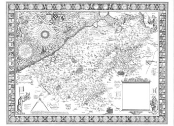
As soon as the map of Britain was published Mercator was invited to undertake the surveying and mapping of Lorraine (Lotharingia). This was a new venture for him in the sense that never before had he collected the raw data for a new regional map. He was then 52, already an old man by the norms of that century, and he may well have had reservations about the undertaking. Accompanied by his son Bartholemew, Mercator meticulously triangulated his way around the forests, hills and steep sided valleys of Lorraine, difficult terrain as different from the Low Countries as anything could be. But something happened: he never committed anything to paper but he must have talked to his friend Ghim who would later write:. "The journey through Lorraine gravely imperilled his life and so weakened him that he came very near to a serious breakdown and mental derangement as a result of his terrifying experiences."[51] Mercator returned home to convalesce leaving Rumold to complete the survey. No map was published at the time but Mercator did provide a single drawn copy for the duke and later he would incorporate this map into his atlas.
The trip to Lorraine in 1564 was a set back for his health but he soon recovered and proceeded to embark on his greatest project yet, a project which would extend far beyond his cartographic interests. The first element was the Chronologia (Mercator 1569), a list of all significant events since the beginning of the world compiled from his literal reading of the bible and no less than 123 other authors of genealogies and histories of every empire that had ever existed.[52] The dates were fixed by reference to all recorded solar and lunar eclipses and related to Babylonian, Roman and other calendars. This huge task (400 pages) was accomplished only four years later but it is probable that he had been compiling information over many previous years. That was only the start of his plans for, as the Chronologia developed, he began to outline an even wider project, the Cosmographia, a description of the whole Universe: (1) the creation of the world; (2) the description of the heavens; (3) the description of the earth comprising modern geography, the geography of Ptolemy and the geography of the ancients; (4) genealogy and history of the states; and (5) chronology. In his mid fifties he was outlining a scheme that would take more than one man's life span. The Chronologia had already appeared in 1569, or 5535 years after the Creation accordining to his chronology. It was greeted with acclaim by scholars throughout Europe and Mercator himself considered it to be his greatest achievement up to that time. On the other hand the Catholic Church placed the work on the Index Librorum Prohibitorum (List of Prohibited Books) because Mercator included the deeds of Martin Luther. Had he published such a work in Louvain he would again be laying himself open to charges of heresy.[53]
As the Chronologia was going to press in 1569, Mercator also published what was to become his most famous map: Nova et Aucta Orbis Terrae Descriptio ad Usum Navigantium Emendate Accommodata, (A new and more complete representation of the terrestrial globe properly adapted for use in navigation).[54] As mariners had started to explore the oceans in the Age of Discovery the problem of accurate navigation had become more pressing. Using charts and maps based on a simple Equirectangular projection (which used equal uniform scales along meridians and parallels) they could be a hundred miles out after a long voyage because a course of constant direction at sea (a rhumb line) did not correspond to a straight line on such a chart. Mercator's solution was to make the scale of his chart increase with latitude in a very special way such that the rhumb lines became straight lines on his new world map. Exactly how he arrived at the required solution is not recorded in any of his own written works but modern scholarship[55] suggests that he used the tables of rhumbs devised by Pedro Nunes. The large size of what was a wall map meant that it did not find favour for use on board ship but, within a hundred years of its creation, the Mercator Projection became the standard for marine charts throughout the world and continues to be so used to the present day. It's use as general world map is less justified and many better projections are available.[56]
Around this time the Chancellor of Duke Wilhem approached Mercator and asked him to prepare an atlas of Europe which would assist in the planning of a grand tour of Europe by his patron's son, the crown prince Johannes. This unique collection is an important source for Mercator's earlier maps.
Apart from a revision of the map of Europe in 1572 there would be no more large wall maps and Mercator began to address the tasks that he had outlined in the Chronologia. First was a new definitive version of Ptolemy's maps. That he should wish to do so may seem strange given that, at the same time, he was planning very different modern maps and others, such as his friend Abraham Ortelius, had forsaken Ptolemy completely. It was almost an act of reverence, a final epitaph for the Ptolemy who had inspired Mercator's love of geography early in his life. He compared the great many editions of the Ptolemy's written Geographia, which described his two projections and listed the latitude and longitude of the places, as well as the many different versions of the printed maps which had appeared over the previous one hundred years, all with errors and accretions. Once again, this self imposed diligence delayed publication and the 28 maps of Ptolemy appeared in 1578, after an interval almost ten years. It was accepted by scholars as the "last word", literally and metaphorically, in a chapter of geography which was closed for good.[57]
Mercator now turned to the modern maps, as author but no longer engraver: the practicalities of production of maps and globes had been passed to his sons and grandsons. In 1585 he issued a collection of 51 maps covering France, the Low Countries and Germany. Other maps may have followed in good order had not the misfortunes of life intervened: his wife Barbara died in 1586 and his eldest son Arnold died in the following year so that only Rumold and the sons of Arnold were left to carry forward his business. In addition the time available he had available for cartography was reduced by a burst of writing on philosophy and theology: a substantial written work on the Harmonisation[58] of the Gospels (Mercator 1592) as well as commentaries on the epistle of St. Paul and the book of Ezekiel.
In 1589, at the age of 77, Mercator had a new lease of life. He took a new wife, Gertrude Vierlings, the wealthy widow of a former mayor of Duisberg, (and at the same time married Rumold to her daughter). A second collection of 22 maps was published covering Italy, Greece and the Balkans. This volume has a noteworthy preface for it includes the first mention of Atlas as a mythical king of Mauretania, a son of the globe-bearing Titan of the same name. "I have set this man Atlas," explained Mercator, "so notable for his erudition, humaneness, and wisdom as a model for my imitation." [59] One year later disaster struck: Mercator had a stroke which left him greatly incapacitated. He struggled on with the assistance of his family trying to complete the remaining maps, the ongoing theological publications and a new treatise on the Creation of the World. This last work, which he did succeed in finishing, was the climax of his life's activities, the work which, in his own opinion, surpassed all his other endeavours and provided a framework and rationale for the complete atlas. It was also his last work in a literal sense for he died after two further strokes in 1594.
Epitaph and legacy
Mercator was buried in the church of St. Salvatore in Duisberg where there is a fine memorial which was erected about fifty years after his death. The main text of the epitaph is a conventionally respectful summary of his life but, on the base of the memorial, there is a witty epigram (which additionally shows how the myths of Mercator's King Atlas and Atlas the Titan had already merged):
To the reader: whoever you are, your fears that this small clod of earth lies heavily on the buried Mercator are groundless; the whole Earth is no burden for a man who had the whole weight of her lands on his shoulders and carried her as an Atlas.
Following Mercator's death his family prepared the Atlas for publication—in four months. It was, after all, a hoped for source of the income that was needed to support them. Sadly The atlas was not an immediate success. One reason may have been that it was incomplete: Spain was omitted and there were no detailed maps outside Europe. Rumold avowed that a second volume would attend to these deficiencies but it was not forthcoming. The whole project lost its momentum; Rumold, who was 55 years old in 1595, was in decline and he died in 1599. His family did produce another edition in 1602 but only the text was reset, there were no new maps.[60] Another reason for the failure of the Atlas was the strength of the continuing sales of the Theatrum of Ortelius. Alongside the sumptuous maps of that book Mercator's un-ornamented new maps looked very unattractive. Despite the death of Ortelius in 1598 the Theatrum flourished: in 1602 it was in its thirteenth Latin edition as well as editions in Dutch, Italian, French German and Spanish. The Mercator atlas seemed destined for oblivion.
The family was clearly in some financial difficulty for, in1604, Mercator’s library of some 1000 books was sold at a public auction in Leyden (Netherlands). The only known copy of the sale catalogue[61] perished in the war but fortunately a manuscript copy had been made by Van Raemdonck in 1891 and this was unearthed in 1987[62]. Of the titles identified there are 193 on theology (both Catholic and Lutheran), 217 on history and geography, 202 on mathematics (in its widest sense), 32 on medicine and over 100 simply classified (by Basson) as rare books. The contents of the library provide an insight into Mercator's intellectual studies but the mathematics books are the only ones to have been subjected to scholarly analysis: they cover arithmetic, geometry, trigonometry, surveying, architecture, fortification, astronomy, astrology, time measurement, calendar calculation, scientific instruments, cartography and applications.[63][64] Only one of his own copies has been found—a first edition of Copernicus' De revolutionibus orbium coelestium annotated in Mercator's hand: this is held by Glasgow University.
The catalogue doesn't mention any maps but it is known that the family sold the copper plates to Jodocus Hondius in 1604. He transformed the atlas. Almost 40 extra maps were added (including Spain and Portugal) and in 1606 a new edition appeared under his name but with full acknowledgement that the bulk was created by Mercator. The title page now included a picture of Hondius and Mercator together although they had never met. Hondius was an accomplished business man and under his guidance the Atlas was an enormous success. Hondius (and son) produced 29 editions between 1609 and 1641, including one in English. In addition they published the atlas in a compact form, the Atlas Minor,[65] which meant that it was readily available to a wide market. As the editions progressed Mercator's theological comments and his map commentaries disappeared from the atlas and images of King Atlas were replaced by the Titan Atlas. By the final edition the number of his maps in the atlas declined to less than 50 as updated new maps were added. Eventually the atlas ran its course and the publications of new map-makers such as Joan Blaeu and Frederik de Wit took over.
Mercator's Ptolemaic editions and his theological writings were in print for many years after the demise of the atlas but they too disappeared into oblivion and it was the Mercator projection which emerged as his sole and greatest legacy. His construction of a chart on which the constant courses of mariners appeared as a straight line ultimately revolutionized the art of sailing. Mercator left no hints to his method of his construction and it was Edward Wright who first clarified the method in his book Certaine Errors (1599)—the relevant error being the erroneous belief that straight lines on conventional charts corresponded to constant courses. Wright's solution was a numerical approximation and it was another 70 years before the projection formula was derived analytically. He (Wright) published a new world map based on the Mercator projection, also in 1599. Slowly, but steadily, charts using the projection appeared throughout the first half of the seventeenth century and by the end of that century chart makers all over the world were using nothing but the Mercator projection, their aim to show the oceans and the coastlines in detail without concern for the continental interiors. At some stage the projection made the unfortunate leap to portrayal of the continents and it eventually became the canonical description of the world, despite its manifest distortions at high latitudes. Recently Mercator's projection has been overtaken for representations of the world but it remains paramount for nautical charts and its use stands as his enduring legacy.
Trivia. Many cities have a statue of Mercator.[66] His name has been attached to ships[67], buildings, universities,[68] insurance companies, small businesses, pizzerias, streets, schools and more. His image appears constantly in Belgium and Germany. In the latter it has been used on postage stamps (which show an incorrect version of the Mercator Projection).[69] He has been modelled in sand and turned into a giant puppet.[70] He has been the subject of a Google Doodle.[71]
Museums.There are two museums dedicated primarily to Mercator:
Preparation
In 1994, the Mercator fonds and Paribas published a facsimile edition of a transcription of the only surviving catalogue of the 1604 auction. This catalogue had belonged to the Bibliothek des Börzenvereins der Deutschen Buchhändler [Library of the Union of German Booksellers],Leipzig in 1885, and it was lost in the last war. Early in 1891 the catalogue had been on loan to Ghent University where it had been copied for Dr Jan Van Raemdonck
chapter in book World of Innovations ISBN 9781443871532 (this is the outfit who have a chapter by Horst)
In 1994 the Koninklijke Oudheidkundige Kring van het Land van Waes or KOKLW [Royal Historical Circle of the Waes Region], organised an exhibition a catalogue entitled Mercator en zijn Boeken [Mercator and his books]
Portrait text
Great thanks are owed to the Pelusian (I.e. Ptolemaic) charts, and great thanks to you, Mercator, for having at last surpassed that ancient labor, and for having shown new stretches of the earth and sea, and the great, all-containing heavens. By J. Vivian. At the base: Gerardus Mercator of Rupelmonde at the age of 62—Frans Hogenburg made this portrait out of affection for him. 1574.
Sphère terrestre et sphère céleste / de Gérard Mercator, 1875
Cosmographical meditations upon the creation of the universe, and the universe as created.
M had forgotten his projection
5 extra maps of Atlas maps use basically the data that Mercator had portrayed on his 1569 world map—with all their faults still evident, such as the bulge on the the west coast of South America, the mythical polar regions, the 'certain' southern polar continent. The projections used in these maps are varied but none uses Mercator's new projection.
Mercator's works
Globes and Instruments
- 1541/1551 Terrestrial and celestial globes
- Over twenty pairs of globes are still in existence. Both of the globes and their un-pasted gores may be examined in high resolution. [72][73] A full description of the globes may be found online in Stevenson.[74] They also described and set in a wider context in the article by Dekker in the History of Cartography, also available online.[75]
- The terrestrial globe is significant in conjecturing that North America is separated from Asia, unlike the globe of Monachus. Mercator also added a feature of special value to seamen: from the numerous compass or wind roses he drew rhumb lines rather than great circles. The rhumb lines correspond to constant sailing directions but on the spherical globe they appear as spirals. The globe was manufactured in great numbers but it was never updated. The celestial globe was up to date in using the information provided by Copernicus.
- Mercator, Gerhard; Smet, Antoine de (1968), Les sphères terrestre et céleste de Gérard Mercator, 1541 et 1551 : reproductions anastatiques des fuseaux originaux, Editions Culture et Civilisation, retrieved 1 March 2016. See also the web site of the Galileo Museum globes
{{citation}}: External link in|postscript=
- Woodward, David (1987), The History of Cartography, Volume 3, Cartography in the European Renaissance, University of Chicago, ISBN 9780226907321, OCLC 166342669. The article on Globes in Renaissance Europe by Dekker is available online.
{{citation}}: External link in|postscript=
http://prints.rmg.co.uk/artist/27901/gemma-frisius 8 images at GreenwichImageD7958-2ObjectGLB0135
- 15
- 15
- 15
- 15
- Stevenson, Edward Luther (1921), Terrestrial and celestial globes : their history and construction, including a consideration of their value as aids in the study of geography and astronomy (Volume 1, to 1600), Published for the Hispanic Society of America by the Yale University Press, OCLC 3283004. A facsimile of this book is available at Archive.org and a modern (clearer) transcription is available at Scientificlib.com
{{citation}}: External link in|postscript=
Maps
- 1537 Holy land View online. A later 1630 copy.
- Amplissima Terrae Sanctae descriptio ad utriusque Testamenti intelligentiam. (A description of the Holy Land for understanding both testaments). Dedicated to Franciscus van Cranevelt. Size; 67x122 cm. in 6 sheets. Two copies extant: one at the library of Perugia and another at the Bibliotheque Nationale de France (link above). Based on a map by the lutheran Jacob Ziegler. Mercator's map shows the route of the Israelites from Egypt to the Promised Land. The title discloses a hope of helping people in their Bible studies, a Lutheran notion that would have aroused the suspicions of the inquisition.
- 1538 World Map High res image online. [File:Quam hic vides orbis imagine(m) lector ca(n)dide ea(m) ut posteriore(m) ita ^ eme(n)datiorem ijs que(...) - Norman B. Leventhal Map Center at the BPL.jpg|thumb|300px|Copy by Antonio Salamanca]
- This wall map has no title but it is normally referred to as Orbis Imago (from the first sentence of the central legend). Size: 54.5x35.5 cm. Dedicated to Johannes Drosius. Two copies extant: one at the American Geographical Society Library (link above), and another at the New York Public Library. The first map identifying North American and South America. The map was a slightly modified copy of a 1531 world map (and its text) by Oronce Fine. The double cordiform projection[76], may well have been chosen because of its relationship to aspects of Lutheran beliefs.[77]
- 1540 Flanders (Flandria). Original, copy by Ortelius, 1595 atlas, 1613 atlas.
- Wall map 96 by 125 cm. in 9 sheets. Dedicated to Charles V. This map was commissioned by merchants of Ghent who intended that it should be presented to Charles V in the forlorn hope that it might divert the wrath of the Emperor after their rebellion. It would be a more respectful replacement of a 1538 map by Pieter Van der Beke which had stressed the defiant independence of the Flemish cities.[78] The map is remarkably accurate and it is presumed to be based on a triangulation of Flanders by Jacob van Deventer. A single original is extant and may be inspected in the Plantin-Moretus Museum: it also appeared in the atlas of 1585 and in the Theatrum of Ortelius.
- 1554 Europe Portions in 1570 Atlas, 1595 atlas version
- Europae descriptio. Wall map 165 by 135 cm. on 15 sheets. Dedicated to Antoine Perrenot. No known copy of the whole map has been discovered but several copies of the map were cut and re-assembled (by Mercator) for inclusion in the unique Atlas of Europe from 1570–72. They are available in facsimile.[79] The map used a cordiform projection. It was revised by Mercator in 1572 and again by Rumold for the 1595 atlas.
- 1564 British Isles, 1570 atlas Individual sheets, Ortelius copy, de Jode copy.
- Anglia & Scotiae & Hibernie nova descriptio. Wall map 92 by 122 cm. on 8 sheets. Mercator states that a friend, possibly Antoine Perronet, had requested that he engrave this map from a manuscript copy, possibly by John Elder, a disaffected Scottish catholic priest.[80] Several copies of this map were cut and re-assembled for the atlas of Europe. The map is oriented with west at the top. 4 copies known
- 1564 Lorraine (Lotharingia) [From 1585 atlas.]
- A map commissioned by Duke René of Lorraine. The map was never published but it may be assumed that it was similar to the map of Lorraine which appears in the Atlas of 1585.
- 1569 world map Full details
- 1570–1572 Atlas of Europe. View online version 1 and version 2.
- A unique collection of maps assembled in the early 1570s, many of which are assembled from portions of Mercator's earlier maps: 9 constructed from Europe (1554), 6 from British Isles (1564) and 2 from the world map (1569). There are also 2 manuscript maps of Mercator and 30 maps are from the Theatrum Orbis Terrarum of Abraham Ortelius.) The dedication is to the Chancellor of Duke Wilhem and the atlas may have been intended to help with planning for a grand tour of Europe by his patron's son, the crown prince of Cleves. The atlas was re-bound into its present form in 1771. (Note that Mercator did not term this collection of maps as an atlas.)
- 1578 Ptolemy's Geographia View online.
- Tabulae geographicae Cl. Ptolemaei ad mentem auctoris restitutis ac emendatis. (Geographic maps according to Claudius Ptolemy, drawn in the spirit of the author and expanded by Gerard Mercator) Mercator's definitive version of Ptolemy's 28 maps. A second edition including the revised text of Geographia was published in 1584. Geographiae Libri Octo : recogniti iam et diligenter emendati. Example map: Britain
- 1585 Atlas Galliae , Belgii Inferioris, Germaniae. (To view see 1595 Atlas).
- The first collection of 51 modern maps: 16 of France (with Switzerland), 9 corresponding to Belgium and the Netherlands and 26 of Germany. The three sections, each with a title page, dedication and supporting text, were sold together and separately. (Mercator did not term this collection of maps as an atlas.)
- 1589 Atlas Italiae, Sclavoniae , Grecia. (To view see 1595 Atlas).
- A second collection of 23 modern maps: 16 of Italy (including Corsica), 3 of Styria and the other Balkan countries, 4 of Greece. (Once again Mercator did not term this collection of maps as an atlas but in the preface he introduces Atlas as a mythical King of Mauretania—a learned philosopher, mathematician and astronomer, credited with the making of the first globe.) This collection has a fulsome dedication to Prince Ferdinando de’ Medici to whom Mercator attributes ancestry from King Atlas.
- 1595 Atlas (published posthumously by Rumold Mercator) View online.Translation online.
- Atlas Sive Cosmographicae Meditationes de Fabrica Mundi et Fabricati Figura. (Atlas or cosmographical meditations upon the creation of the universe, and the universe as created.) This is the first time that the name Atlas is used as a title of a collection of maps. Many library copies are available worldwide. There are also a number of freely available digital volumes such as those at the Library of Congress and Darlington Library (University of Pittsburg). In addition high resolution facsimiles are available on a CD published by Octavo (OCLC 48878698). This publication is accompanied by an introduction to the atlas by (Karrow 2000) and a translation of all the text (Sullivan 2000) both of which are freely available in an online PDF from the New York Society Library. (archived version)
- The atlas includes further 28 maps: 16 of Britain, 4 of Denmark and one each of the polar regions, Iceland, Norway with Sweden, Prussia, Livonia, Russia, Lithuania, Transylvania and Crimea. This collection of maps is dedicated to Queen Elizabeth of England and in the preface Mercator acknowledges the information he received from English mariners through Rumold who had spent much of his working life in London. The full atlas included all the maps of the previous two collections, making in all 102 new maps by Mercator. His heirs added 5 introductory maps before publication: world map and Europe by Rumold, Africa and Asia by grandson Gerard and America by grandson Michael. Nevertheless the atlas was incomplete: Spain was omitted and there were no detailed maps outside Europe. The maps are in a variety of projections.[81]
- Less than half the pages in the atlas are maps. The title page shows King Atlas holding a globe, not supporting it, then the portrait of Mercator, a dedication to the Dukes of Cleves (father and son), a eulogy on the portrait, two epitaphs, the biography by Ghim, another epitaph by his grandson, two 'testimonial' letters, an ode on King Atlas by a grandson and Mercators own genealogy of Atlas in which he outlines his intended plans for the rest of the atlas: a description of the creation events, then a description of all that was created in the heavens (astronomy and astrology) and finally a description of the Earth, its geography. Of this grandiose plan all that was completed were the first and last objectives. The first part of the atlas, De mundi creatione ac fabrica liber (The creation of the world and the structure of the book), consists of 27 pages of text on the theology of creation, the events of creation, the elements created (such as animals, plants, sun, moon, stars,man), the Fall of Man and finally the salvation of creation through Christ.
- The second part of the Atlas contains the maps but each section has its own title page, dedication and preface, and every country is succinctly supplemented by text describing a mixture of history, royal genealogy, ecclesiastical hierarchies, list of universities and occasionally facets of contemporary economy. Every place mentioned in the text is given its geographic coordinates[82] to the nearest minute.
- As an example of the textual content the section on the British Isles mentions (amongst other things): alternative names; the etymology of British and its relation to woad painted tribes; climate; lack of snakes; the seemly manners of the populace; coroners and ecclesiastical courts; lists of counties, bishoprics and universities; the structure of aristocracy; and much more, even a list of recommended reading.
Books
- Mercator, Gerardus (1540), Literarum latinarum, quas italicas,cursorias que vocant, scribendarum ratio (How to write the latin letters which they call italic or cursive), Antwerp, OCLC 63443530. Available online at the Library of Congress and Das Münchener Digitalisierungszentrum. It may be downloaded as a pdf from the latter. This book is the subject of a monograph which includes a translation of the text (Osley 1969).
{{citation}}: External link in|postscript= - Mercator, Gerardus (1554), Declaratio insigniorum utilitatum quae sunt in globo terrestri : coelesti, et annulo astronomico ad invictissimum romanum imperatorem Carolum Quintum. (A description of the most important applications of the terrestial and celestial globes and the astronomical ring. For the most invincible Roman Emperor Charles V., Duisberg. Reprinted in 1868 with a commentary by Jean van Raemdonck. (OCLC 459842538). There is a copy of the latin text and a german translation on the website of F.W. Kreuken
{{citation}}: External link in|postscript=|postscript=at position 65 (help)CS1 maint: postscript (link) - Mercator, Gerardus (1569), Chronologia, Hoc Est Temporvm Demonstratio Exactissima, Ab Initio Mvndi, Vsqve Ad Annvm Domini M.D.LXVIII. Ex Eclipsibvs Et Observationibvs Astronomicis omnium temporum concinnata. ('A chronology, a very accurate of recorded time from the beginning of the world until AD1568. Elaborated from astronomical observations of eclipses for all times.), Duisberg: Arnoldi Birkmanni, OCLC 165787166. There are PDF downloads, at the Hathi Trust (catalogue and title page) and also the Munich Digitization Center (title page)
{{citation}}: External link in|postscript= - Mercator, Gerardus (1592), Evangelicae historiae quadripartita monas sive harmonia quatuor Evangelistarum. (Gospel story of fourfold unity(?) or the harmony of the four Evangelists.) Many other copies listed at World Cat
{{citation}}: External link in|postscript=
Notes and References
Bibliography
- "Gerardus Mercator", Britannica Online Encyclopedia.
- Averdunk, Heinrich; Müller-Reinhard, Josef (1914), Gerhard Mercator und die Geographen unter seinen Nachkommen (Gerardus Mercator and geographers among his descendents, Perthes, Gotha, OCLC 3283004. Reprinted by Theatrum Orbis Terrarum, Amsterdam 1969 (OCLC 911661875. WorldCat also lists an English edition (OCLC 557542582).
{{citation}}: External link in|postscript=|postscript=at position 57 (help)CS1 maint: postscript (link) - Basson, Thomas (1604), Catalogus librorum bibliothecae clarissimi doctissimique viro piae memoriae, Gerardi Mercatoris (A catalogue of the books of the library of the most famous and very learned man, Gerard Mercator of pious memory), Antwerp: Mercatorfonds Paribas, 1994. -, ISBN 90-6153-332-5. This is a facsimile of the handwritten copy of the original printed auction catalog published by Thomas Basson, (Leiden, 1604). Copies are available through the Mercator museum in Sint Niklaas.
{{citation}}: CS1 maint: postscript (link) - Brandt, Geeraert; Chamberlayne, John (1740), The History of the Reformation and Other Ecclesiastical Transactions in and about the Low-Countries., T. Wood
- Breusing, Arthur (1869), Gerhard Kremer gen. Mercator, der deutsche Geograph, Duisberg, OCLC 9652678. Note: 'gen.' is an abbreviation for genommen, named. Recently reprinted by General Books (ISBN 978-1235527234) and Kessinger (ISBN 978-1168321688). A facsimile may be viewed and downloaded from Bayerische StaatsBibliothek
{{citation}}: External link in|postscript=|postscript=at position 93 (help)CS1 maint: location missing publisher (link) CS1 maint: postscript (link) - Calcoen, Roger; Elkhadem, Hossam; Heerbrant, Jean-Paul; Imhof, Dirk; Otte, Els; Van der Gucht, Alfred; ellens-De Donder, Liliane (1994). Le cartographe Gerard Mercator 1512—1694. Bruxelles: Credit Communal. ISBN 2-87193-202-6. Published on the occasion of the 400th anniversary of the death of Mercator to coincide with the opening of the Musée Mercator in Sint-Niklaas and an exhibition at La Bibliotheque royale Albert Ier à Bruxelles.
{{cite book}}: External link in|postscript= - Clair, Colin (1987), Christopher Plantin, London: Plantin Publishers, ISBN 978-1870495011, OCLC 468070695. First published in 1960 by Cassel (London)
{{citation}}: CS1 maint: postscript (link) - Crane, Nicholas (2003). Mercator: the man who mapped the planet (paperback ed.). London: Phoenix (Orion Books Ltd). ISBN 0-7538-1692-X. OCLC 493338836. Original hardback edition published in 2002. Published in New York by H. Holt. Kindle editions are available from Amazon.co.uk and Amazon.com
{{cite book}}: External link in|postscript= - De Graeve, Jan (2012a), "The Mathematical Library of a Genius", Le livre & l'estampe (Bruxelles : Société des bibliophiles et iconophiles de Belgique), 177: 6–202, OCLC 830346410. A brief summary of this book (in English) appears in Newsletter 44, p.24 of the Brussels Map Circle. There is also a review in Newsletter 45, p.7. See also google books.
{{citation}}: External link in|postscript= - De Graeve, Jan (2012b), Mercator: His contribution to surveying and cartography (PDF)
- Ghim, Walter (1595), Vita Mercatoris. The latin text is included was printed in the 1595 atlas which may be viewed at websites such as the Library of Congress or the Darlington Library at the University of Pittsburg. For translations see Osley (1969) and Sullivan (2000)
{{citation}}: External link in|postscript= - Horst, Thomas (2011), Le monde en cartes : Gérard Mercator (1512-1594) et le premier atlas du monde, Mercator Fonds, ISBN 9789061531579, OCLC 800735628.
- Imhof, Dirk (2012), "Gerard Mercator and the Officina Plantiniana", Mercator: exploring new horizons, BAI. Published on the occasion of an exhibition at the Plantin-Moretus Museum.
{{citation}}: CS1 maint: postscript (link) - Jonge, Henk Jan de (1990), Sixteenth Century Gospel Harmonies: Chemnitz and Mercator (PDF), OCLC 703539131. (Pages 155–166 of Théorie et pratique de l’exégèse. Actes du 3me colloque international sur l’histoire de l’exégèse biblique au XVIme siècle, Geneva, Droz, 1990),.
{{citation}}: CS1 maint: postscript (link) - Karrow, R.W. (1993), Mapmakers of the sixteenth century and their maps, Published for the Newberry Library by Speculum Orbis Press, ISBN 0932757057
- Karrow, Robert William (2000), 1995 An introduction to the Mercator atlas of 1595. For details see atlas 1595
{{citation}}: CS1 maint: postscript (link) - Keuning, J. (1947), "The History of an Atlas: Mercator. Hondius", Imago Mundi, 4: 37–62, doi:10.1080/03085694708591880, JSTOR 1149747
- Leitão, Henrique; Gaspar, Joaquim Alves (2014), "Globes, Rhumb Tables, and the Pre-History of the Mercator Projection", Imago Mundi, 66 (2), Imago Mundi Vol. 66, Part 2:180-195: 180–195, doi:10.1080/03085694.2014.902580, S2CID 128800259
- Monmonier, Mark Stephen (2004), Rhumb Lines and Map Wars: A Social History of the Mercator Projection, Chicago, Ill: University of Chicago Press, ISBN 0-226-53431-6. Available as an ebook. Chapter 3, Mercator's Résumé, has been made available (with permission) at Roma Tre University.
{{citation}}: External link in|postscript= - Osley, Arthur Sidney (1969), Mercator, a monograph on the lettering of maps, etc. in the 16th century Netherlands, with a facsimile and translation of his treatise on the italic hand and a translation of Ghim's 'Vita Mercatoris', London: Faber and Faber, OCLC 256563091. For another translation of 'Vita Mercatoris' see Sullivan (2000)
{{citation}}: CS1 maint: postscript (link) - Penneman, Theo (1994), Mercator & zijn boeken (Mercator and his books), Koninklijke Oudheidkundige Kringvan het Land van Waas (Royal Archaeological Circle of the region of Waas).. This is a catalogue prepared for an exhibition at the Mercator Museum in Sint-Niklaas, 1994. It includes over 100 illustrations of title pages of books known to be in Mercator's library (but not his own copies).
{{citation}}: CS1 maint: postscript (link) - Shirley, R. W. (1983), The Mapping of the World : Early Printed World Maps 1472-1700, ISBN 0-226-76747-7
- Snyder, John P (1993), Flattening the Earth: Two Thousand Years of Map Projections, University of Chicago Press, ISBN 0-226-76747-7
- Sullivan, David (2000), A translation of the full text of the Mercator atlas of 1595. For details see atlas 1595
{{citation}}: CS1 maint: postscript (link) - Taylor, Andrew (2004), The world of Gerard Mercator, Walker, ISBN 0802713777, OCLC 55207983
- Van Durme, Maurice (1959), Correspondance mercatorienne, Antwerp: Nederlandsche Boekhandel, OCLC 1189368
- Van Raemdonck, Jean (1868), Gerard Mercator: sa vie et ses oeuvres, St Nicolas (Sint Niklaas), Belgium. Reissued in facsimile by Adamant Media Corporation (ISBN 978-1273812354). It is also freely available at the Hathi Trust and Google books.
{{citation}}: External link in|postscript=|postscript=at position 56 (help)CS1 maint: location missing publisher (link) CS1 maint: postscript (link) - Van Raemdonck, Jean (1869), Gérard de Cremer, ou Mercator, géographe flamand: Réponse à la Conférence du Dr. Breusing, St Nicolas (Sint Niklaas), Belgium. Reissued in facsimile by Adamant Media Corporation (ISBN 978-0543801326). It is also freely available at Google books.
{{citation}}: External link in|postscript=|postscript=at position 56 (help)CS1 maint: location missing publisher (link) CS1 maint: postscript (link) - Watelet, Marcel (ed.) (1997), The Mercator Atlas of Europe: Facsimile of the Maps by Gerardus Mercator Contained in the Atlas of Europe, circa 1570–1572, Walking Tree Press, PO Box 871, Pleasant Hill, OR 97455, ISBN 9780965973571. Includes 17 facsimile maps and an introduction and 4 other articles: The atlas of Europe (Marcel Watelet), Atlas, birth of a title (James R. Akerman), The map of Europe (Arthur Dürst, The British Isles (Peter M. Barber), The 1569 world map (Mireille Pastoureau). Abstracts. A substantial excerpt of Barber's article appeared in the Mercator's World magazine.
{{citation}}:|first=has generic name (help); External link in|postscript=
Misc
This content downloaded from 129.215.17.190 on Wed, 02 Mar 2016 22:46:05 UTC
Mercator's Atlas of 1595Clara Egli LeGearQuarterly Journal of Current AcquisitionsVol. 7, No. 3 (MAY 1950), pp. 9-13
The writings of Mercator are describedin bibliographical detail by Fernand vanOrtroy in his "Bibliographie sommaire deToeuvre mercatorienne," Revue des bibliotheques, vol. 24, 1914, pp. 113-148; vol.25, 1915, pp. 9-30; and vol. 25-26, 191516, pp. 119-141.
Mercator's atlases and
the maps they contain are described byLeo Bagrow in his A. Ortelii cataloguscartographorum, vol. 2, 1930, pp. 3-17(Erg?nzungsheft Nr. 210 zu PetermannsMitteilungen) and by J. Keuning in his"History of an Atlas. Mercator?Hondius," Imago mundi, vol. 4,1947, pp. 37-62.
Chronologia. Hoc est, temporum demonstratio exactissima ab initio mundi vsque ad annum Domini M.D.LXVIII, ex eclipsibus et obseruationibus astronomicis omnium temporum, Sacris quoq[ue] Biblijs, & optimis quibusq[ue] scriptoribus summa fide concinnata
Chronology, that is total of time, from the beginning of the world, and of the partial eclipses astronomical observations and the Holy Scriptures Creatures strong evidence demonstr-
Ptolemy
Orbis antiqui tabulae geographicae secundum Cl. Ptolemaeum : cum indice philologico absolutissimo, omnium locorum, montium, fluminum, &c. in tabulis occurrentium, situm, nomina recentiora, & alia eò pertinentia, lineis per ipsas ductis, accuratissime indicate; in usum geographiae veteris studiosorum.

Hogenberg Portrait. Text
Around the portrait: Magna Pelusiacis debetur gratia chartis// Magna tibi priscum tandem superasse laborem// Mercator, tractusque novos, terraeque, marisque// Monstrasse, et magnum quod continent omnia caelum. I. Vivian. ludeb (Great thanks are owed to the Ptolemaic charts, and great thanks to you, Mercator, for having at last surpassed that ancient labor, and for having shown new stretches of the earth and sea, and the great, all-containing heavens. By J. Vivian) The text below the image reads GERARDI MERCATORIS RUPELMUNDANI EFFIGIEM ANNOR. / DUORUM ET SEX – AGINTA, SUI ERGA IPSUM STV DII / CAUSA DEPINGI CURABAT FRAC. HOG. M. D. LXXIV (Gerardus Mercator of Rupelmonde at the age of 62—Frans Hogenburg made this portrait out of affection for him. 1574).