

Sākotnējais fails (SVG fails, definētais izmērs 450 × 456 pikseļi, faila izmērs: 471 KB)
| This is a retouched picture, which means that it has been digitally altered from its original version. The original can be viewed here: Blank map of Europe 1956-1990.svg:
|
This image is a derivative work of the following images:
Uzklikšķini uz datums/laiks kolonnā esošās saites, lai apskatītos, kā šis fails izskatījās tad.
| Datums/Laiks | Attēls | Izmēri | Dalībnieks | Komentārs | |
|---|---|---|---|---|---|
| tagadējais | 2018. gada 28. septembris, plkst. 04.31 | | 450 × 456 (471 KB) | FelipeRev | Se incluye Berlín Oeste pero con un color diferente, para marcar que pertenecía a su espacio económico |
| 2015. gada 15. jūlijs, plkst. 07.04 |  | 450 × 456 (476 KB) | Elevatorrailfan | Breaking apart West Germany and West Berlin paths. | |
| 2014. gada 10. decembris, plkst. 04.43 |  | 450 × 456 (476 KB) | Elevatorrailfan | West Berlin was not part of West Germany. | |
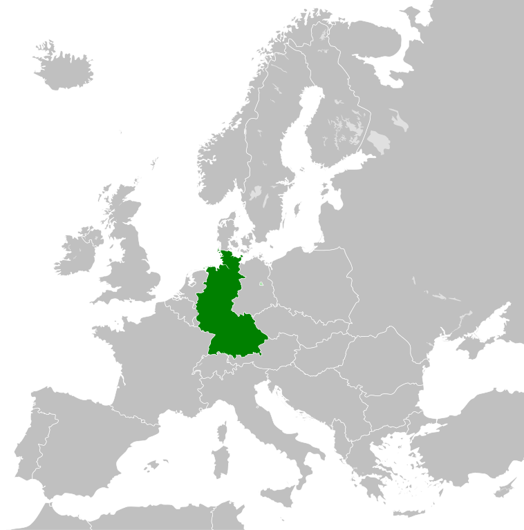
| 2011. gada 26. novembris, plkst. 03.39 |  | 450 × 456 (474 KB) | StalwartUK | == {{int:filedesc}} == {{Information |Description={{en|Map of West Germany (Federal Republic of Germany) as it was from 1949-1990. Surrounding countries accurate from 1956-1990.}} |Source=*[[:File:Blank_map_of_Europe_1956-1990.svg|Bla |
Šo failu izmanto šajā 1 lapā:
Šīs Vikipēdijas izmanto šo failu:
Skatīt šī faila pilno globālo izmantojumu.
Šis fails satur papildu informāciju, kuru, visticamāk, ir pievienojis digitālais fotoaparāts vai skeneris, ar ko veidots fails. Ja šis fails pēc tam ir ticis modificēts, šie dati var neatbilst izmaiņām (var būt novecojuši).
| Īsais nosaukums | Countries of Europe |
|---|---|
| Attēla nosaukums | A blank Map of Europe. Every country has an id which is its ISO-3166-1-ALPHA2 code in lower case.Members of the EU have a class="eu", countries in europe (which I found turkey to be but russia not) have a class="europe".Certain countries are further subdivided the United Kingdom has gb-gbn for Great Britain and gb-nir for Northern Ireland. Russia is divided into ru-kgd for the Kaliningrad Oblast and ru-main for the Main body of Russia. There is the additional grouping #xb for the "British Islands" (the UK with its Crown Dependencies - Jersey, Guernsey and the Isle of Man)Contributors.Original Image: (http://commons.wikimedia.org/wiki/Image:Europe_countries.svg) Júlio Reis (http://commons.wikimedia.org/wiki/User:Tintazul).Recolouring and tagging with country codes: Marian "maix" Sigler (http://commons.wikimedia.org/wiki/User:Maix)Improved geographical features: http://commons.wikimedia.org/wiki/User:W!B:Updated to reflect dissolution of Serbia & Montenegro: http://commons.wikimedia.org/wiki/User:ZirlandUpdated to include British Crown Dependencies as seperate entities and regroup them as "British Islands", with some simplifications to the XML and CSS: James Hardy (http://commons.wikimedia.org/wiki/User:MrWeeble)Released under CreativeCommons Attribution ShareAlike (http://creativecommons.org/licenses/by-sa/2.5/). |
| platums | 450 |
| augstums | 456 |


.svg)
.svg)
.svg)
.svg)
.svg)


.svg)
.svg)
.svg)


.png)
.png)


.svg)


.svg)

.svg)


.svg)
.svg)
.svg)
.svg)


.svg)
.png)


.svg)


.svg)
.svg)


.svg)


.svg)


.svg)
.svg)
.svg)
.svg)
.svg)
.svg)
.svg)
_cropped.svg)
.svg)
.svg)
.svg)
.svg)
.svg)
.svg)
.svg)
.svg)
.svg)
.svg)
.svg)
.svg)
.svg)
.svg)
.svg)
.svg)
.svg)
.svg)
.svg)
.svg)
.svg)
.svg)
.svg)
.svg)
.svg)
.svg)
.svg)
.svg)
.svg)
.svg)
.svg)
.svg)
.svg)
.svg)
.svg)
.svg)
.svg)
.svg)
.svg)
.svg)
.svg)
.svg)
.svg)
.svg)
.svg)