List of counties in Michigan
Wikimedia list article
There are 83 counties in the U.S. state of Michigan.
List of counties
| County | FIPS code | County seat[1] | Established[1] | Origin | Meaning of name | Population (2020)[1] | Area[1] | Map |
|---|---|---|---|---|---|---|---|---|
| Alcona County | 001 | Harrisville | 1840 (boundaries declared) 1869 (organized) | From unorganized territory; named Negwegon County until 1843 | Pseudo-Native American name created by Henry Schoolcraft | 10,167 | 1,791 sq mi (4,639 km2) |  |
| Alger County | 003 | Munising | 1885 | From part of Schoolcraft County | Russell A. Alger, (1836-1907): Governor and national politician | 8,842 | 5,049 sq mi (13,077 km2) |  |
| Allegan County | 005 | Allegan | 1831 (boundaries declared) 1835 (organized) | From part of Barry County, and unorganized territory | Pseudo-Native American name created by Henry Schoolcraft | 120,502 | 1,833 sq mi (4,747 km2) |  |
| Alpena County | 007 | Alpena | 1840 (boundaries declared) 1857 (organized) | From part of Mackinac County, and unorganized territory Was named Anamickee County until 1843. | Pseudo-Native American name created by Henry Schoolcraft | 28,907 | 1,695 sq mi (4,390 km2) |  |
| Antrim County | 009 | Bellaire | 1840 | From part of Mackinac County; named Meegisee County until 1843 | County Antrim, now in Northern Ireland | 23,431 | 602 sq mi (1,559 km2) |  |
| Arenac County | 011 | Standish | 1831 | From unorganized territory; annexed to Bay County in 1857, but reinstated in 1883 | Pseudo-Native American name created by Henry Schoolcraft | 15,002 | 681 sq mi (1,764 km2) |  |
| Baraga County | 013 | L'Anse | 1875 | From part of Houghton County | Frederic Baraga (1797-1868): Catholic missionary and first bishop of Sault Ste. Marie | 8,158 | 1,069 sq mi (2,769 km2) |  |
| Barry County | 015 | Hastings | 1829 | From unorganized territory | William T. Barry (1784-1835): Postmaster General in the Jackson Administration | 62,423 | 577 sq mi (1,494 km2) | 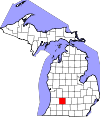 |
| Bay County | 017 | Bay City | 1857 | From parts of Arenac, Midland, and Saginaw Counties | Saginaw Bay | 103,856 | 631 sq mi (1,634 km2) |  |
| Benzie County | 019 | Beulah | 1863 | From part of Leelenau County | French name of Betsie River: (rivière aux) Bec-scies, the "(river of) sawbill ducks" | 17,970 | 860 sq mi (2,227 km2) |  |
| Berrien County | 021 | St. Joseph | 1829 | From unorganized territory | John M. Berrien (1781-1856): Attorney General in the Jackson Administration | 154,316 | 1,581 sq mi (4,095 km2) |  |
| Branch County | 023 | Coldwater | 1829 | From unorganized territory | John Branch (1782-1863): Secretary of the Navy in the Jackson Administration | 44,862 | 519 sq mi (1,344 km2) |  |
| Calhoun County | 025 | Marshall | 1829 | From unorganized territory | John C. Calhoun (1782-1850): Vice President of the United States in the Jackson Administration | 134,310 | 718 sq mi (1,860 km2) |  |
| Cass County | 027 | Cassopolis | 1829 | From unorganized territory | Lewis Cass (1782-1866): Secretary of War in the Jackson Administration | 51,589 | 508 sq mi (1,316 km2) |  |
| Charlevoix County | 029 | Charlevoix | 1869 | From parts of Antrim, Emmet, and Otsego Counties | Pierre François Xavier de Charlevoix (1682-1761): Jesuit traveller and historian of New France | 26,054 | 1,391 sq mi (3,603 km2) |  |
| Cheboygan County | 031 | Cheboygan | 1840 | From part of Mackinac County | Cheboygan River | 25,579 | 885 sq mi (2,292 km2) |  |
| Chippewa County | 033 | Sault Ste. Marie | 1827 | From part of Mackinac County | Ojibwa Native American tribe, also known as the Chippewa | 36,785 | 2,698 sq mi (6,988 km2) |  |
| Clare County | 035 | Harrison | 1840 | From part of Mackinac County, and unorganized territory; named Kaykakee County until 1843 | County Clare, Ireland | 30,856 | 575 sq mi (1,489 km2) | 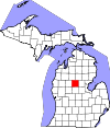 |
| Clinton County | 037 | St. Johns | 1831 | From unorganized territory | DeWitt Clinton (1769-1828): Governor of New York. | 79,128 | 575 sq mi (1,489 km2) |  |
| Crawford County | 039 | Grayling | 1840 | From part of Mackinac County and unorganized territory. Was named Shawano County until 1843. | William Crawford, (1732-82), American Revolutionary War colonel western surveyor | 12,988 | 563 sq mi (1,458 km2) |  |
| Delta County | 041 | Escanaba | 1843 | From part of Mackinac County and unorganized territory. | Greek letter delta, referring to the triangular shape of the original county, which included segments of Menominee, Dickinson, Iron and Marquette counties | 36,903 | 1,992 sq mi (5,159 km2) |  |
| Dickinson County | 043 | Iron Mountain | 1891 | From parts of Iron County, Marquette County and Menominee County. | Donald M. Dickinson (1846-1917): Postmaster General in the Cleveland Administration | 25,947 | 777 sq mi (2,012 km2) | 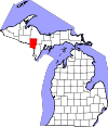 |
| Eaton County | 045 | Charlotte | 1829 | From unorganized territory. | John Eaton (1790-1856): Secretary of War in the Jackson Administration | 109,175 | 579 sq mi (1,500 km2) |  |
| Emmet County | 047 | Petoskey | 1840 | From part of Mackinac County. Was named Tonegadana County until 1843. | Robert Emmet (1778-1803): Irish nationalist and rebel leader | 34,112 | 882 sq mi (2,284 km2) |  |
| Genesee County | 049 | Flint | 1835 | From parts of Lapeer County, Saginaw County and Shiawassee County. | Seneca word, "je-nis-hi-yeh," meaning "beautiful valley": named after western New York valley from which many settlers came | 406,211 | 649 sq mi (1,681 km2) | 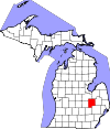 |
| Gladwin County | 051 | Gladwin | 1831 | From unorganized territory. | Major Henry Gladwin, British commander of the fort at Detroit during the siege by Chief Pontiac in 1763-64. | 25,386 | 516 sq mi (1,336 km2) |  |
| Gogebic County | 053 | Bessemer | 1887 | From part of Ontonagon County. | Probably from the Chippewa "bic" which most references interpret as "rock." | 14,380 | 1,476 sq mi (3,823 km2) |  |
| Grand Traverse County | 055 | Traverse City | 1851 | From part of Omeena County. | French grande traverse[note 1] ("long crossing"), given first to Grand Traverse Bay by French voyageurs. | 95,238 | 601 sq mi (1,557 km2) |  |
| Gratiot County | 057 | Ithaca | 1831 | From unorganized territory. | Captain Charles Gratiot (1788-1855), built Fort Gratiot at the present site of Port Huron | 41,761 | 572 sq mi (1,481 km2) |  |
| Hillsdale County | 059 | Hillsdale | 1829 | From unorganized territory. | From its terrain, made up of hills and dales.[3] | 45,746 | 607 sq mi (1,572 km2) |  |
| Houghton County | 061 | Houghton | 1845 | From parts of Marquette County and Ontonagon County. | Douglass Houghton (1809-1845), first state geologist of Michigan, physician and surgeon, mayor of Detroit (1842-1843) | 37,361 | 1,502 sq mi (3,890 km2) |  |
| Huron County | 063 | Bad Axe | 1840 | From part of Sanilac County. | Lake Huron, which the French named lac des Hurons after the Hurons. | 31,407 | 2,136 sq mi (5,532 km2) |  |
| Ingham County | 065 | Mason | 1829 (boundaries declared) 1838 (organized) | From parts of Shiawassee County, Washtenaw County and unorganized territory. | Samuel D. Ingham (1779-1860), U.S. Secretary of the Treasury in the Jackson Administration | 284,900 | 561 sq mi (1,453 km2) | 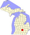 |
| Ionia County | 067 | Ionia | 1831 | From part of Mackinac County and unorganized territory. | Province in ancient Greece | 66,804 | 580 sq mi (1,502 km2) |  |
| Iosco County | 069 | Tawas City | 1840 | From unorganized territory. Was named Kanotin County until 1843. | Pseudo-Native American name created by Henry Schoolcraft | 25,237 | 1,891 sq mi (4,898 km2) |  |
| Iron County | 071 | Crystal Falls | 1885 | From parts of Marquette County and Menominee County. | For the iron deposits and mines found in the county | 11,631 | 1,211 sq mi (3,136 km2) |  |
| Isabella County | 073 | Mt. Pleasant | 1831 | From part of Mackinac County and unorganized territory. | Queen Isabella I (1451-1504) of Spain, under whose patronage Columbus undertook his voyages. | 64,394 | 578 sq mi (1,497 km2) |  |
| Jackson County | 075 | Jackson | 1829 (boundaries declared) 1832 (organised) | From part of Washtenaw County and unorganized territory. | Andrew Jackson (1767-1845), 7th President of the United States and President when Michigan was admitted to the Union | 160,366 | 724 sq mi (1,875 km2) |  |
| Kalamazoo County | 077 | Kalamazoo | 1829 | From unorganized territory. | Named for the Kalamazoo River. See Etymology of Kalamazoo for a discussion of the river's name. | 261,670 | 580 sq mi (1,502 km2) | 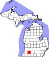 |
| Kalkaska County | 079 | Kalkaska | 1840 | From part of Mackinac County. Was named Wabassee County until 1843. | Pseudo-Native American name created by Henry Schoolcraft | 17,939 | 571 sq mi (1,479 km2) | 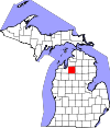 |
| Kent County | 081 | Grand Rapids | 1831 | From part of Mackinac County and unorganized territory. | New York jurist James Kent, who represented the Michigan Territory in its dispute with Ohio over the Toledo Strip. | 657,974 | 872 sq mi (2,258 km2) |  |
| Keweenaw County | 083 | Eagle River | 1861 | From part of Houghton County. | Ojibwe word gakiiwe-wewaning meaning "portage" | 2,046 | 5,966 sq mi (15,452 km2) |  |
| Lake County | 085 | Baldwin | 1840 | From part of Mackinac County. Was named Aischum County until 1843. | Has several small lakes and lies near Lake Michigan | 12,096 | 575 sq mi (1,489 km2) |  |
| Lapeer County | 087 | Lapeer | 1822 | From parts of Oakland County and St. Clair County. | An Americanization of the French la pierre, meaning "the rock" (flint) | 88,619 | 663 sq mi (1,717 km2) | 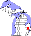 |
| Leelanau County | 089 | Suttons Bay Township | 1840 | From part of Mackinac County. | Pseudo-Native American name created by Henry Schoolcraft | 22,301 | 2,532 sq mi (6,558 km2) | 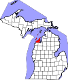 |
| Lenawee County | 091 | Adrian | 1822 | From part of Monroe County. | A name created by Henry Schoolcraft meaning a Native American word for man -- either from the Delaware "leno or lenno" or the Shawnee "lenawai" | 99,423 | 761 sq mi (1,971 km2) |  |
| Livingston County | 093 | Howell | 1833 (boundaries declared) 1836 (organized) | From parts of Shiawassee County and Washtenaw County. | Edward Livingston (1764-1836): second Secretary of State in the Andrew Jackson administration | 193,866 | 585 sq mi (1,515 km2) |  |
| Luce County | 095 | Newberry | 1887 | From parts of Chippewa County and Mackinac County. | Named for Michigan Governor Cyrus G. Luce | 5,339 | 1,912 sq mi (4,952 km2) |  |
| Mackinac County | 097 | St. Ignace | 1818 | From part of Wayne County. Was named Michilimackinac County until 1837. | Originally Michilimackinac, believed to be a French interpretation of the Native American name for Mackinac Island, meaning "big turtle" | 10,834 | 2,101 sq mi (5,442 km2) |  |
| Macomb County | 099 | Mt. Clemens | 1818 | From part of Wayne County. | Named for U.S. General Alexander Macomb, a notable officer of the War of 1812 | 881,217 | 570 sq mi (1,476 km2) |  |
| Manistee County | 101 | Manistee | 1840 | From part of Mackinac County. | Named for the Manistee River, which in turn is from the Ojibwe name, ministigweyaa meaning "(river) at whose mouth there are islands" | 25,032 | 1,281 sq mi (3,318 km2) |  |
| Marquette County | 103 | Marquette | 1843 | From parts of Chippewa County and Mackinac County. | Named for French Jesuit missionary Jacques Marquette | 66,017 | 3,425 sq mi (8,871 km2) |  |
| Mason County | 105 | Ludington | 1840 | From part of Mackinac County. Was named Notipekago County until 1843. | Named for Michigan Governor Stevens T. Mason | 29,052 | 1,242 sq mi (3,217 km2) |  |
| Mecosta County | 107 | Big Rapids | 1840 | From parts of Mackinac County and Oceana County. | Named for Mecosta, a Native American leader | 39,714 | 571 sq mi (1,479 km2) |  |
| Menominee County | 109 | Menominee | 1861 | From part of Delta County. Was named Bleeker County until 1863. | Named for the Menominee Native American people | 23,502 | 1,338 sq mi (3,465 km2) |  |
| Midland County | 111 | Midland | 1831 | From part of Saginaw County and unorganized territory. | Located near the geographical center of the Lower Peninsula | 83,494 | 528 sq mi (1,368 km2) |  |
| Missaukee County | 113 | Lake City | 1840 | From part of Mackinac County. | Named for Missaukee, an Ottawa leader who signed land-grant treaties in 1831 and 1833 | 15,052 | 574 sq mi (1,487 km2) |  |
| Monroe County | 115 | Monroe | 1817 | From part of Wayne County. | Named for James Monroe, the fifth U.S. President | 154,809 | 680 sq mi (1,761 km2) | 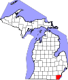 |
| Montcalm County | 117 | Stanton | 1831 | From part of Mackinac County and unorganized territory. | Named for Louis-Joseph de Montcalm, a French military commander in Quebec | 66,614 | 721 sq mi (1,867 km2) |  |
| Montmorency County | 119 | Atlanta | 1840 | From part of Mackinac County and unorganized territory. Was named Cheonoquet County until 1843. | House of Montmorency, influential in the history of French Canada | 9,153 | 562 sq mi (1,456 km2) |  |
| Muskegon County | 121 | Muskegon | 1859 | From parts of Oceana County and Ottawa County. | Muskegon River running through county, from the Ojibwa/Chippewa word mashkig meaning "swamp" or "marsh." | 175,824 | 1,459 sq mi (3,779 km2) |  |
| Newaygo County | 123 | White Cloud | 1840 | From parts of Mackinac County and Oceana County. | Named for a Chippewa leader who signed the Saginaw Treaty of 1819[4] | 49,978 | 861 sq mi (2,230 km2) |  |
| Oakland County | 125 | Pontiac | 1819 (boundaries declared) 1820 (organized) | From part of Macomb County. | The numerous "oak openings" in the area: "majestic orchard[s] of oaks and hickories varied by small prairies, grassy lawns and clear lakes"[5] | 1,274,395 | 908 sq mi (2,352 km2) |  |
| Oceana County | 127 | Hart | 1831 | From part of Mackinac County. | Borders Lake Michigan, the freshwater "ocean." | 26,659 | 1,307 sq mi (3,385 km2) |  |
| Ogemaw County | 129 | West Branch | 1840 | From unorganized territory. Annexed to Iosco County in 1867 and reinstated in 1873. | The Ojibwe word ogimaa, meaning "chief" or "leader" | 20,770 | 575 sq mi (1,489 km2) |  |
| Ontonagon County | 131 | Ontonagon | 1843 | From parts of Chippewa County and Mackinac County. | Named for the Ontonagon River. The Ojibwa word onagon means "dish" or "bowl." | 5,816 | 3,741 sq mi (9,689 km2) |  |
| Osceola County | 133 | Reed City | 1840 | From part of Mackinac County. Was named Unwattin County until 1843. | Osceola (1804-1838), Seminole chief | 22,891 | 573 sq mi (1,484 km2) | 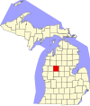 |
| Oscoda County | 135 | Mio | 1840 | From part of Mackinac County and unorganized territory. | Pseudo-Native American name created by Henry Schoolcraft | 8,219 | 572 sq mi (1,481 km2) |  |
| Otsego County | 137 | Gaylord | 1840 | From part of Mackinac County. Was named Okkudo County until 1843. | Named for Otsego County, New York | 25,091 | 526 sq mi (1,362 km2) | 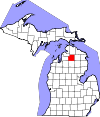 |
| Ottawa County | 139 | Grand Haven | 1831 | From part of Mackinac County and unorganized territory. | Named for the Native American Ottawa people. | 296,200 | 1,632 sq mi (4,227 km2) |  |
| Presque Isle County | 141 | Rogers City | 1840 | From part of Mackinac County. | A derivation of the French phrase for "peninsula", literally "almost an island." | 12,982 | 2,573 sq mi (6,664 km2) |  |
| Roscommon County | 143 | Roscommon | 1840 | From part of Mackinac County and unorganized territory. Was named Mikenauk County until 1843. | County Roscommon, Ireland | 23,459 | 580 sq mi (1,502 km2) |  |
| Saginaw County | 145 | Saginaw | 1822 | From part of Oakland County. | A Native American term, perhaps a reference to the Saginaw River and Saginaw Bay, Ojibwe for "at the outlet" [6] | 190,124 | 816 sq mi (2,113 km2) |  |
| St. Clair County | 147 | Port Huron | 1820 | From part of Macomb County. | Named for either Arthur St. Clair, first governor of the Northwest Territory, or Saint Clair on whose feast day Lake St. Clair was discovered | 160,383 | 837 sq mi (2,168 km2) |  |
| St. Joseph County | 149 | Centreville | 1829 | From unorganized territory. | The St. Joseph River, which flows through the county.[7] | 60,939 | 521 sq mi (1,349 km2) |  |
| Sanilac County | 151 | Sandusky | 1822 | From part of St. Clair County. | Sanilac, a Wyandotte chief | 40,611 | 1,590 sq mi (4,118 km2) |  |
| Schoolcraft County | 153 | Manistique | 1843 | From parts of Chippewa County and Mackinac County. | Henry Rowe Schoolcraft, (1793-1864): American geographer and Superintendent of Indian Affairs in Michigan | 8,047 | 1,884 sq mi (4,880 km2) |  |
| Shiawassee County | 155 | Corunna | 1822 | From parts of Oakland County and St. Clair County. | Named for the Shiawassee River, and means 'river that twists about.[8] | 68,094 | 541 sq mi (1,401 km2) |  |
| Tuscola County | 157 | Caro | 1840 | From part of Sanilac County. | Pseudo-Native American name created by Henry Schoolcraft | 53,323 | 914 sq mi (2,367 km2) |  |
| Van Buren County | 159 | Paw Paw | 1829 | From unorganized territory. | Martin Van Buren (1782-1862): Secretary of State in the Jackson Administration, later Vice President and eighth President of the United States | 75,587 | 1,090 sq mi (2,823 km2) |  |
| Washtenaw County | 161 | Ann Arbor | 1822 (boundaries declared) 1826 (organised) | From parts of Oakland County and Wayne County | From the Native American name for the Grand River, O-wash-ta-nong ("faraway water"),[9] whose headwaters were within the county's bounds. | 372,258 | 723 sq mi (1,873 km2) | 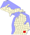 |
| Wayne County | 163 | Detroit | 1815 | All lands within Michigan Territory that had been ceded by Native Americans through the 1807 Treaty of Detroit. | "Mad" Anthony Wayne, (1745-1796): United States Army general and statesman | 1,793,561 | 672 sq mi (1,740 km2) |  |
| Wexford County | 165 | Cadillac | 1840 | From part of Mackinac County. Was named Kautawaubet County until 1843. | County Wexford, Ireland | 33,673 | 576 sq mi (1,492 km2) |  |
Former counties
- Brown County: formed in 1818 from unorganized territory. Given to Wisconsin Territory in 1836 and continues as Brown County, Wisconsin.
- Keskkauko County: formed in 1840 from part of Mackinac County. Renamed Charlevoix County in 1843. Annexed to Emmet County in 1853. Reformed as Charlevoix County from Emmet County in 1869.
- Crawford County: formed in 1818 from unorganized territory when Michigan Territory was expanded to include area west of Lake Michigan upon formation of ths state of Illinois. Transferred to Wisconsin Territory in 1836 and continues as Crawford County, Wisconsin.
- Des Moines County: formed in 1834 from unorganized territory. Given to Wisconsin Territory in 1836 and continues as Des Moines County, Iowa.
- Dubuque County: formed in 1834 from unorganized territory. Given to Wisconsin Territory in 1836 and continues as Dubuque County, Iowa.
- Iowa County: formed in 1830 from part of Crawford County. Given to Wisconsin Territory in 1836 and continues as Iowa County, Wisconsin.
- Isle Royale County: formed in 1875 from part of Keweenaw County. Returned to it in 1897.
- Manitou County: formed in 1855 from parts of Emmet County and Leelenau County. County was ended in 1895 and added to Charlevoix County and Leelanau County.
- Milwaukee County: formed in 1834 from part of Brown County. Given to Wisconsin Territory in 1836 and continues as Milwaukee County, Wisconsin.
- Omeena County: formed in 1840 from part of Mackinac County. Added to Grand Traverse County in 1853.
- Wyandot County: formed in 1840 from part of Mackinac County. Added to Cheboygan County in 1853.
References
More reading
- Armitage, B. Phyllis. (Oct–Dec 1943). "A Study of Michigan's Place-Names". Michigan History Magazine. 27: 626–637.
- County histories published in Michigan History Magazine. Some back issues that include these histories are still available for purchase.
- Jenks, William L. (1912). "History and Meaning of the County Names of Michigan". Collections and Researches of the Michigan Pioneer and Historical Society. 38: 439–478.
- Michigan Manual (the "Red Book") published biennially by the Legislative Service Bureau under the direction of the. Legislative Council, State of Michigan.
- Powers, Perry F.; Cutler, H.G., assisting (1912). A History of Northern Michigan and its People.
{{cite book}}: CS1 maint: multiple names: authors list (link) at Google books - Reports of Counties, Towns and Districts. Vol. I (2nd ed.). Lansing, Michigan: Robert Smith Printing Co. 1874. pp. 94–520.
{{cite book}}:|work=ignored (help) - Romig, Walter; Massie, Larry B (Designer) (1986). Michigan Place Names: The History of the Founding and the Naming of More Than Five Thousand Past and Present Michigan Communities. Detroit, Michigan: Wayne State University Press. ISBN 978-0-8143-1838-6.
- Vogel, Virgil J. (1986). Indian Names in Michigan. Ann Arbor, Michigan: University of Michigan Press. pp. 244, 8 B&W photographs & 3 maps. ISBN 978-0-472-06365-9.
🔥 Top keywords: Main PageSpecial:SearchModule:Track gauge/dataSOLID (object-oriented design)Wikipedia:AboutHelp:ContentsHelp:IntroductionSpecial:RecentChangesPornhubBlackAdolf Hitler UunonaFile:ASCII-Table-wide.svgList of constituencies of the Lok SabhaList of U.S. states and territories by time zoneSchrödinger's catList of U.S. states by date of admission to the UnionFile:Sexual intercourse with internal ejaculation.webmHeera MandiList of people who have walked on the MoonDavid24-hour clockModule:Emoji/dataLawrence WongCristiano RonaldoPeriodic tableList of countries by areaUnited StatesCategory:2000s American music groupsList of U.S. statesBismillahir Rahmanir RaheemList of fruitsQueen (band)Special:MyTalkXXXTentacionWikipedia:Contact usHelp:Authority controlWikipedia:Simple talkList of countries by continentsWikipedia:Simple start