

Oorspronklike lêer (SVG-lêer, normaalweg 512 × 386 piksels, lêergrootte: 468 KG)
Hierdie lêer kom vanaf Wikimedia Commons en kan ook in ander projekte gebruik word.Die beskrywing op die lêer se inligtingsblad word hieronder weergegee.
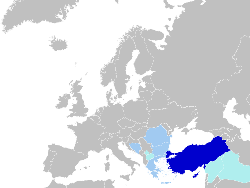
| BeskrywingMap of Turkish Language.svg | English: Status of Turkish Language. Türkçe: Türkçenin Statüsü. |
| Datum | |
| Bron | Eie werk, blank map: File:Blank map of Europe (without disputed regions).svg by User:Nordwestern |
| Outeur | Jelican9 |
| This file is made available under the Creative Commons CC0 1.0 Universal Public Domain Dedication. | |
| The person who associated a work with this deed has dedicated the work to the public domain by waiving all of their rights to the work worldwide under copyright law, including all related and neighboring rights, to the extent allowed by law. You can copy, modify, distribute and perform the work, even for commercial purposes, all without asking permission. http://creativecommons.org/publicdomain/zero/1.0/deed.enCC0Creative Commons Zero, Public Domain Dedicationfalsefalse |
Klik op die datum/tyd om te sien hoe die lêer destyds gelyk het.
| Datum/Tyd | Duimnael | Dimensies | Gebruiker | Opmerking | |
|---|---|---|---|---|---|
| huidig | 14:34, 15 April 2024 | | 512 × 386 (468 KG) | Lionel Cristiano | Update |
| 16:53, 1 September 2022 |  | 512 × 386 (468 KG) | Golden | rmv countries with zero recognition (+outdated borders) | |
| 12:56, 26 April 2021 |  | 512 × 386 (450 KG) | Kurmanbek | Fix minor bugs | |
| 12:54, 26 April 2021 |  | 512 × 392 (450 KG) | Kurmanbek | Fix minor bugs | |
| 12:51, 26 April 2021 |  | 512 × 392 (502 KG) | Kurmanbek | Uploaded own work with UploadWizard |
Die volgende bladsy gebruik dié lêer:
Die volgende ander wiki's gebruik hierdie lêer:
Wys meer globale gebruik van die lêer.
Die lêer bevat aanvullende inligting wat moontlik deur 'n digitale kamera of skandeerder bygevoeg is.
As die lêer verander is, sal sekere inligting dalk nie meer ooreenkom met dié van die gewysigde lêer nie.
| Beeldtitel | A blank Map of Europe. Every country has an id which is its ISO-3166-1-ALPHA2 code in lower case.Members of the EU have a class="eu", countries in europe (which I found turkey to be but russia not) have a class="europe".Certain countries are further subdivided the United Kingdom has gb-gbn for Great Britain and gb-nir for Northern Ireland. Russia is divided into ru-kgd for the Kaliningrad Oblast and ru-main for the Main body of Russia. There is the additional grouping #xb for the "British Islands" (the UK with its Crown Dependencies - Jersey, Guernsey and the Isle of Man) and the Kingdom of Denmark (Denmark, Faroe Islands, Greenland)Contributors.Original Image: (http://commons.wikimedia.org/wiki/Image:Europe_countries.svg) Júlio Reis (http://commons.wikimedia.org/wiki/User:Tintazul).Recolouring and tagging with country codes: Marian "maix" Sigler (http://commons.wikimedia.org/wiki/User:Maix)Improved geographical features: http://commons.wikimedia.org/wiki/User:W!B:Updated to reflect dissolution of Serbia & Montenegro: http://commons.wikimedia.org/wiki/User:ZirlandUpdated to include British Crown Dependencies as seperate entities and regroup them as "British Islands", with some simplifications to the XML and CSS: James Hardy (http://commons.wikimedia.org/wiki/User:MrWeeble)Validated (http://commons.wikimedia.org/wiki/User:CarolSpears)Changed the country code of Serbia to RS per http://en.wikipedia.org/wiki/Serbian_country_codes and the file http://www.iso.org/iso/iso3166_en_code_lists.txt (http://commons.wikimedia.org/wiki/User:TimothyBourke)Uploaded on behalf of User:Checkit, direct complaints to him plox: 'Moved countries out of the "outlines" group, removed "outlines" style class, remove separate style information for Russia' (http://commons.wikimedia.org/wiki/User:Collard)Updated various coastlines and boarders and added various islands not previously shown (details follow). Added Kosovo, Northern Cyprus, Crimea, Abkhazia, South Ossetia, Transnistria and Nagorno-Karabakh as disputed territories. Moved major lakes to their own object and added more. List of updated boarders/coastlines: British Isles (+ added Isle of Wight, Skye, various smaller islands), the Netherlands, Germany, Austria, Hungary, Czech Republic, Denmark, Sweden, Finland, Poland, Kaliningrad Oblast of the Russian Federation (and minor tweaks to Lithuania), Estonia, Ukraine, Moldova (minor), Romania, Bulgaria, Turkey, Greece, F.Y.R. Macedonia, Serbia, Bosnia and Herzegovina, Montenegro, Albania, Croatia, Italy (mainland and Sicily), Malta (http://commons.wikimedia.org/wiki/User:Alphathon).Added Bornholm (http://commons.wikimedia.org/wiki/User:Heb)Released under CreativeCommons Attribution ShareAlike (http://creativecommons.org/licenses/by-sa/2.5/). |
|---|---|
| Breedte | 100% |
| Hoogte | 100% |
.svg)