Adour
The Adour (Basque: Aturri, Occitan: Ador) is a river in southwestern France. It flows through the Occitanie and Nouvelle-Aquitaine regions.
| Adour L'Adour (French) | |
|---|---|
 Adour seen from the bridge at Aire-sur-l'Adour | |
.jpg) | |
| Location | |
| Country | France |
| Physical characteristics | |
| Source | |
| - location | High-Bigorre |
| - elevation | 2,200 m (7,200 ft) |
| Mouth | |
| - location | Atlantic Ocean |
| - coordinates | 43°31′46″N 1°31′25″W / 43.52944°N 1.52361°W |
| Length | 308 km (191 mi) |
| Basin size | 16,880 km2 (6,520 sq mi) |
| Discharge | |
| - average | 150 m3/s (5,300 cu ft/s) |
It starts in the Pyrenees, at the Arbizon mountain. It flows into the Atlantic Ocean (Bay of Biscay) near Bayonne.
Geography
The Adour river has a length of 309 kilometres (192 miles).[1][N 1] Its drainage basin has an area of approximately 16,912 square kilometres (6,530 square miles).
Course
The Adour river starts, as Adour de Payolle, at the north side of the Arbizon mountain. This river combines with the Adour de Gripp and the Adour de Lesponne to form the Adour river at Campan.
The Adour flows north for almost 160 kilometres (100 miles) through the Hautes-Pyrénées to Gers. There, it turns to the west and gets into the Landes department. In Port-de-Lanne, the Adour is joined by the Gaves réunis river. Finally, it flows into the Bay of Biscay, in the Atlantic Ocean, between Anglet (Pyrénées-Atlantiques) and Tarnos (Landes).
Boats can travel on the river beginning about 72 kilometres (45 miles) from its mouth.
Tributaries of the Adour
Some of the important tributaries (longer than 50 kilometres [31 miles]) of the Adour are:
Left tributaries:
| Right tributaries |
Towns along the river
Départements and towns found along the Adour river are:
- Hautes-Pyrénées: Campan, Bagnères-de-Bigorre, Tarbes, Maubourguet
- Gers: Riscle
- Landes: Aire-sur-l'Adour, Dax, Tarnos
- Pyrénées-Atlantiques: Bayonne
Hydrology
The average yearly discharge for the Adour river is 86.60 cubic metres per second (3,058 cubic feet per second) at Saint-Vincent-de-Paul in the Landes department.[12]
Average monthly discharge (m3/s) at Saint-Vincent-de-Paul (1918 - 2017)[12]

The Adour shows typical seasonal changes. The highest levels of the river are in winter and spring, from December to May inclusive, with the highest level in February. They are followed by a rapid fall in the flow during the low water period that goes from July to October.
Gallery
 The Adour at Riscle
 The Adour at Aire-sur-l'Adour
 The Adour view from Saint-Maurice-sur-Adour
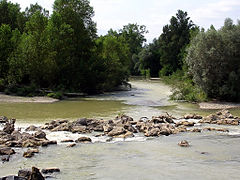 The Adour at Saint-Sever
 The Adour at Dax
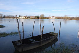 The Adour between Urt and Saint-Laurent-de-Gosse
 Bayonne, mouth of the Adour
 Bayonne, mouth of the Adour
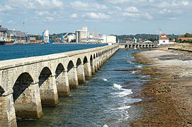 Bayonne, the commerce port
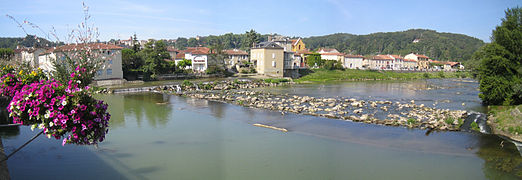 Adour seen from the bridge at Aire-sur-l'Adour


.jpg)
.jpg)
Related pages
Notes
References
Other websites
- L'Adour : histoire, géographie et détournement Archived 2016-01-02 at the Wayback Machine (in French)
- L'adour et ses affluents, villes et villages, faune et flore, navigation et pêche Archived 2013-06-22 at the Wayback Machine (in French)