100°28′W / 39.800°N 100.467°W / 39.800; -100.467
From Simple English Wikipedia, the free encyclopedia
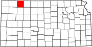
Decatur County (county code DC ) is a county in Northwest Kansas . In 2020 , 2,764 people lived there.[1] county seat is Oberlin . Oberlin is also the biggest city in Decatur County.[2]
Decatur County was created on March 20, 1873 and organized on December 15, 1879. It is named after the Navy war hero Commodore Stephen Decatur, Jr..[3] War of 1812 .
Oberlin was where the last Native American (specifically the Northern Cheyenne) Raid in Kansas happened.[4]
The U.S. Census Bureau says that the county has a total area of 894 square miles (2,320 km2 ). Of that, 894 square miles (2,320 km2 ) is land and 0.6 square miles (1.6 km2 ) (0.07%) is water.[5]
Historical population Census Pop. %± 1880 4,180 — 1890 8,414 101.3% 1900 9,234 9.7% 1910 8,976 −2.8% 1920 8,121 −9.5% 1930 8,866 9.2% 1940 7,434 −16.2% 1950 6,185 −16.8% 1960 5,778 −6.6% 1970 4,988 −13.7% 1980 4,509 −9.6% 1990 4,021 −10.8% 2000 3,472 −13.7% 2010 2,961 −14.7% 2020 2,764 −6.7% U.S. Decennial Census[6] [7] [8] [9] [1]
Population pyramid Decatur county is very Republican. The last time a democratic candidate won the county was in 1936 by Franklin D. Roosevelt .
Presidential Elections Results
Presidential Elections Results [10] Year Republican Democratic Third Parties 2020 84.1% 1,260 14.6% 218 1.3% 20 2016 83.0% 1,210 12.2% 178 4.7% 69 2012 79.5% 1,218 17.4% 266 3.1% 48 2008 76.8% 1,189 22.2% 343 1.0% 16 2004 77.9% 1,355 20.4% 355 1.7% 30 2000 71.4% 1,255 24.1% 424 4.6% 80 1996 68.1% 1,255 22.6% 417 9.3% 172 1992 45.0% 940 27.6% 576 27.4% 573 1988 60.1% 1,291 36.9% 793 3.0% 64 1984 78.2% 1,770 20.6% 467 1.2% 28 1980 73.0% 1,642 19.7% 443 7.3% 165 1976 52.7% 1,232 43.3% 1,011 4.0% 93 1972 70.2% 1,707 25.3% 616 4.4% 108 1968 65.7% 1,654 25.9% 652 8.4% 210 1964 51.0% 1,382 48.5% 1,314 0.6% 16 1960 63.8% 1,846 35.9% 1,038 0.3% 8 1956 68.6% 2,028 31.1% 920 0.3% 9 1952 74.5% 2,451 25.0% 821 0.5% 16 1948 51.4% 1,545 46.7% 1,402 1.9% 58 1944 59.9% 1,758 39.5% 1,159 0.6% 17 1940 56.2% 2,018 43.0% 1,546 0.8% 29 1936 42.1% 1,727 57.6% 2,362 0.4% 15 1932 36.3% 1,439 61.0% 2,422 2.7% 108 1928 66.5% 2,314 32.5% 1,129 1.0% 35 1924 46.9% 1,621 35.2% 1,218 17.9% 618 1920 51.6% 1,448 43.5% 1,221 5.0% 140 1916 27.7% 1,007 67.0% 2,431 5.3% 193 1912 14.9% 256 55.5% 955 29.6% 509 1908 39.3% 898 54.8% 1,250 5.9% 135 1904 59.7% 1,215 20.2% 411 20.1% 409 1900 41.8% 848 57.0% 1,158 1.2% 24 1896 36.4% 594 63.2% 1,032 0.4% 7 1892 38.6% 619 61.4% 985 1888 57.4% 1,224 34.3% 731 8.3% 177
Oberlin USD 294 Prairie Heights USD 295, dissolved as of July 1, 2006; absorbed by USD 294. 2005 KDOT Map of Decatur County (map legend ) County Maps
Cities Map of Kansas highlighting Decatur County Unincorporated Allison Cedar Bluffs Kanona Leoville Lyle Traer Ghost towns Bassetville Decatur Hawkeye Hooker Jackson Lund Sheffield Shibboleth Stephen Vallonia Townships Allison Altory Bassettville Beaver Center Cook Custer Dresden Finley Garfield Grant Harlan Jennings Liberty Lincoln Logan Lyon Oberlin Olive Pleasant Valley Prairie Dog Roosevelt Sappa Sherman Summit Footnotes ‡This community also has portions in an adjacent county or counties.


