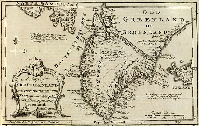
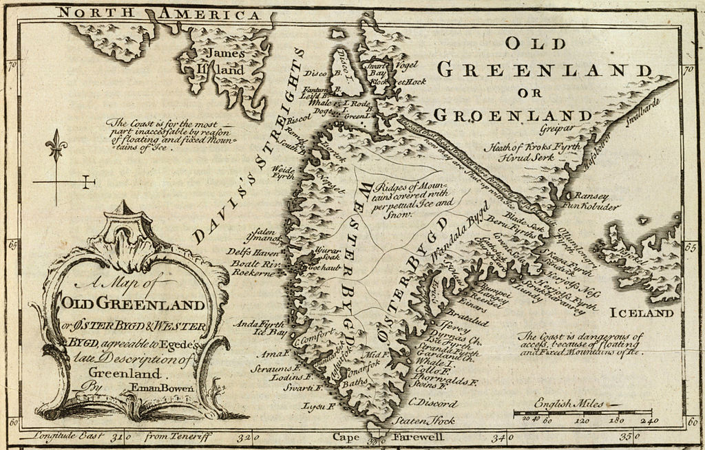
Файл:Old Greenland 1747.jpg

Повна роздільність (2048 × 1307 пікселів, розмір файлу: 2,23 МБ, MIME-тип: image/jpeg)
| Відомості про цей файл містяться на Вікісховищі — централізованому сховищі вільних файлів мультимедіа для використання у проектах Фонду Вікімедіа. |
Опис файлу
| Опис | English: Cropped and rotated from the original.
|
| Час створення | |
| Джерело | David Rumsey Collection |
| Автор | Emanuel Bowen (c. 1694–1767) |
Ліцензування
Це зображення (чи мультимедійний файл) перебуває в суспільному надбанні у всьому світі через те, що термін охорони закінчився (минуло 70 років з дня смерті автора або з моменту першої публікації).
Таким чином, ця репродукція також перебуває в суспільному надбанні. Це стосується репродукцій, створених у США (див. справу Bridgeman Art Library v. Corel Corp.), Німеччині та багатьох інших країнах. | ||||
Історія файлу
Клацніть на дату/час, щоб переглянути, як тоді виглядав файл.
| Дата/час | Мініатюра | Розмір об'єкта | Користувач | Коментар | |
|---|---|---|---|---|---|
| поточний | 15:21, 10 травня 2012 | | 2048 × 1307 (2,23 МБ) | LlywelynII |
Використання файлу
Такі сторінки використовують цей файл:
Глобальне використання файлу
Цей файл використовують такі інші вікі:
- Використання в af.wikipedia.org
- Використання в ar.wikipedia.org
- Використання в bs.wikipedia.org
- Використання в ca.wikipedia.org
- Використання в ceb.wikipedia.org
- Використання в cs.wikipedia.org
- Використання в en.wikipedia.org
- Використання в es.wikipedia.org
- Використання в fa.wikipedia.org
- Використання в fy.wikipedia.org
- Використання в io.wikipedia.org
- Використання в ko.wikipedia.org
- Використання в pt.wikipedia.org
- Використання в sv.wikipedia.org
- Використання в te.wikipedia.org
- Використання в tr.wikipedia.org
- Використання в www.wikidata.org
- Використання в zh.wikipedia.org