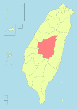
نانتوو کاؤنٹی
نانتوو کاؤنٹی (انگریزی: Nantou County) جمہوریۂ چین کا ایک تائیوان کی کاؤنٹیاں جو صوبہ تائیوان میں واقع ہے۔[1]
南投縣 | |
|---|---|
| تائیوان کی کاؤنٹیاں | |
 Top:Shuili Water Creek in Shuili Township, 2nd left:Mount Yu, 2nd right:Nantou County Museum of History in Nantou City, 3rd left:View of Sun Moon Lake, from Xuanzang Temple in Yuchi Township, 3rd right:Evergreen Glassland in Renci Township, Bottom left:Tou George Pond in Taiwan Educational University of Nature, Bottom right:Mount Hehuan | |
 | |
| ملک | جمہوریۂ چین |
| علاقہ | Central Taiwan |
| نشست | Nantou City |
| Largest city | Nantou City |
| بورو (انتظامیہ) | 1 cities, 12 (4 urban, 8 rural) townships |
| حکومت | |
| • County Magistrate | Lin Ming-chen (کومنتانگ) |
| رقبہ | |
| • کل | 4,106.436 کلومیٹر2 (1,585.504 میل مربع) |
| رقبہ درجہ | فہرست جمہوریۂ چین کی انتظامی تقسیمات |
| آبادی (Dec. 2014) | |
| • کل | 514,315 |
| • درجہ | فہرست جمہوریۂ چین کی انتظامی تقسیمات |
| منطقۂ وقت | CST (UTC+8) |
| ویب سائٹ | www.nantou.gov.tw |
| Symbols | |
| Flower | Plum blossom (Prunus mume) |
| Tree | Camphor Laurel (Cinnamomum camphora) |
تفصیلات
نانتوو کاؤنٹی کا رقبہ 4,106.436 مربع کیلومیٹر ہے اور اس کی مجموعی آبادی 514,315 افراد پر مشتمل ہے۔
مزید دیکھیے
- جمہوریۂ چین
- فہرست جمہوریۂ چین کے شہر
حوالہ جات
|
|
🔥 Top keywords: صفحۂ اولخاص:تلاشانا لله و انا الیه راجعونمحمد بن عبد اللہحق نواز جھنگویسید احمد خانپاکستاناردوغزوہ بدرمحمد اقبالجنت البقیععلی ابن ابی طالبقرآنعمر بن خطابانہدام قبرستان بقیعحریم شاہغزوہ احداردو حروف تہجیاردو زبان کی ابتدا کے متعلق نظریاتابوبکر صدیقاسلاممحمد بن اسماعیل بخاریکوسغزوہ خندقخاص:حالیہ تبدیلیاںاسماء اللہ الحسنیٰجناح کے چودہ نکاتفلسطینموسی ابن عمراندجالمیری انطونیامتضاد الفاظمرزا غالبآدم (اسلام)پریم چندفاطمہ زہراصحیح بخاریجنگ آزادی ہند 1857ءضمنی انتخابات


