From today's featured list
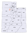
There are 29 counties in the U.S. state of Utah. There were originally seven counties established under the provisional State of Deseret in 1849: Davis, Iron, Sanpete, Salt Lake, Tooele, Utah, and Weber. The Territory of Utah was created in 1851 with the first territorial legislature meeting from 1851–1852. The first legislature re-created the original counties from the State of Deseret under territorial law as well as establishing three additional counties: Juab, Millard, and Washington. All other counties were established between 1854 and 1894 by the Utah Territorial Legislature under territorial law except for the last two counties formed, Daggett and Duchesne. They were created by popular vote and by gubernatorial proclamation after Utah became a state. Based on 2010 United States Census data, the population of Utah was 2,763,885. Just over 75 percent of Utah's population is concentrated along four Wasatch Front counties: Salt Lake, Utah, Davis, and Weber. (Full list...)
Today's featured picture
Other areas of Wikipedia
- Community portal – Bulletin board, projects, resources and activities covering a wide range of Wikipedia areas.
- Help desk – Ask questions about using Wikipedia.
- Local embassy – For Wikipedia-related communication in languages other than English.
- Reference desk – Serving as virtual librarians, Wikipedia volunteers tackle your questions on a wide range of subjects.
- Site news – Announcements, updates, articles and press releases on Wikipedia and the Wikimedia Foundation.
- Village pump – For discussions about Wikipedia itself, including areas for technical issues and policies.
Wikipedia's sister projects
Wikipedia is hosted by the Wikimedia Foundation, a non-profit organization that also hosts a range of other projects:
Free media repository
Wiki software development
Wikimedia project coordination
Free textbooks and manuals
Free knowledge base
Free-content news
Collection of quotations
Free-content library
Directory of species
Free learning materials and activities
Free travel guide
Dictionary and thesaurus
